Thursday July 11 2019
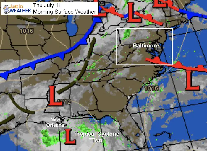
There is a lot in the weather department today to discuss. While ‘Potential’ Cyclone Two (its official name so far) is not a tropical storm yet, it should get named Barry today. The latest projections are for rapid development but a shift closer to New Orleans for landfall track. More on that below. Locally we have a strong cold front that puts much of our region under the risk for severe storms… Completely separate from the tropical system.
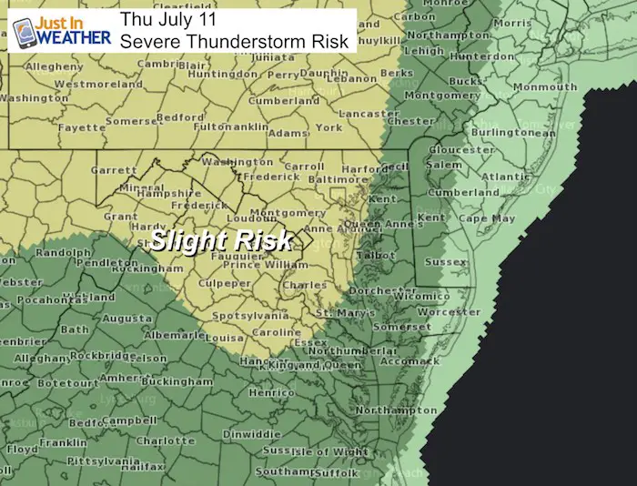
Severe Storm Risk
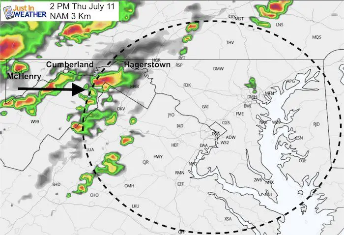
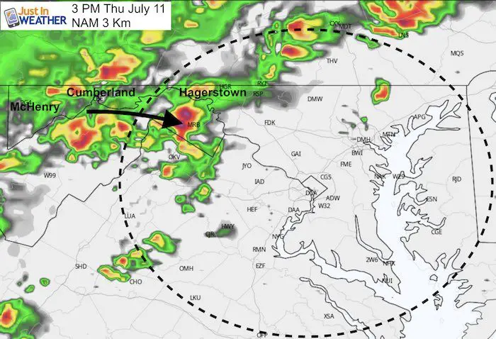
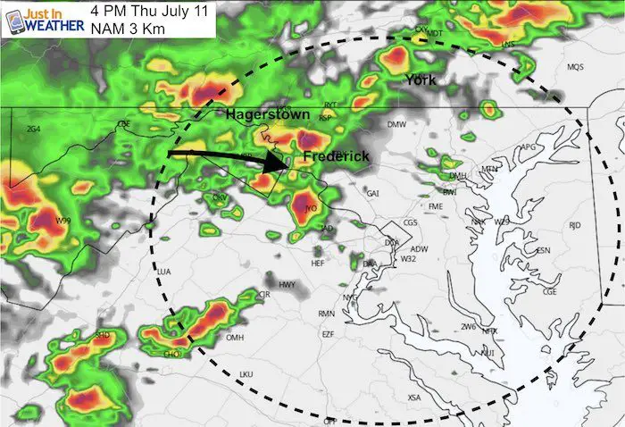
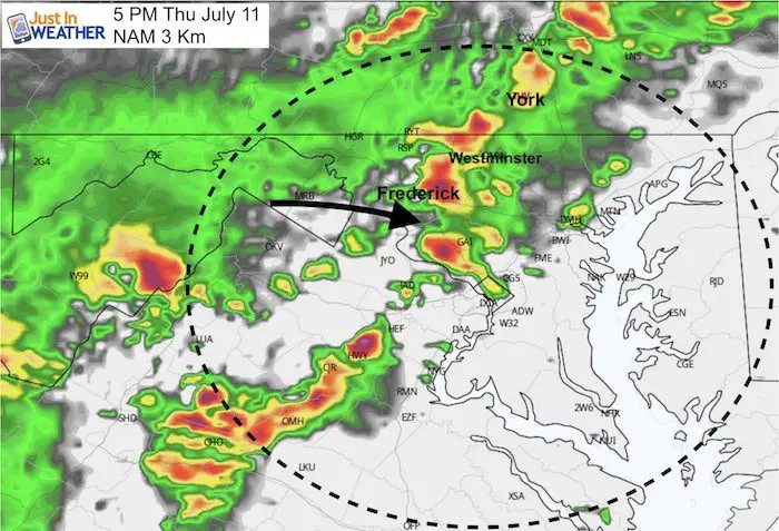
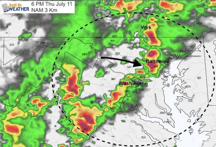
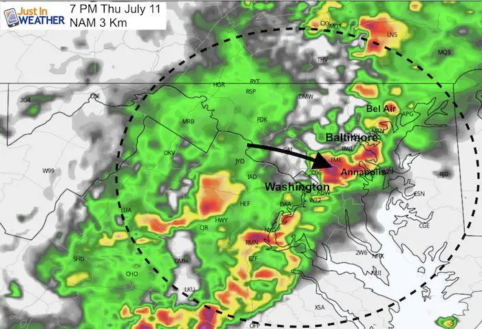
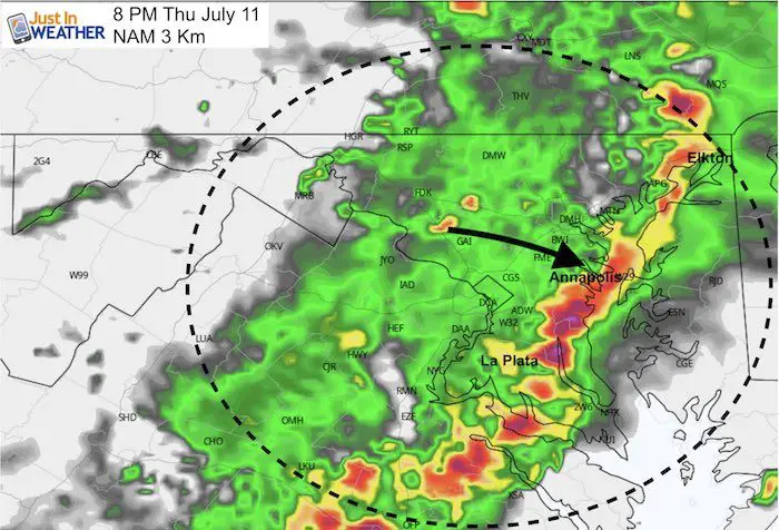
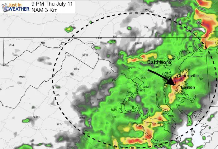
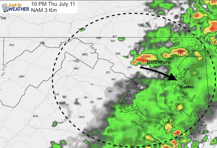
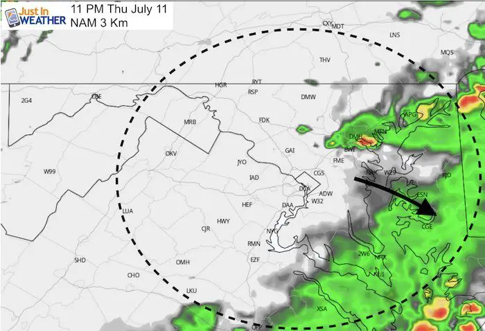
The best chance for storms to turn severe are between the mountains and the Chesapeake Bay between 2 PM and 8 PM.
For a storm to be considered severe, it must have either winds over 58 mph, large hail over 1 inch diameter, rotation with potential to drop a tornado, flash flooding, and possibly frequent lightning. See the timeline below with specific areas highlighted
[adrotate group=”4″]
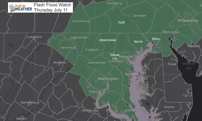
Flash Flood Watch
Local Weather Stats: Thursday July 11, 2019 in Baltimore
Average High: 88ºF
Record High: 100ºF in 1988
Average Low: 67ºF
Record Low: 53ºF in 1996
Sunrise: 5:49 AM
Sunset 8:34 PM
*Daylight = 1:05 shorter than yesterday
*Bay Water Temperature = 79ºF at Thomas Pt. Light House
Keep In Touch Every Day
Just in case you don’t get all posts on your social media feed, stay up to date with the latest info…
Click here to sign up for email alerts…. Be the first to hear any new weather.
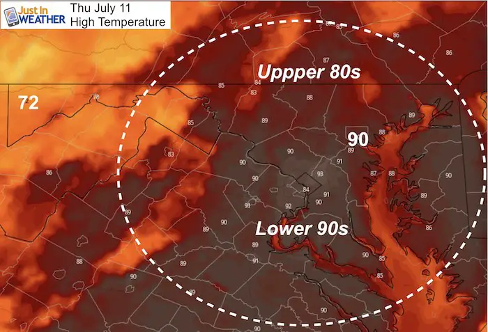
Highs Thursday
Radar Simulation Timeline—> slider
Best guess timing
- 2 PM to 4PM: McHenry to Hagerstown
- 4 PM to 6 PM: Frederick, York, and Baltimore
- 6 PM to 8 PM: Bel Air, Elkton, Annapolis
- Evening: Eastern Shore
[adrotate group=”4″]
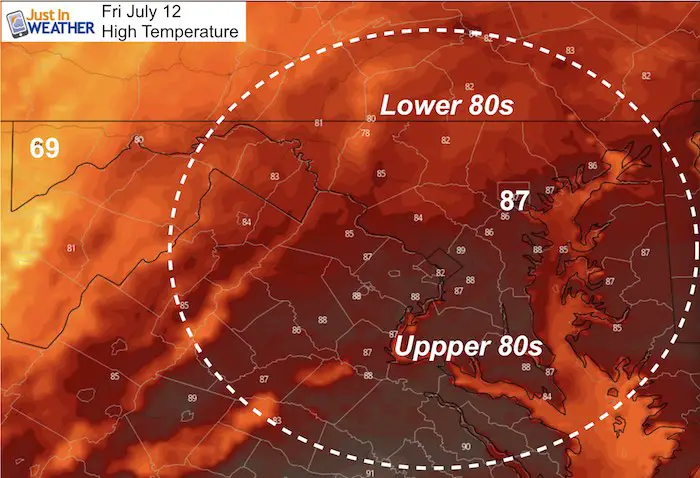
Highs Friday
Look at the cool air in McHenry, only 69ºF. But 80s will hold in metro areas.
Tropical Cyclone Two- Soon To Be Barry
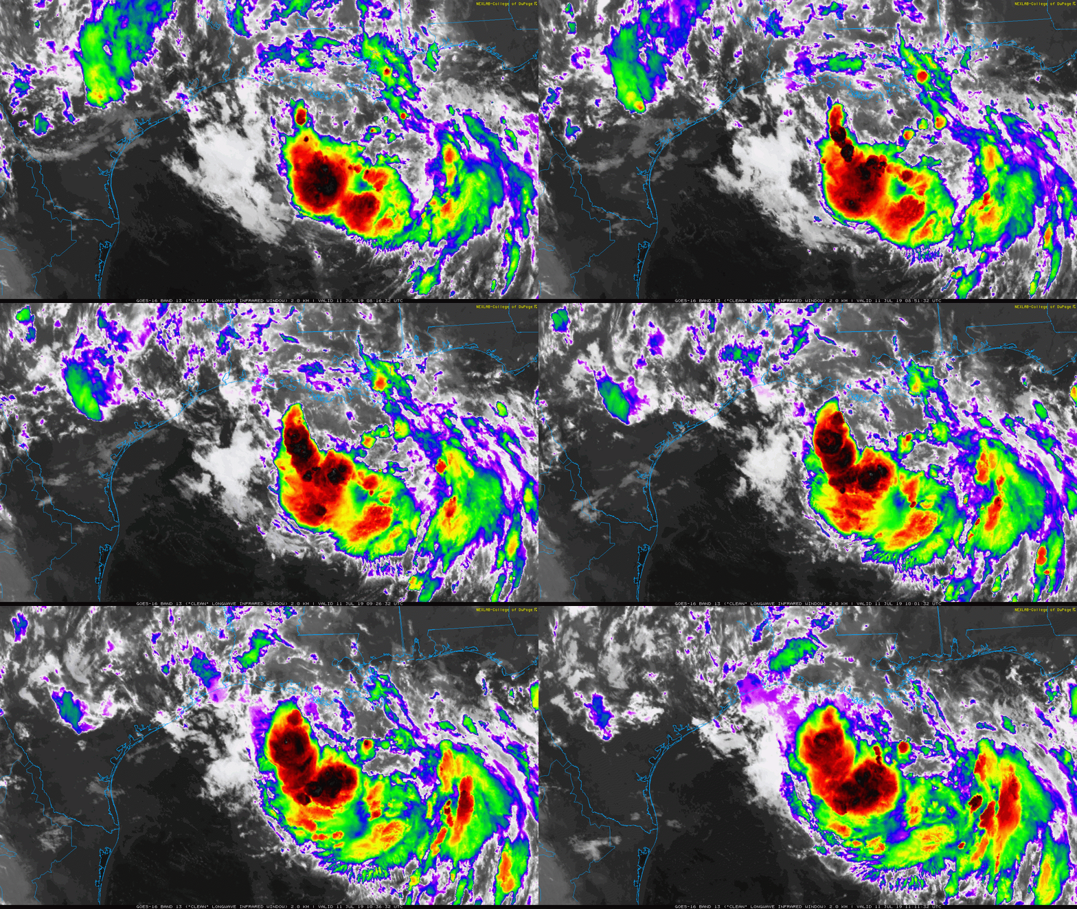
This storm has shown a lot of enhanced storm activity this morning on satellite. But the organization has been slow. This delay is what has changed the expectations.
Forecast Models
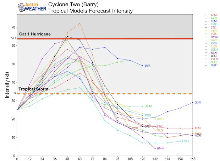
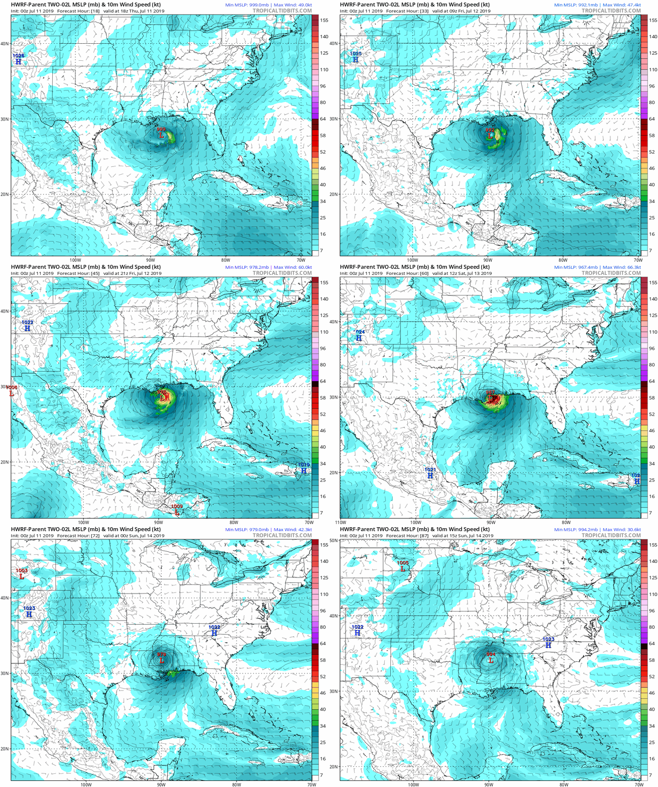
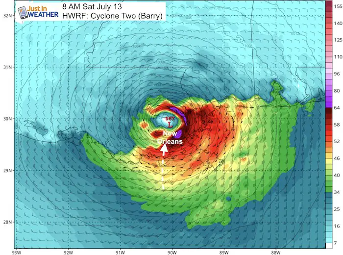
Intensity: Rapid development is still expected once this gets going. Gulf of Mexico waters are very warm! But there will be less time for it to grow, so at best this looks like it might reach Category 1 hurricane intensity before landfall on Saturday morning.
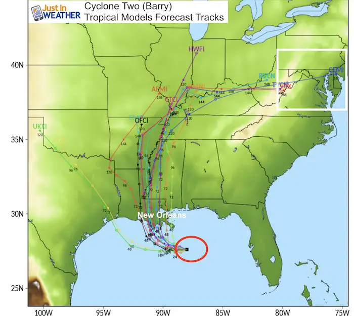
Landfall: Because it is forming slower (to this point), that will impact the track… So landfall is now expected to be farther east, just south of New Orleans on Saturday morning.
HWRF Forecast Model Animation
Potential Track Over New Orleans
[adrotate group=”4″]
Will This Reach Us?
Some of the model tracks above did indicate a shift in our direction early next week. By that point it would not be tropical in nature.
Landfalling tropical systems are tough to plot out. Considering that this forecast development and landfall has already changed a lot in one day, I would not put to much stock in where it goes after landfall yet. We need this to form and do its thing, to have a better handle on the timing and then tracking.
Please share your thoughts, best weather pics/video, or just keep in touch via social media
-
Facebook: Justin Berk, Meteorologist
-
Twitter: @JustinWeather
-
Instagram: justinweather
Join My Team: Maryland Trek 6
Our look got an upgrade, but we have the same purpose. Please click the logo take a look at our new page.
- Consider joining our team for the week, a single day, or even as a sponsor.
Kids Trek Too!
Bring Your Kids To Join My Team This Summer
Click the logo for more information
Support Our Nonprofit:
Proceeds go to our programs Providing FREE holistic care for kids in cancer treatment and up to 5 years post treatment and caregivers.

Shine On
Proceeds from all sales go to Just In Power Kids. Click the image to shop and show your support.
Love Maryland Shirts and Hoodies
This shirt was designed by my ‘bonus’ daughter Jaiden. The hoodie has been the biggest hit, so our promotion has been extended until the end of this week.
|
||
|
Show your love for Maryland and make this 14 year old artist and her mom extra proud
|
Related Links:


