Wednesday July 10 2019
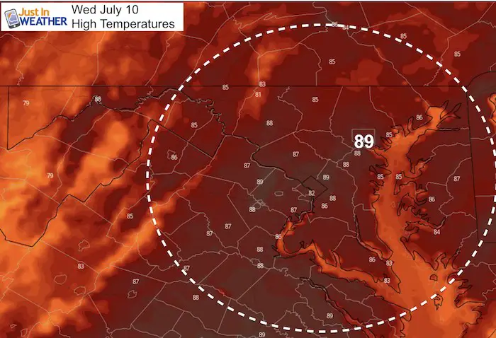
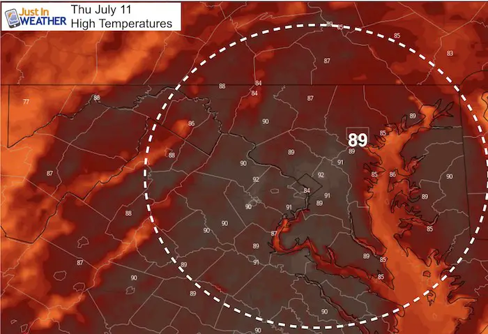
Today is the anniversary of the hottest temperature on record for Baltimore. In 1936 it was 107ºF. Thankfully that will not happen today. We have one more quiet weather day before another round of storms erupt tomorrow. Typical summer heat is building with upper 80s to near 90ºF.
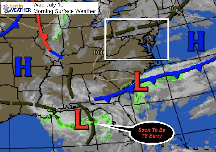
The other thing building is a tropical storm in the Gulf of Mexico. Currently it has a 90% chance of being upgraded and it could happen today. If so, it will be named Barry. The latest model forecasts are below.
[adrotate group=”4″]
Local Weather Stats: Wednesday July 10, 2019 in Baltimore
Average High: 88ºF
Record High: 107ºF in 1936
Average Low: 67ºF
Record Low: 55ºF in 1961
Sunrise: 5:48 AM
Sunset 8:34 PM
*Daylight = 1:02 shorter than yesterday
*Bay Water Temperature = 79ºF at Thomas Pt. Light House
Keep In Touch Every Day
Just in case you don’t get all posts on your social media feed, stay up to date with the latest info…
Click here to sign up for email alerts…. Be the first to hear any new weather.
Temperatues
Highs Wednesday
Highs Thursday
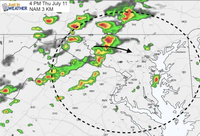
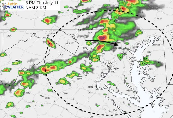
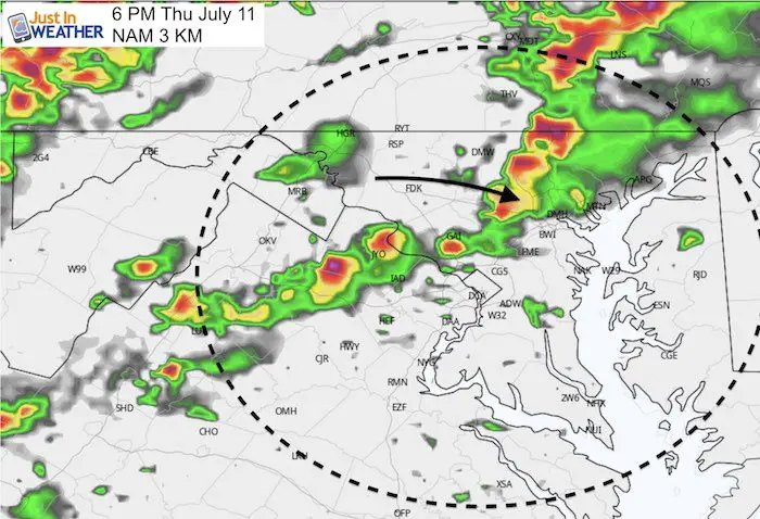
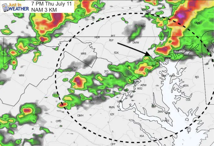
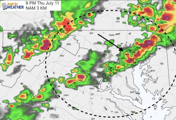
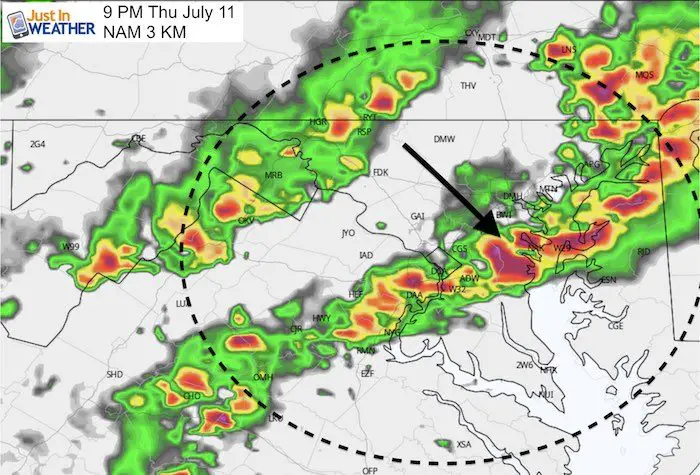
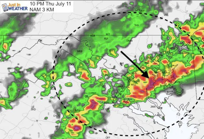
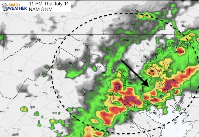
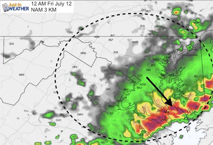
Radar Simulation Thursday —> slider
Storms are likely to develop after 4 PM inland. Metro areas will get the one between 5 PM and 8 PM, then the focus will shift south through midnight.
[adrotate group=”4″]
Invest 92 – Soon to be Tropical Storm Barry
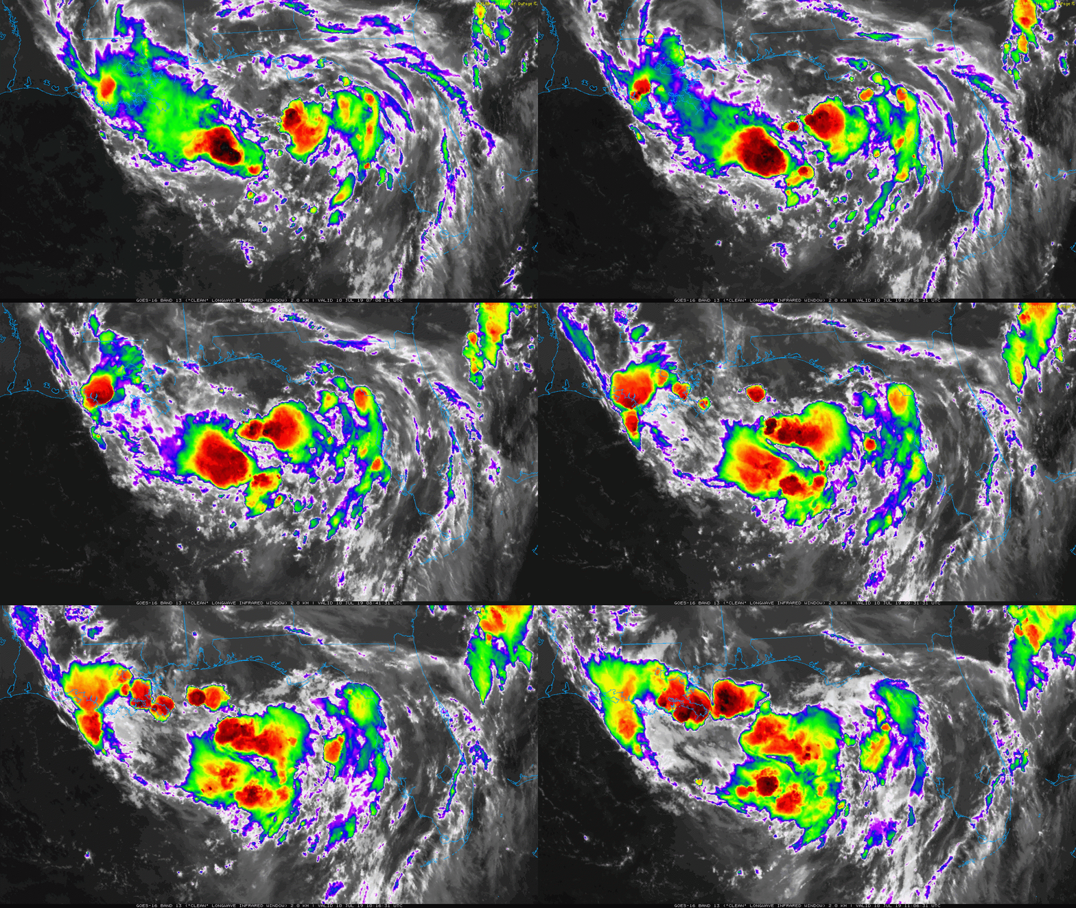
The satellite loop this morning does look mighty impressive as the center circulation is getting better organized.
[adrotate group=”4″]
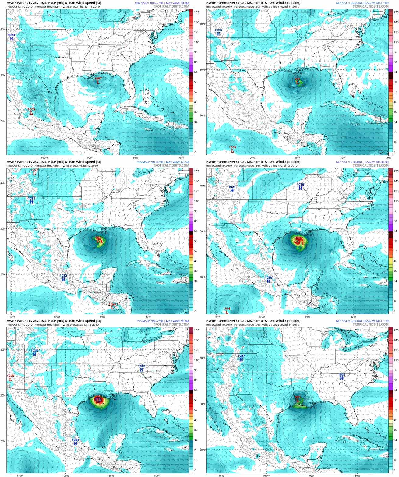
The HWRF is most aggressive showing a 949 mb Low at landfall in western Louisiana on Saturday. This would translate to a Category 2 Hurricane- IF it was able to stay farther south over water long enough to develop.
Not All Models Agree
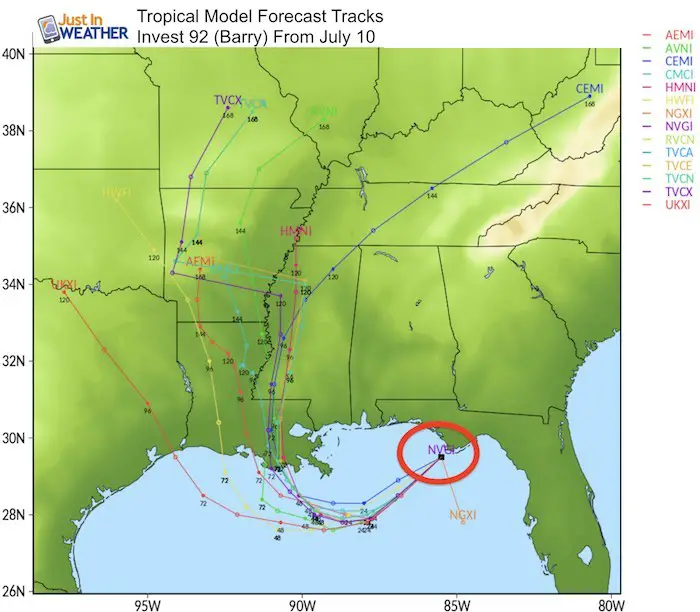
Forecast Model Tracks
The spread here shows more support for a landfall that is sooner, and just west of New Orleans. That would not give it enough time to develop as shown above.
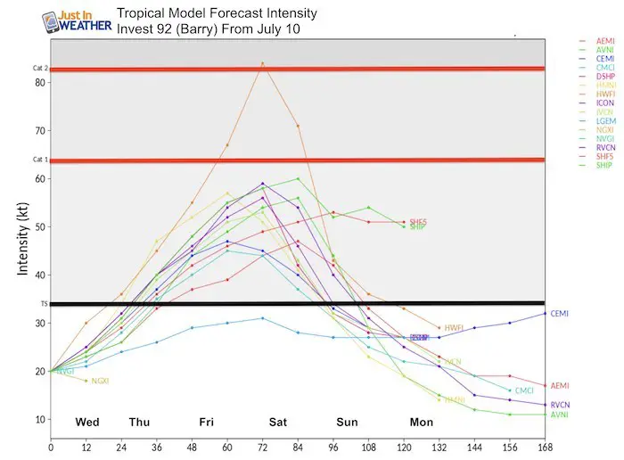
Forecast Model Intensity
The more likely scenario is that this becomes a Tropical Storm by tonight or tomorrow. Here we can see the majority of computer models support it remaining a tropical storm. However, given the very warm water in the Gulf of Mexico, rapid development is possible. This is our first real storm of the season, and much like a winter event… we need to see if the models have a good handle on it in the short run before giving too much trust away.
Join My Team: Maryland Trek 6
Our look got an upgrade, but we have the same purpose. Please click the logo take a look at our new page.
- Consider joining our team for the week, a single day, or even as a sponsor.
Kids Trek Too!
Bring Your Kids To Join My Team This Summer
Click the logo for more information
Support Our Nonprofit:
Proceeds go to our programs Providing FREE holistic care for kids in cancer treatment and up to 5 years post treatment and caregivers.

Shine On
Proceeds from all sales go to Just In Power Kids. Click the image to shop and show your support.
Love Maryland Shirts and Hoodies
This shirt was designed by my ‘bonus’ daughter Jaiden. The hoodie has been the biggest hit, so our promotion has been extended until the end of this week.
|
||
|
Show your love for Maryland and make this 14 year old artist and her mom extra proud
|
Please share your thoughts, best weather pics/video, or just keep in touch via social media
-
Facebook: Justin Berk, Meteorologist
-
Twitter: @JustinWeather
-
Instagram: justinweather
Related Links:


