


July 18 Flood Watch In The Mountains Then Storms Expand Back This Weekend
Friday, July 18 2025 Morning Report There is some relief in sight, but I remain cautious. For the short term, today remains muggy, while the focus of strong storms and…
Saturday June 29 2019
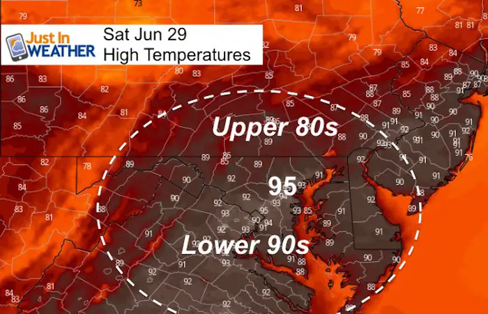
We have another hot and humid day in store. Typical late June stuff. But a cold front will trigger a line of storms that is likely to turn severe later this afternoon through evening. A second line of storms tonight will signify the break of the heat wave (temps in the 90s) for a day or two. Sunday and Monday should be noticeable more comfortable outside. Then the heat returns through Independence Day weekend.
Contrary to the limited heat this year, the second highest temperature in Baltimore history was recorded on this date 85 years ago. It was 105ºF on June 29, 1934.
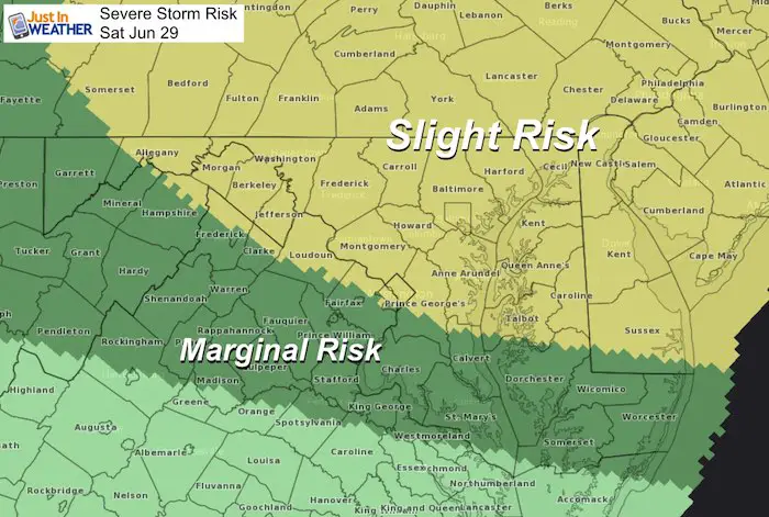
Severe Storm Risk
Most of our region is in the Slight Risk for severe storms, with the exception of southern Maryland according the SPC. However I would just remain on the look out for powerful storms later today.
Please note that as we get closer, these are potential alerts to be issued.
Severe Thunderstorm Watch: A broad area and window with a 4 to 6 hour time frame. This means it MIGHT happen.
Severe Thunderstorm Warning: A focused area like a county usually with a 30 to 60 minute time frame. This means it IS HAPPENING NOW.
Tornado Warning: A focused area and time frame. This would list towns in a likely path within a 15 to 45 minute window.
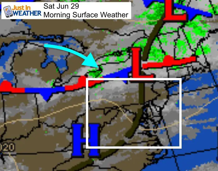
Morning Set Up
Kids Trek Too!
Bring Your Kids To Join My Team This Summer
Click the logo for more information
![]()
Average High: 87ºF
Record High: 105ºF in 1934
Average Low: 66ºF
Record Low: 53ºF in 1974
Sunrise: 5:42 AM
Sunset 8:37 PM
*Daylight = 0:26 shorter than yesterday
*Bay Water Temperature = 79ºF at Thomas Pt. Light House
Just in case you don’t get all posts on your social media feed, stay up to date with the latest info…
Click here to sign up for email alerts…. Be the first to hear any new weather.
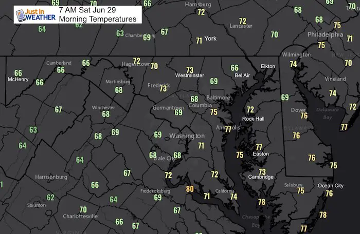
Morning Temperatures
Afternoon High Temperatures
Radar Simulation —> slider

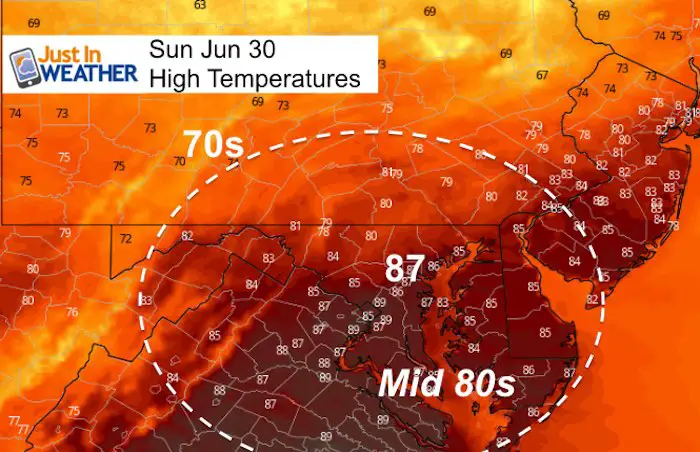
High Temperatures Sunday
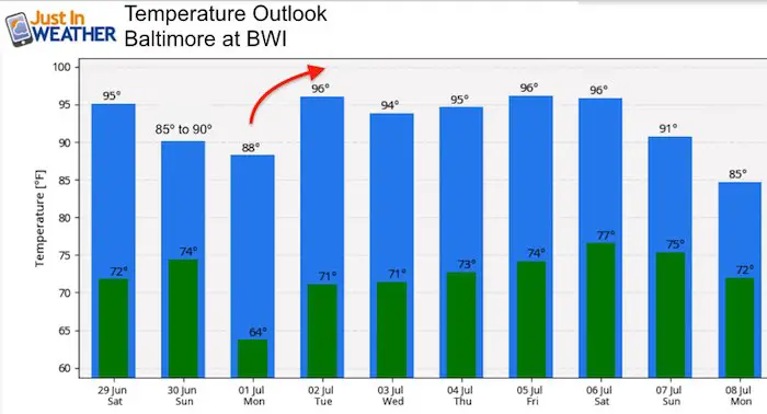
Temperature Outlook
Join My Team: Maryland Trek 6
Our look got an upgrade, but we have the same purpose. Please click the logo take a look at our new page.

Support Our Nonprofit:
Proceeds go to our programs Providing FREE holistic care for kids in cancer treatment and up to 5 years post treatment and caregivers.
![]()
Shine On
Proceeds from all sales go to Just In Power Kids. Click the image to shop and show your support.

Love Maryland Shirts and Hoodies
This shirt was designed by my ‘bonus’ daughter Jaiden. The hoodie has been the biggest hit, so our promotion has been extended until the end of this week.
|
||
|
Show your love for Maryland and make this 14 year old artist and her mom extra proud
|
Please share your thoughts, best weather pics/video, or just keep in touch via social media
Related Links:
Was Your County Not Included?
Click this map for more on the regional forecast zones
