


El Nino Winters
What El Niño usually means for us:
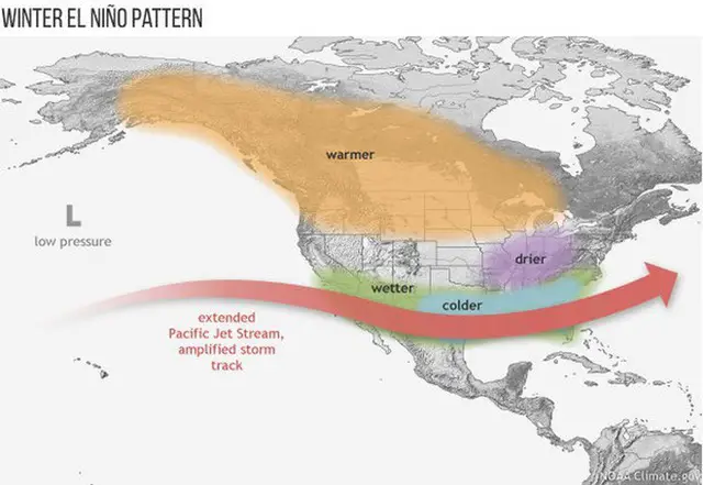
A stormy pattern across the southern US that can turn into Nor’easters for us.
El Niño is when warm water in the tropical Pacific moves east and shifts the jet stream over North America. This happens every 3 to 7 years. The rest of that water gyre is called the Southern Oscillation. La Niña is when cool water upwelling resumes in the eastern Pacific, and the warmer water is pushed farther west.
How is El Niño measured and determined?
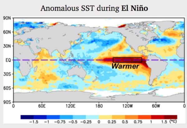
Sea Surface Temperatures (SST) Anomalies. Basically, where the ocean water is warmer or colder than normal. This is done through numerous remote buoys and satellites. The region of above normal temperatures can expand across the tropical Pacific from Central and South America.
Video: El Niño and La Niña Explained
From NOAA’s National Ocean Service
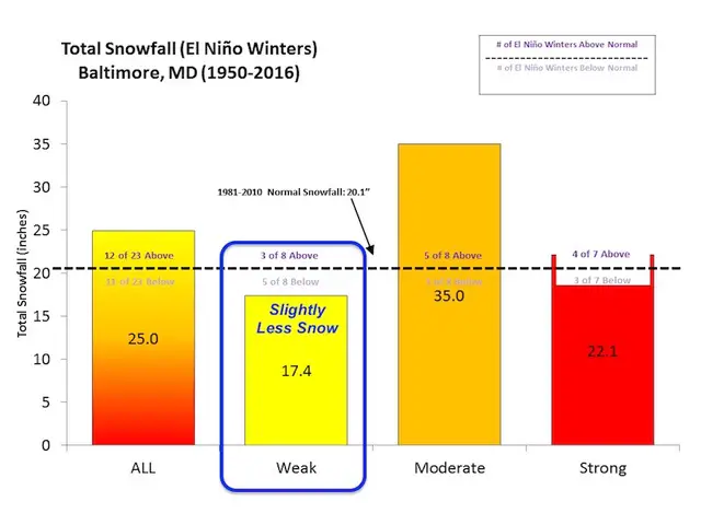
Winter Snow From El Niño
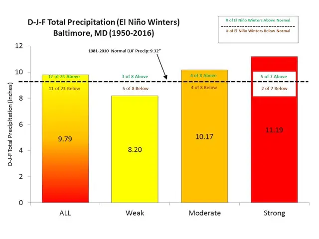
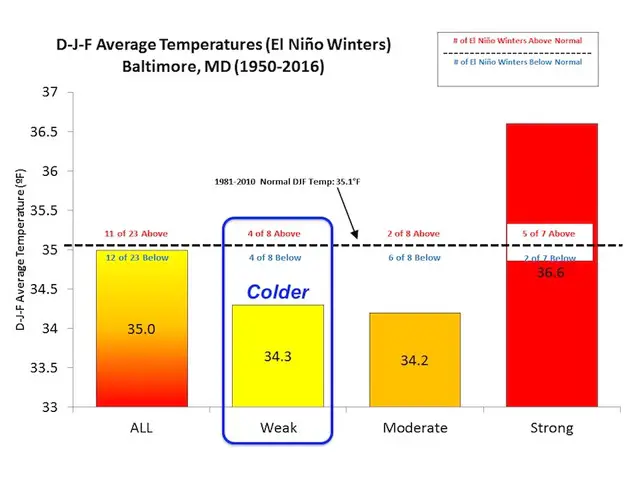
For arguments sake, I use Baltimore as a central location for our region.
As I wrote recently: If you want snow during an El Niño year, you would want to root on a MODERATE El Niño. That historically has been our best chance to get well above normal snow. The average in those years is 35 inches compared to the ‘normal’ 20.1 inches. *Normal is not the best scientific term, but is what NWS uses.
First, what is El Niño?
No, it’s not Chris Farley. But if I didn’t show it I would be letting many down.
Simply put, El Niño is a build up of warm water in the tropical Pacific that shifts to the eastern part of the ocean every 3 to 7 years. The net result shifts where many storms form, upper level winds, and the resulting storm pattern in the US during the winter.