


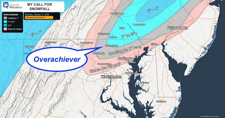
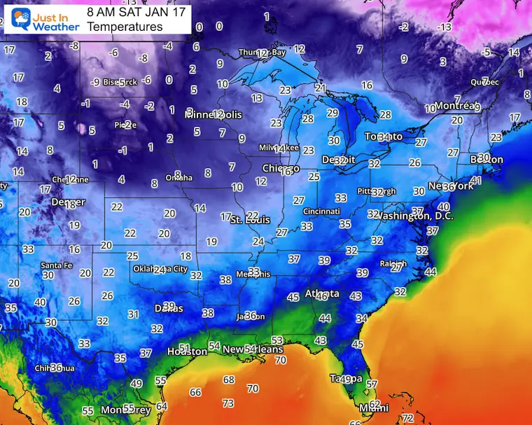
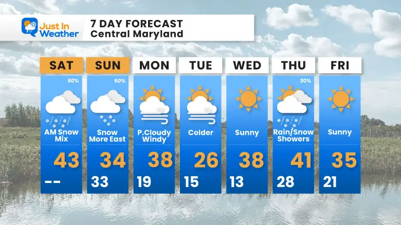
My Call For Snowfall Saturday Morning Inland And Sunday Closer To The Coast
Friday Evening Update January 16, 2026 Two weather events will bring snow to our region this weekend. They are related to the fast winds aloft on the edge of this…
Saturday, January 17 Morning Report
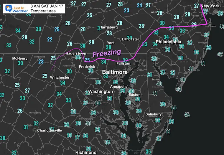
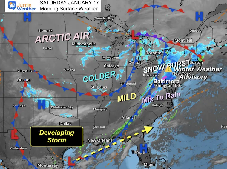
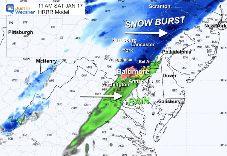
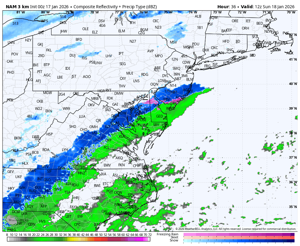
This morning has already validated the forecast for snow but put the complication on display. First, this has been well ahead of modeling in timing and location. Second, the temps are above freezing in most local areas. So, we have snow, and it will mix across parts of Central and Southern Maryland during the morning. Meanwhile, a Winter Weather Advisory is in place for South Central Pennsylvania, where the snow burst will catch with temps barely at freezing early enough for some stickage on roads.
I’ve included my snow expectations for parts of North Central Maryland as well.
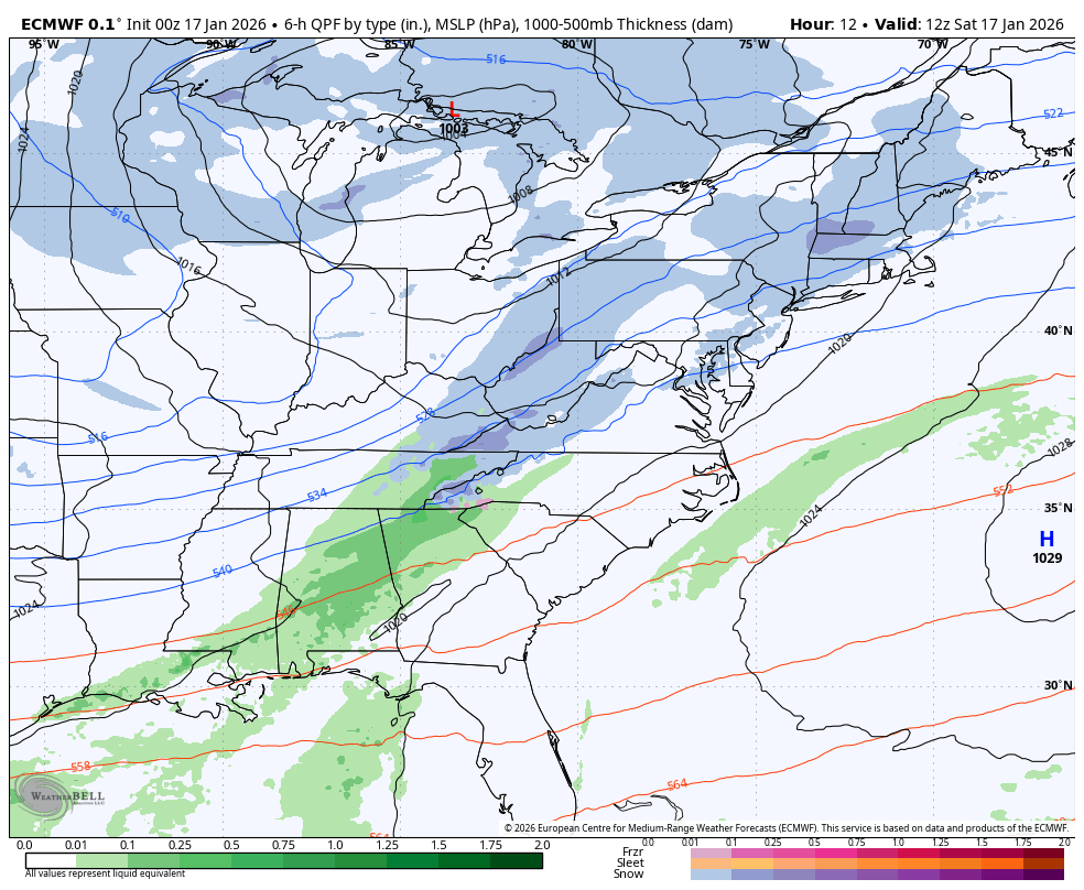
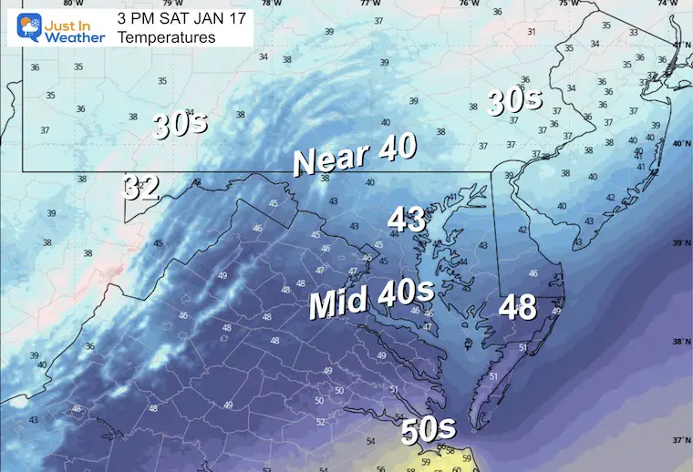
Tomorrow, a second storm will form on the Gulf and move off the coast. This will bring that North Florida snow we’ve talked about, and clip the coast. Again, temperatures will be above freezing so stickage will depend on intensity. I see this as more of an impact on Delmarva, but there has been a trend a little west on the modeling to bring at least falling snow to the I-95 region west of the Chesapeake Bay.
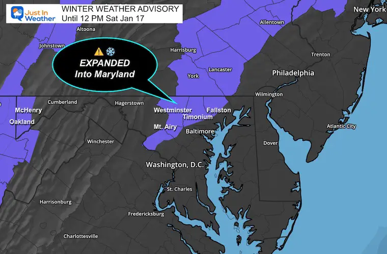
This has been EXPANDED into Maryland. This includes Western Howard County, Carroll, Northern Baltimore AND Northern Harford Counties.
1 to 3 inches of slushy snow and road impacts!
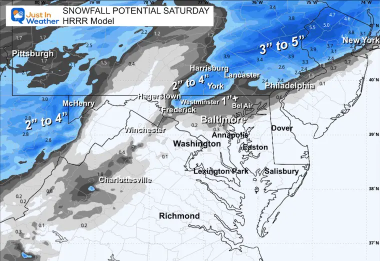
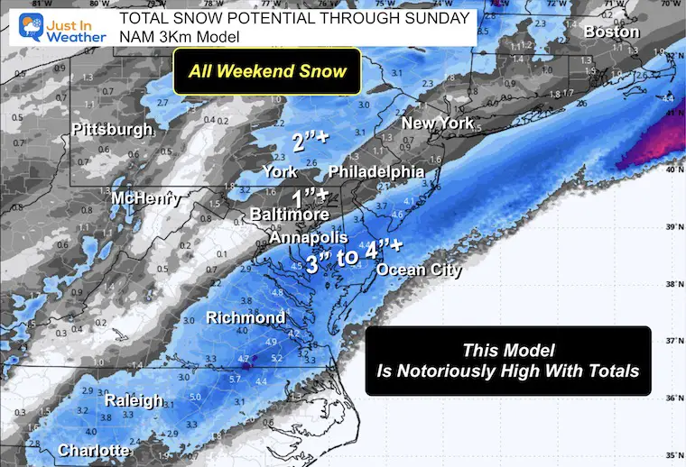
I am admitting fault here as some areas have reported OVER 2 inches as of 8 AM. Perhaps the HRRR Model last night was correct. Compare that below.
This showed the potential for 2 to 4 inches north of Frederick to York and Lancaster PA. It may have had the right idea.
Here was my post on Facebook, and the comments supporting these Dippin’Dots like flakes.
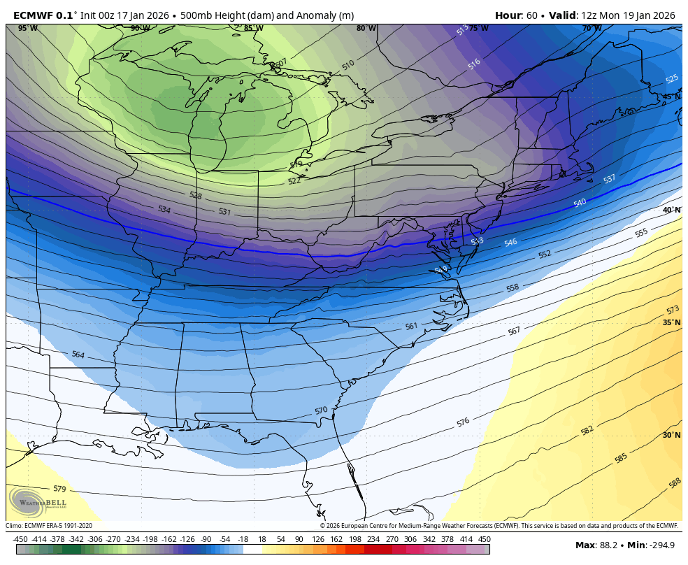
This wide view highlights the push of colder air and arctic sourcing across the Northern Plains.
For Baltimore and the Mid-Atlantic: A wintry mix is moving through the region this morning! Snow burst to our north, while we see a mix transitioning to rain.
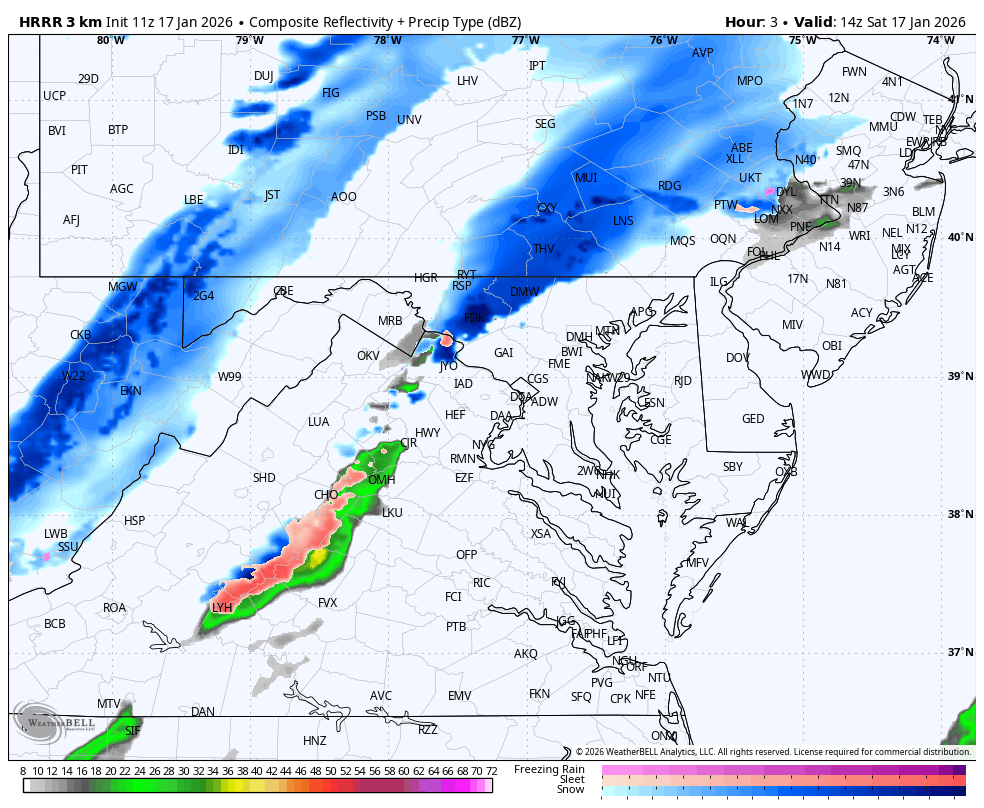
Suggestion, not a promise. This model missed the early band of snow, so this line may be off as much as 1 hour with timing.
WESTERN MARYLAND
This webcam is positioned at The Greene Turtle Deep Creek Lake and shows Wisp Resort, including a zoomed-in view of Squirrel Cage, The Face, the terrain park, Boulder, the mountain coaster, the tubing park and a shot of McHenry Cove at Deep Creek Lake!
Yesterday: Low 18°F; High 36°F
Precipitation: 0.00″
Season Snow Total: 2.0″
Snow Depth: MM (Missing)
Top Wind Gust: 37 mph
Sunrise at 7:24 AM
Sunset at 5:10 PM
Normal Low in Baltimore: 25ºF
Record Low: -7ºF in 1982
Normal High in Baltimore: 43ºF
Record High: 68ºF in 1913
Rainfall Deficit at BWI
The challenge here will be two-fold:
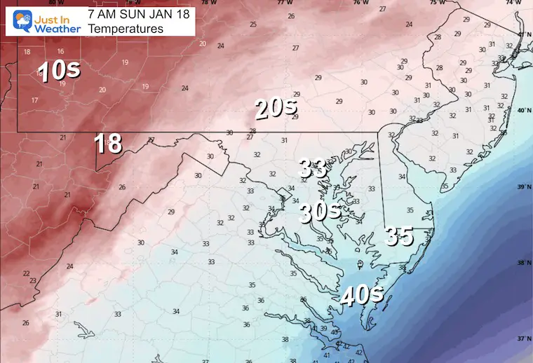
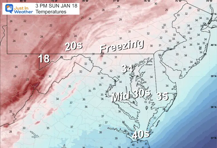
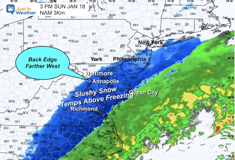
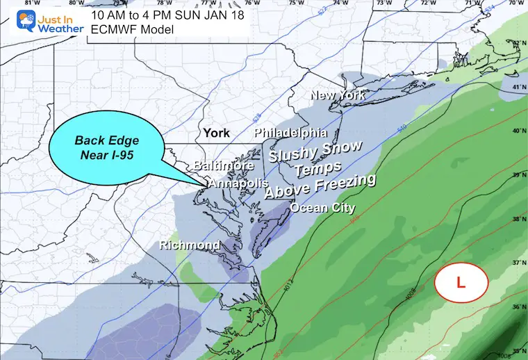
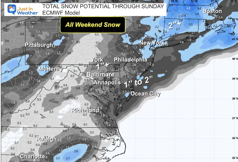
There will be a southern storm moving off the coast and bringing slushy snow along the coast. If we stick with the reliable European Model, we see the light snow mainly South and East of Annapolis. Other models have been pulling this farther west with light snow near I-95.
The important factor here will be temperatures that will primarily be ABOVE Freezing. Snow can fall from colder clouds, but will it stick or impact the ground?
Heavier intensity, like today, can overtake the ground and lead to slushy snow. That is what may occur on Delmarva.
This model is aggressive with the snow intensity and farther west.
This is the model I have been sticking with due to consistency, and the focus is on Delmarva. Light snow or flurries may reach West of the Bay.
Highest possible, but less likely.
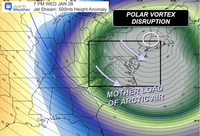
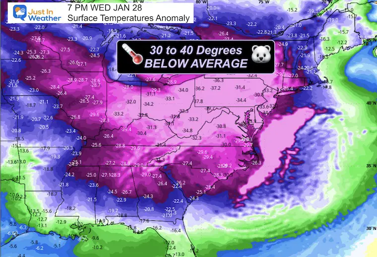
We might be looking at temperatures 30 degrees below average or more!
This is imperfect and just a suggestion for now.
Subscribe for email Alerts
Sign up and be the first to know!

In case you missed it, click this image for brief summary of the final snow totals from the last event.

In case you missed it, click this image for brief summary of the final snow totals from the last event.

Click here for the full report

This was issued October 9, as expected: A weak and short-lived event to start winter may play a different role this winter.

These are NOT all the same caterpillar!


Click to see more and ‘Book’ a visit to your school


The annual event: Hiking and biking 329 miles in 7 days between The Summit of Wisp to Ocean City.
Each day, we honor a kid and their family’s cancer journey.
Fundraising is for Just In Power Kids: Funding Free Holistic Programs. I never have and never will take a penny. It is all for our nonprofit to operate.
Click here or the image to donate:

I am aware there are some spelling and grammar typos and occasional other glitches. I take responsibility for my mistakes and even the computer glitches I may miss. I have made a few public statements over the years, but if you are new here, you may have missed it: I have dyslexia and found out during my second year at Cornell University. It didn’t stop me from getting my meteorology degree and being the first to get the AMS CBM in the Baltimore/Washington region. One of my professors told me that I had made it that far without knowing and to not let it be a crutch going forward. That was Mark Wysocki, and he was absolutely correct! I do miss my mistakes in my own proofreading. The autocorrect spell check on my computer sometimes does an injustice to make it worse. I can also make mistakes in forecasting. No one is perfect at predicting the future. All of the maps and information are accurate. The ‘wordy’ stuff can get sticky. There has been no editor who can check my work while writing and to have it ready to send out in a newsworthy timeline. Barbara Werner is a member of the web team that helps me maintain this site. She has taken it upon herself to edit typos when she is available. That could be AFTER you read this. I accept this and perhaps proves what you read is really from me… It’s part of my charm. #FITF