


January 13 Mild Ahead Of Arctic Front That Will Bring Rain To Snow Later Wednesday
Tuesday January 13 We are once again back to mild afternoons with sunshine, but that is about to change. The next cold front will usher in a series of arctic…
Wednesday January 14
Winter is about to make a return with cold air. While this is an unsettled pattern, the stars are not aligning just yet to produce any organized winter storms. We will have little disturbances that can produce snow showers on a few days in the near future.
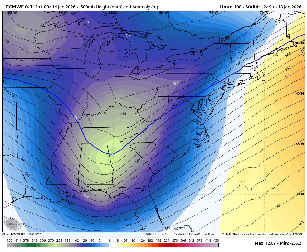
A reinforcing push of arctic air will be colder next week. This is all in line with climatology that typically shows the coldest air of the year during mid to late January.
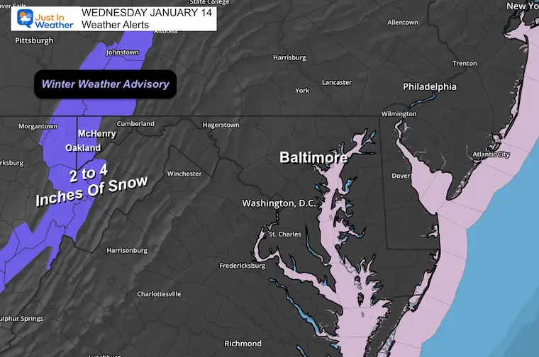
Winter is a alive and well in Western Maryland. A new Winter Weather Advisory goes into effect tonight for 2 to 4 new inches of snow. Wisp has had 52” of snow already so far this season.
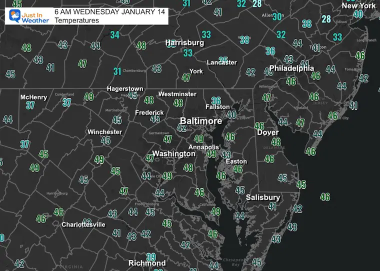
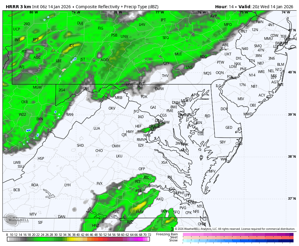
Some rain developing this morning, but the main event will be later.
Lack of Phasing! If you want a winter storm in the Eastern US, you need a connection of the Northern and Southern branches of the jet stream. They are separated.
The GFS Model (which I never supported) is the one that made the mistake bringing these forces today, tonight, into tomorrow.
The cold air is going to arrive, but not team up over our region.
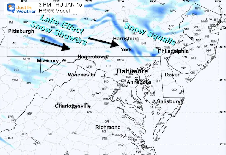
What we will get is arctic air and a smaller piece of energy to produce occasional snow showers or flurries.
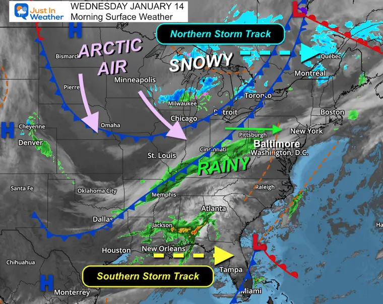
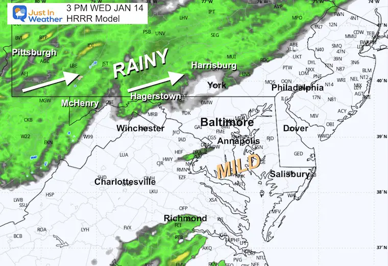
Rain pushes into central areas tonight.
Colder air catches up to the mountains, where snow over Western Maryland and nearby PA and WV have a Winter Weather Advisory for 2 to 4 inches of new snow.
Tonight to Thursday Morning for 2 to 4 inches of new snow.
This webcam is positioned at The Greene Turtle Deep Creek Lake and shows Wisp Resort, including a zoomed-in view of Squirrel Cage, The Face, the terrain park, Boulder, the mountain coaster, the tubing park and a shot of McHenry Cove at Deep Creek Lake!
Yesterday: Low 25°F; High 52°F
Precipitation: 0.00″
Season Snow Total: 2.0″
Snow Depth: 0″
Top Wind Gust: 23 mph
Sunrise at 7:25 AM
Sunset at 5:07 PM
Normal Low in Baltimore: 25ºF
Record Low: -2ºF in 1912
Normal High in Baltimore: 43ºF
Record High: 79ºF in 1932
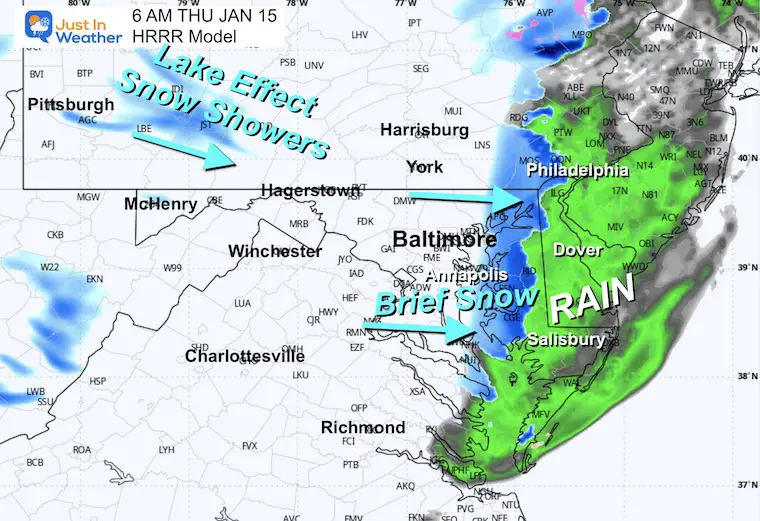
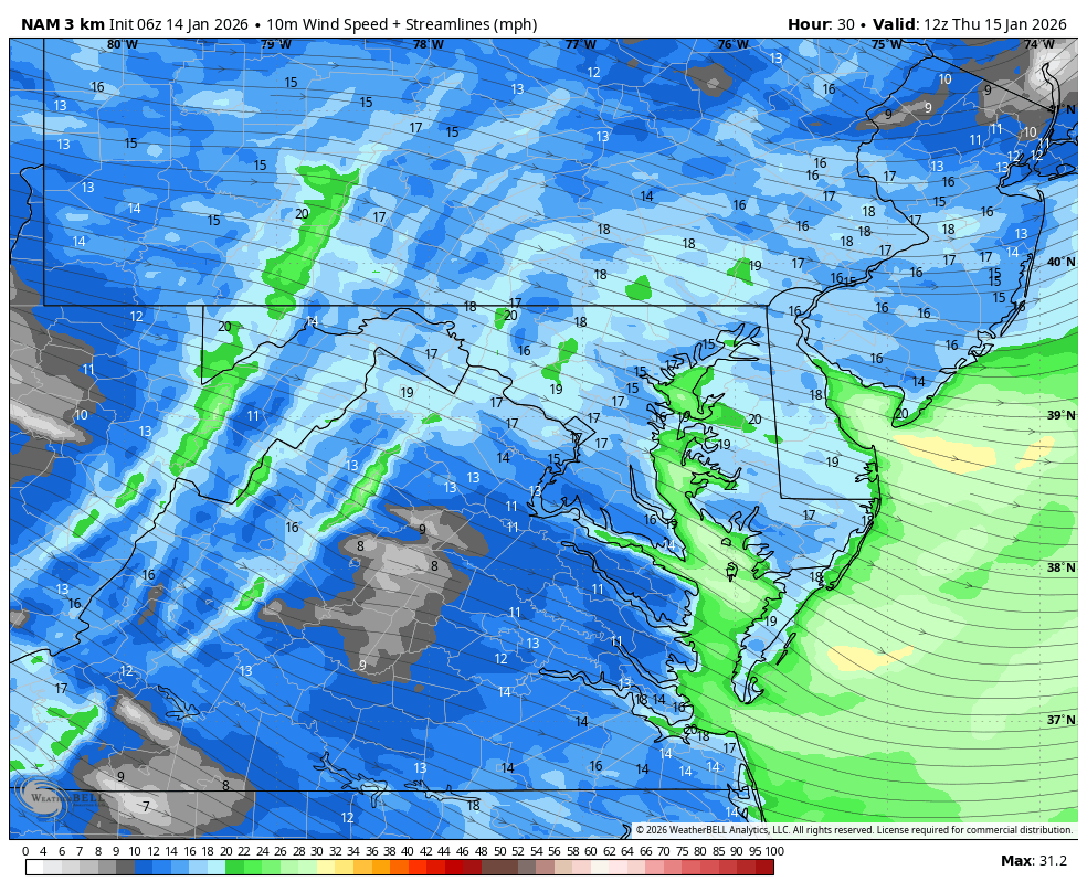
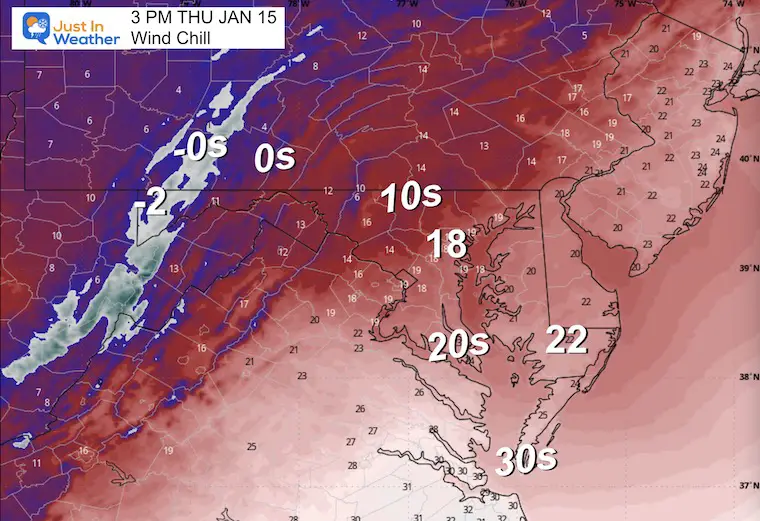
Brief change to snow on the arctic front, then the winds pick up as temperatures drop!
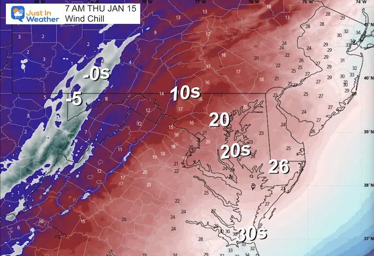
Gusts 30 to 45 mph
The cold winds will carry snow showers and maybe a Snow Squall across the northern areas (typical).
The active pattern will carry pieces of energy that the global deterministic models are still having trouble resolving.
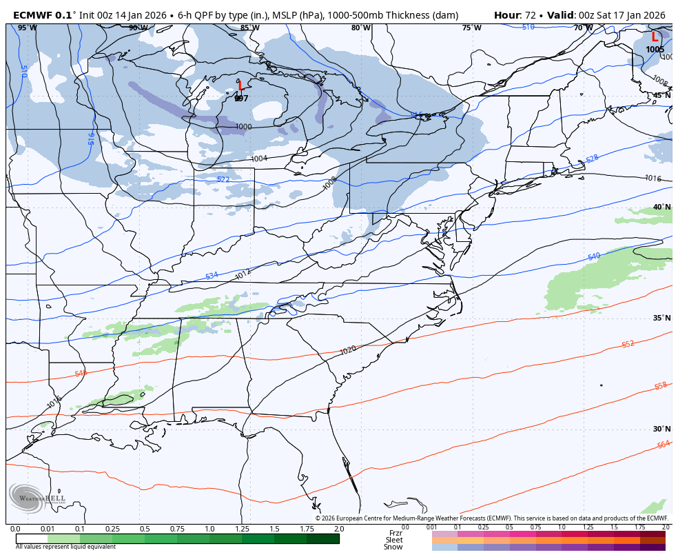
Here we see a band of snow showers set up with the jet streak on Saturday. And another pushing towards the coast on Sunday.
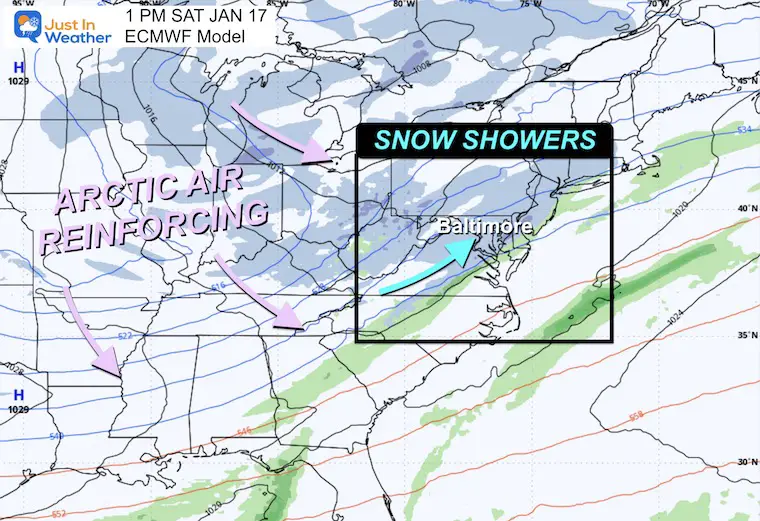
The second push of arctic air will be colder next week.
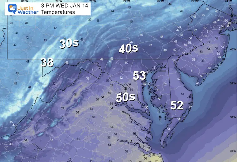
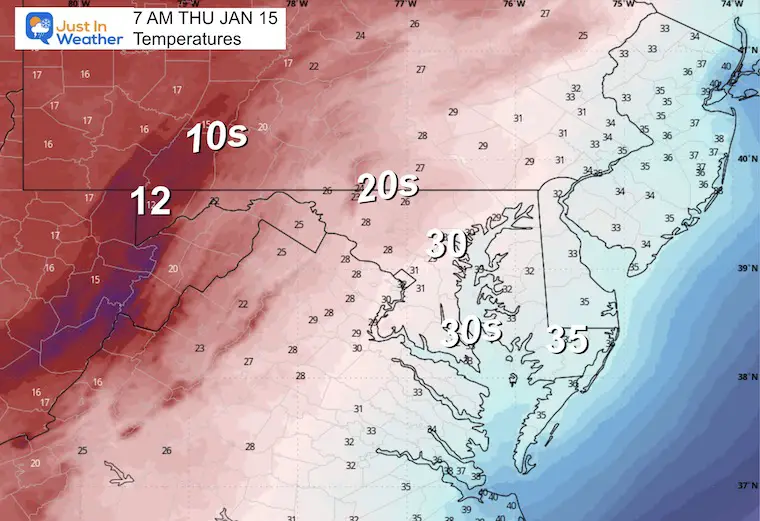
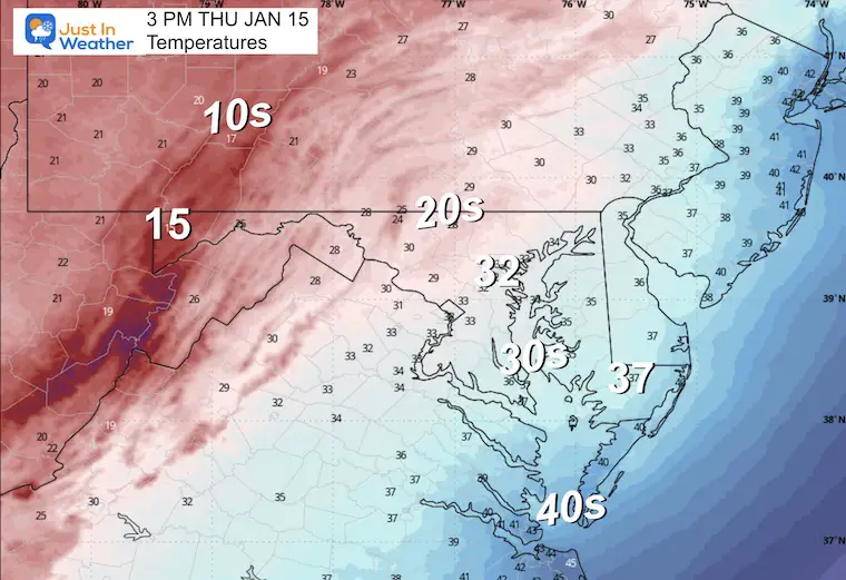
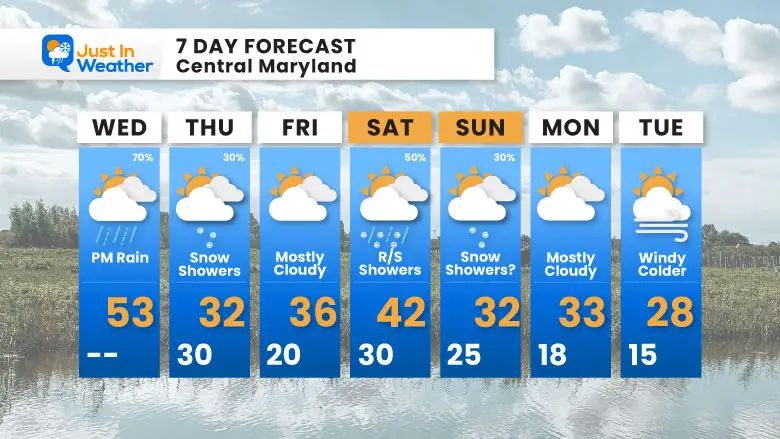
Big temperature swing coming! From the low 50s on Wednesday down to the low 30s on Thursday — and look at that Monday low of 15°F! Winter is settling in for a while.
Subscribe for email Alerts
Sign up and be the first to know!

In case you missed it, click this image for brief summary of the final snow totals from the last event.

In case you missed it, click this image for brief summary of the final snow totals from the last event.

Click here for the full report

This was issued October 9, as expected: A weak and short-lived event to start winter may play a different role this winter.

These are NOT all the same caterpillar!


Click to see more and ‘Book’ a visit to your school


The annual event: Hiking and biking 329 miles in 7 days between The Summit of Wisp to Ocean City.
Each day, we honor a kid and their family’s cancer journey.
Fundraising is for Just In Power Kids: Funding Free Holistic Programs. I never have and never will take a penny. It is all for our nonprofit to operate.
Click here or the image to donate:

I am aware there are some spelling and grammar typos and occasional other glitches. I take responsibility for my mistakes and even the computer glitches I may miss. I have made a few public statements over the years, but if you are new here, you may have missed it: I have dyslexia and found out during my second year at Cornell University. It didn’t stop me from getting my meteorology degree and being the first to get the AMS CBM in the Baltimore/Washington region. One of my professors told me that I had made it that far without knowing and to not let it be a crutch going forward. That was Mark Wysocki, and he was absolutely correct! I do miss my mistakes in my own proofreading. The autocorrect spell check on my computer sometimes does an injustice to make it worse. I can also make mistakes in forecasting. No one is perfect at predicting the future. All of the maps and information are accurate. The ‘wordy’ stuff can get sticky. There has been no editor who can check my work while writing and to have it ready to send out in a newsworthy timeline. Barbara Werner is a member of the web team that helps me maintain this site. She has taken it upon herself to edit typos when she is available. That could be AFTER you read this. I accept this and perhaps proves what you read is really from me… It’s part of my charm. #FITF