


December 20 Less Wind This Weekend And A Little Mess Before Christmas
Saturday, December 20, 2025 The FIERCE FRIDAY lived up to expectations. The Peak Wind Gust at BWI was 56 mph, while Camp David in the mountains of Northern Frederick County…
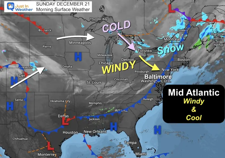
Sunday, December 21, 2025
Today marks the start of astronomical winter. The Winter Solstice at 10:03 AM is when the North Pole is pointing the farthest away from the sun. It’s our lowest sun angle AND shortest daylight of the year. So winter is truly just getting started, even if it may feel mild for a week.
More fun facts below.
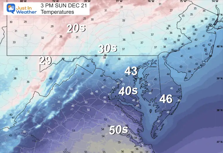
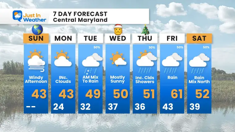
There is a building heat wave of sorts for the middle of the US. We will be on the edge, catching some active weather in the transition zone before Christmas and perhaps after. We never get into the full warmth, but it will be mild for a while.
The curious parts will be an attempt for a wintry mix in the region on Tuesday that will bring snow to our north. Then another push of rain and colder air is expected over next weekend.
So while the holiday will be quiet and mild, the winter pattern is nearby and will try to fight back.
Let’s take a look.

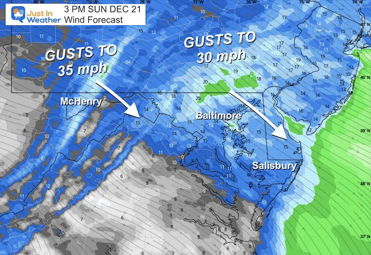
High Pressure will track off the coast, shifting our light wind from the south, allowing a push of mild air to return.
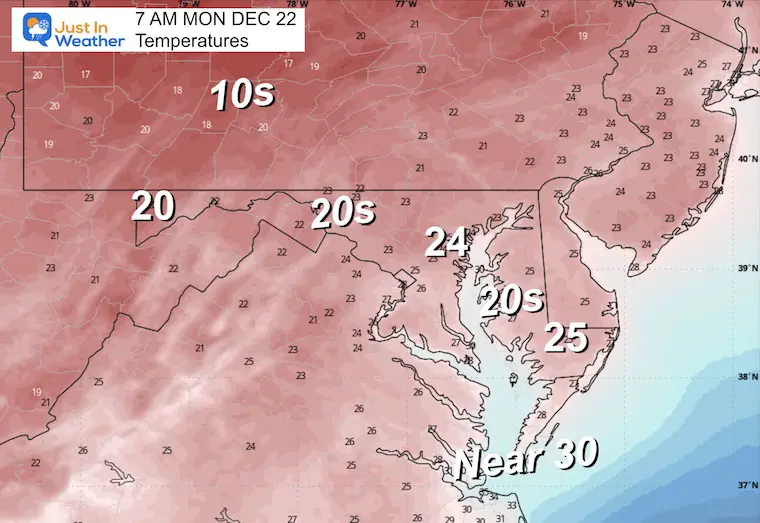
There is one more push of cold air that will reach us on Monday.
Look closely, and you might see the High Pressure pass across Southern Maryland and shift the winds this afternoon and evening.
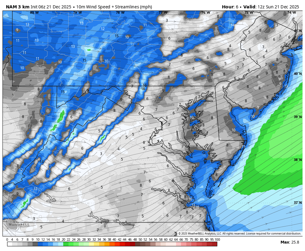
Wind is still in full force in this region. A fresh coasting to few inches of snow has blanketed the region.
This webcam is positioned at The Greene Turtle Deep Creek Lake and shows Wisp Resort, including a zoomed-in view of Squirrel Cage, The Face, the terrain park, Boulder, the mountain coaster, the tubing park and a shot of McHenry Cove at Deep Creek Lake!
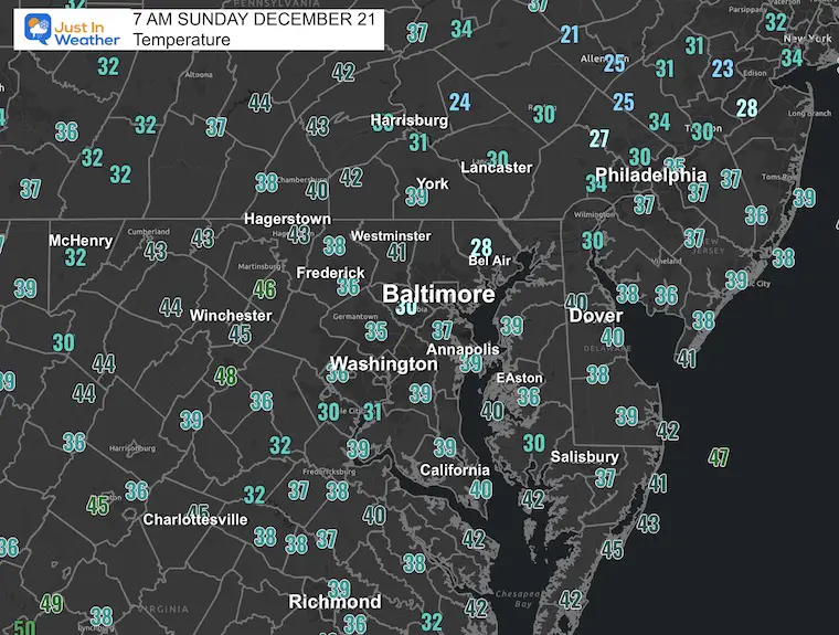
Yesterday: Low 23°F; High 44°F
Precipitation: 0.00″
Season Snow Total: 2.0″
Snow Depth: 0″
Top Wind Gust: 22 mph
Sunrise at 7:23 AM
Sunset at 4:47 PM
Normal Low in Baltimore: 29ºF
Record Low: 5ºF in 1942
Normal High in Baltimore: 46ºF
Record High: 71ºF in 2013
Rainfall Deficit at BWI
Sign up and be the first to know!

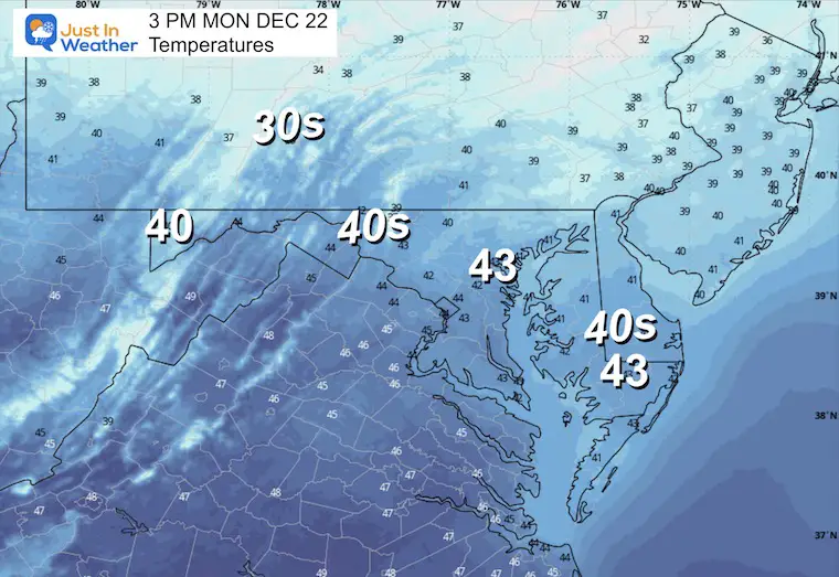
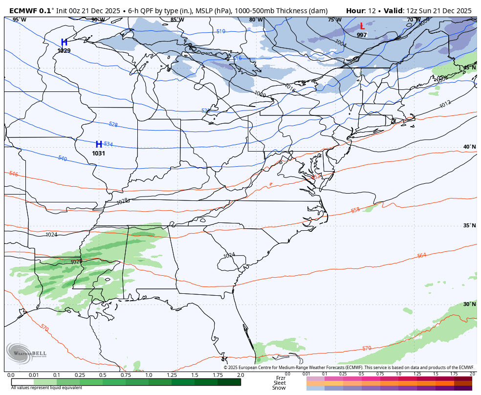
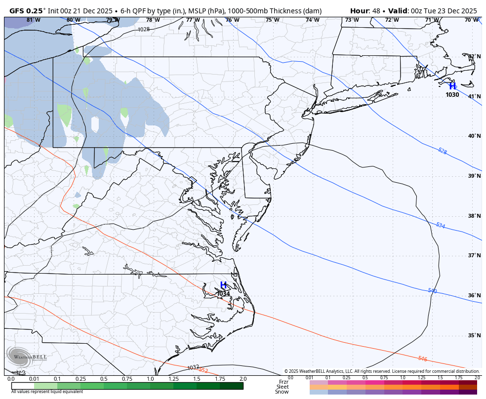
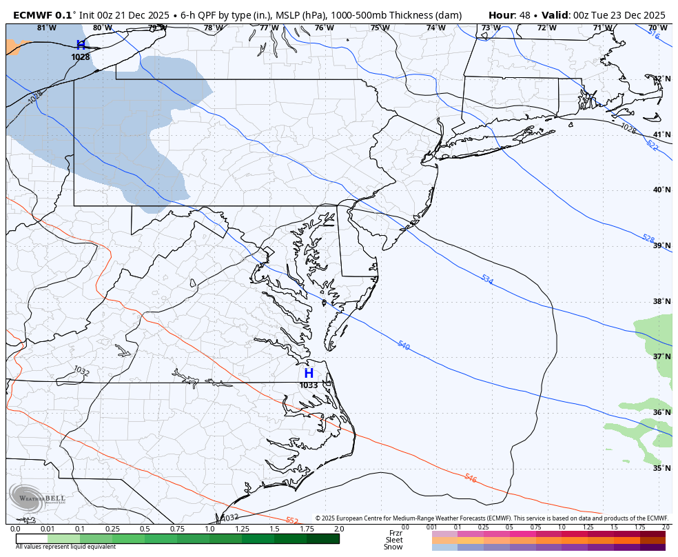
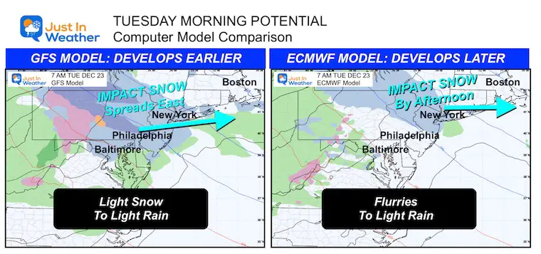
Monday Night to Tuesday Night: The boundary or transition between the chilly Northeast and warm Midwest will be a band of overrunning precipitation. The GFS Model (not my favorite) has been persistently pushing light snow to reach Central Maryland Tuesday morning, then turning to rain. While a moderate impact snow will fall across parts of Pennsylvania, New York, and New England.
The ECMWF Model has this develop slower and moves the impact farther north and east.
I am showing the comparison because there has been a trend farther south… and may bring ambient morning flakes to parts of metro Baltimore. Also, there will be an impact for travelers heading north on Tuesday.
OMEGA BLOCK: Christmas Eve may turn out to bring record heat to the Southern Plains of the US. The coasts will be unsettled.
This is called an Omega Block because it looks like the Greek Letter Omega.
Here in the Mid-Atlantic and Northeast US, the edge of the cool influence is from a trough. This is why we may see some wintry mix in the region and a sharp boundary from the warmth to the chill.
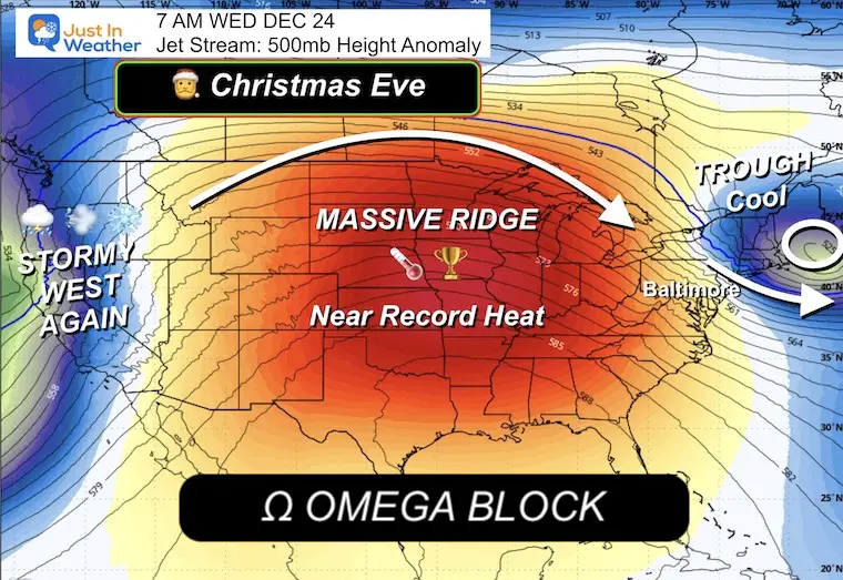
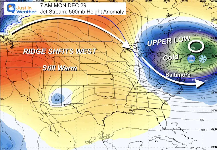
Watching how the blocking on the North Atlantic will attempt to build WEST into New England and just barely get into the Mid-Atlantic.
IF this happens, then the very warm air in the middle of the nation will also get pushed back to the West.
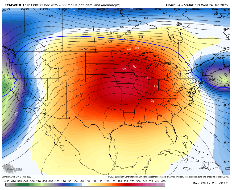
This all depends on a blocking pattern in the North Atlantic. If it does develop, then a push of colder air will arrive from New England as the Ridge with Warm air in the middle of the US gets pushed West.
Subscribe for eMail Alerts
Sign up and be the first to know!
In case you missed it, click this image for brief summary of the final snow totals from the last event.

In case you missed it, click this image for brief summary of the final snow totals from the last event.

Click here for the full report

This was issued October 9, as expected: A weak and short-lived event to start winter may play a different role this winter.

These are NOT all the same caterpillar!


Click to see more and ‘Book’ a visit to your school


The annual event: Hiking and biking 329 miles in 7 days between The Summit of Wisp to Ocean City.
Each day, we honor a kid and their family’s cancer journey.
Fundraising is for Just In Power Kids: Funding Free Holistic Programs. I never have and never will take a penny. It is all for our nonprofit to operate.
Click here or the image to donate:

I am aware there are some spelling and grammar typos and occasional other glitches. I take responsibility for my mistakes and even the computer glitches I may miss. I have made a few public statements over the years, but if you are new here, you may have missed it: I have dyslexia and found out during my second year at Cornell University. It didn’t stop me from getting my meteorology degree and being the first to get the AMS CBM in the Baltimore/Washington region. One of my professors told me that I had made it that far without knowing and to not let it be a crutch going forward. That was Mark Wysocki, and he was absolutely correct! I do miss my mistakes in my own proofreading. The autocorrect spell check on my computer sometimes does an injustice to make it worse. I can also make mistakes in forecasting. No one is perfect at predicting the future. All of the maps and information are accurate. The ‘wordy’ stuff can get sticky. There has been no editor who can check my work while writing and to have it ready to send out in a newsworthy timeline. Barbara Werner is a member of the web team that helps me maintain this site. She has taken it upon herself to edit typos when she is available. That could be AFTER you read this. I accept this and perhaps proves what you read is really from me… It’s part of my charm. #FITF