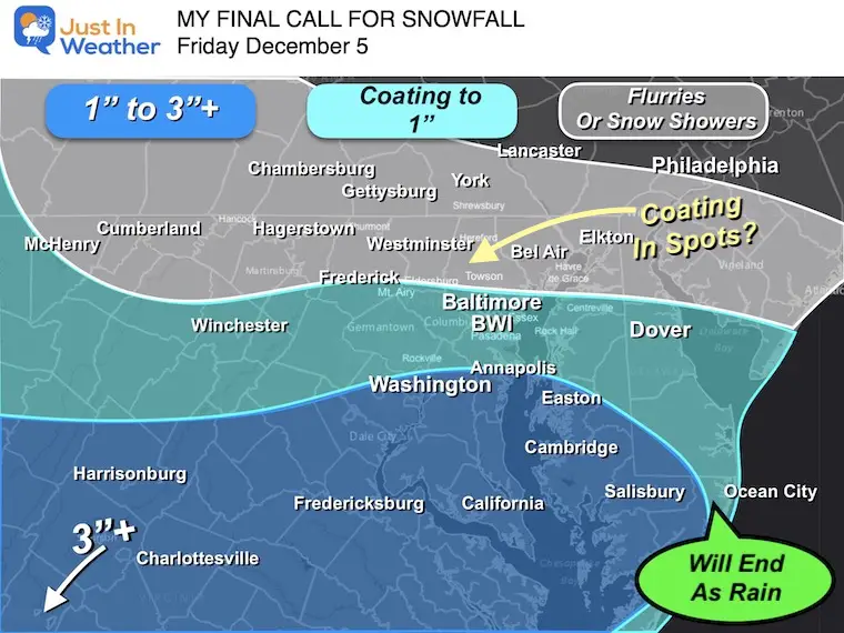
Saturday December 6 2025
Morning Report
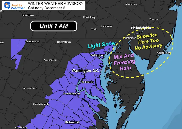
There was a Winter Weather Advisory issued last night for the expectation of freezing drizzle. The short-range models supported that with slightly warmer air aloft.
What occurred was more light snow and a fresh coating around metro Baltimore and Northeast Maryland.
Pockets of icing with freezing rain did occur around the Chesapeake Bay up I-95 to New Jersey.
This was tough to analyze, but I got a lot of corroborating reports with my early morning post, even photos to validate the snow coating.
My First EARLY Report
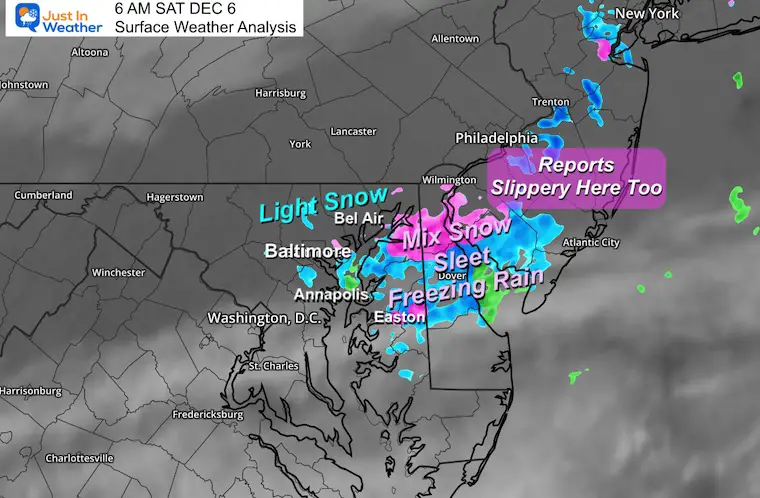
Local Analysis
The light snow and freezing rain mix affected Central Maryland and across the Bay to Delmarva. Also up to Northeast Maryland and Metro Philadelphia to New Jersey and New York
It might be slick this morning.
Winter Weather Advisory: Expired At 7 AM
This was intended for Freezing Drizzle, but there was more light snow, and a coating did lay and stay on the ground.
I want to show you the area alerted and the area that may have similar conditions that were not included.
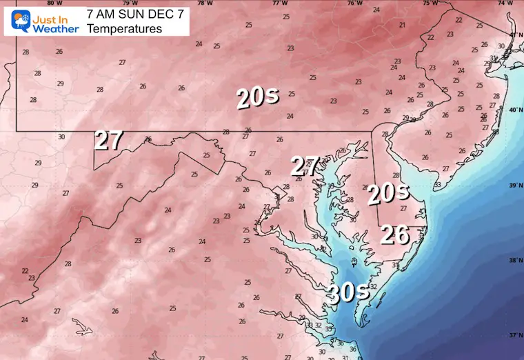
Temperatures at 7 AM

WEATHER TODAY
Morning Surface Weather
This pocket of light snow and freezing rain that developed overnight was confined to Central Maryland across Delmarva and up I-95 to include metro Philadelphia to New York.

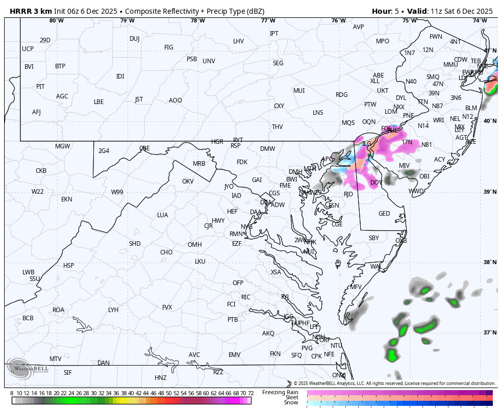
SHORT RANGE FORECAST
Radar Simulation to Noon
The light precipitation will be ending over the next few hours.
Cloud Forecast to 7 PM
There are some breaks in the cloud cover that will try to expand east during the day. Better chance tonight to clear out.

Afternoon Temperatures

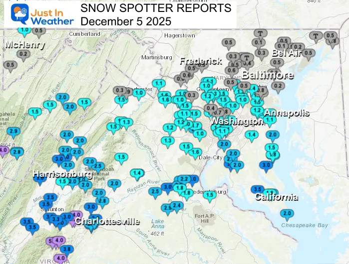
PRELIMINARY SNOW REPORTS
I will have the final report later this morning. Full analysis is at 8 AM daily.
Local Snow Spotter Reports
Regional Snow Analysis As Of Last Evening

Very Close to My Formal Forecast
CLIMATE DATA: Baltimore
Yesterday: Low 25F; High 32F
Precipitation: 0.04”
Snow = 1” – The first accumulating snow in December since 2020
Top Wind Gust 21 mph
TODAY December 6
Sunrise at 7:12 AM
Sunset at 4:44 PM
Normal Low in Baltimore: 32ºF
Record 16ºF in 1886; 1926; 1966
Normal High in Baltimore: 50ºF
Record 75ºF 2001
Rainfall Deficit at BWI
- Ending 2024 = -8.00”
- Since Jan 1 = 6.50”
- We are STILL DOWN -14.50” INCLUDING LAST YEAR
FAITH IN THE FLAKES STORE
NOW OPEN FOR THE SEASON
click here

SUNDAY
Morning Temperatures
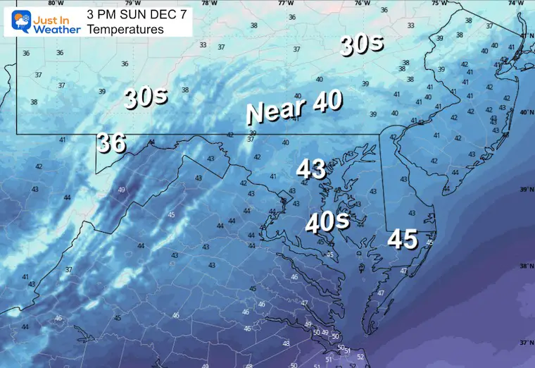
Afternoon Temperatures
Looking Ahead:
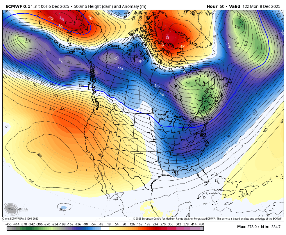
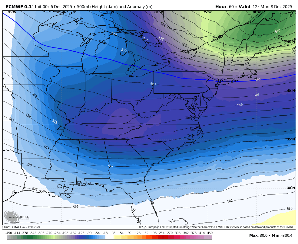
Jet Stream: North America Monday to Friday
The advertised Polar Vortex will be sending more lobes of arctic air our way. The first will arrive on Monday, then again later in the week, which may be the coldest so far.
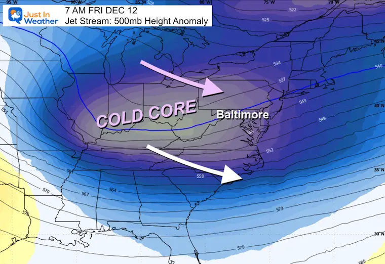
Closer Look: Monday to Friday
Snapshot Friday
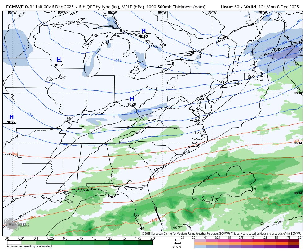
Storm Forecast: Monday To Friday
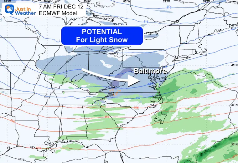
There will be a few clippers passing to our north. This will help some mild air fill in during the week, then possibly bring in a track farther south that could bring us a chance for light snow on Friday.
Snapshot Next Friday
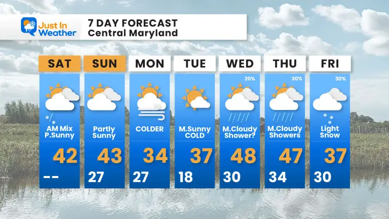
7 Day Forecast
Subscribe for eMail Alerts
My Winter Outlook For Above-Average Snow
Click here for the full report

La Niña Advisory
This was issued October 9, as expected: A weak and short-lived event to start winter may play a different role this winter.

In Case You Missed It
Woolly Bear Caterpillar Winter Folklore
These are NOT all the same caterpillar!

Winter Outlook From 2 Farmers’ Almanacs

STEM Assemblies/In School Fields Trips Are Back
Click to see more and ‘Book’ a visit to your school

THANK YOU:
Baltimore Sun Magazine Readers’ Choice Best Of Baltimore

Maryland Trek 12 Day 7 Completed Sat August 9
UPDATED: We raised OVER $166,000 for Just In Power Kids – AND Still Collecting More
The annual event: Hiking and biking 329 miles in 7 days between The Summit of Wisp to Ocean City.
Each day, we honor a kid and their family’s cancer journey.
Fundraising is for Just In Power Kids: Funding Free Holistic Programs. I never have and never will take a penny. It is all for our nonprofit to operate.
Click here or the image to donate:

RESTATING MY MESSAGE ABOUT DYSLEXIA
I am aware there are some spelling and grammar typos and occasional other glitches. I take responsibility for my mistakes and even the computer glitches I may miss. I have made a few public statements over the years, but if you are new here, you may have missed it: I have dyslexia and found out during my second year at Cornell University. It didn’t stop me from getting my meteorology degree and being the first to get the AMS CBM in the Baltimore/Washington region. One of my professors told me that I had made it that far without knowing and to not let it be a crutch going forward. That was Mark Wysocki, and he was absolutely correct! I do miss my mistakes in my own proofreading. The autocorrect spell check on my computer sometimes does an injustice to make it worse. I can also make mistakes in forecasting. No one is perfect at predicting the future. All of the maps and information are accurate. The ‘wordy’ stuff can get sticky. There has been no editor who can check my work while writing and to have it ready to send out in a newsworthy timeline. Barbara Werner is a member of the web team that helps me maintain this site. She has taken it upon herself to edit typos when she is available. That could be AFTER you read this. I accept this and perhaps proves what you read is really from me… It’s part of my charm. #FITF
Please share your thoughts and best weather pics/videos, or just keep in touch via social media.


