


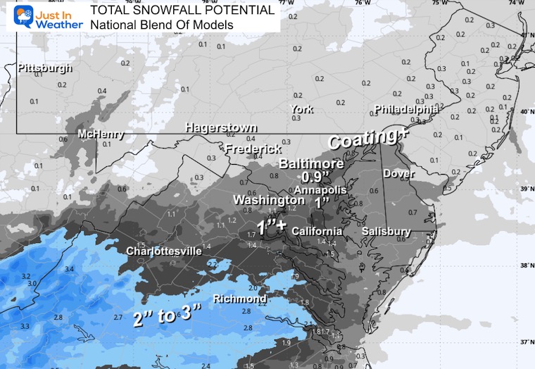
My First Call For Light Snow On Friday Afternoon And Evening And Model Total Maps
Wednesday December 3 Evening Update A little bit of snow can be a big problem, especially when the timing is for a commute, and the temperatures will be cold enough…
Thursday, December 4 2025
Morning Report
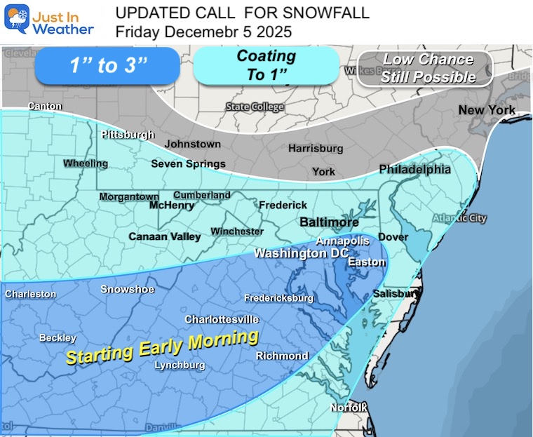
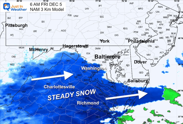
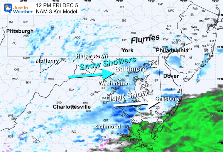
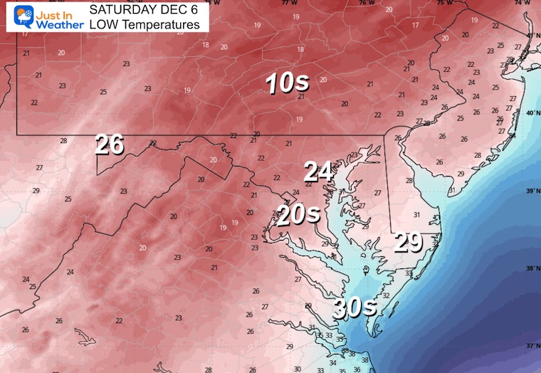
The important change I want to emphasize in this report is that the little snow event on Friday will arrive a few hours earlier and may bring more ‘in the sweet spot’. This time, snow will be mostly across Virginia into Southern Maryland.
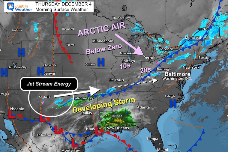
There is a race between arctic air with a cold front and a southern branch storm trying to form. Whichever arrives first will determine how far north they can reach Friday morning, and of course, metro Baltimore is on the edge… AGAIN!
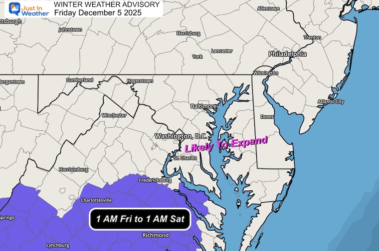
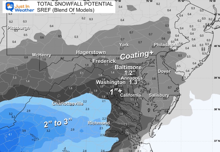
A Winter Weather Advisory has been posted for Southern Virginia that includes Charlottesville and Richmond, where 1 to 3 inches of snow are likely. I expect the alerts to expand to Southern Maryland, where the path of impact snow will arrive overnight before sunrise.
The northern edge is still up for debate in Central Maryland, but if that happens, the timing may also be in the morning. YES, THIS IS 3 to 6 HOURS EARLIER.
Further north into Southern PA and New Jersey, still on the lookout for a possible coating, but the chances are lower.
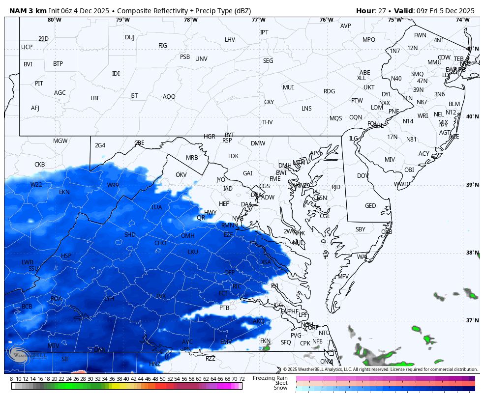
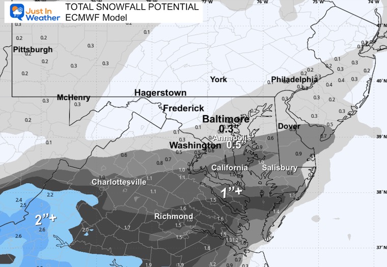
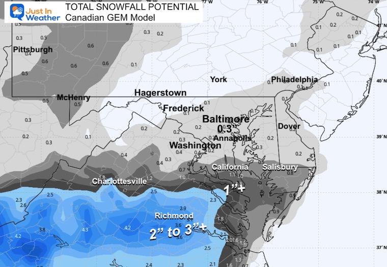
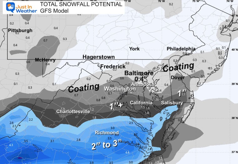
No One Computer Model Is Perfect. I see a blend of the information available. The challenge is finding the correct blend.
In this report, I have a slight adjustment for snow totals and 5 Computer Model snow maps to compare, which helps illustrate the close call for metro Baltimore.
Compare to 5 Snow Model Maps Below
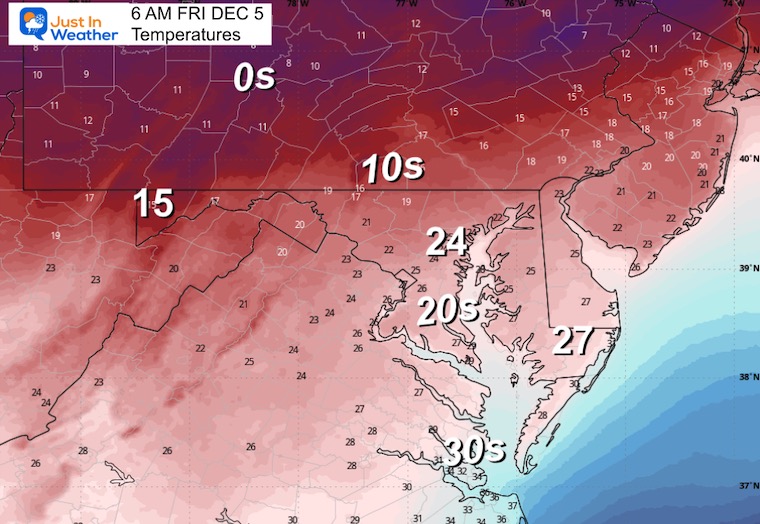
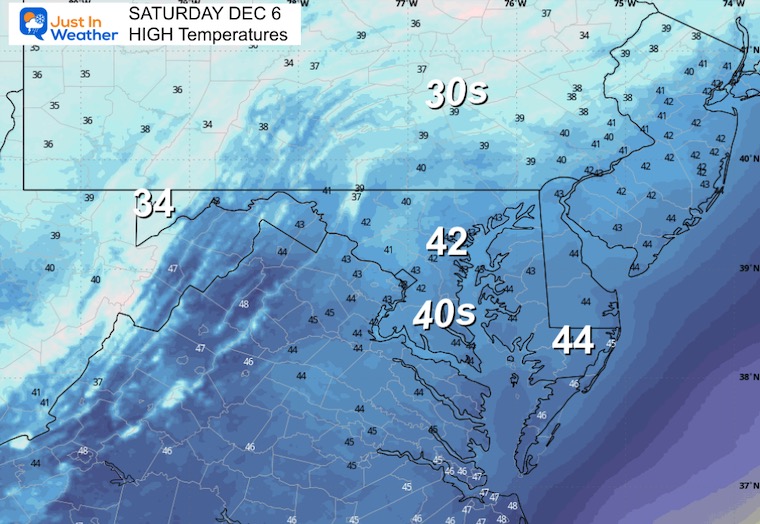
This cold is with the clear sky. A new air mass is on the way to reinforce the cold.
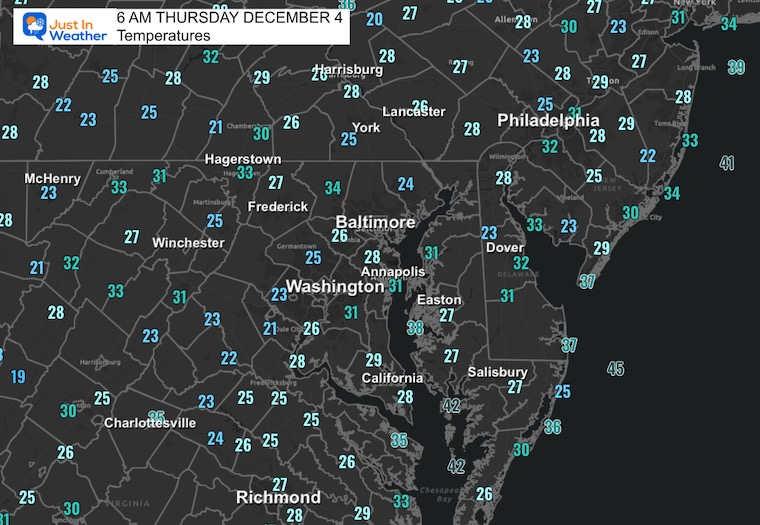
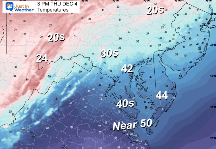
Yesterday: Low 26F; High 44F
Precipitation: 0.00”
Top Wind Gust 27 mph
Sunrise at 7:10AM
Sunset at 4:44 PM
Normal Low in Baltimore: 32ºF
Record 13ºF in 1966
Normal High in Baltimore: 51ºF
Record 74ºF 1982
Rainfall Deficit at BWI
Subscribe for eMail Alerts
Sign up and be the first to know!
The Arctic Air in the Northern Plains has temperatures below zero! The leading edge of this is a cold front as close as Ohio. Watching how far this advances will determine the northern edge of the snow tomorrow.
Last night on my social media pages, I highlighted energy in the Southern Rockies that looked stronger. It still does, and that will eject east to team up with the low-pressure developing around Houston. This is the Southern Branch Storm forming.
This is the Canadian GEM Model and only one solution. It is not the only plot, but one I trust more with an arctic-driven pattern.
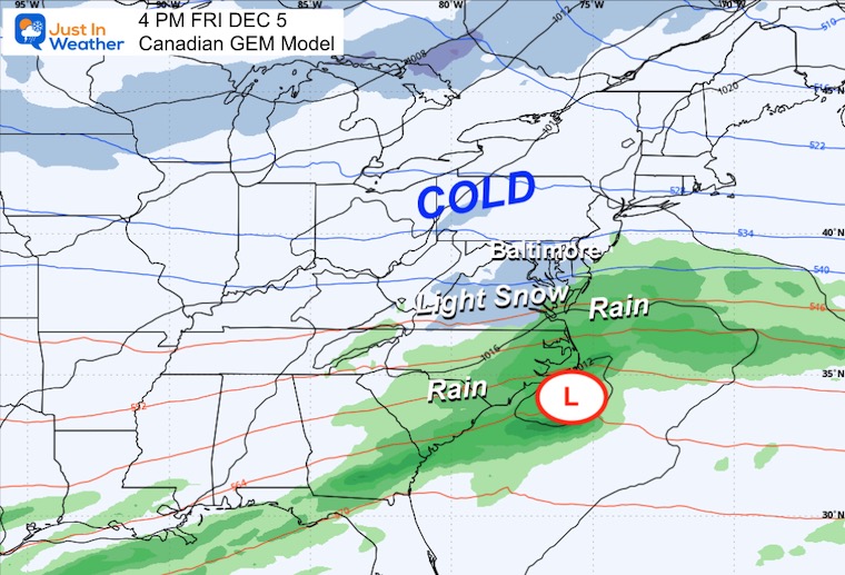
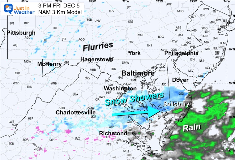
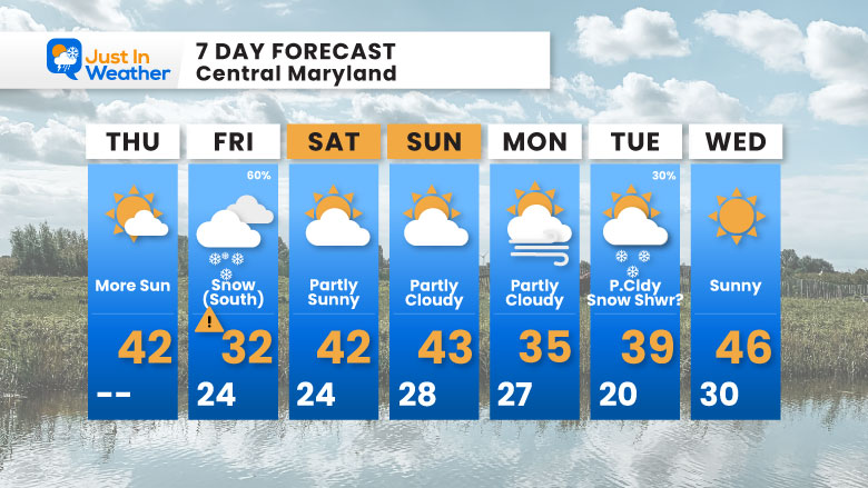
This will be a quick hit and mostly done by Friday evening.
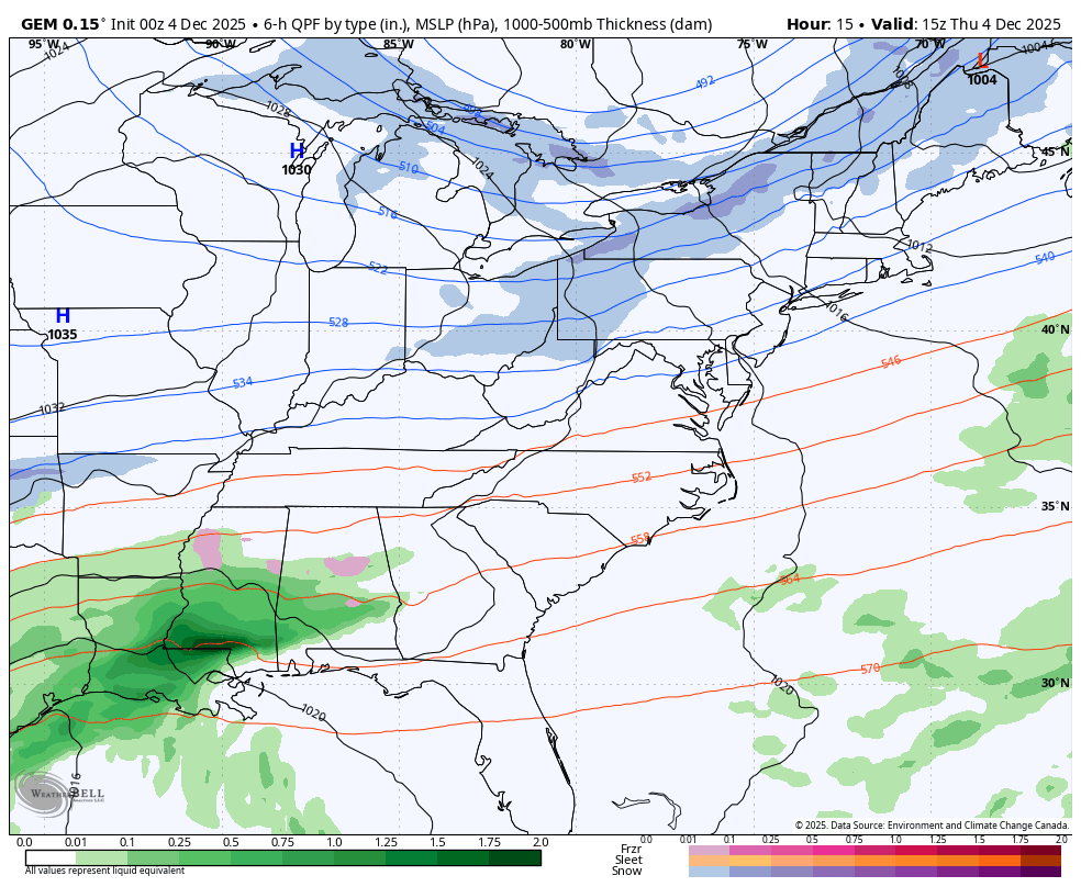
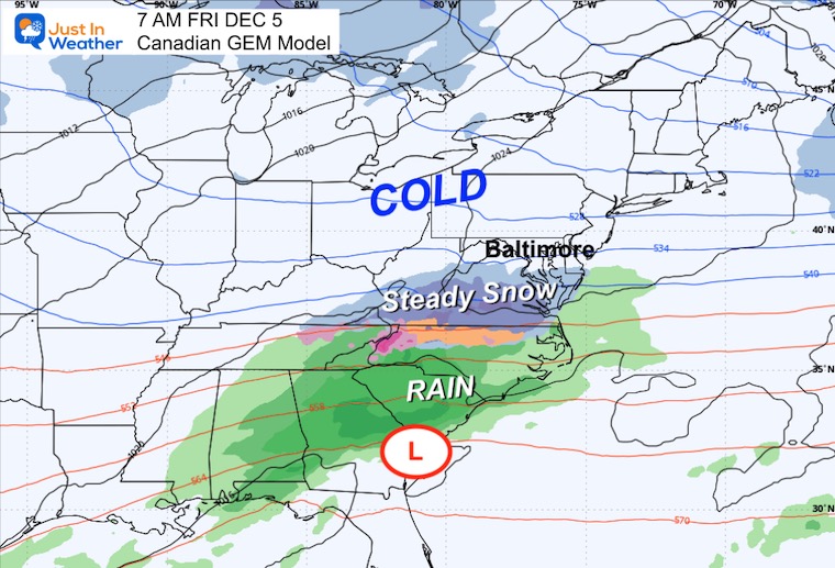
This is a faster mover, so the morning will be affected in Virginia and Southern Maryland.
Steady snow will be approaching Washington, DC and Southern Maryland.
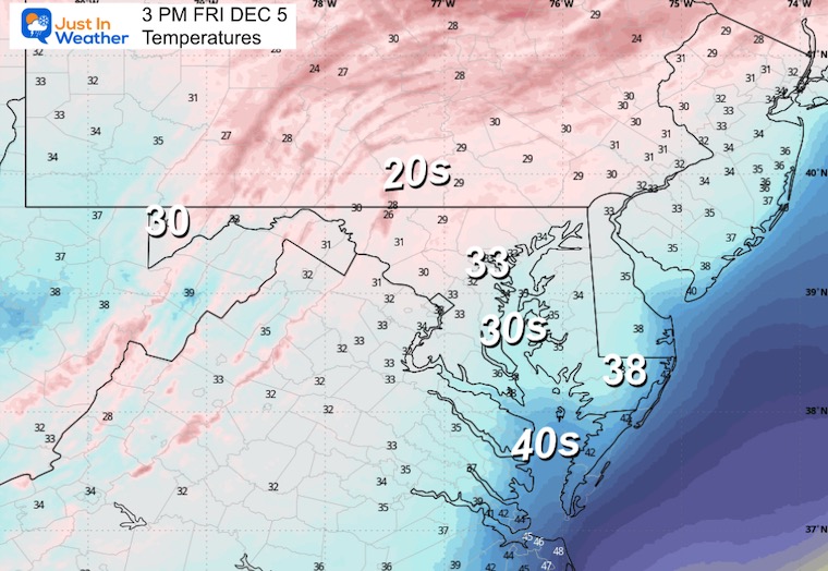
It will be cold enough to stick.
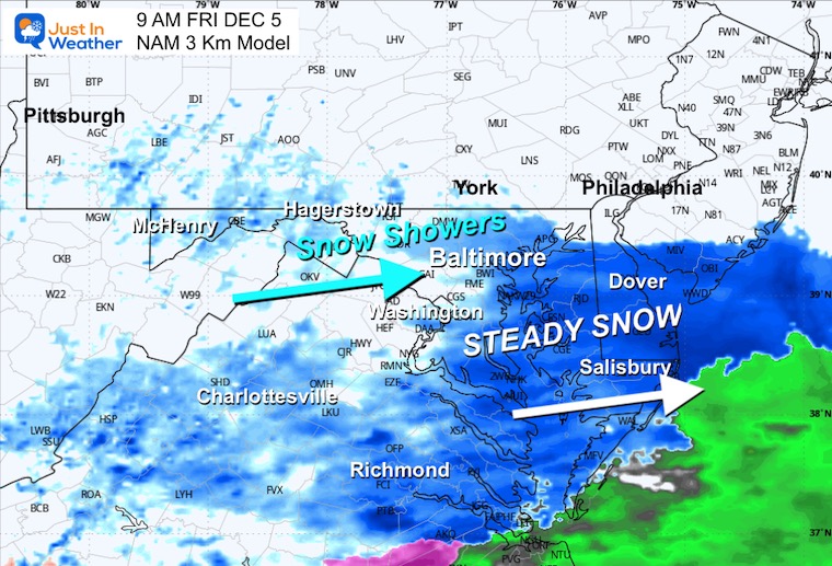
The northern edge of steady light snow to snow showers reaches into Central Maryland and Southern PA.
Light Snow showers and flurries fading across Southern Maryland.
The core of the cold air may result in some records.
Subscribe for eMail Alerts
Sign up and be the first to know!
Click here for the full report

This was issued October 9, as expected: A weak and short-lived event to start winter may play a different role this winter.

These are NOT all the same caterpillar!


Click to see more and ‘Book’ a visit to your school


The annual event: Hiking and biking 329 miles in 7 days between The Summit of Wisp to Ocean City.
Each day, we honor a kid and their family’s cancer journey.
Fundraising is for Just In Power Kids: Funding Free Holistic Programs. I never have and never will take a penny. It is all for our nonprofit to operate.
Click here or the image to donate:

I am aware there are some spelling and grammar typos and occasional other glitches. I take responsibility for my mistakes and even the computer glitches I may miss. I have made a few public statements over the years, but if you are new here, you may have missed it: I have dyslexia and found out during my second year at Cornell University. It didn’t stop me from getting my meteorology degree and being the first to get the AMS CBM in the Baltimore/Washington region. One of my professors told me that I had made it that far without knowing and to not let it be a crutch going forward. That was Mark Wysocki, and he was absolutely correct! I do miss my mistakes in my own proofreading. The autocorrect spell check on my computer sometimes does an injustice to make it worse. I can also make mistakes in forecasting. No one is perfect at predicting the future. All of the maps and information are accurate. The ‘wordy’ stuff can get sticky. There has been no editor who can check my work while writing and to have it ready to send out in a newsworthy timeline. Barbara Werner is a member of the web team that helps me maintain this site. She has taken it upon herself to edit typos when she is available. That could be AFTER you read this. I accept this and perhaps proves what you read is really from me… It’s part of my charm. #FITF