


Winter Weather Advisory Sunday As Snowfall In Two Parts Affecting Two Different Areas
Saturday Evening Update January 17 2026 One thing I carry after all of my years of forecasting: If one model does a really good job in an active pattern, then…
Monday Night Update
I want to take a break from the overload of anticipation of the Arctic Air arriving after Thanksgiving. Yes, I am excited about it, but there is way too much of it on my newsfeed from others.
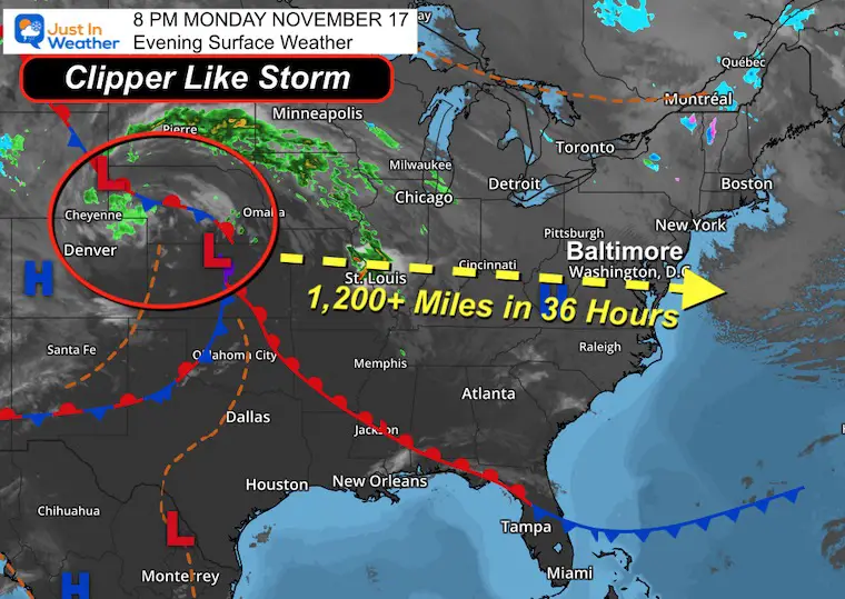
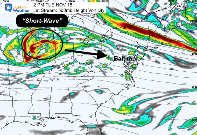
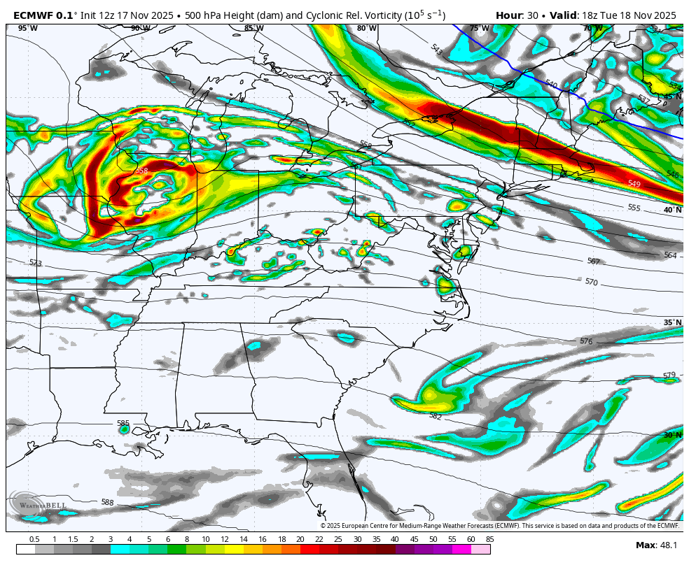
In the short range, we have a fast-moving weather system that will race halfway across the country in 24 hours to pass over Maryland from the Central US to the coast. This track is south for a clipper, but on the edge of chilly and a good test for the computer models on both the track and totals.
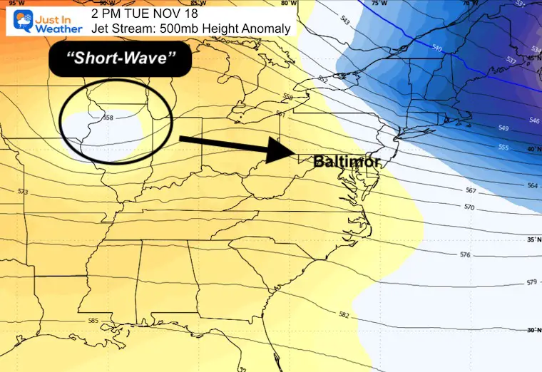
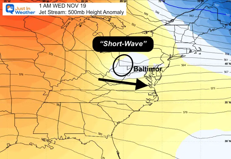
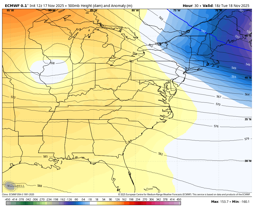
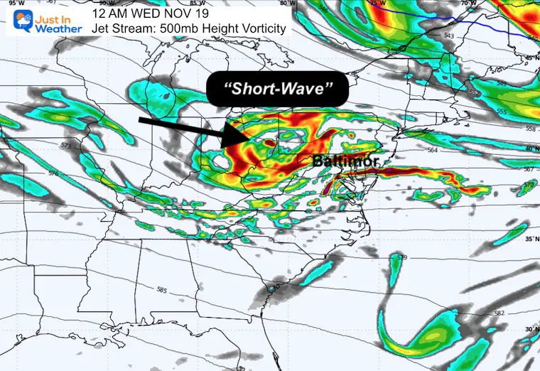
This Short Wave in the jet stream will translate to a robust little surface low-pressure system that has a tight circulation and can drop a moderate amount of precipitation in a few hours.
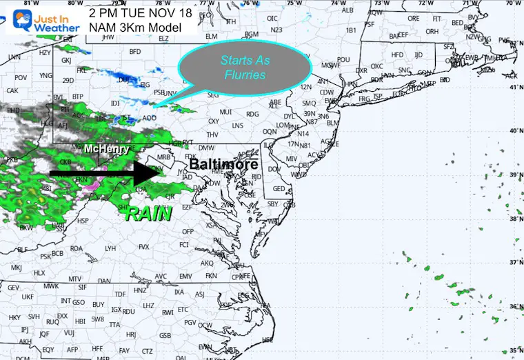
The initial rain may mix with sleet and slow in the mountains around noon. This will expand east into metro areas during the afternoon, but the main event will be overnight.
It seems like this pattern continues with events producing precipitation during the dark hours and ending by morning.
The reason for this post is to show the animations of how this will develop, AND to track some of the forecast totals to compare with the results.
It is important to note that we are in a drought that has been pulsing with intensity over the past two years.
As of today, Baltimore is 6.41” BELOW AVERAGE rainfall on the year, and -14.44” including all of 2024.
Let’s take a look…..
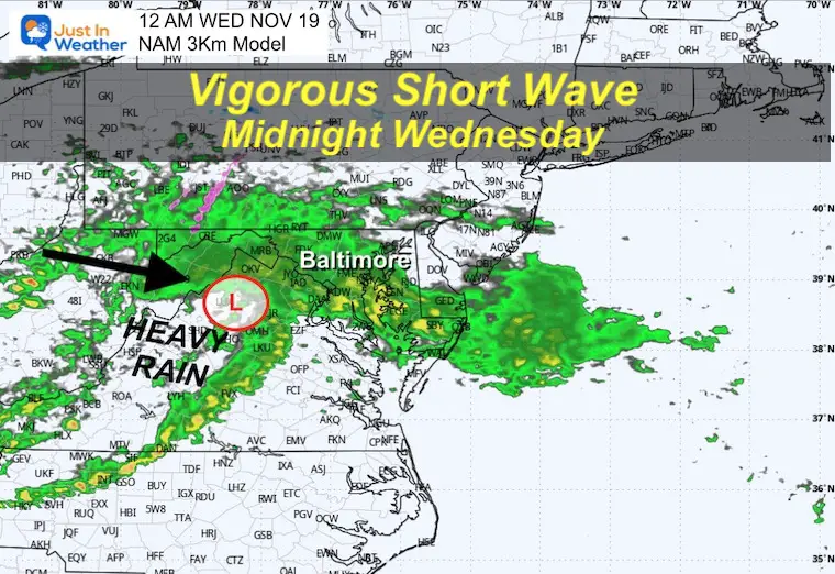
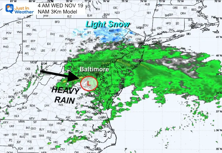
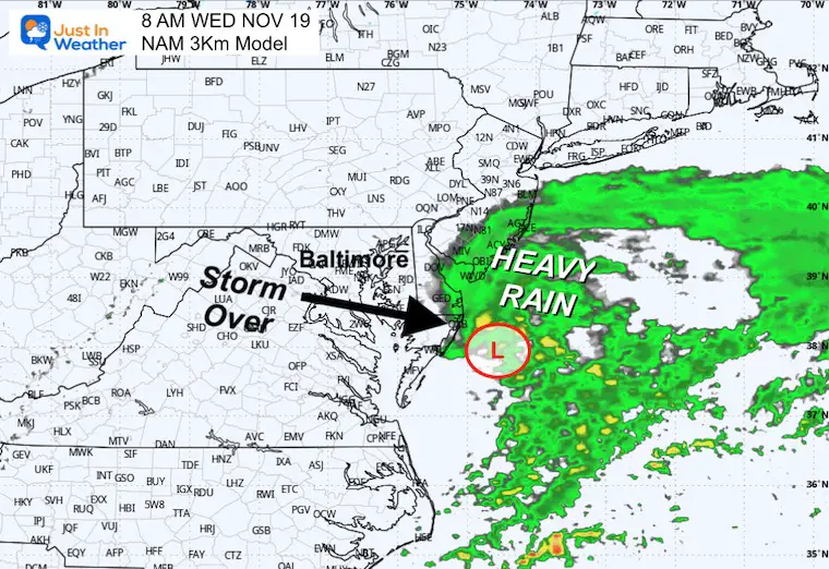
Low Pressure was located over Kansas. This is expected to reach the East Coast off Ocean City MD by daybreak on Wednesday.
That’s more than 1,200 miles in 36 hours.
This should begin in the mountains between Noon and 2 PM. Let’s pick this up early afternoon.
It will be chilly with 30s in the mountains and 40s across much of our area between Southern PA and across Central Maryland to Delmarva.
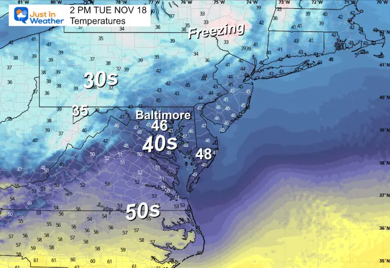
This suggests the start with sleet and snow in the mountains of Western Maryland and Western PA. A band of snow to the north of Pittsburgh is also possible.
Rain may reach close to Hagerstown.
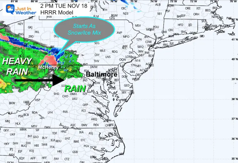
This solution is a little milder with mostly rain, and breaks up across the mountains to showers.
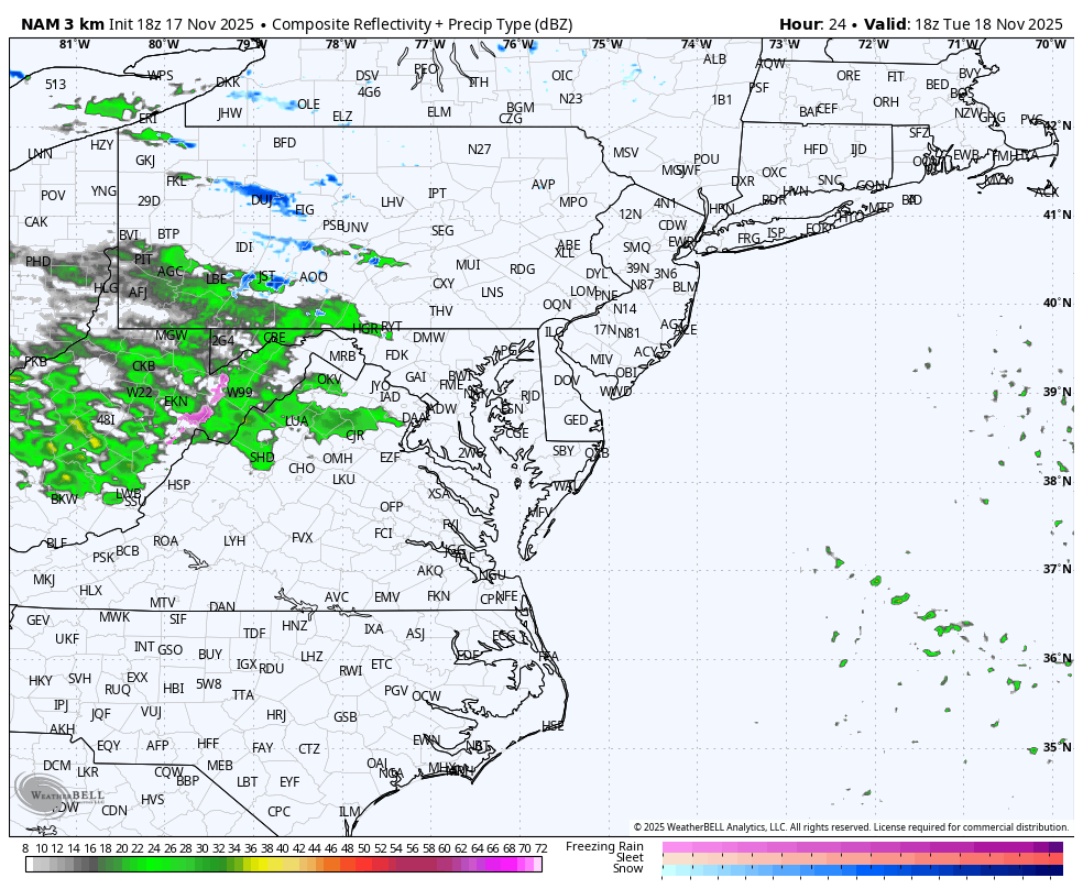
The upper-level energy translates to a compact surface low that may track across Northern Virginia with defined mesoscale frontal boundaries. This may produce some lightning and thunder with heavy downpours tracking along the low near Washington and Baltimore.
Steady, moderate to heavy rain with a band of light snow across north central Pennsylvania.
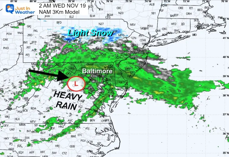
The Surface Low may pass south of Washington, DC.
The Surface Low will pass east of Ocean City, taking the rain with it. The storm will be over by daybreak for most of the region.
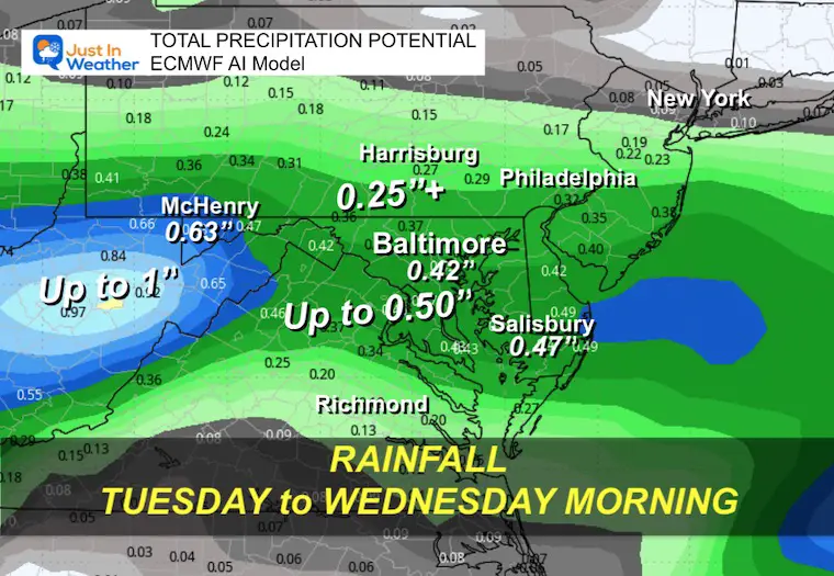
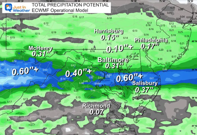
This has been leading all models with accuracy, so I want to start with this as the baseline.
Baltimore: 0.42”
This has a distinct lower total for the mountains, but pulses along Rt 50.
Baltimore: 0.31”
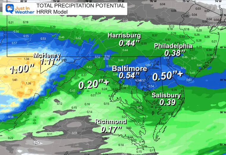
This high-resolution rapid update is close to the Euro AI, but higher for Central Maryland.
Baltimore: 0.54”
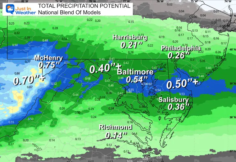
This blend does support 1” totals in the mountains and matched the Baltimore mark with the HRRR.
Baltimore: 0.54”
I posted this brief summary on social media with the focus on:
This Weekend starts cool and damp, then warming.
Thanksgiving warm with an arctic surge and stormy weather approaching from the west.
December 1 is the mark for the Arctic air to settle in across the Eastern US.
There is plenty of time to sort out the specifics.
Faith in the Flakes
Subscribe for eMail Alerts
Sign up and be the first to know!

This was issued October 9, as expected: A weak and short-lived event to start winter may play a different role this winter

These are NOT all the same caterpillar!


Click to see more and ‘Book’ a visit to your school


The annual event: Hiking and biking 329 miles in 7 days between The Summit of Wisp to Ocean City.
Each day, we honor a kid and their family’s cancer journey.
Fundraising is for Just In Power Kids: Funding Free Holistic Programs. I never have and never will take a penny. It is all for our nonprofit to operate.
Click here or the image to donate:

I am aware there are some spelling and grammar typos and occasional other glitches. I take responsibility for my mistakes and even the computer glitches I may miss. I have made a few public statements over the years, but if you are new here, you may have missed it: I have dyslexia and found out during my second year at Cornell University. It didn’t stop me from getting my meteorology degree and being the first to get the AMS CBM in the Baltimore/Washington region. One of my professors told me that I had made it that far without knowing and to not let it be a crutch going forward. That was Mark Wysocki, and he was absolutely correct! I do miss my mistakes in my own proofreading. The autocorrect spell check on my computer sometimes does an injustice to make it worse. I can also make mistakes in forecasting. No one is perfect at predicting the future. All of the maps and information are accurate. The ‘wordy’ stuff can get sticky. There has been no editor who can check my work while writing and to have it ready to send out in a newsworthy timeline. Barbara Werner is a member of the web team that helps me maintain this site. She has taken it upon herself to edit typos when she is available. That could be AFTER you read this. I accept this and perhaps proves what you read is really from me… It’s part of my charm. #FITF