Saturday, November 8, 2025
We will have a few mild days this weekend, with more sun today and rain on Sunday. That will be the weather system that will be followed by unseasonably cold air for November. The core of the extreme cold and new records may reach all the way to the Gulf Coast.
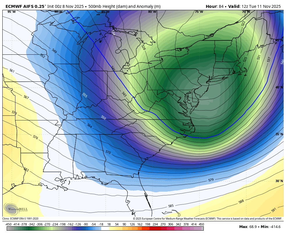
We may have record cold air aloft and get a taste of winter chill here at the surface, bottoming out on Tuesday.
The pre-season winter blast will bring snow to the mountains and flurries to metro areas.
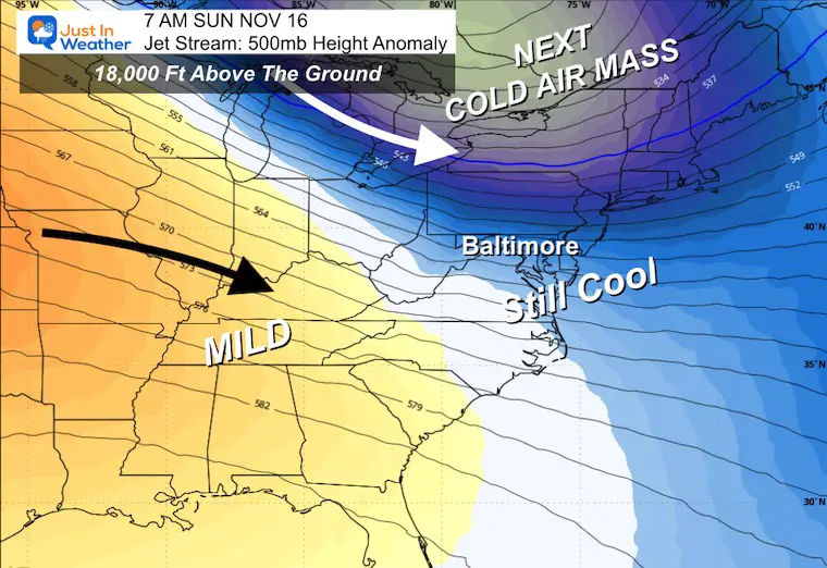
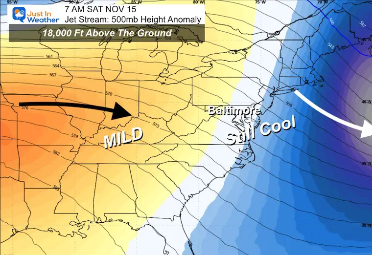
While the pattern relaxes during the week, there will continue to be an active pattern with more cold impulses to our north.
Let’s take a look:
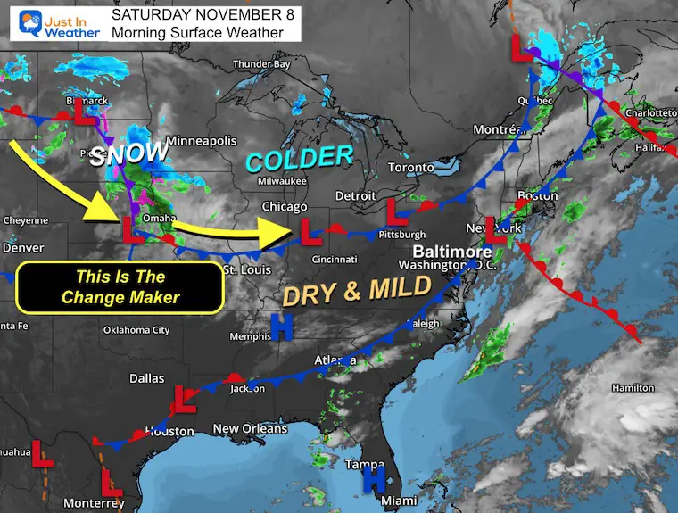
WEATHER TODAY
Surface Weather
We will have a dry and mild day between systems. The cold air AND the developing storm that will be our weather changer is taking form in the North Central Plains. We will watch that bring us rain on Sunday, then drag the cold air behind it.
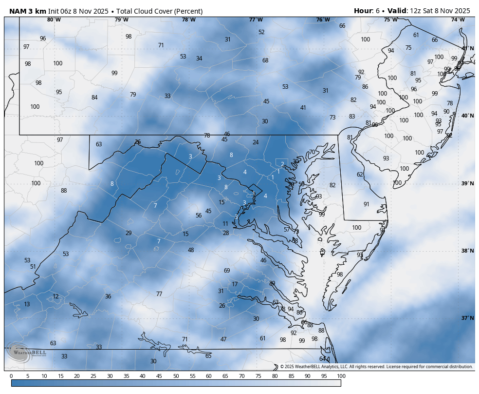
Cloud Forecast 7 AM to 7 PM
Any morning clouds should move away and make for a mostly sunny sky.
More clouds may arrive later.
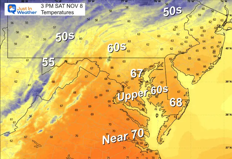
High Temperatures
CLIMATE DATA: Baltimore
Yesterday: Low 30F; High 63F
Precipitation: 0.07”
TODAY November 8
Sunrise at 6:42 AM
Sunset at 4:58 PM
Normal Low in Baltimore: 39ºF
Record 24ºF in 1960
Normal High in Baltimore: 60ºF
Record 80ºF 1975
Rainfall Deficit at BWI
- Ending 2024 = -8.00”
- Since Jan 1 = 5.84”
- We are STILL DOWN -13.84” INCLUDING LAST YEAR
My Winter Outlook For Above-Average Snow
Click here for the full report

Subscribe for eMail Alerts
SUNDAY
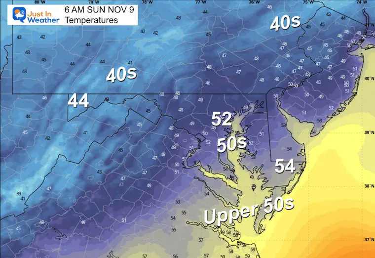
Morning Temperatures
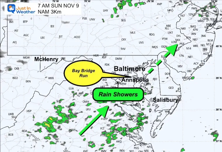
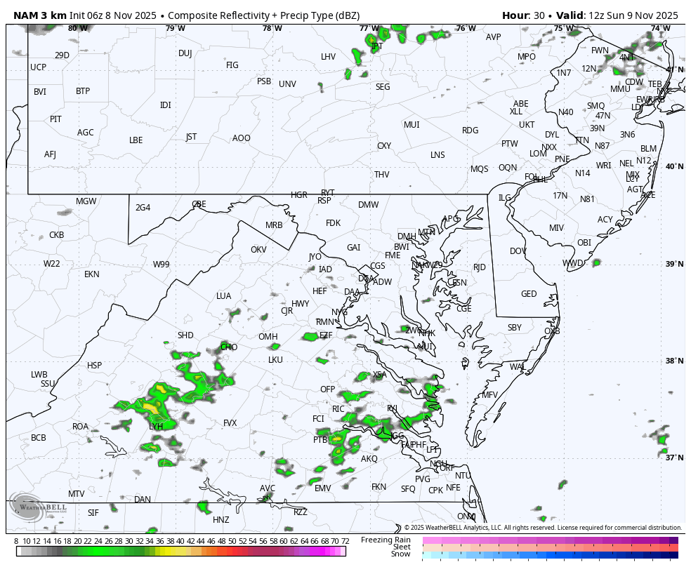
Morning Radar Snapshot
Showers will be approaching from the south. This focuses on the Bay Bridge Run across the Chesapeake Bay from Annapolis.
Umbrellas are NOT ALLOWED!
Full Day Radar through midnight
The snow starts to show up in the high mountains after dark.
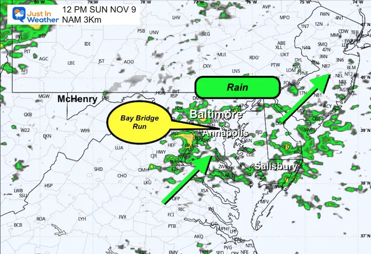
Noon Radar Snapshot
Rain with heavier cells expected in Central Maryland.
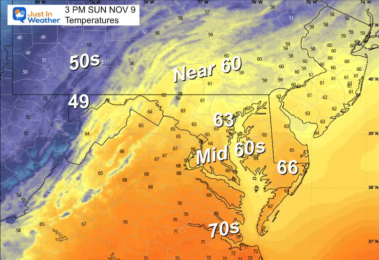
Afternoon Temperatures
Still mild, while colder air will be arriving in the mountains.
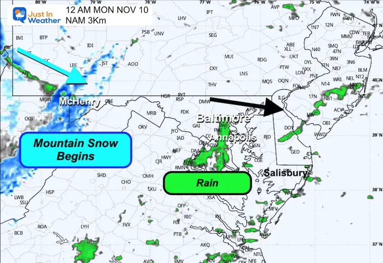
Midnight:
Snow showers will begin to accumulate in the mountains and rain showers will continue in metro areas.
WEATHER FOCUS:
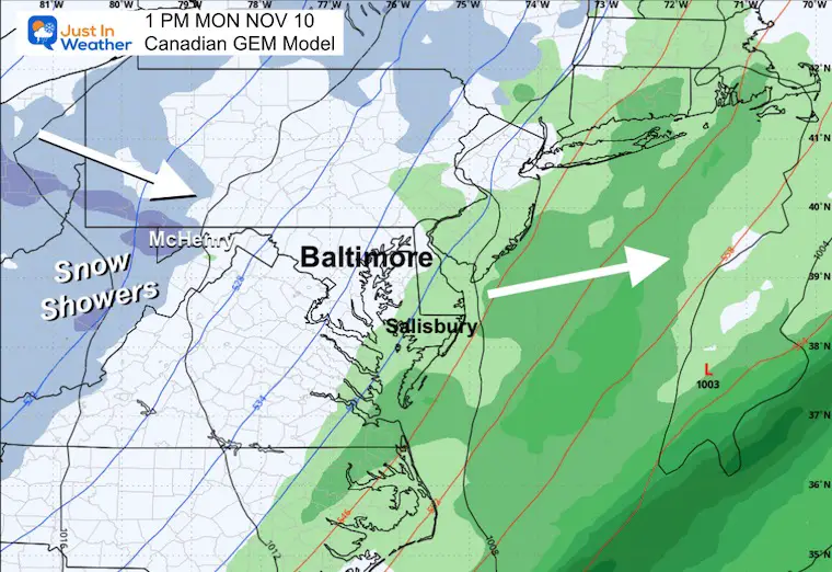
Monday Afternoon
The strong cold upslope winds will bring moderate snow bands into the high mountains as the rain departs off the coast.
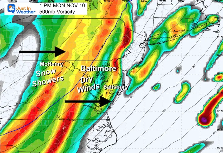
Jet Stream: Vorticity at 500mb
This is the spin around 18,000 Ft, a standard forecast level. We use this to look for instability and support for showers.
In the winter, this can show if snow or flurries can cross the mountains into metro areas.
Monday Afternoon
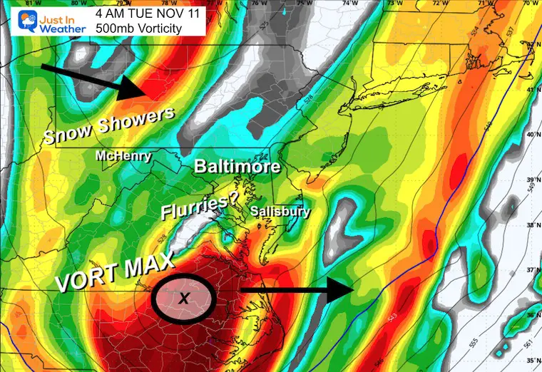
Tuesday BEFORE Sunrise
This VORT MAX is the final push of energy. When it passes south of Baltimore, there is a good chance for the snow showers to cross the mountains and for flurries to fly in parts of Central Maryland and beyond.
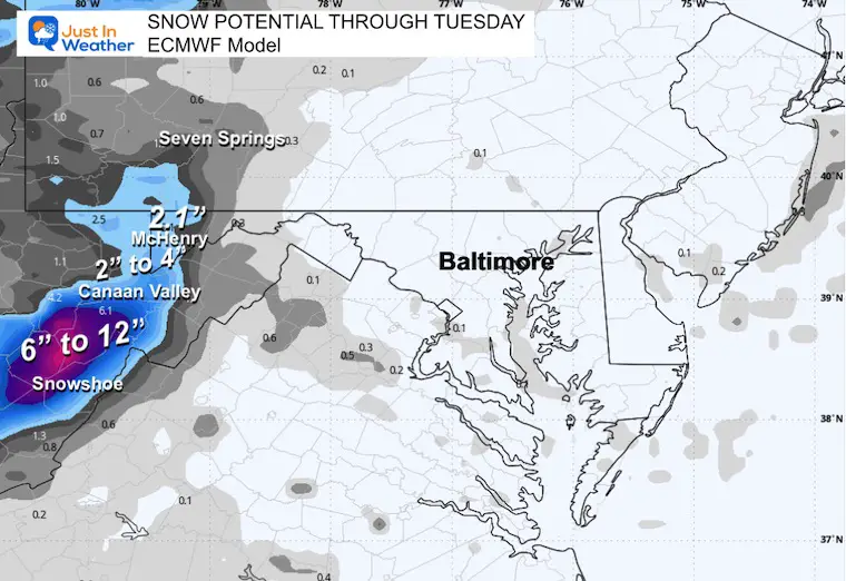
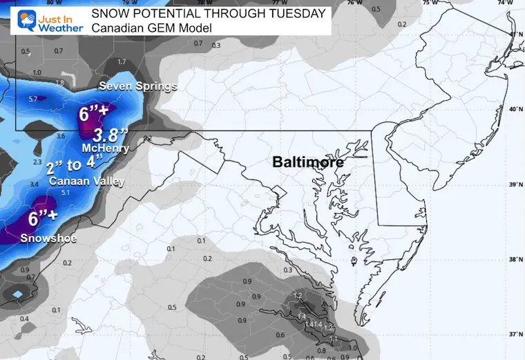
Snow Potential:
Comparing the European Model to the Canadian
I focus more on the Canadian GEM when we are in an arctic-dominant air flow. This is where that model performs best.
This will be a good test as I plan to be at McHenry to measure!
The Canadian is slightly higher with snow totals.
ECMWF Model
Canadian GEM
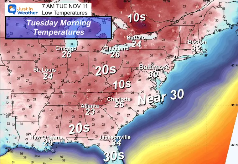
Tuesday Morning Low Temperatures
The truly cold air will be in our high mountains AND all the way to the Gulf Coast. That early-season FREEZE is a big deal and may affect the citrus crops in Florida.
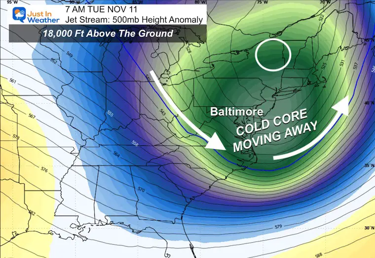
Jet Stream Tuesday Morning
The core of the cold air will move off the coast.
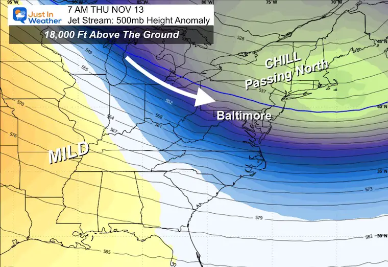
Jet Stream: Tuesday to Sunday
The core of the cold air swings through Tuesday. There will be reinforcing hits through the week, but gradually it will relax as the focus of cold transit shifts north.
The warm-up will reach the Central US while we remain slightly cooler than average.
Snapshot: Thursday Morning
Snapshot: Saturday Morning
Snapshot: Sunday Morning
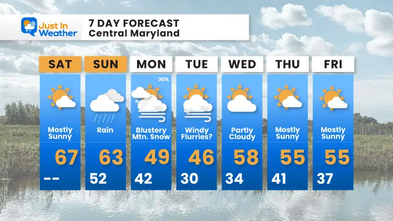
7 Day Forecast
- Sunday: Rain Develops
- Mountain Snow Late Sunday to Tuesday
- Next Week: Coldest Air Tuesday; Snow Flurries Will Fall Over Central Maryland.
- It will be COLDER inland, and snow accumulates in the mountains.
Subscribe for eMail Alerts
Average First Frost

La Niña Advisory
This was issued October 9, as expected: A weak and short-lived event to start winter may play a different role this winter

In Case You Missed It
Woolly Bear Caterpillar Winter Folklore
These are NOT all the same caterpillar!

Winter Outlook From 2 Farmers’ Almanacs

STEM Assemblies/In School Fields Trips Are Back
Click to see more and ‘Book’ a visit to your school

THANK YOU:
Baltimore Sun Magazine Readers’ Choice Best Of Baltimore

Maryland Trek 12 Day 7 Completed Sat August 9
UPDATED: We raised OVER $166,000 for Just In Power Kids – AND Still Collecting More
The annual event: Hiking and biking 329 miles in 7 days between The Summit of Wisp to Ocean City.
Each day, we honor a kid and their family’s cancer journey.
Fundraising is for Just In Power Kids: Funding Free Holistic Programs. I never have and never will take a penny. It is all for our nonprofit to operate.
Click here or the image to donate:

RESTATING MY MESSAGE ABOUT DYSLEXIA
I am aware there are some spelling and grammar typos and occasional other glitches. I take responsibility for my mistakes and even the computer glitches I may miss. I have made a few public statements over the years, but if you are new here, you may have missed it: I have dyslexia and found out during my second year at Cornell University. It didn’t stop me from getting my meteorology degree and being the first to get the AMS CBM in the Baltimore/Washington region. One of my professors told me that I had made it that far without knowing and to not let it be a crutch going forward. That was Mark Wysocki, and he was absolutely correct! I do miss my mistakes in my own proofreading. The autocorrect spell check on my computer sometimes does an injustice to make it worse. I can also make mistakes in forecasting. No one is perfect at predicting the future. All of the maps and information are accurate. The ‘wordy’ stuff can get sticky. There has been no editor who can check my work while writing and to have it ready to send out in a newsworthy timeline. Barbara Werner is a member of the web team that helps me maintain this site. She has taken it upon herself to edit typos when she is available. That could be AFTER you read this. I accept this and perhaps proves what you read is really from me… It’s part of my charm. #FITF
Please share your thoughts and best weather pics/videos, or just keep in touch via social media.


