Friday, November 7 2025
There has been a lot of chatter about the Arctic blast on the way next week. It will be unprecedented, but it is not here yet! You might need to scrape frost off your windshield this morning.
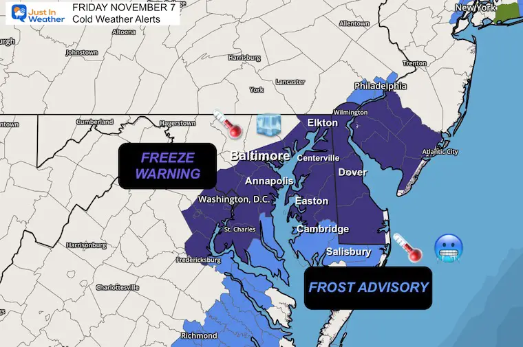
A different source of cold air has allowed temperatures to drop to the freezing level in Central Maryland and parts of Delmarva. NWS updated its advisories and warnings overnight.
We will have a few mild days that include more clouds this afternoon and rain tonight. Saturday will end up improving, then more rain on Sunday.
The pre-season winter blast will arrive Monday into Tuesday, bringing snow to the mountains and flurries to the metro areas.
A freeze may reach the Gulf Coast which can have negative effects on the citrus crop.
Let’s take a look:
Freeze Warning and Frost Advisory
The Freeze Alert was expanded overnight into Central Maryland.
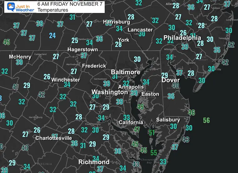
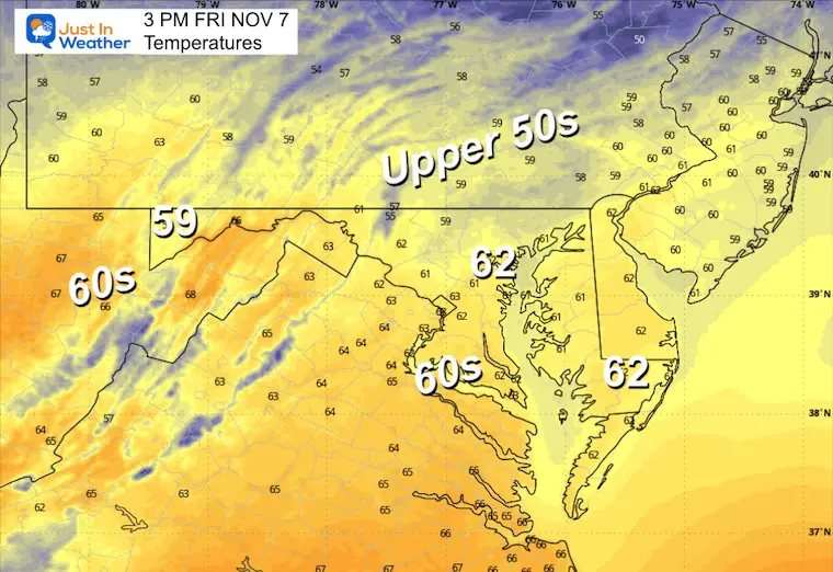
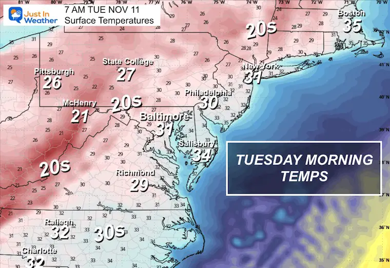
Temperatures at 6 AM
WEATHER TODAY
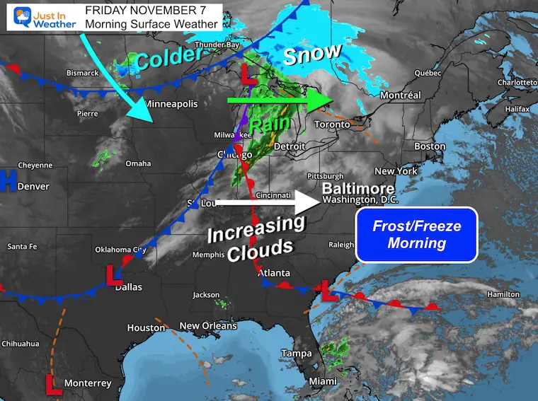
Surface Weather
The next weather system will send more clouds our way during the day.
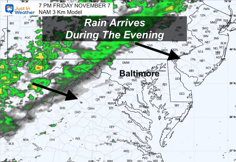
Rain with the cold front is crossing the Great Lakes and will arrive in our region AFTER dark.
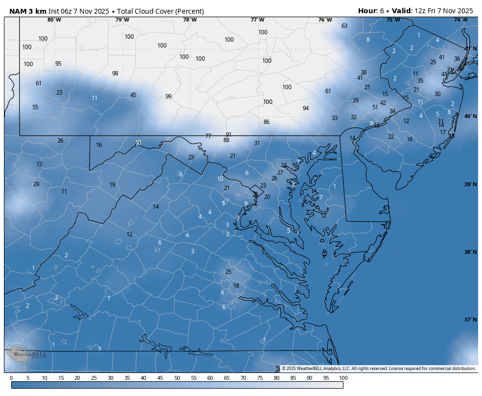
Cloud Forecast 7 AM to 7 PM
High Temperatures
Rain This Evening
7 PM Snapshot
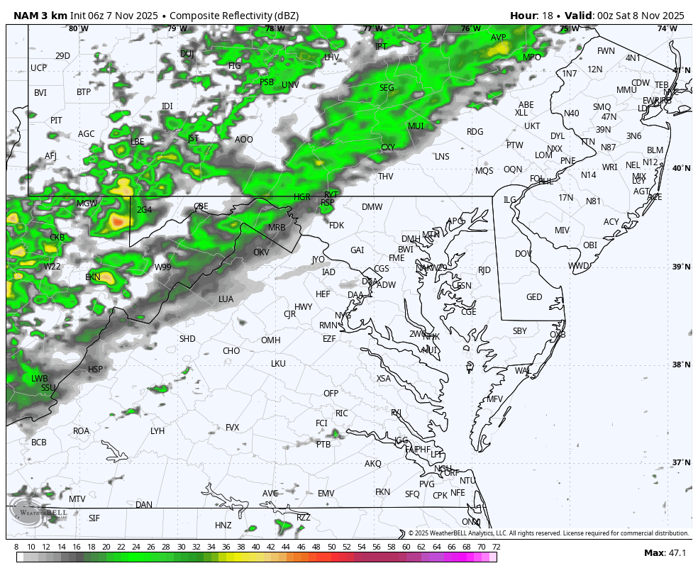
Radar Simulation 7 PM Fri to 7 AM Sat
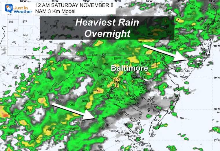
Midnight Snapshot
A few hours with steady rain may be heavy at times.
CLIMATE DATA: Baltimore
Yesterday: Low 36F; High 59F
Precipitation: 0.00
TODAY November 7
Sunrise at 6:41 AM
Sunset at 4:59 PM
Normal Low in Baltimore: 39ºF
Record 22ºF in 1962
Normal High in Baltimore: 60ºF
Record 81ºF 2021
Rainfall Deficit at BWI
- Ending 2024 = -8.00”
- Since Jan 1 = 5.80”
- We are STILL DOWN -13.80” INCLUDING LAST YEAR
My Winter Outlook For Above-Average Snow
Click here for the full report

Subscribe for eMail Alerts
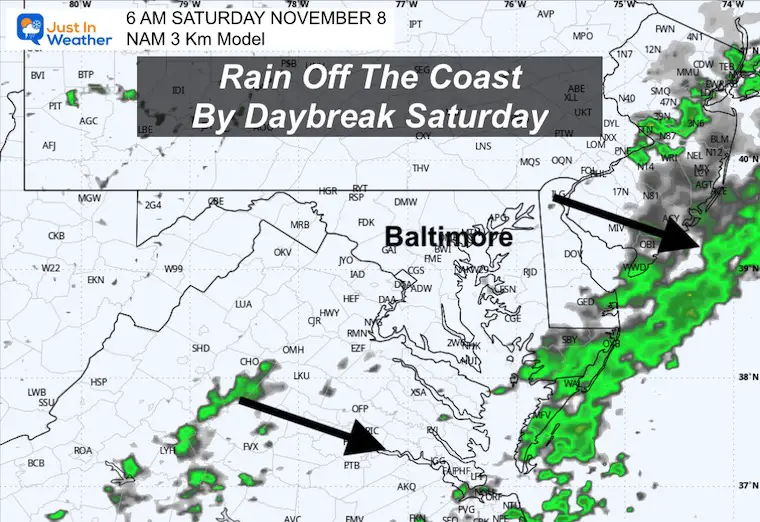
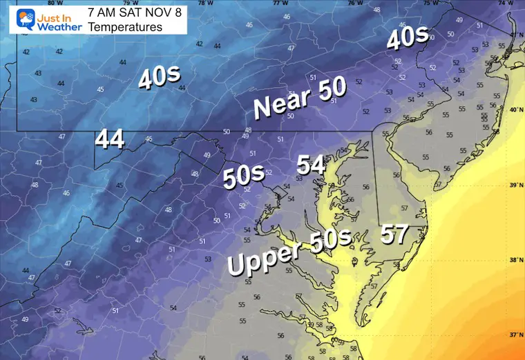
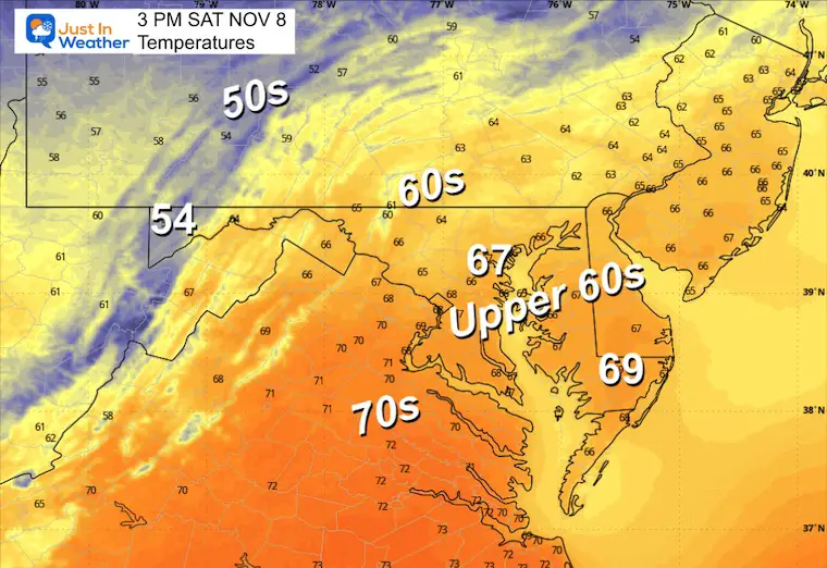
SATURDAY
Morning Radar Snapshot
The rain will be moving away early, then expect some clearing.
Morning Temperatures
Afternoon Temperatures
Mild Afternoon: Mix of clouds and sun.
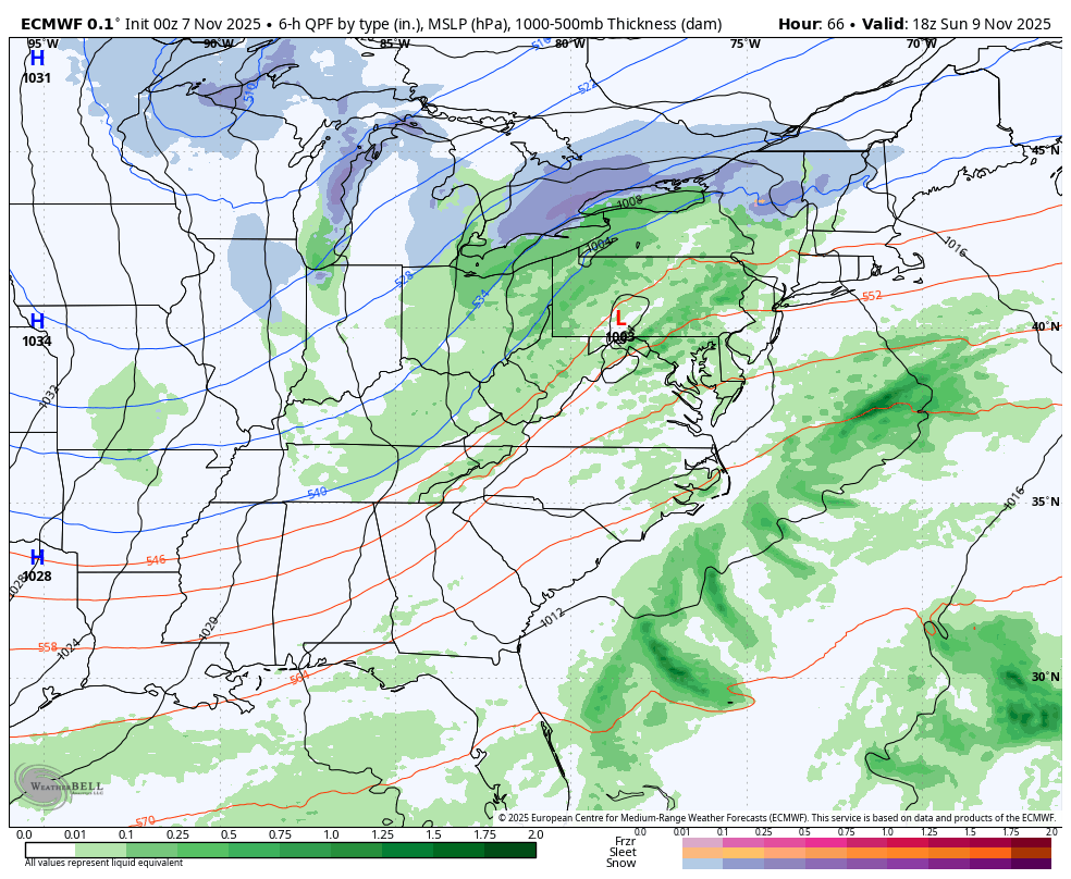
WEATHER TREND: Sunday To Tuesday
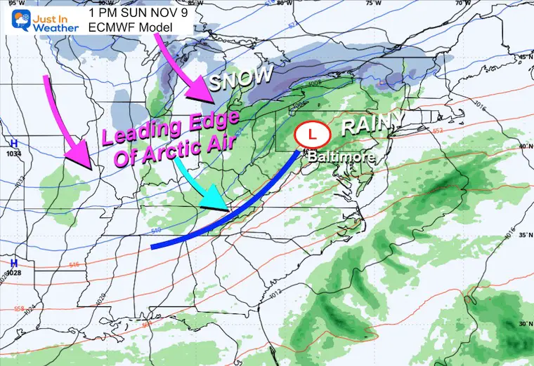
Sunday brings more rain ahead of the unprecedented arctic blast.
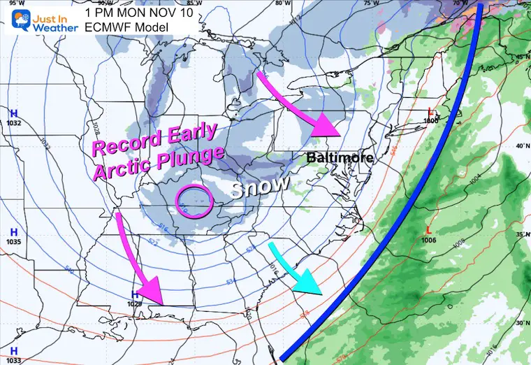
Very cold air will arrive Monday to open up Lake Effect Snow for the mountains. The core of the cold air arrives Tuesday and this may bring flurries to Central Maryland.
Snapshots
Sunday Morning
Rain will develop as the low-pressure system organizes ahead of the Arctic front. This day will be mild.
Monday Afternoon
Moderate to heavy snow develops in the high mountains.
A few inches may accumulate in Garrett County, MD, and nearby ski areas of PA to WV.
The upper Low drops into the Southern Appalachian Mountains.
Early Tuesday
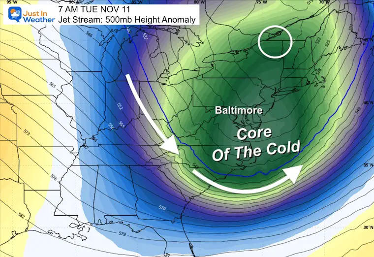
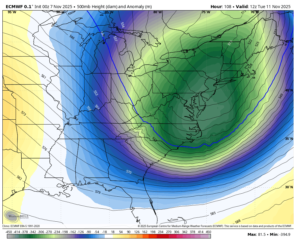
Jet Stream:
The core of the cold air will reach the East Coast. This is unmatched intensity of cold in this location for this time of year!
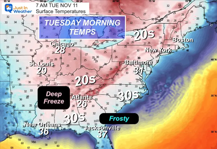
Temperatures
Very cold air will look like mid-winter across the Eastern US.
Freezing temps may reach parts of the Gulf Coast, and a frost is likely in interior Florida.
Closer Look
Freezing temperatures will reach the Chesapeake Bay, and inland will drop into the 20s.
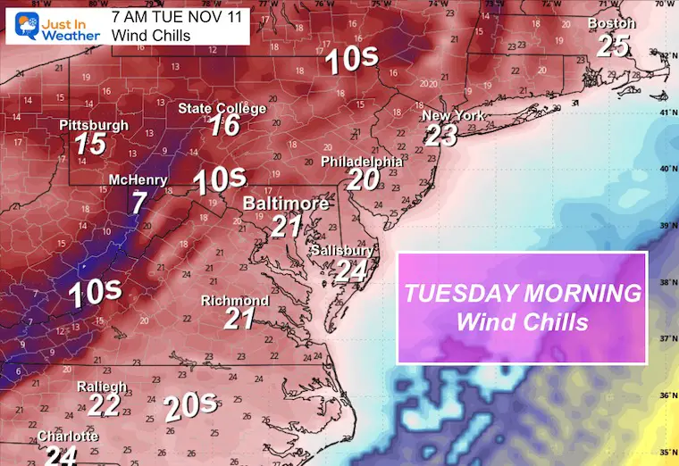
Wind Chill
This will surely feel like January.
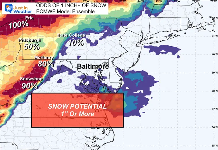
Snow Potential
We are just beyond my 3-day window. But the Odds of getting over 1 inch to stick on the ground are shown here with the ECMWF Model Ensemble.
The high mountains are very likely to get it.
Jet Stream: Tuesday to Friday
The core of the cold air swings through Tuesday. There will be reinforcing hits through the week, but it will gradually relax.
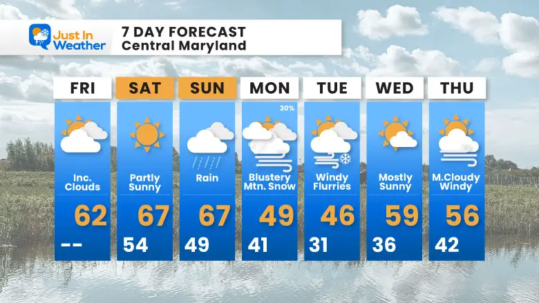
7 Day Forecast
- Mild Temps For A Few More Days
- Rain Events: Sunday
- Next Week: Coldest Air Tuesday; Snow Flurries Will Fall Over Central Maryland.
- It will be COLDER inland, and snow accumulates on the mountains.
Subscribe for eMail Alerts
Average First Frost

La Niña Advisory
This was issued October 9, as expected: A weak and short-lived event to start winter may play a different role this winter

In Case You Missed It
Woolly Bear Caterpillar Winter Folklore
These are NOT all the same caterpillar!

Winter Outlook From 2 Farmers’ Almanacs

STEM Assemblies/In School Fields Trips Are Back
Click to see more and ‘Book’ a visit to your school

THANK YOU:
Baltimore Sun Magazine Readers’ Choice Best Of Baltimore

Maryland Trek 12 Day 7 Completed Sat August 9
UPDATED: We raised OVER $166,000 for Just In Power Kids – AND Still Collecting More
The annual event: Hiking and biking 329 miles in 7 days between The Summit of Wisp to Ocean City.
Each day, we honor a kid and their family’s cancer journey.
Fundraising is for Just In Power Kids: Funding Free Holistic Programs. I never have and never will take a penny. It is all for our nonprofit to operate.
Click here or the image to donate:

RESTATING MY MESSAGE ABOUT DYSLEXIA
I am aware there are some spelling and grammar typos and occasional other glitches. I take responsibility for my mistakes and even the computer glitches I may miss. I have made a few public statements over the years, but if you are new here, you may have missed it: I have dyslexia and found out during my second year at Cornell University. It didn’t stop me from getting my meteorology degree and being the first to get the AMS CBM in the Baltimore/Washington region. One of my professors told me that I had made it that far without knowing and to not let it be a crutch going forward. That was Mark Wysocki, and he was absolutely correct! I do miss my mistakes in my own proofreading. The autocorrect spell check on my computer sometimes does an injustice to make it worse. I can also make mistakes in forecasting. No one is perfect at predicting the future. All of the maps and information are accurate. The ‘wordy’ stuff can get sticky. There has been no editor who can check my work while writing and to have it ready to send out in a newsworthy timeline. Barbara Werner is a member of the web team that helps me maintain this site. She has taken it upon herself to edit typos when she is available. That could be AFTER you read this. I accept this and perhaps proves what you read is really from me… It’s part of my charm. #FITF
Please share your thoughts and best weather pics/videos, or just keep in touch via social media.


