Thursday, November 6, 2025
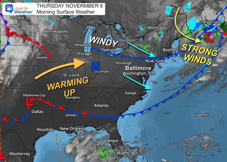
Strong winds blew through last night with gusts ranging between 45 and 60 mph. Our weather pattern is active with a change every day or two.
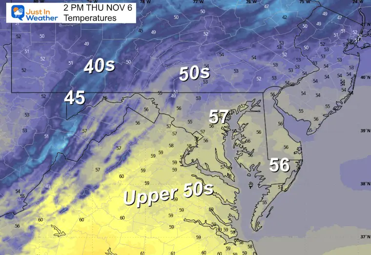
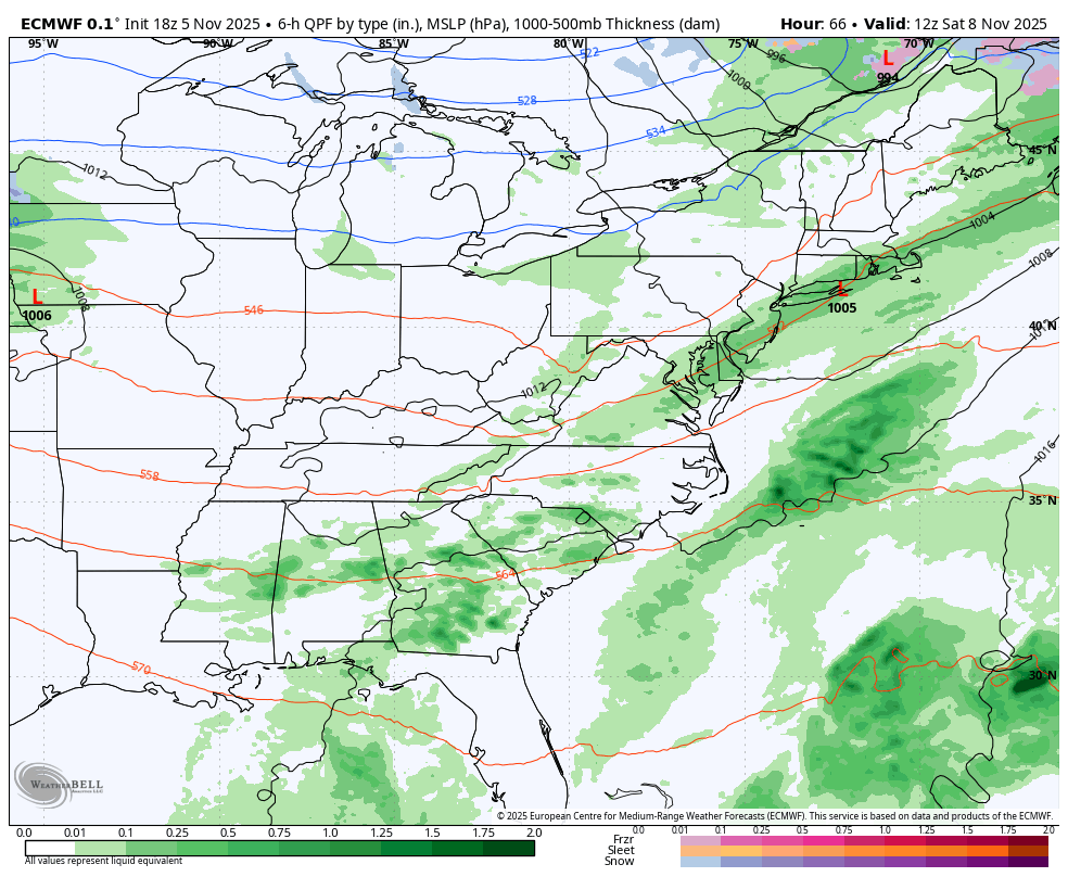
Cool winds today, and a Frost Advisory Friday morning on Delmarva. Then a warm-up Saturday might be our last chance for 70°F this year. This will be followed by more rain on Sunday and an arctic air mass on Monday. That will open up snow to accumulate in the mountains and maybe some flurries mixed in locally.
NEXT WEEK will start with an early-season arctic air mass. This will bring temperatures nearly 20 degrees below average and open up Lake Effect Snow in the high mountains, and flurries could reach metro areas briefly.
Surface Weather
A very strong storm is wrapping up East of New England with winds a cloud level pushing 100 mph.
The air behind this has the support of a series of cold fronts to reinforce the cold winds!
The next systems will actually pull a brief warm-up Saturday in between rain Friday night and again Sunday.
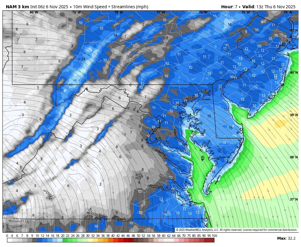
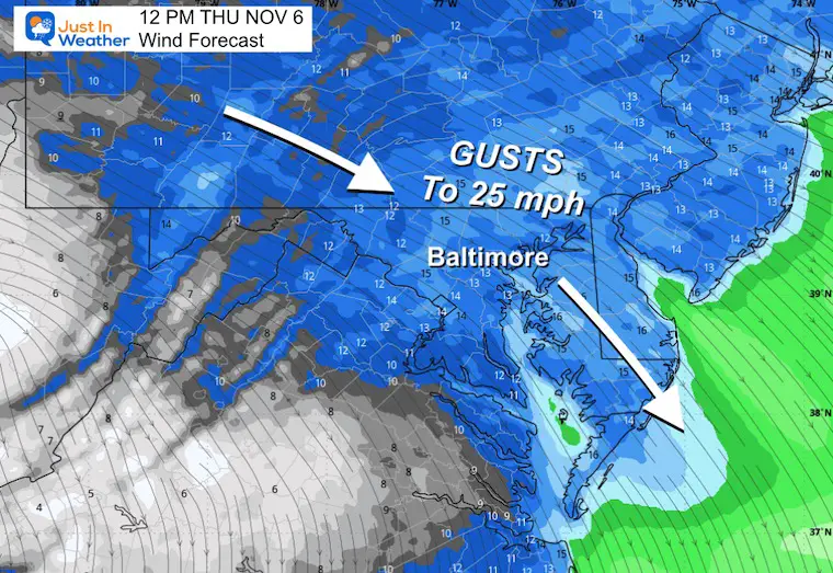
Wind Forecast 8 AM to 8 PM
Noon Snapshop
High Temperatures
CLIMATE DATA: Baltimore
Yesterday: Low 36F; High 71F
Precipitation: 0.00
TODAY November 6
Sunrise at 6:40 AM
Sunset at 5:00 PM
Normal Low in Baltimore: 39ºF
Record 22ºF in 1991
Normal High in Baltimore: 61ºF
Record 81ºF 2024
Rainfall Deficit at BWI
- Ending 2024 = -8.00”
- Since Jan 1 = 5.69”
- We are STILL DOWN -13.58” INCLUDING LAST YEAR
Subscribe for eMail Alerts
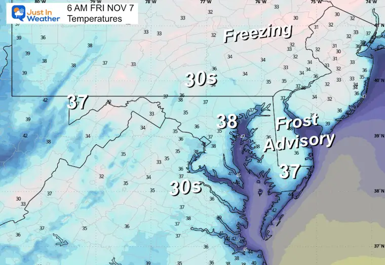
FRIDAY
Frost Advisory On Delmarva

Morning Temperatures
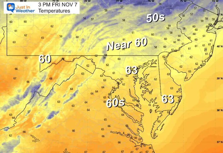
Afternoon Temperatures
Increasing clouds may make it still feel cool.
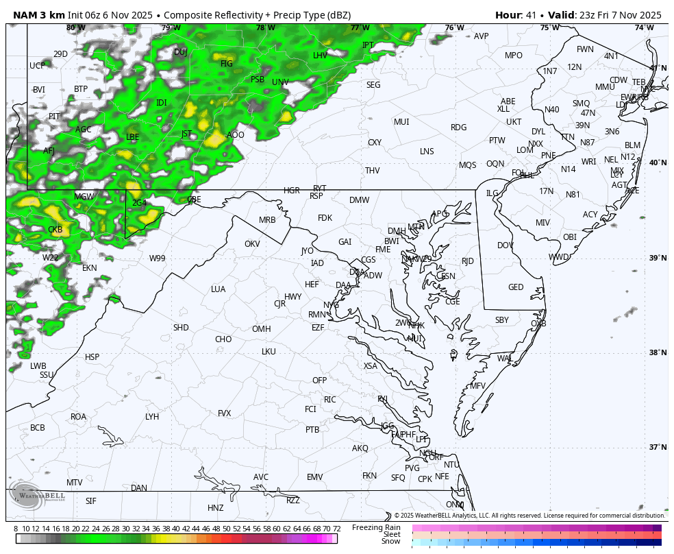
Rain Forecast 6 PM Fri to 6 AM Sat
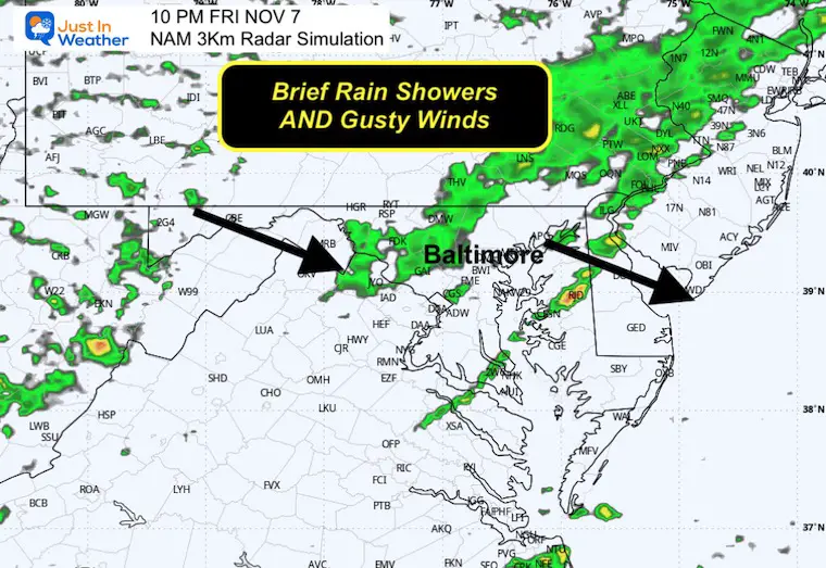
10 PM Snapshot
The rain will be brief at night, then followed by more wind.
WEATHER TREND: Friday To Monday
Multiple weather systems will include a few cold fronts.
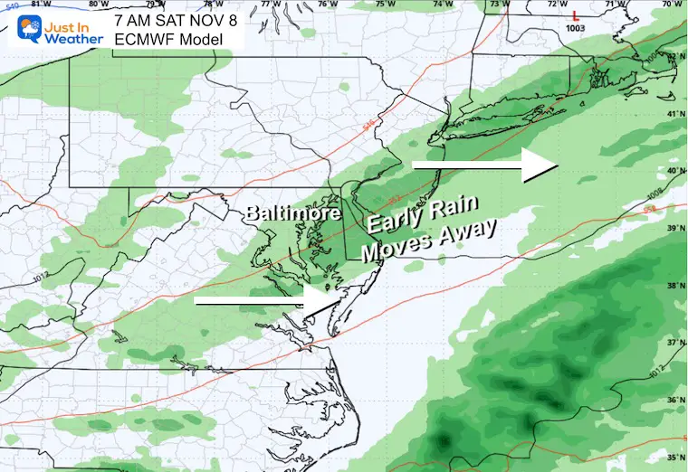
Rain is expected on Friday night, departing on Saturday morning, leaving a nice afternoon.
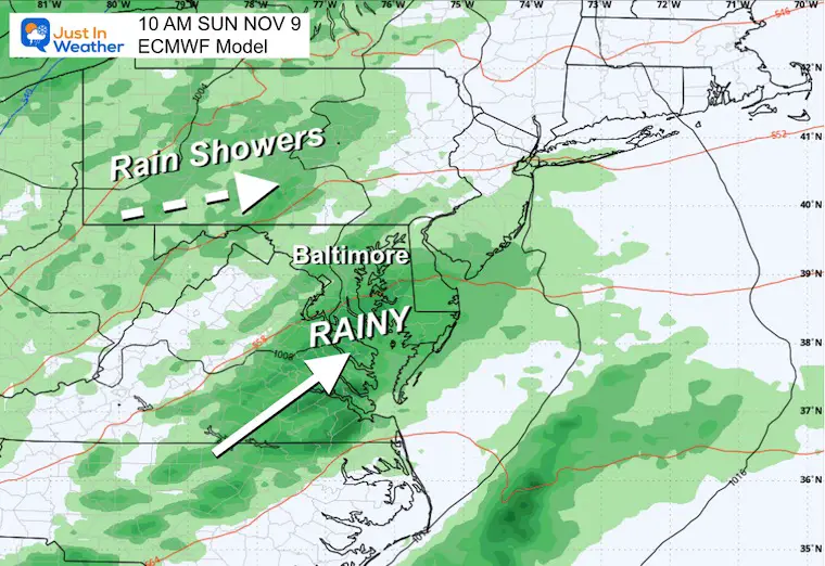
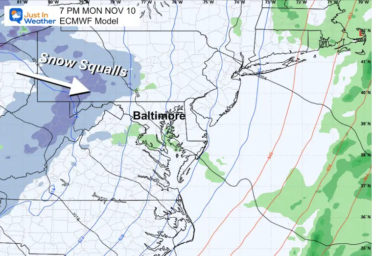
Sunday brings more rain showers followed by a colder air mass. This cold air will arrive on Monday and open up Lake Effect Snow for the mountains. It may bring flurries to Central Maryland.
Closer View
Saturday Morning
Rain showers ending early, then mild winds may push temps near 70°F in the afternoon.
Sunday Morning
More rain is expected.
Monday Evening
Moderate to heavy snow in the high mountains.
A few inches may accumulate in Garrett County, MD, and nearby ski areas of PA to WV.
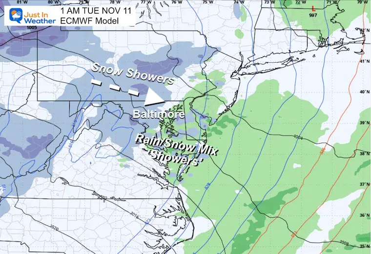
Early Tuesday
Snow flurries may reach central Maryland, with rain showers on Delmarva and the coast.
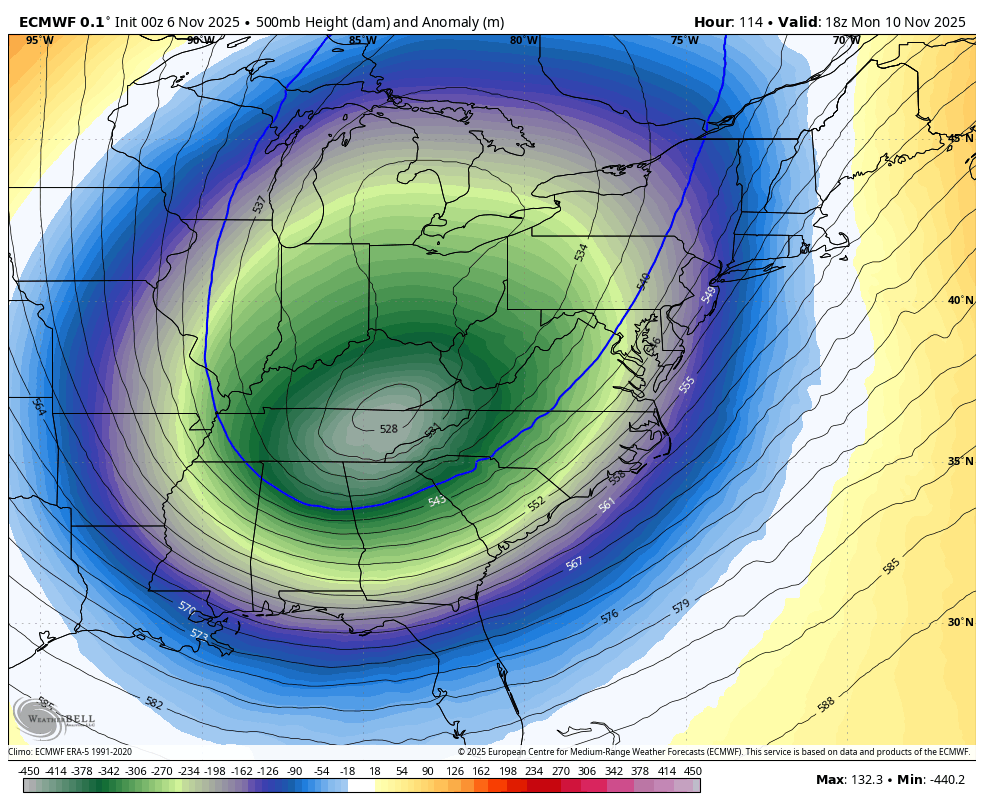
Jet Stream: Monday to Saturday
The core of the cold air swings through Tuesday. There will be reinforcing hits through the week, but gradually it will relax.
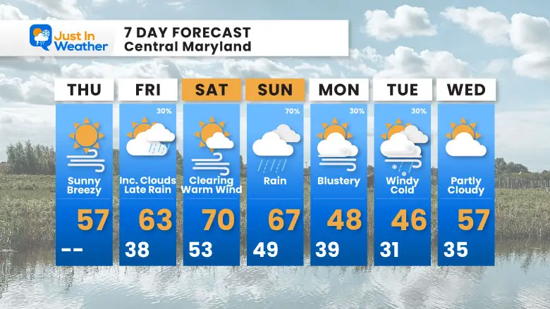
7 Day Forecast
- Today: Windy And Cooler
- Rain Events: Friday Night and Sunday
- Next Week: Coldest Air Tuesday, may have rain/snow mixed showers in metro areas
- It will be COLDER inland, and snow accumulates in the mountains
Subscribe for eMail Alerts
Average First Frost

La Niña Advisory
This was issued October 9, as expected: A weak and short-lived event to start winter may play a different role this winter

In Case You Missed It
Woolly Bear Caterpillar Winter Folklore
These are NOT all the same caterpillar!

Winter Outlook From 2 Farmers’ Almanacs

STEM Assemblies/In School Fields Trips Are Back
Click to see more and ‘Book’ a visit to your school

THANK YOU:
Baltimore Sun Magazine Readers’ Choice Best Of Baltimore

Maryland Trek 12 Day 7 Completed Sat August 9
UPDATED: We raised OVER $166,000 for Just In Power Kids – AND Still Collecting More
The annual event: Hiking and biking 329 miles in 7 days between The Summit of Wisp to Ocean City.
Each day, we honor a kid and their family’s cancer journey.
Fundraising is for Just In Power Kids: Funding Free Holistic Programs. I never have and never will take a penny. It is all for our nonprofit to operate.
Click here or the image to donate:

RESTATING MY MESSAGE ABOUT DYSLEXIA
I am aware there are some spelling and grammar typos and occasional other glitches. I take responsibility for my mistakes and even the computer glitches I may miss. I have made a few public statements over the years, but if you are new here, you may have missed it: I have dyslexia and found out during my second year at Cornell University. It didn’t stop me from getting my meteorology degree and being the first to get the AMS CBM in the Baltimore/Washington region. One of my professors told me that I had made it that far without knowing and to not let it be a crutch going forward. That was Mark Wysocki, and he was absolutely correct! I do miss my mistakes in my own proofreading. The autocorrect spell check on my computer sometimes does an injustice to make it worse. I can also make mistakes in forecasting. No one is perfect at predicting the future. All of the maps and information are accurate. The ‘wordy’ stuff can get sticky. There has been no editor who can check my work while writing and to have it ready to send out in a newsworthy timeline. Barbara Werner is a member of the web team that helps me maintain this site. She has taken it upon herself to edit typos when she is available. That could be AFTER you read this. I accept this and perhaps proves what you read is really from me… It’s part of my charm. #FITF
Please share your thoughts and best weather pics/videos, or just keep in touch via social media.


