October 29, 2025
Wednesday Evening Update
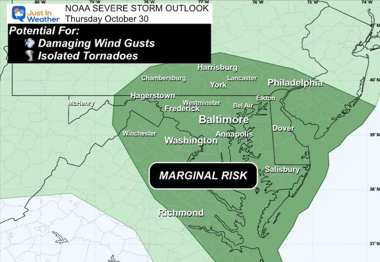
Plan for a bumpy day on Thursday! A strong storm is moving through the Tennessee and the Ohio River Valleys and heading to the East Coast. This is part of the large-scale pattern that is helping to push Hurricane Melissa out into the Atlantic. So while we are trading one storm for another.
The setup has prompted NOAA to increase the Severe Storm Risk to Marginal for our region. This also includes the potential for storm cells with low-level spin to produce damaging winds or even isolated tornadoes.
Heavy rain will develop overnight and into the morning hours. There will be some upper-level energy to enhance storm cells through the morning and into the early afternoon.
Reminder of Storm Alerts:
A Watch will be issued if there is potential for severe weather to develop.
A Warning will be issued when severe weather is occurring AND being tracked through specific towns.
NOAA Severe Storm Risk
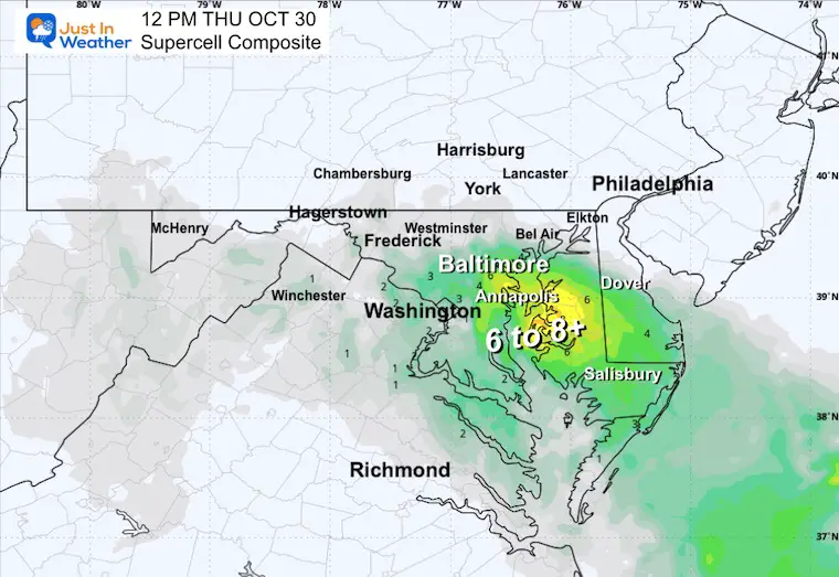
Supercell Composite Thursday
HRRR Model
Focus around the central Chesapeake Bay and Delmarva
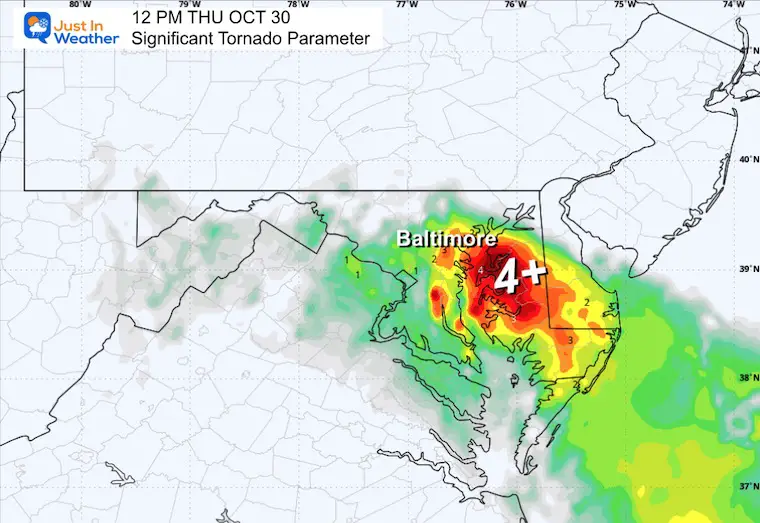
Significant Tornado Parameter Thursday
HRRR Model
Focus around the central Chesapeake Bay and Delmarva
UPDATE:
Live Radar Widget
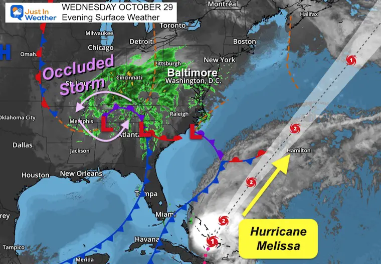
Wednesday Night Set Up
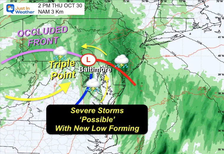
The rapid circulation around our inland storm is leading to a mature occluded phase. This is when the cold air wraps completely around the Primary Low Pressure. At this point, often a shift of energy can occur where there is a triple point of the occluded front and a new surface Low Pressure that will spin with the connected cold and warm front.
We see that East of Atlanta this morning, and it will ride north through I-81 into Virginia, Maryland, and Pennsylvania tomorrow.
Storm Simulation
HRRR Model Thursday: Midnight to 8 PM
Snapshot Early Afternoon
The estimated time of 2 PM may be best to consider a window between 10 AM and 2 PM.
This is the suggested location of the Triple Point Low between Frederick and Hagerstown, Maryland.
The low-level circulation is what will enhance the severe weather risk!
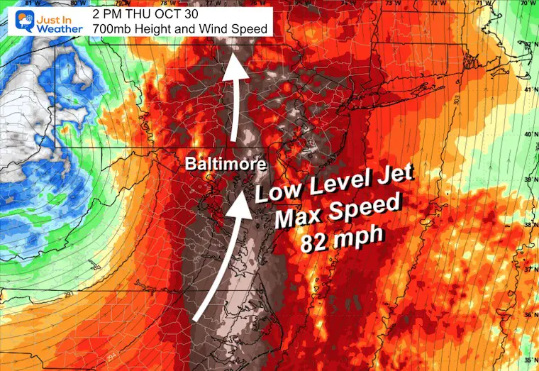
Low Level Jet Steam
The air flow here at 700mb, which is around 10,000 Ft above the ground.
The air flow at this level peaks at 82 mph. This can be translated down to the surface with some storm cells.
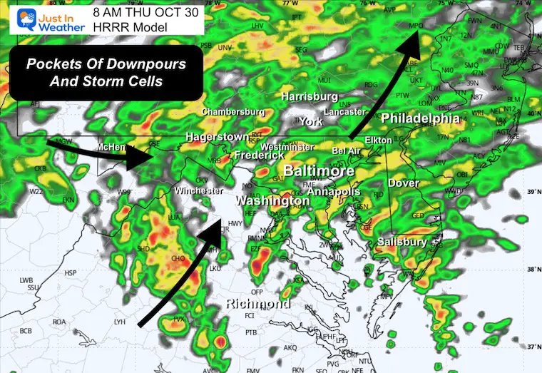
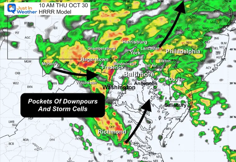
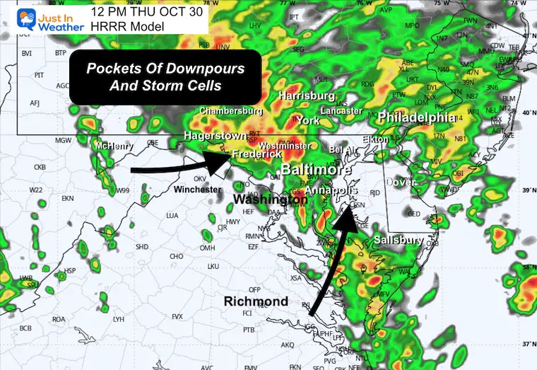
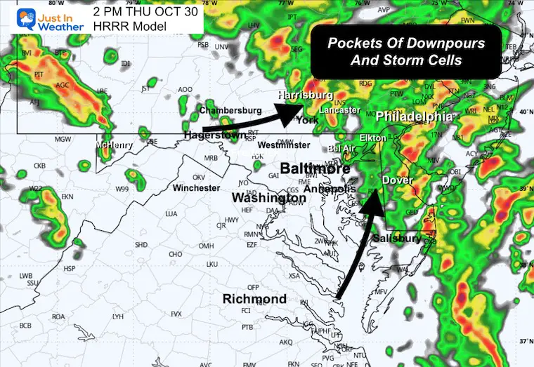
Radar Simulation Midnight to 4 PM
Snapshots
8 AM
10 AM
Noon
2 PM
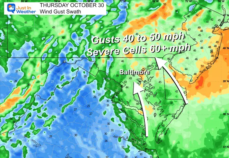
Wind Forecast Max Gusts
The model predicts a regional average of 40 to 50 mph.
However, some individual cells could push OVER 60 mph and qualify as severe storm criteria.
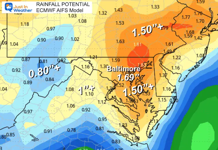
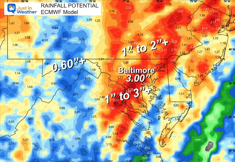
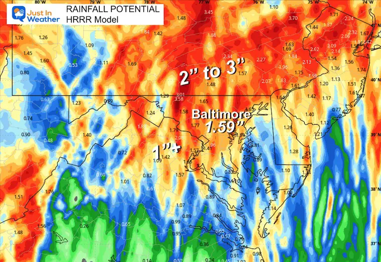
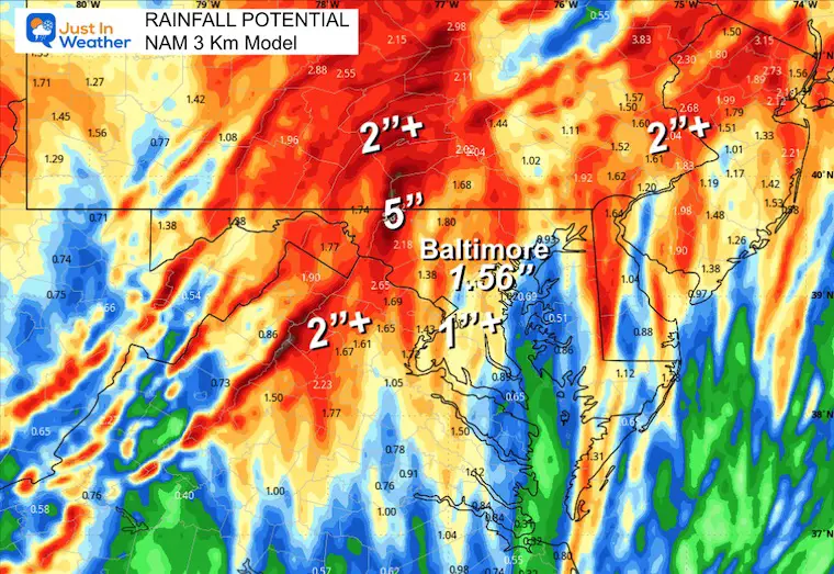
How Much Rain?
We are in desperate need for rainfall and this will help.
I have been saying all week that we can expect 1 to 2 inches.
These 4 models do show there is potential for higher pockets.
ECWMF AI Model
ECMWF Operational Model
HRRR Model
NAM 3 Km Model
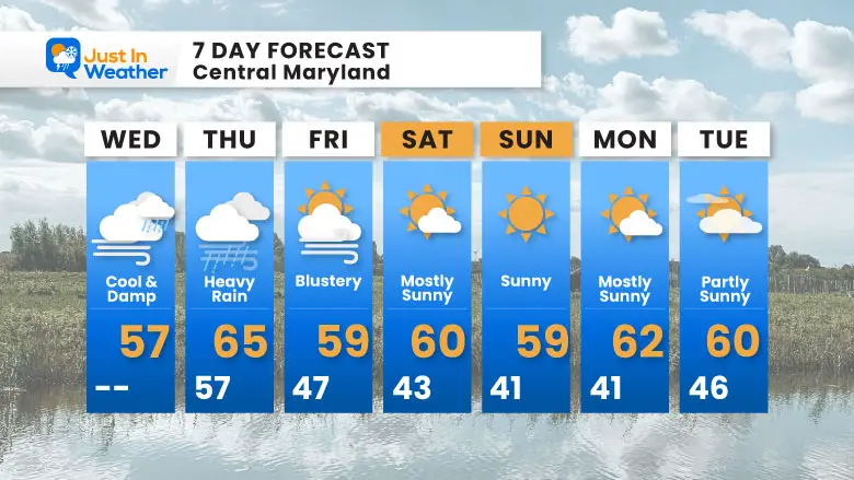
7 Day Forecast
- Thursday: Rain and possible severe storms
- Halloween: Blustery
- Weekend: Dry
Subscribe for eMail Alerts
Average First Frost

La Niña Advisory
This was issued October 9, as expected: A weak and short-lived event to start winter may play a different role this winter

4 SUPERMOONS In A ROW

In Case You Missed It
Woolly Bear Caterpillar Winter Folklore
These are NOT all the same caterpillar!

Winter Outlook From 2 Farmers’ Almanacs

STEM Assemblies/In School Fields Trips Are Back
Click to see more and ‘Book’ a visit to your school

THANK YOU:
Baltimore Sun Magazine Readers’ Choice Best Of Baltimore

Maryland Trek 12 Day 7 Completed Sat August 9
UPDATED: We raised OVER $166,000 for Just In Power Kids – AND Still Collecting More
The annual event: Hiking and biking 329 miles in 7 days between The Summit of Wisp to Ocean City.
Each day, we honor a kid and their family’s cancer journey.
Fundraising is for Just In Power Kids: Funding Free Holistic Programs. I never have and never will take a penny. It is all for our nonprofit to operate.
Click here or the image to donate:

RESTATING MY MESSAGE ABOUT DYSLEXIA
I am aware there are some spelling and grammar typos and occasional other glitches. I take responsibility for my mistakes and even the computer glitches I may miss. I have made a few public statements over the years, but if you are new here, you may have missed it: I have dyslexia and found out during my second year at Cornell University. It didn’t stop me from getting my meteorology degree and being the first to get the AMS CBM in the Baltimore/Washington region. One of my professors told me that I had made it that far without knowing and to not let it be a crutch going forward. That was Mark Wysocki, and he was absolutely correct! I do miss my mistakes in my own proofreading. The autocorrect spell check on my computer sometimes does an injustice to make it worse. I can also make mistakes in forecasting. No one is perfect at predicting the future. All of the maps and information are accurate. The ‘wordy’ stuff can get sticky. There has been no editor who can check my work while writing and to have it ready to send out in a newsworthy timeline. Barbara Werner is a member of the web team that helps me maintain this site. She has taken it upon herself to edit typos when she is available. That could be AFTER you read this. I accept this and perhaps proves what you read is really from me… It’s part of my charm. #FITF
Please share your thoughts and best weather pics/videos, or just keep in touch via social media.


