Sunday, October 19, 2025
If you liked the warm air yesterday, we get an additional boost today into the mid-70s. This will come with a noticeable push of stronger winds. This is ahead of a strong cold front that is expected to arrive in the mountains with showers later this afternoon, followed by a squall line with possible severe weather that is expected to reach metro and eastern areas overnight.
So much of the day will be warm and dry. Tomorrow will be cooler and dry. Both days will have strong winds, and the rain will be focused in the dark hours overnight.
Next Week will have frequent impulses to reinforce the cool air.
If you are interested in the tropics, the season may have a new storm on a southern track through the Caribbean, and of no interest to us.
Let’s take a look…
Comet Lemmon
The latest view of Comet Lemmon comes from a Carroll County teacher who set up in the dark areas of Jefferson, PA.
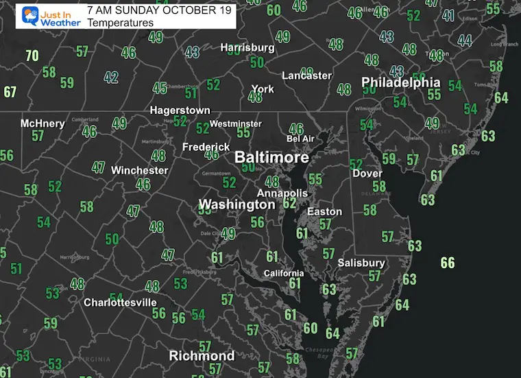
Morning Temperatures
Not as chilly as yesterday morning, thanks to added cloud cover.
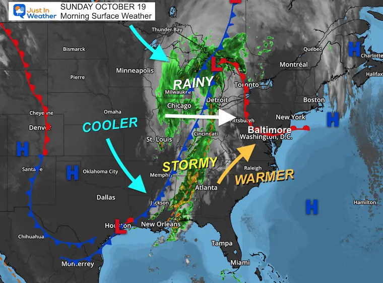
Surface Weather
Warm winds will stream in ahead of a strong cold front.
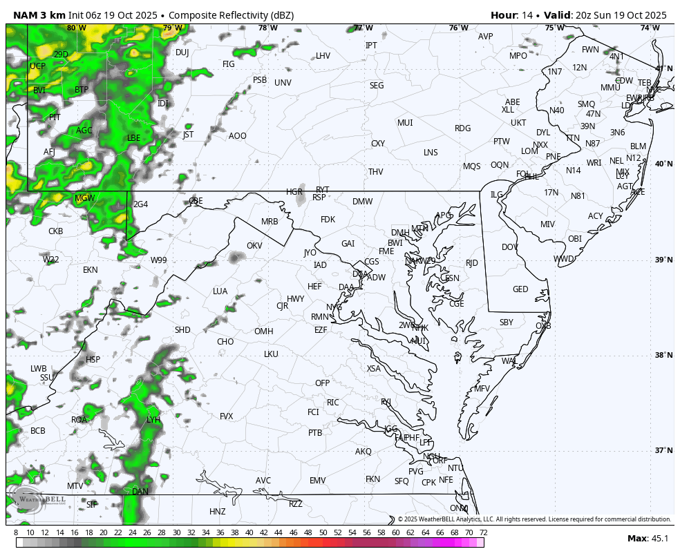
This morning, the focus of rain in the Great Lakes has a trailing cold front with thunderstorms extending all the way to the Gulf Coast.
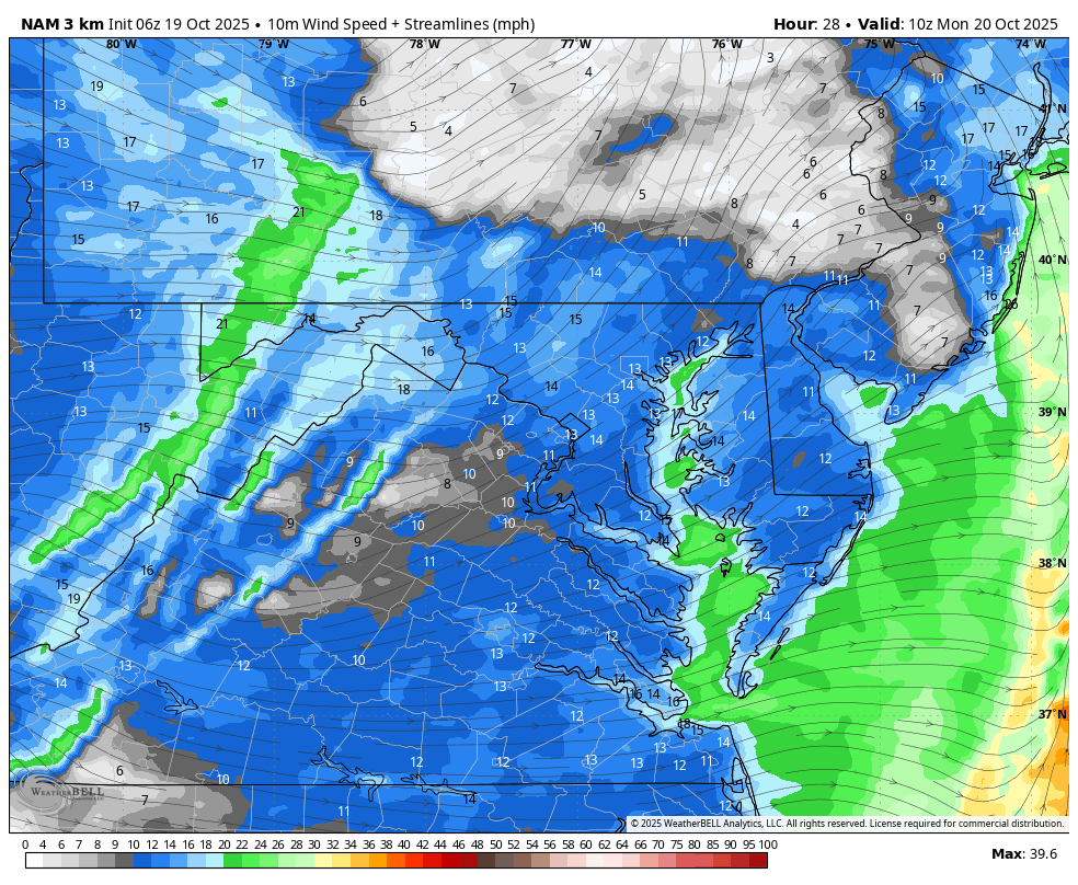
That cold front will spawn very active weather today and will reach metro areas in the Mid-Atlantic overnight. While we lose the heat of the day, the vigorous energy will allow for the burst of wind and perhaps an isolated tornado spin up as it passes.
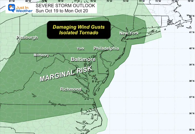
NOAA SEVERE STORM RISK
It is important to highlight that the focus will be later today and in most metro and eastern areas overnight!
Storm Forecast: Sunday Afternoon to Monday Afternoon
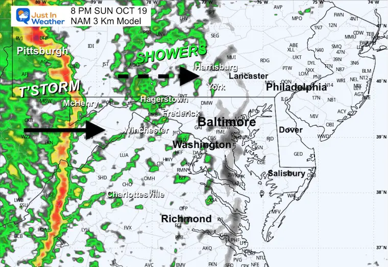
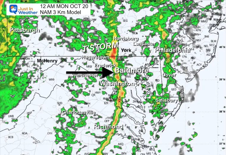
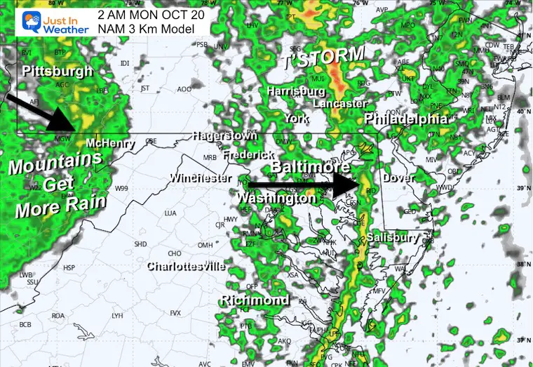
The cold front will arrive late Sunday and overnight. We can expect the bulk of rain during the ‘dark hours’ ending by sunrise Monday.
However, more rain will follow on Monday in the mountains.
OVERNIGHT FOCUS
The Squall Line with the Cold Front will pass through metro areas between midnight and 4 AM.
LOCAL LOOK BELOW
CLIMATE DATA: Baltimore
Yesterday: Low 44F; High 71F
Precipitation: 0.00”
TODAY October 19
Sunrise at 7:21 AM
Sunset at 6:22 PM
Normal Low in Baltimore: 45ºF
Record 29ºF in 2015
Normal High in Baltimore: 67ºF
Record 87ºF 2016
Rainfall Deficit at BWI
- Ending 2024 = -8.00”
- Since Jan 1 = 5.85”
- We are STILL DOWN -13.85” INCLUDING LAST YEAR
Subscribe for eMail Alerts
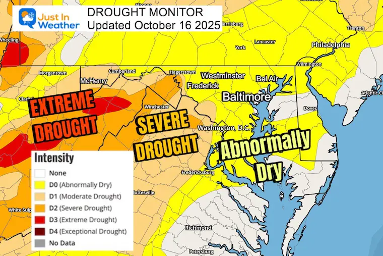
Drought Update: Report on Thursday
Extreme Drought in the Mountains
Abnormally dry in metro areas, but it does seem worse than that.
SUNDAY
Wind Forecast 8 AM to 8 PM
Winds will gust 20 to 30 mph from the South
Afternoon Temperatures

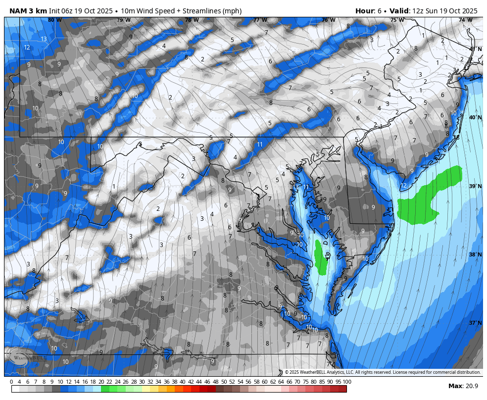
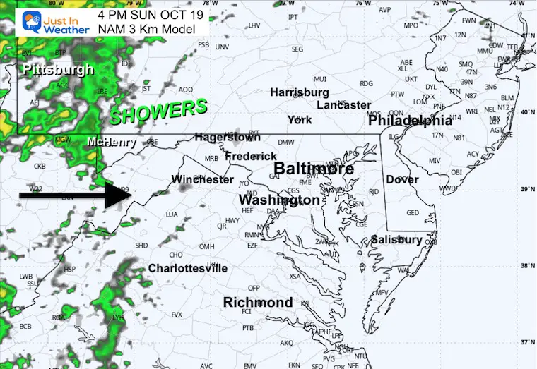
Radar Simulation at 4 PM
Radar Simulation: 4 PM Sun to 8 AM Monday
The rain will develop in the evening and fall mostly overnight. This may include some embedded thunderstorms.
The rain will be moving out before sunrise.
Snapshots
Evening at 8 PM
Midnight
Monday Early Morning
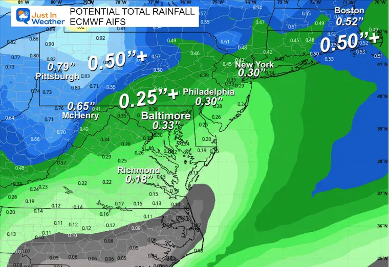
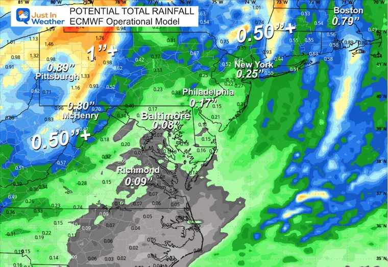
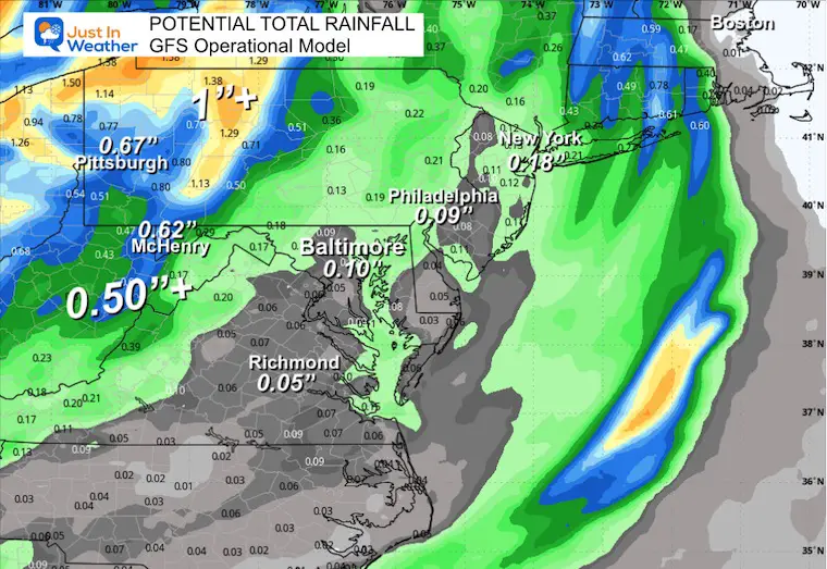
POTENTIAL RAINFALL
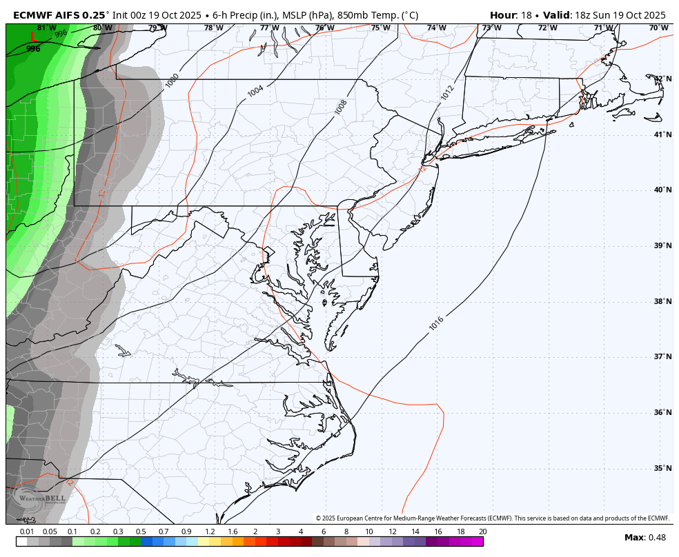
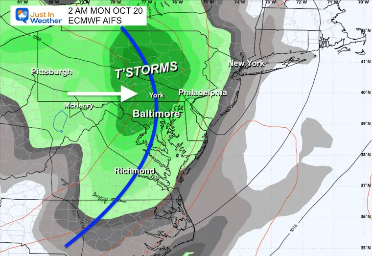
THIS IS A CONTINUED TEST: Let’s compare the AI Version of the European Model to the Operational version and the GFS Model.
ECMWF AIFS (AI Version)
ECMWF Operational Model (Traditional)
GFS Operational Mode (Traditional)
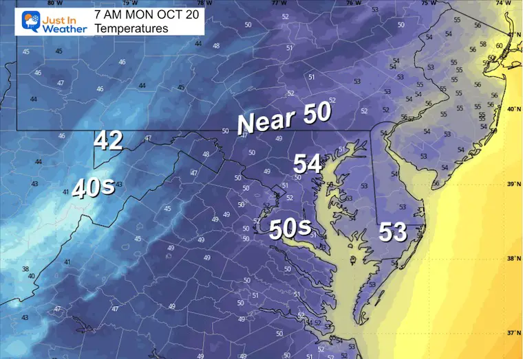
MONDAY
Morning Temperatures
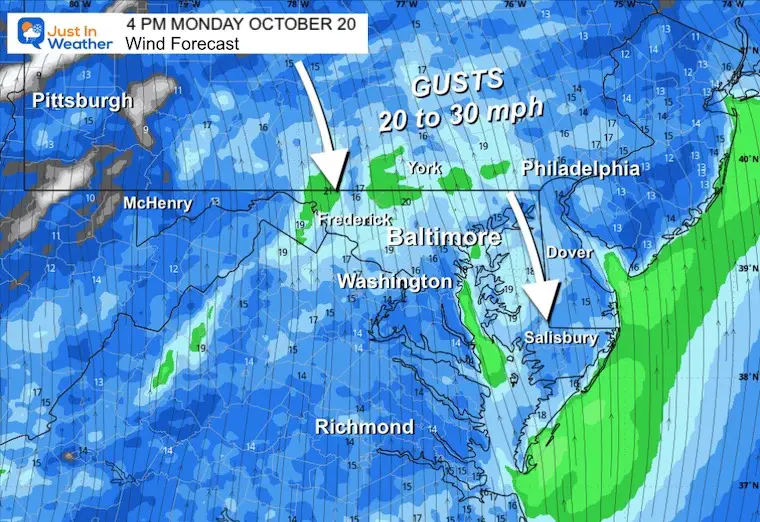
Wind Forecast 6 AM to 4 PM
Strong winds are expected throughout the day.
Afternoon Snapshot
Gusts will gust 20 to 30 mph from the North, ushering in the new cool air mass.
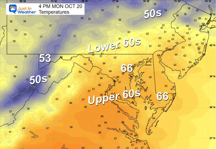
Afternoon Temperatures
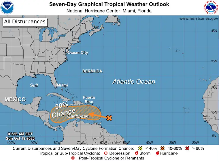
Tropical Outlook
The next storm potential is up to 50% and is NOT an interest to Bermuda for a change!
This will be a southern track Caribbean system.
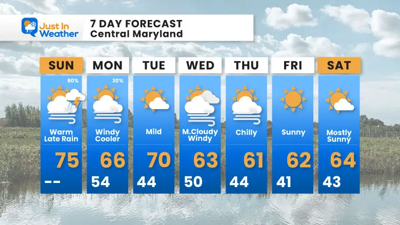
7 Day Forecast
- Today: Warm With Sun; Evening And Tonight: Rain/T’Storms
- Monday: Windy And Cooler
- More Chilly Air During The Week
Subscribe for eMail Alerts
Average First Frost

La Niña Advisory
This was issued October 9, as expected: A weak and short-lived event to start winter may play a different role this winter

4 SUPERMOONS In A ROW

In Case You Missed It
Woolly Bear Caterpillar Winter Folklore
These are NOT all the same caterpillar!

Winter Outlook From 2 Farmers’ Almanacs

STEM Assemblies/In School Fields Trips Are Back
Click to see more and ‘Book’ a visit to your school

THANK YOU:
Baltimore Sun Magazine Readers’ Choice Best Of Baltimore

Maryland Trek 12 Day 7 Completed Sat August 9
UPDATED: We raised OVER $166,000 for Just In Power Kids – AND Still Collecting More
The annual event: Hiking and biking 329 miles in 7 days between The Summit of Wisp to Ocean City.
Each day, we honor a kid and their family’s cancer journey.
Fundraising is for Just In Power Kids: Funding Free Holistic Programs. I never have and never will take a penny. It is all for our nonprofit to operate.
Click here or the image to donate:

RESTATING MY MESSAGE ABOUT DYSLEXIA
I am aware there are some spelling and grammar typos and occasional other glitches. I take responsibility for my mistakes and even the computer glitches I may miss. I have made a few public statements over the years, but if you are new here, you may have missed it: I have dyslexia and found out during my second year at Cornell University. It didn’t stop me from getting my meteorology degree and being the first to get the AMS CBM in the Baltimore/Washington region. One of my professors told me that I had made it that far without knowing and to not let it be a crutch going forward. That was Mark Wysocki, and he was absolutely correct! I do miss my mistakes in my own proofreading. The autocorrect spell check on my computer sometimes does an injustice to make it worse. I can also make mistakes in forecasting. No one is perfect at predicting the future. All of the maps and information are accurate. The ‘wordy’ stuff can get sticky. There has been no editor who can check my work while writing and to have it ready to send out in a newsworthy timeline. Barbara Werner is a member of the web team that helps me maintain this site. She has taken it upon herself to edit typos when she is available. That could be AFTER you read this. I accept this and perhaps proves what you read is really from me… It’s part of my charm. #FITF
Please share your thoughts and best weather pics/videos, or just keep in touch via social media.


