Friday, October 17, 2025
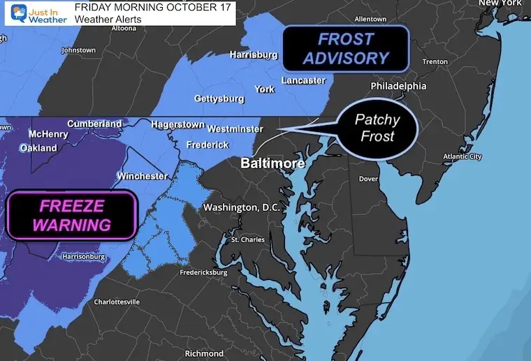
The end of the week will be quiet and chilly. A Frost Advisory and Freeze Warning are in place in the region.
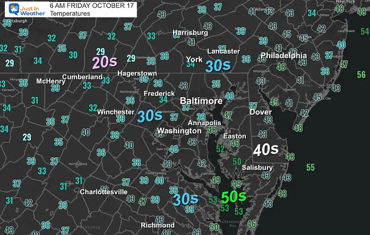
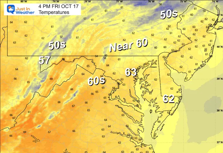
Temperatures have dropped into the 30s in many areas. With sunshine, we will remain cool today in the 60s, then back to the 70s over the weekend.
Our next rain will arrive with a cold front late Sunday into Monday morning.
In Case You Missed It
Comet Lemmon
This was captured on Thursday Night
This is growing brighter and more visible. It will be an evening sky show this weekend and for the rest of the month.
Weekend Weather
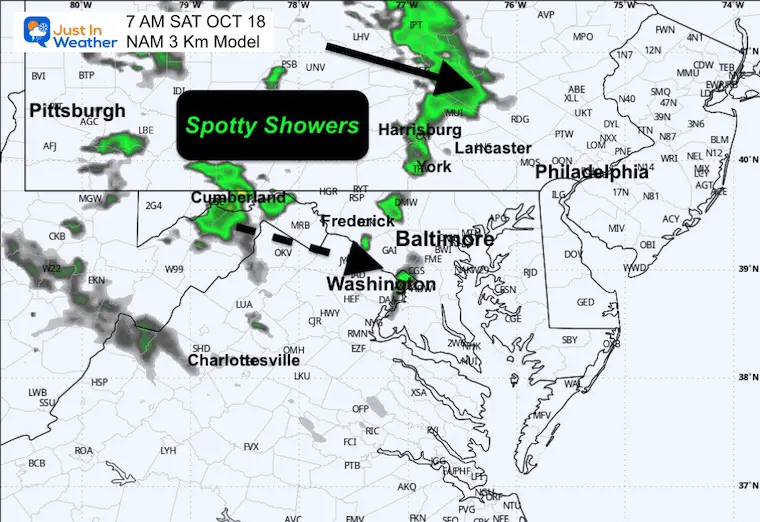
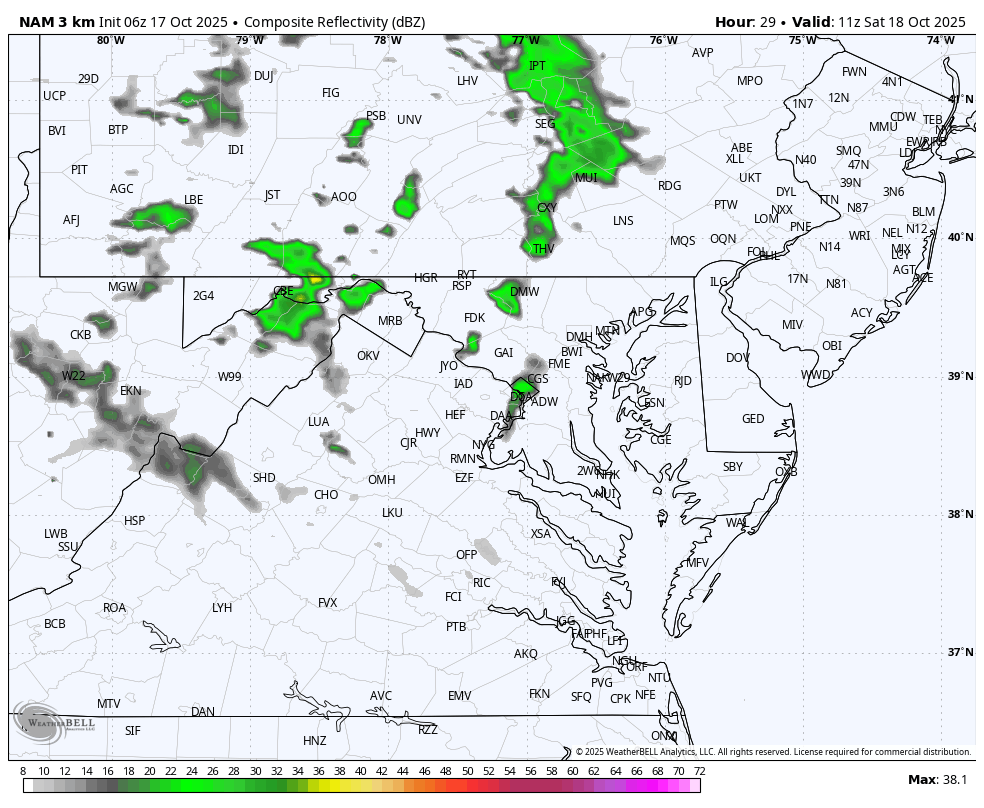
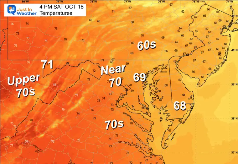
This weekend we warm back up close to 70F, with Sunday being warmer, then a line of rain and thunderstorms arrives late. This may start with more clouds and spotty showers early Saturday as the wind shift aloft has enhanced a little disturbance.
Most of the weekend looks good!
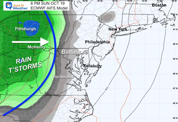
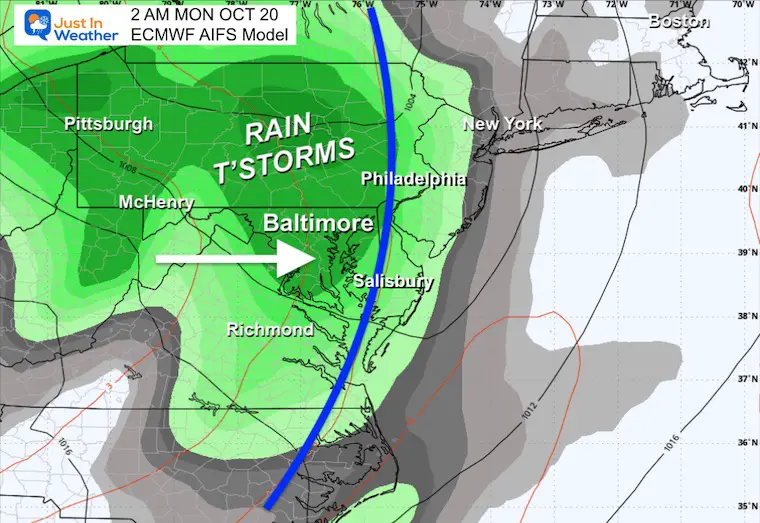
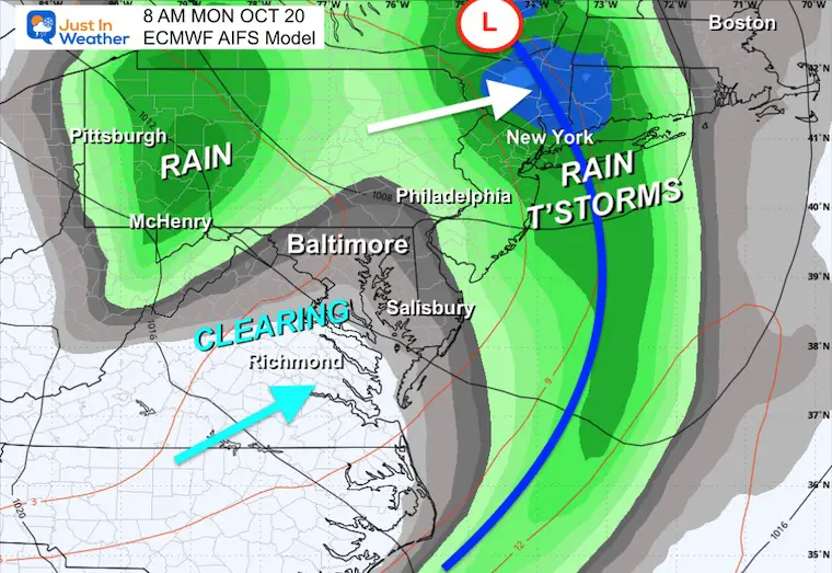
Sunday will be warm with sun, then we watch a cold front arrive late in the day. The rain showers and thunderstorms will reach the mountains in the afternoon, and arrive in metro areas by evening. The bulk of the rain is expected overnight and is expected to end by Monday morning.
Next Week will have frequent impulses to reinforce the cool air.
Let’s take a look…
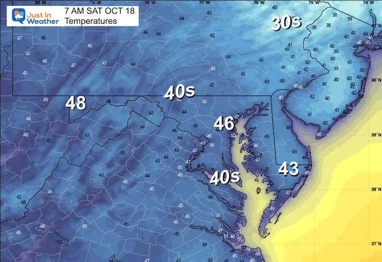
Frost Advisory And Freeze Warning
Morning Temperatures
Surface Weather
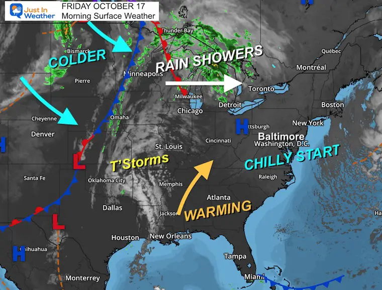
High Pressure will keep us sunny and dry today, but also remaining cool.
A warm-up this weekend will come with more clouds for the first part of Saturday, and then the cold front will arrive late Sunday.
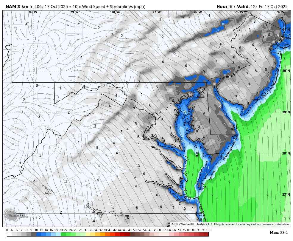
TODAY
Wind Animation: 8 AM to 8 PM
Afternoon Temperatures
CLIMATE DATA: Baltimore
Yesterday: Low 42F; High 64F
Precipitation: 0.00”
TODAY October 17
Sunrise at 7:19 AM
Sunset at 6:25 PM
Normal Low in Baltimore: 46ºF
Record 32ºF in 2024
Normal High in Baltimore: 68ºF
Record 90ºF 1897
Rainfall Deficit at BWI
- Ending 2024 = -8.00”
- Since Jan 1 = 5.59”
- We are STILL DOWN -13.59” INCLUDING LAST YEAR
Subscribe for eMail Alerts
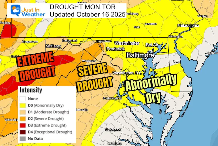
Drought Update: Report on Thursday
- Extreme Drought in the Mountains
- Abnormally dry in metro areas, but it seems worse than that.
Fall Foliage Update
SATUDAY
Morning Temperatures
Radar Snapshot
There may be a stray rain shower early. This is a result of the wind shift to warmer air and a disturbance aloft.
Radar Simulation 7 AM to 4 PM
Cloud Simulation 7 AM to 4 PM
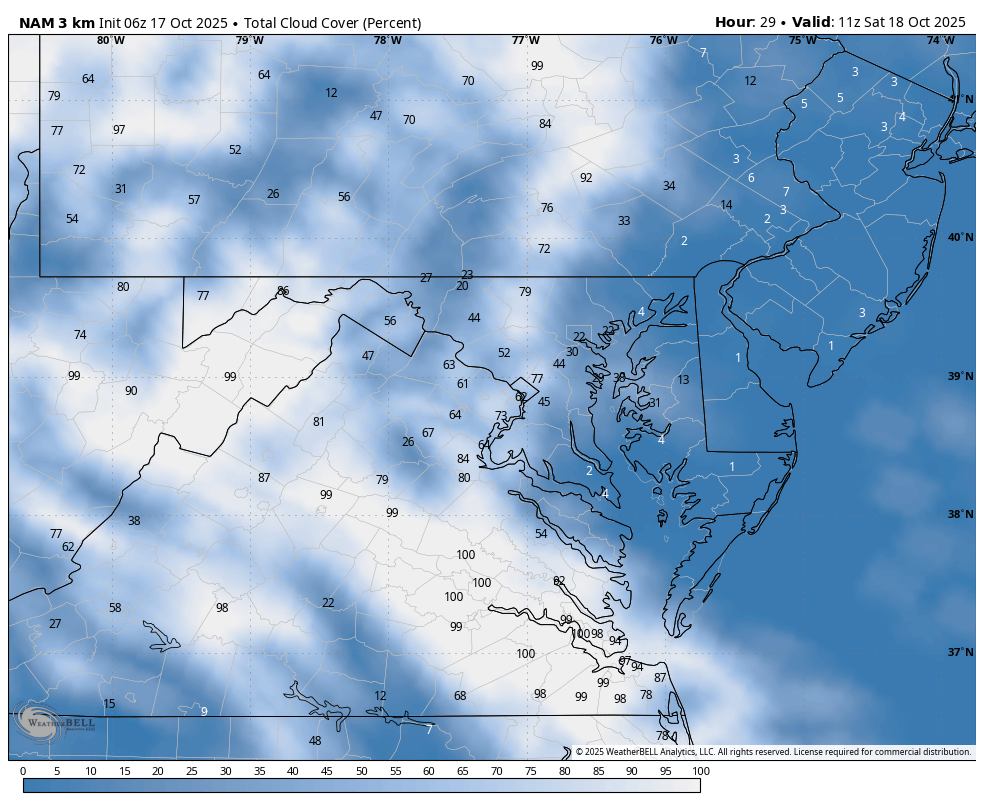
More clouds in the morning will clear during the afternoon and evening.
Afternoon Temperatures
Looking Ahead:
Storm Forecast: Saturday to Tuesday
Weekend Warm-Up will be the theme. Temps should get back to the 70s by Sunday, then a cold front will arrive.
At this time, the timeline looks to bring thunderstorms to the Ohio Valley and high mountains by Sunday afternoon. Then into metro areas Sunday night into Monday morning.
A pocket of cool air will follow, while a new Coastal Low Pressure may develop along the front and move up to New England.
Snapshots
Sunday Night
Monday Before Sunrise
Monday After Sunrise
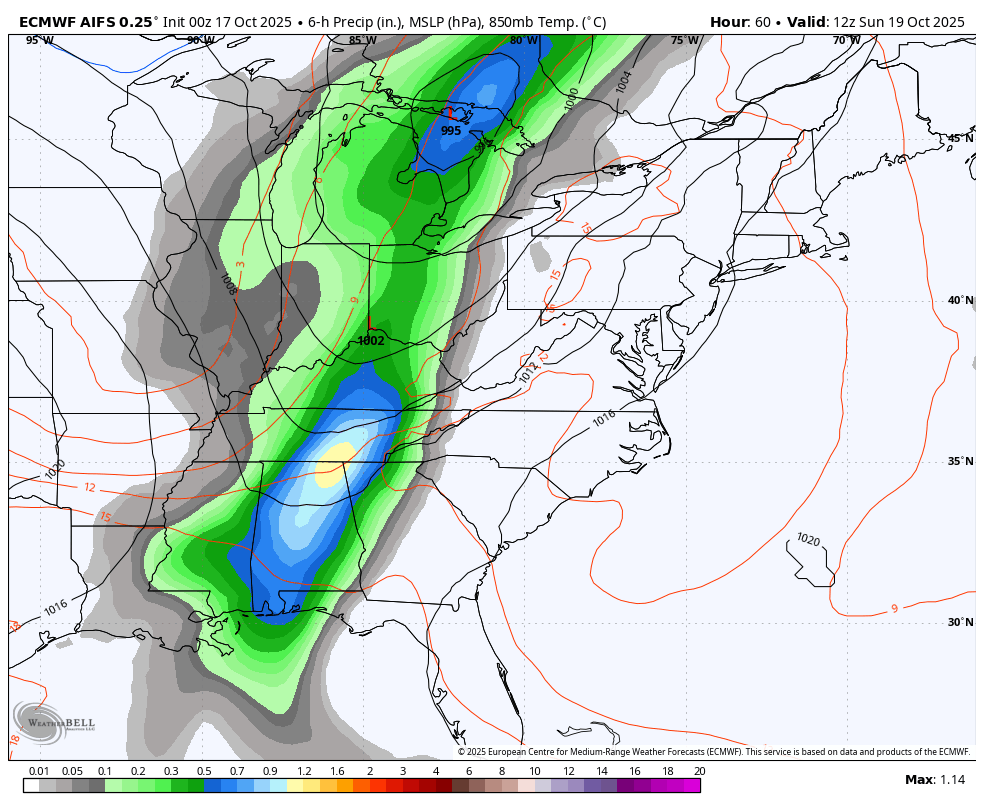
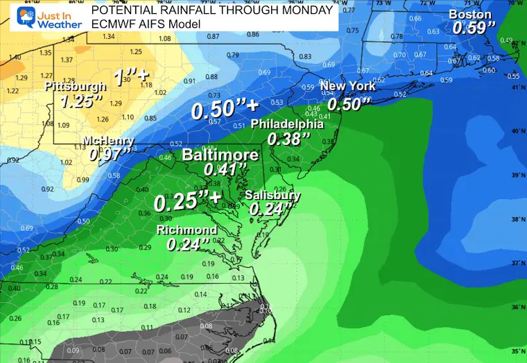
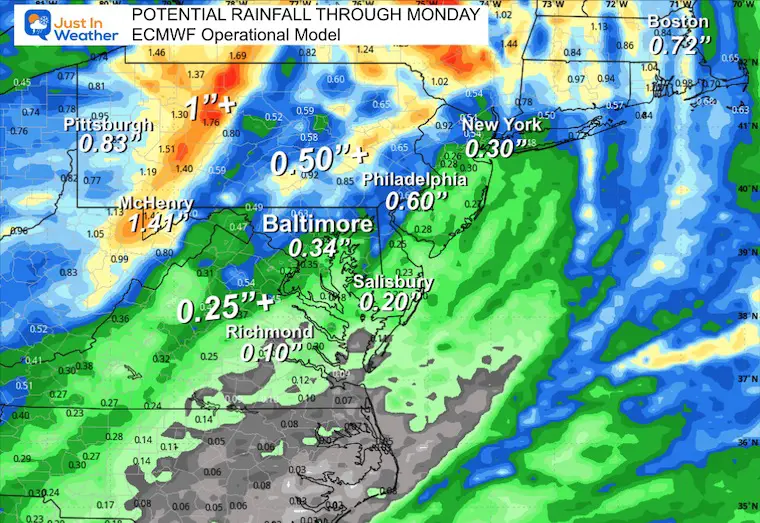
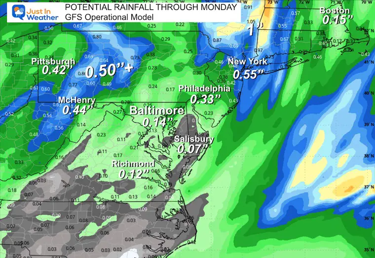
POTENTIAL RAINFALL
THIS IS A CONTINUED TEST: Comparing the AI Version of the European Model to the Operational version and the GFS Model.
Last week I showed these three, and the AI version performed the best in this same time window. I will again do a comparison of the results.
ECMWF AIFS (AI Version)
ECMWF Operational Model (Traditional)
GFS Operational Mode (Traditional)
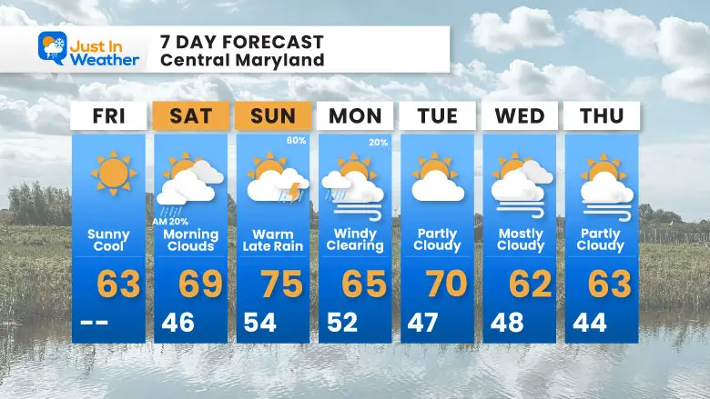
7 Day Forecast
- Today: Sunny and Cool
- Weekend: Warmer and MOSTLY Dry
- Saturday: More Clouds, Maybe a Stray Shower
- Sunday: Warm With Sun; Evening Rain/T’Storms