Tuesday, October 14, 2025
The Nor’easter has continued to produce beach-eating waves and wind. The Low Pressure is moving away from the coast, while drizzle and fog remain this morning.
Conditions will slowly improve, and gusty winds prevail. This means advisories remain for the Chesapeake Bay and along the coast.
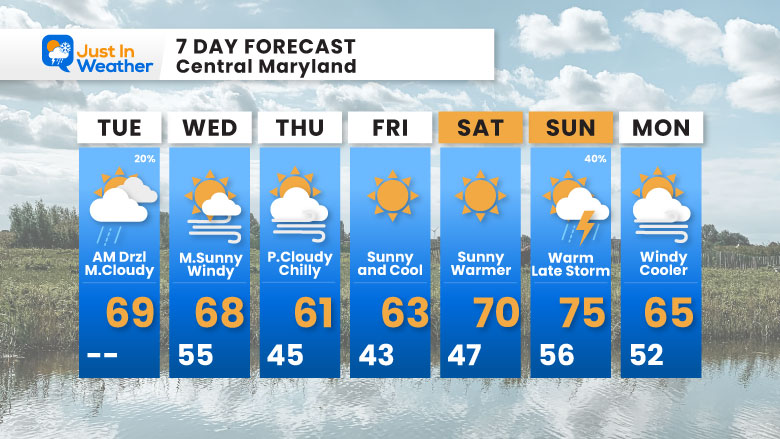
A new air mass will arrive with a cold front, which will not bring rain, but will increase the winds from the north. That will be followed by a noticeably cooler air mass on Thursday and Friday.
Then a swing to bring warmer air this weekend and perhaps the 70s for two days. That will come to an end with a chance of thunderstorms later on Sunday.
Let’s take a look…
Live Radar Widget
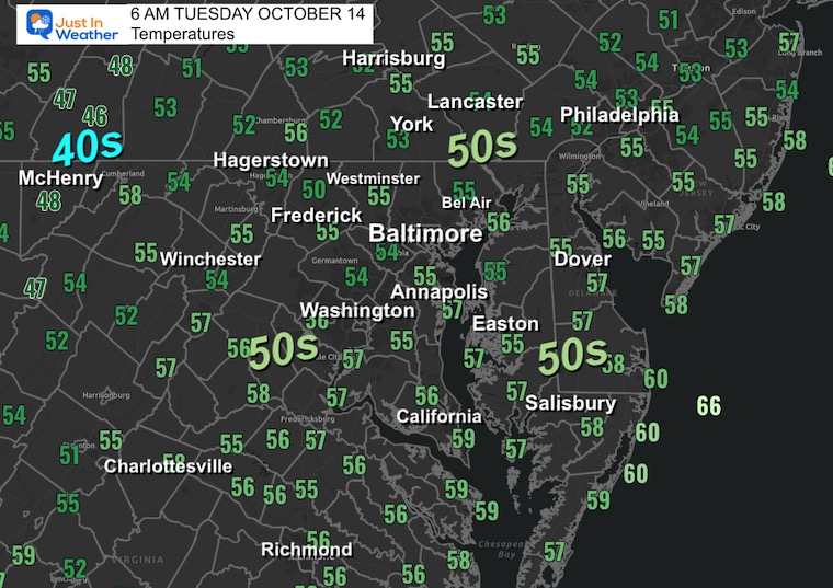
Morning Temperatures
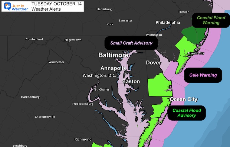
Weather Alerts
- A Gale Warning remains along the Mid-Atlantic coast.
- Coastal Flooding from Southern New Jersey through Delaware, Maryland, and Virginia.
- Small Craft Advisory on the Chesapeake Bay
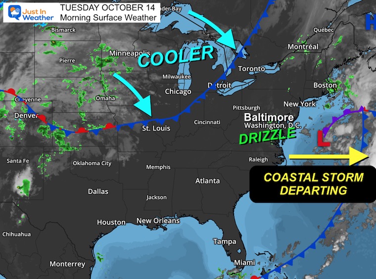
Surface Weather
Our Coastal Storm is moving away, but a pocket of moisture remains in place with drizzle and fog this morning. The clouds may not fully break up today.
The next focus will be the cold front crossing the Great Lakes now and which will pass through with another boost of chilly winds tomorrow.
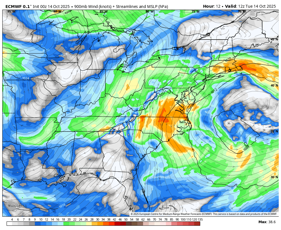
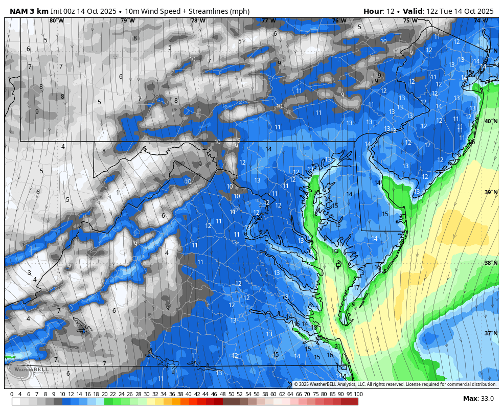
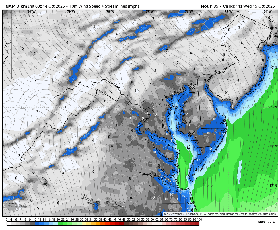
Streamline Winds:
Forecast Through Thursday Night
This is the air above the ground, highlighting the storm departing AND the push of colder air with a boost of wind FROM THE NORTH for the next few days.
LOCAL WEATHER
CLIMATE DATA: Baltimore
Yesterday: Low 55F; High 61F
Precipitation: 0.17”
TODAY October 14
Sunrise at 7:16 AM
Sunset at 6:29 PM
Normal Low in Baltimore: 47ºF
Record 29ºF in 1988
Normal High in Baltimore: 69ºF
Record 86ºF 1975
Rainfall Deficit at BWI
- Ending 2024 = -8.00”
- Since Jan 1 = 5.33”
- We are STILL DOWN -13.33” INCLUDING LAST YEAR
Subscribe for eMail Alerts
TODAY
Wind Animation: 8 AM to Midnight
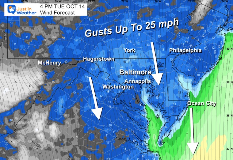
Afternoon Winds
Strong Breeze!
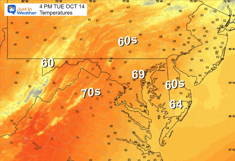
Afternoon Temperatures
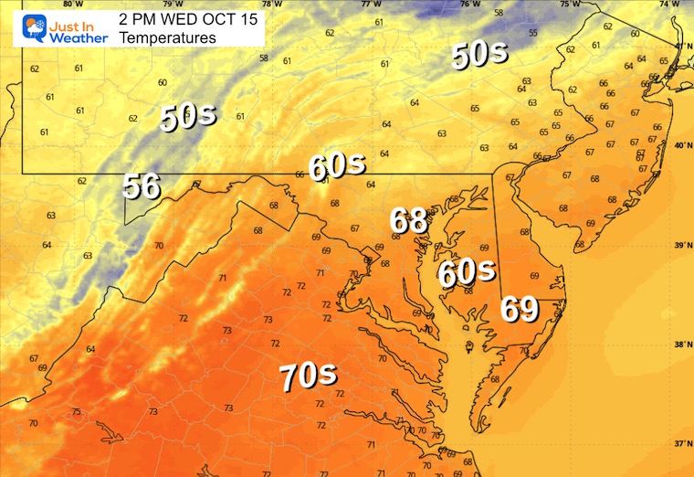
Wednesday
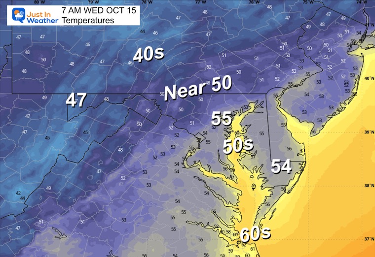
Morning Temperatures
Wind Forecast
Once again, gusts over 20 mph as the cooler air arrives from the North.
Afternoon Temperatures
Looking Ahead:
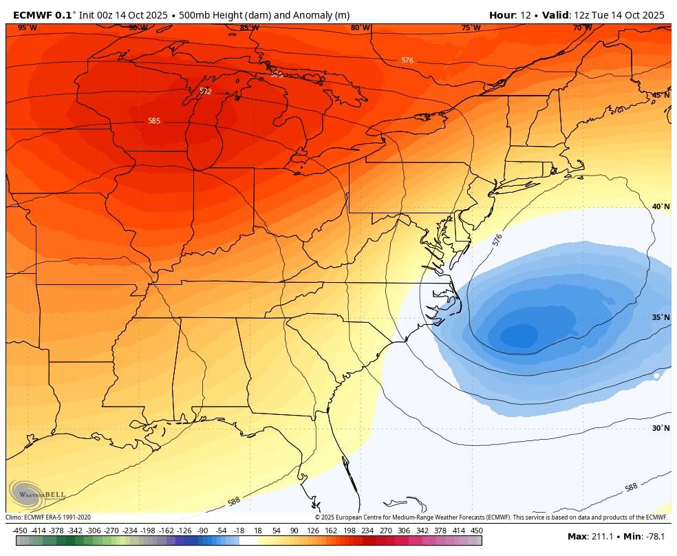
Jet Stream: Tuesday to Monday
We can see the cooler air mass for a few days, then the warm up this weekend, followed by the next pocket of chilly air next week.
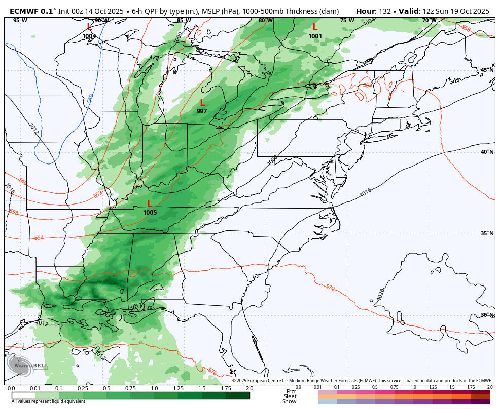
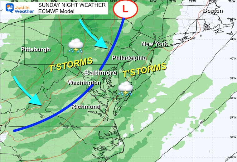
Storm Forecast: Saturday to Monday
A line of rain and thunderstorms will arrive with that next cool air.
Sunday evening to Monday morning is the most likely time for it to arrive in metro areas and on the coast.
Snapshot Sunday Night
The most likely time for thunderstorms to reach metro areas may be close to and after sundown.
7 Day Forecast
- Today: Morning Drizzle; Clouds Linger
- Wednesday: Windy
- Thursday – Friday: Cooler
- Weekend: Warmer and Dry; T’storms Sunday Evening
Subscribe for eMail Alerts
La Niña Advisory
This was issued October 9, as expected: A weak and short-lived event to start winter may play a different role this winter

4 SUPERMOONS In A ROW

In Case You Missed It
Woolly Bear Caterpillar Winter Folklore
These are NOT all the same caterpillar!

Winter Outlook From 2 Farmers’ Almanacs

STEM Assemblies/In School Fields Trips Are Back
Click to see more and ‘Book’ a visit to your school

THANK YOU:
Baltimore Sun Magazine Readers’ Choice Best Of Baltimore

Maryland Trek 12 Day 7 Completed Sat August 9
UPDATED: We raised OVER $166,000 for Just In Power Kids – AND Still Collecting More
The annual event: Hiking and biking 329 miles in 7 days between The Summit of Wisp to Ocean City.
Each day, we honor a kid and their family’s cancer journey.
Fundraising is for Just In Power Kids: Funding Free Holistic Programs. I never have and never will take a penny. It is all for our nonprofit to operate.
Click here or the image to donate:

RESTATING MY MESSAGE ABOUT DYSLEXIA
I am aware there are some spelling and grammar typos and occasional other glitches. I take responsibility for my mistakes and even the computer glitches I may miss. I have made a few public statements over the years, but if you are new here, you may have missed it: I have dyslexia and found out during my second year at Cornell University. It didn’t stop me from getting my meteorology degree and being the first to get the AMS CBM in the Baltimore/Washington region. One of my professors told me that I had made it that far without knowing and to not let it be a crutch going forward. That was Mark Wysocki, and he was absolutely correct! I do miss my mistakes in my own proofreading. The autocorrect spell check on my computer sometimes does an injustice to make it worse. I can also make mistakes in forecasting. No one is perfect at predicting the future. All of the maps and information are accurate. The ‘wordy’ stuff can get sticky. There has been no editor who can check my work while writing and to have it ready to send out in a newsworthy timeline. Barbara Werner is a member of the web team that helps me maintain this site. She has taken it upon herself to edit typos when she is available. That could be AFTER you read this. I accept this and perhaps proves what you read is really from me… It’s part of my charm. #FITF
Please share your thoughts and best weather pics/videos, or just keep in touch via social media.


