Sunday, October 5, 2025
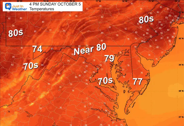
Some areas already hit 80°F yesterday. Today will be a notch or two higher. If you are going to the Ravens home game, it may feel hot in the sun. Let’s hope they can turn the season back around with a win!
We also need to turn around our weather pattern: We are VERY DRY! The yearly rainfall deficit is approaching 5 inches again. As leaves turn and fall, we may start to get fire restrictions put back into place.
Our next chance for storms will be later on Tuesday.
The tropics are quieting down, and the outlook is minimal at best.
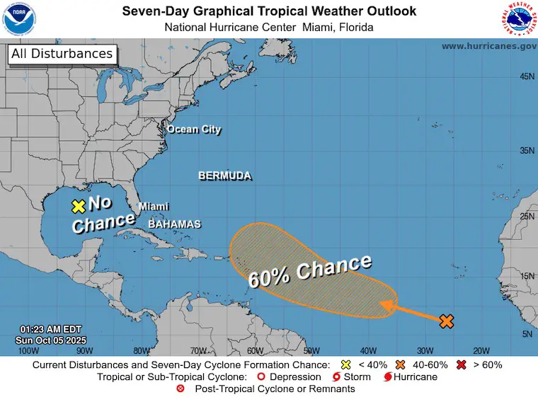
TROPICAL WEATHER
National Hurricane Center Outlook
If you are hearing about ‘two potential storms’ in the Atlantic, this is the latest look for the next 7 days!
It’s not that impressive!
The region across the Gulf is NOT going to become tropical.
The Atlantic Look is up to 60% and follows the last few storms. The climatology of this region for this time of year would support staying out to sea.
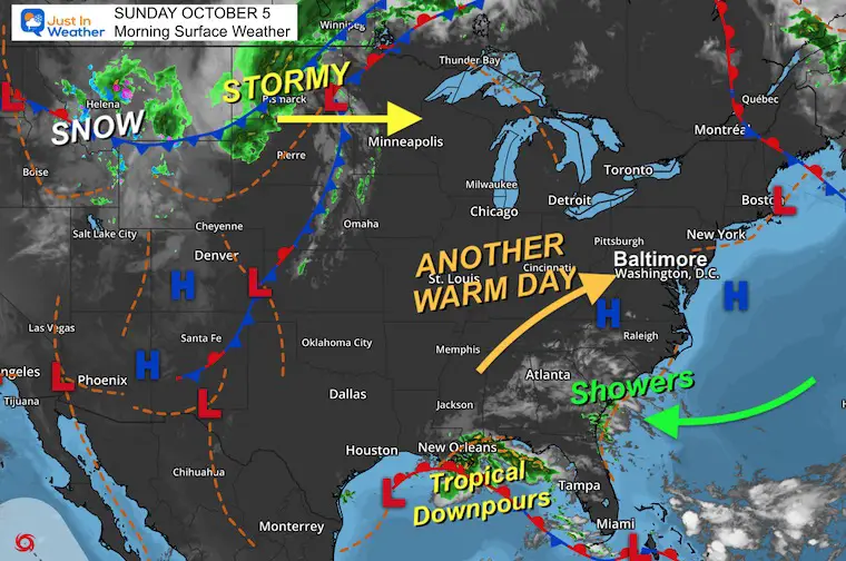
Local Weather Look: SUNDAY WEATHER
Surface Weather
High Pressure is what dominates our weather. While we get a warmer wind from the South, the other side is pushing moisture with rain into South Carolina and helping produce tropical downpours across the Gulf near New Orleans.
Reminder: That is NOT going to become an organized tropical storm.
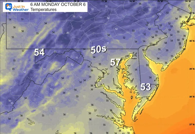
Morning Temperatures
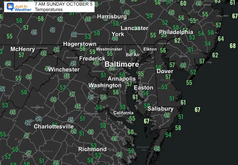
CLIMATE DATA: Baltimore
Yesterday: Low 48F; High 79F
Precipitation: 0.00”
TODAY October 5
Sunrise at 7:07 AM
Sunset at 6:42 PM
Normal Low in Baltimore: 51ºF
Record 35ºF in 1965; 1996
Normal High in Baltimore: 72ºF
Record 97ºF 1941
Rainfall Deficit at BWI
- Ending 2024 = -8.00”
- Since Jan 1 = 4.48”
- We are STILL DOWN -12.48” INCLUDING LAST YEAR
Subscribe for eMail Alerts
High Temperatures Today
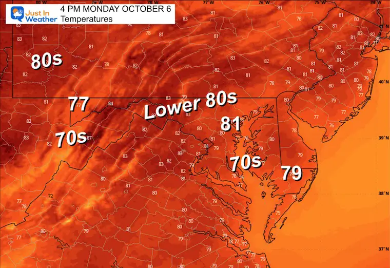
MONDAY
Morning Temperatures
Afternoon Temperatures
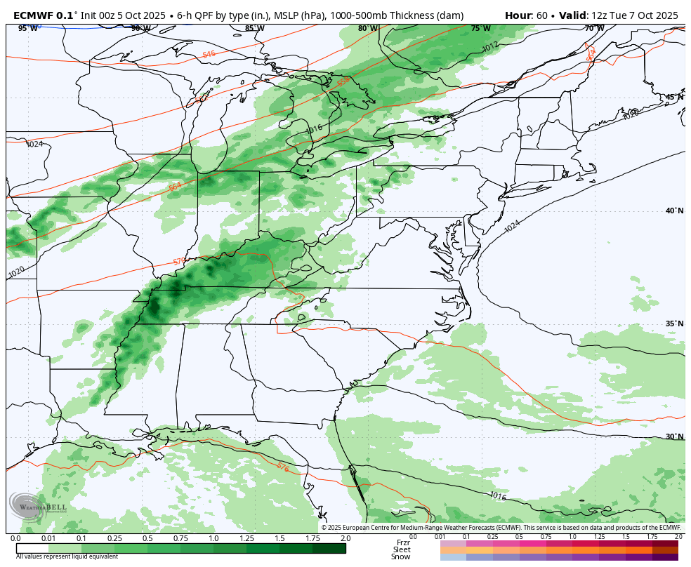
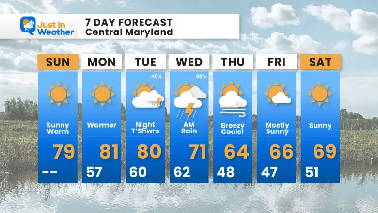
Looking Ahead: Forecast Tuesday to Thursday
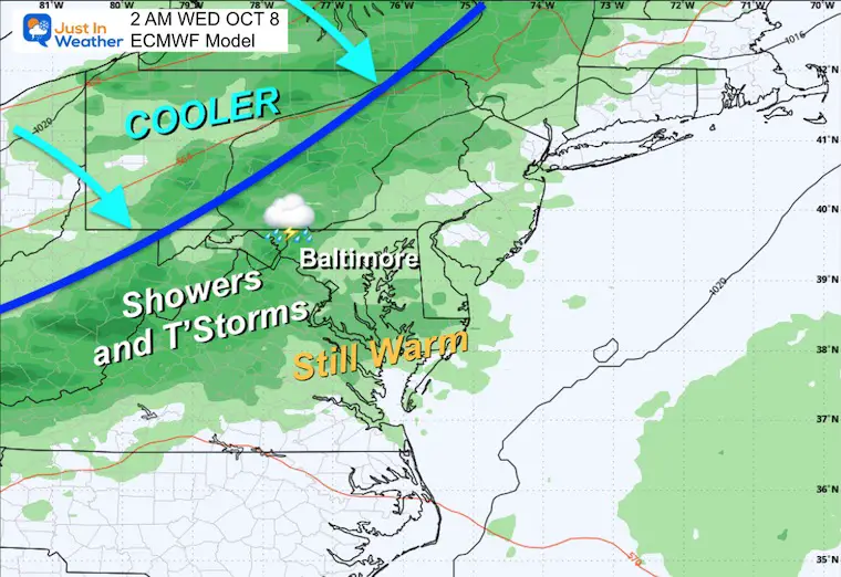
The next cold front will bring a chance for thunderstorms late Tuesday into Wednesday morning. This will be followed by the next chilly air mass.
Snapshots
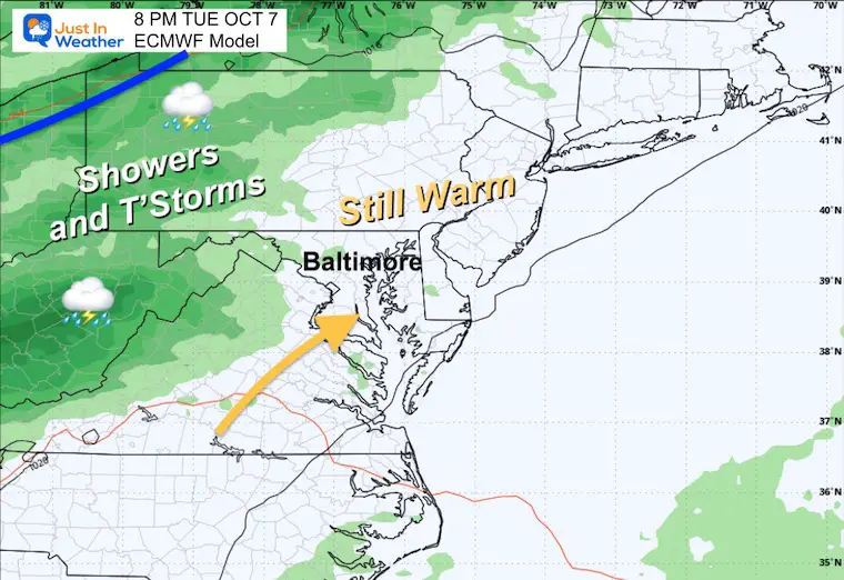
Tuesday Evening
Showers and thunderstorms approach from the Great Lakes and Ohio Valley.
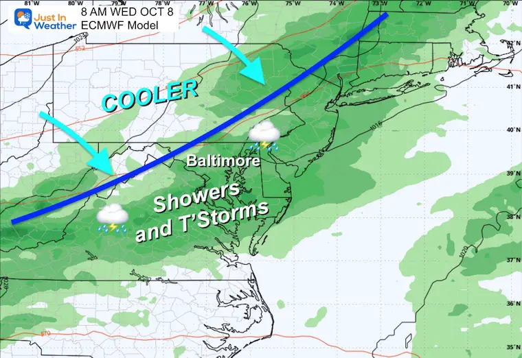
Wednesday Early Morning
Showers and leftover Thunderstorms pass through.
Wednesday Morning
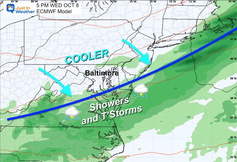
Wednesday Afternoon
High Pressure builds in with cooler winds.
Temperature Suggestion
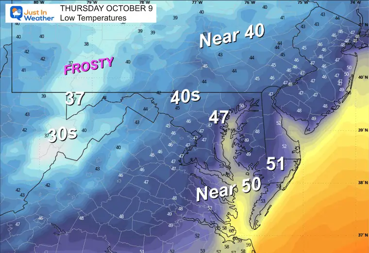
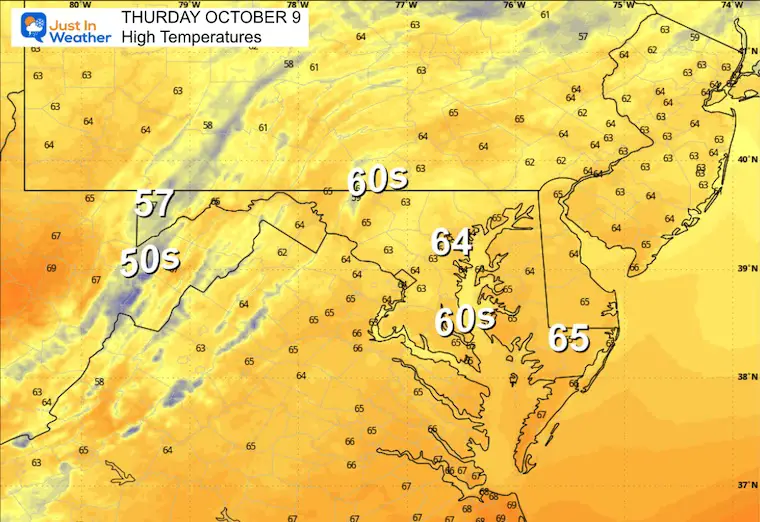
Thursday Morning
Thursday Afternoon
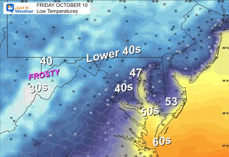
Friday Morning
Frost likely across the mountains.
7 Day Forecast
Next Chance Of Storms Late Tuesday to Wednesday
Chilly End To Next Week
Subscribe for eMail Alerts
In Case You Missed It
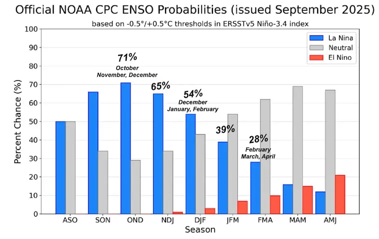
I posted a report earlier about The La Niña Watch. This is expected to be brief and trend back to neutral, which could result in an active and snowy winter.
Take A Look…
STEM Assemblies/In School Fields Trips Are Back
Click to see more and ‘Book’ a visit to your school

THANK YOU:
Baltimore Sun Magazine Readers’ Choice Best Of Baltimore

Maryland Trek 12 Day 7 Completed Sat August 9
UPDATED: We raised OVER $166,000 for Just In Power Kids – AND Still Collecting More
The annual event: Hiking and biking 329 miles in 7 days between The Summit of Wisp to Ocean City.
Each day, we honor a kid and their family’s cancer journey.
Fundraising is for Just In Power Kids: Funding Free Holistic Programs. I never have and never will take a penny. It is all for our nonprofit to operate.
Click here or the image to donate:

RESTATING MY MESSAGE ABOUT DYSLEXIA
I am aware there are some spelling and grammar typos and occasional other glitches. I take responsibility for my mistakes and even the computer glitches I may miss. I have made a few public statements over the years, but if you are new here, you may have missed it: I have dyslexia and found out during my second year at Cornell University. It didn’t stop me from getting my meteorology degree and being the first to get the AMS CBM in the Baltimore/Washington region. One of my professors told me that I had made it that far without knowing and to not let it be a crutch going forward. That was Mark Wysocki, and he was absolutely correct! I do miss my mistakes in my own proofreading. The autocorrect spell check on my computer sometimes does an injustice to make it worse. I can also make mistakes in forecasting. No one is perfect at predicting the future. All of the maps and information are accurate. The ‘wordy’ stuff can get sticky. There has been no editor who can check my work while writing and to have it ready to send out in a newsworthy timeline. Barbara Werner is a member of the web team that helps me maintain this site. She has taken it upon herself to edit typos when she is available. That could be AFTER you read this. I accept this and perhaps proves what you read is really from me… It’s part of my charm. #FITF
Please share your thoughts and best weather pics/videos, or just keep in touch via social media.


