


My First Call For Tuesday Snowfall December 2 Winter Event
Saturday, November 29, Outlook For Tuesday, December 2, 2025 We are now within the 72-hour period for the prime event for the Mid Atlantic, which is within my comfort zone…
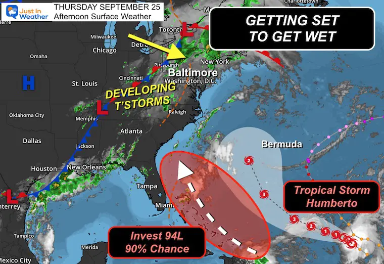
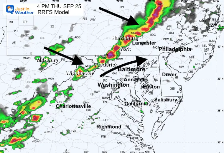
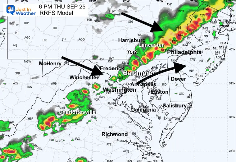
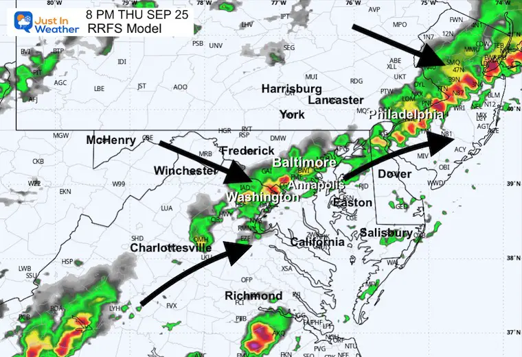
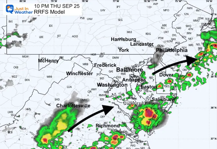
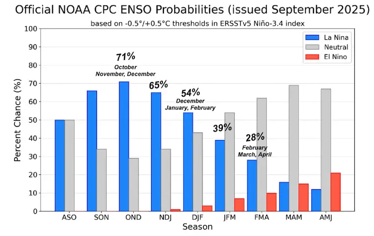
Thursday Afternoon, September 25 2025
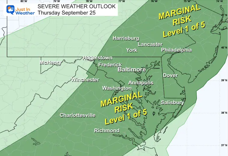
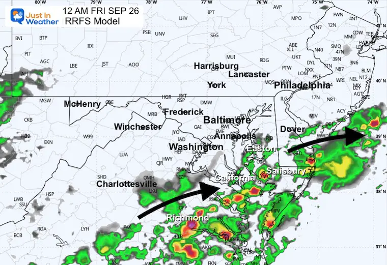
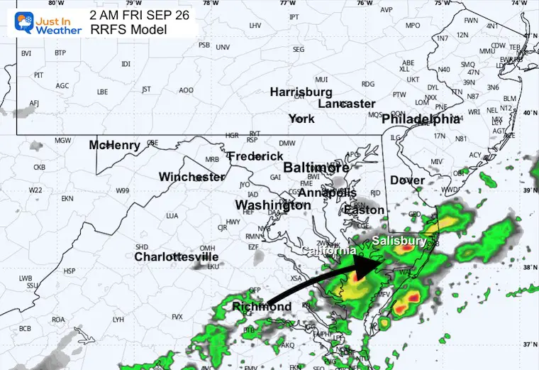
We are about to get wet and make up for the second wave drought that has been growing. A cold front will help develop a line of strong thunderstorms this afternoon, with a marginal risk that they turn severe. The prime risk may be gusty winds up to 60 mph.
This system is tracked below with my model pick for radar simulation and live radar widget.
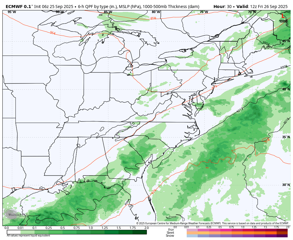
That front will stall to our south and return with steady rain later Saturday into Sunday.
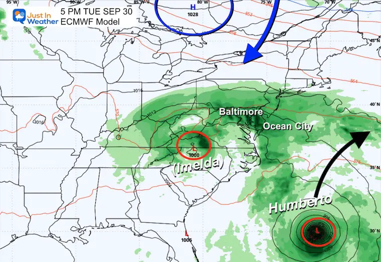
What follows depends on a new tropical storm developing off the southwest US coast. This will be affected by Tropical Storm Humberto, which is farther off the coast and expected to become a major hurricane.
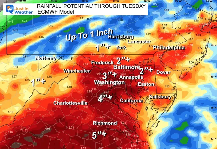
In short, there is a traffic jam developing off the Atlantic seaboard that will keep the risk of rain around for most of the next 7 days, with totals well over 2 inches in many areas.
This is from the European ECMWF Model.
IF we do get under the influence of a new Tropical Storm Imelda, then the rain impact will continue beyond this time window and add up even more.
The cold front is slowly moving into the Mid-Atlantic states.
Tropical Storm Humberto has 50 mph winds and is forecast to track WEST of Bermuda while reaching Major Hurricane Category 3 intensity.
Invest 94L has a 90% chance to develop and get named Imelda by the end of the weekend. This is the concern for heavy rain, wind, and beach erosion. It has not formed yet, which is why the forecast is uncertain.
This is a Level 1 chance for any storm cell to produce winds over 58 mph, large hail, and an isolated tornado.
This is the RRFS Experimental Model. I chose this over other products since recent events have been underrepresented by the HRRR and NAM 3Km.
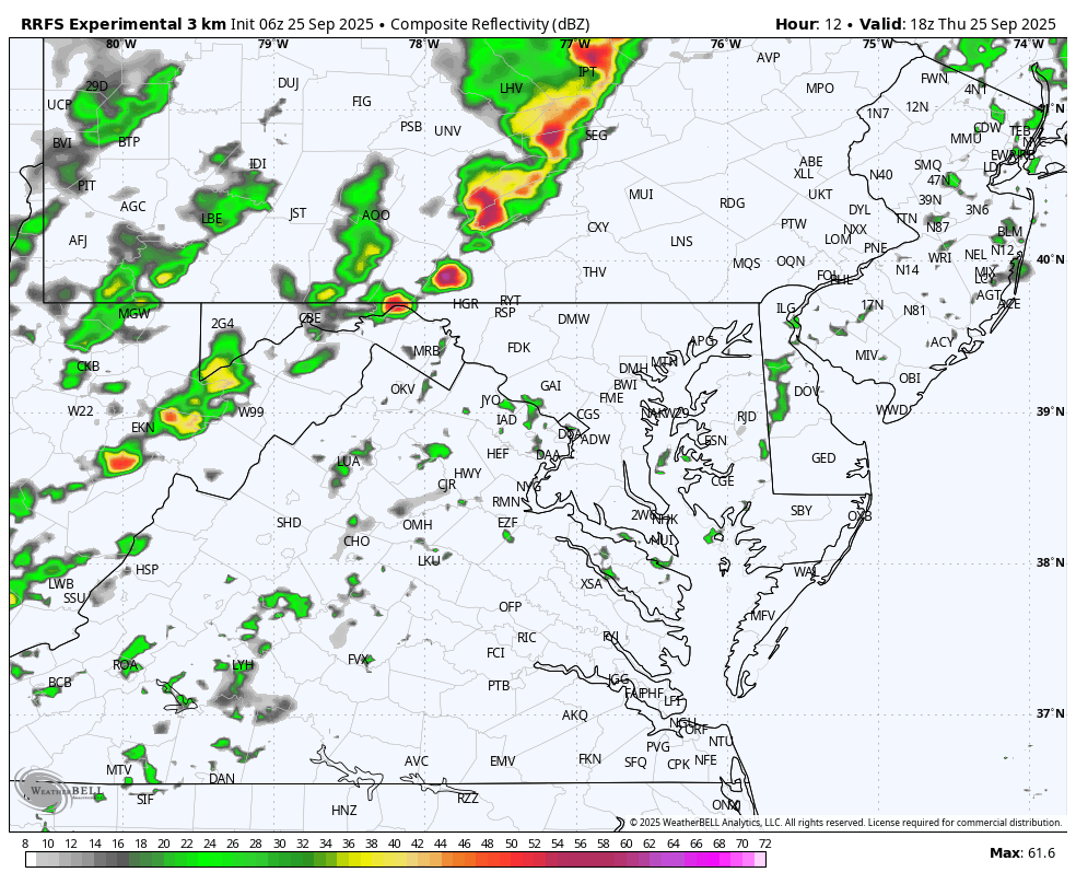
This is a guide and not a promise.
Friday should end up dry.
Saturday may start dry, then turn rainy in the afternoon and evening.
Sunday looks soggy!
Monday and Tuesday really depend on the influence of that new tropical cyclone forming.
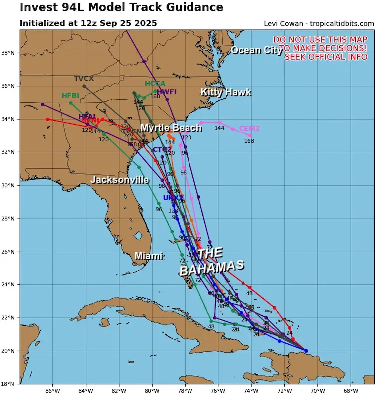
This product was first to be aggressive and push that new storm (Imelda) inland.
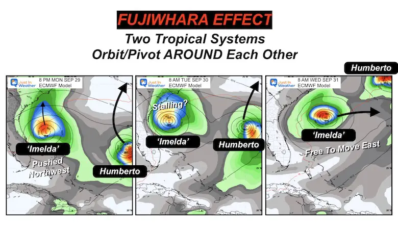
Fujiwhara Effect
This AI version is stalling the Low off the coast, allowing Humberto to pass by, then moving out to sea.
This may not include the entire rainy event.
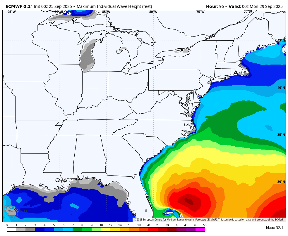
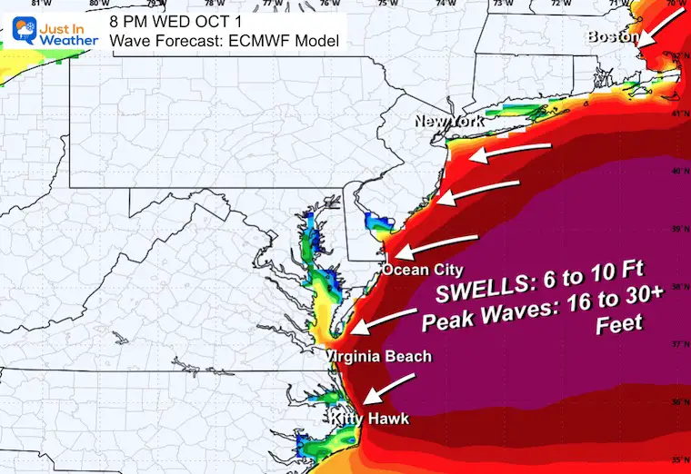
This is based on the European Model showing the highest waves off the East Coast at this time.
Take Away: There is no promise of the track, but there will be up to 5 days of high water pounding the coast with more beach erosion.
I posted a report earlier about The La Niña Watch. This is expected to be brief and trend back to neutral and may result in an active and snowy winter.
Take A Look…
Sign up and be the first to know!
Click to see more and ‘Book’ a visit to your school


The annual event: Hiking and biking 329 miles in 7 days between The Summit of Wisp to Ocean City.
Each day, we honor a kid and their family’s cancer journey.
Fundraising is for Just In Power Kids: Funding Free Holistic Programs. I never have and never will take a penny. It is all for our nonprofit to operate.
Click here or the image to donate:

I am aware there are some spelling and grammar typos and occasional other glitches. I take responsibility for my mistakes and even the computer glitches I may miss. I have made a few public statements over the years, but if you are new here, you may have missed it: I have dyslexia and found out during my second year at Cornell University. It didn’t stop me from getting my meteorology degree and being the first to get the AMS CBM in the Baltimore/Washington region. One of my professors told me that I had made it that far without knowing and to not let it be a crutch going forward. That was Mark Wysocki, and he was absolutely correct! I do miss my mistakes in my own proofreading. The autocorrect spell check on my computer sometimes does an injustice to make it worse. I can also make mistakes in forecasting. No one is perfect at predicting the future. All of the maps and information are accurate. The ‘wordy’ stuff can get sticky. There has been no editor who can check my work while writing and to have it ready to send out in a newsworthy timeline. Barbara Werner is a member of the web team that helps me maintain this site. She has taken it upon herself to edit typos when she is available. That could be AFTER you read this. I accept this and perhaps proves what you read is really from me… It’s part of my charm. #FITF