


January 2 Weather Still Cold This Weekend With A Warm Up Next Week
Friday, January 2, 2026 After the New Year's Day Morning Snow Squall, the cold air mass has been firmly in place. One more system passed through overnight with flurries and…
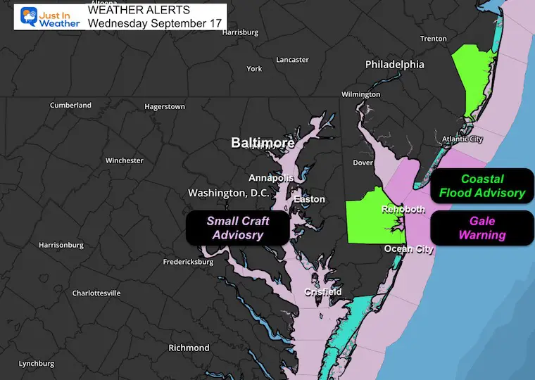
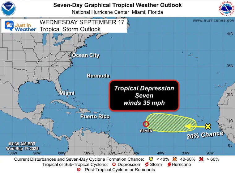
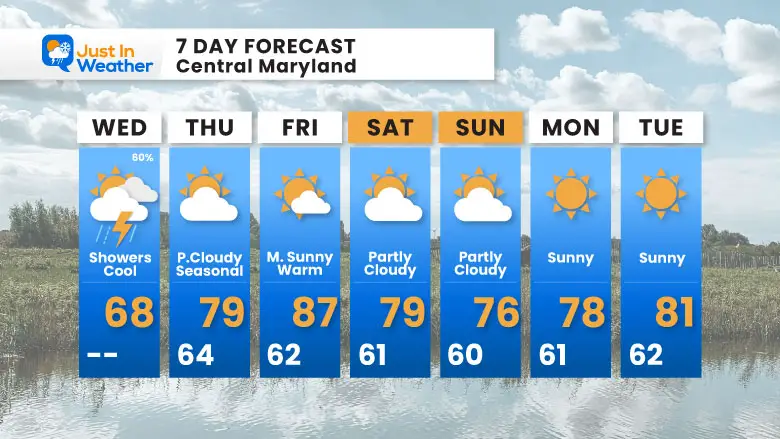
Wednesday, September 17, 2025
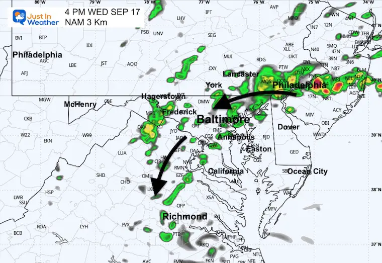
This recent storm had all the signals of being subtropical, but it never received a name. The tight wind circulation was seen on radar as it came onshore in Southeast VA yesterday. Rain totals topped over 8 inches near Virginia Beach.
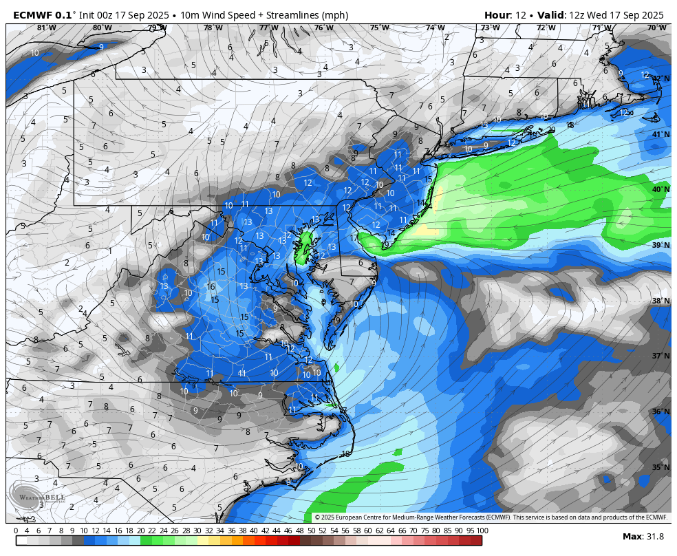
The Gale Warning pushed wind gusts to near 50 mph, and extensive beach erosion was seen across Delmarva on the north side.
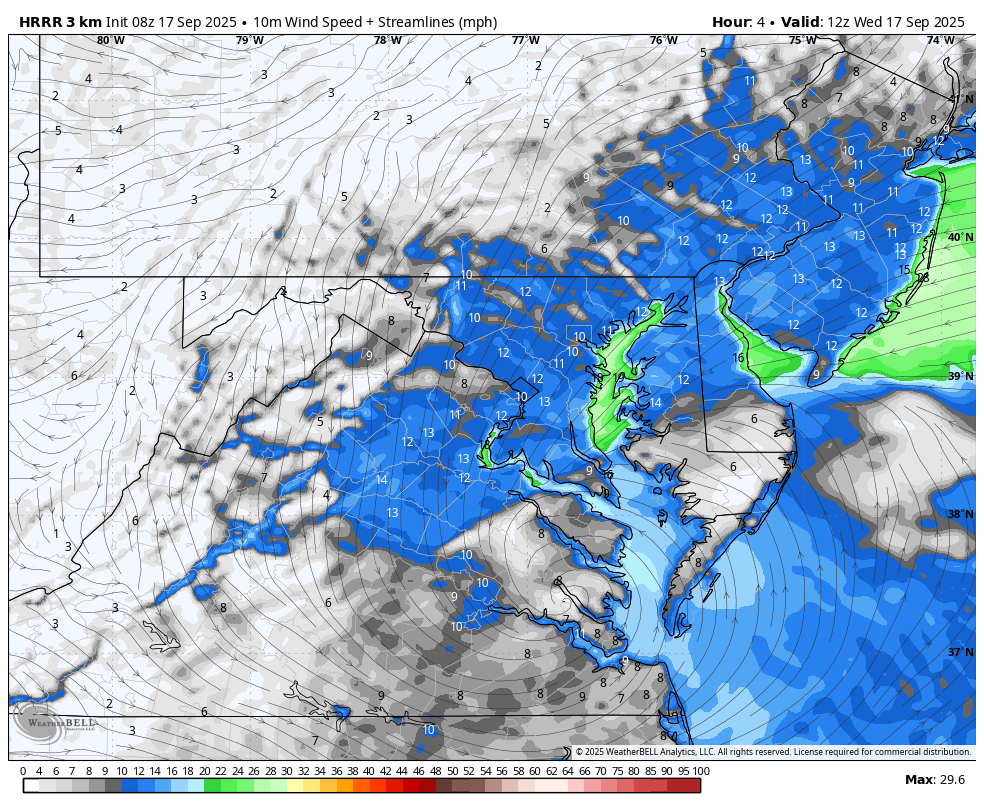
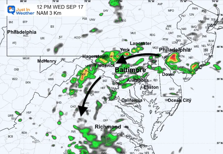
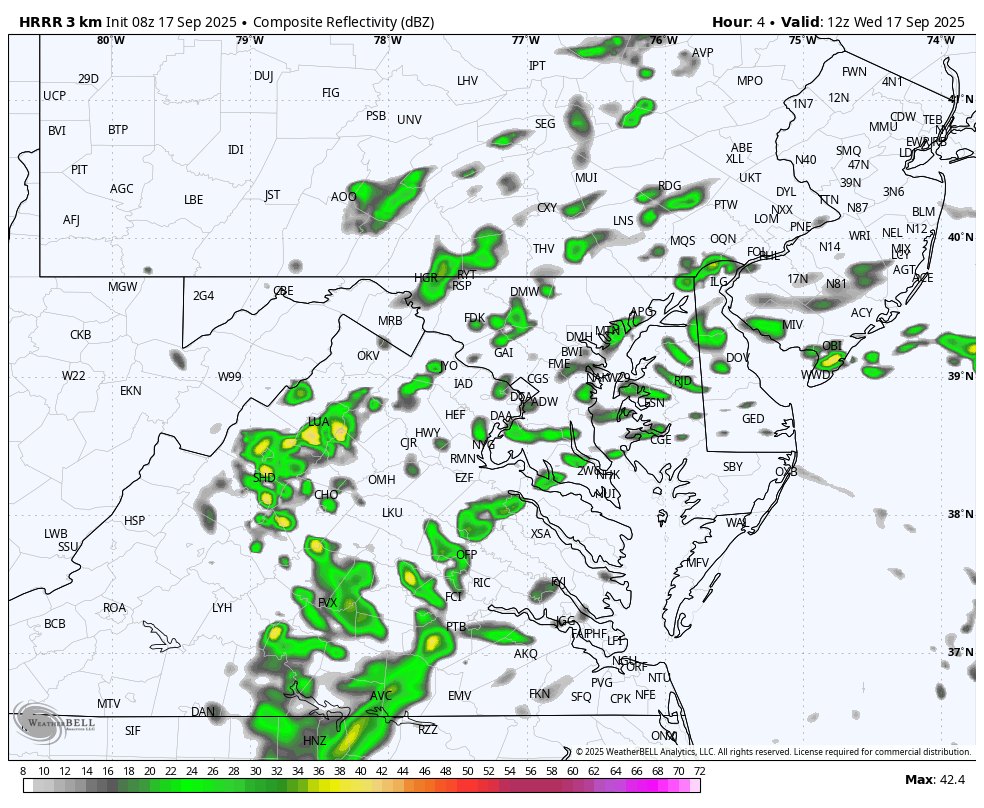
Bands of heavy rain and thunderstorms have continued overnight and will last today as well.
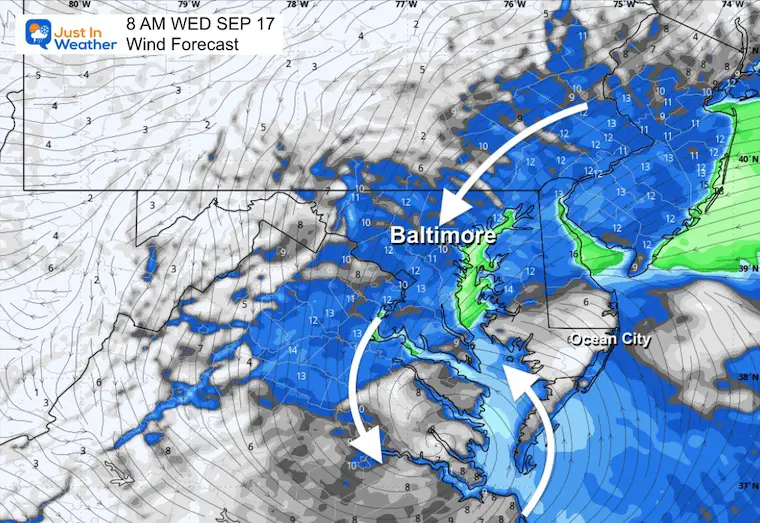
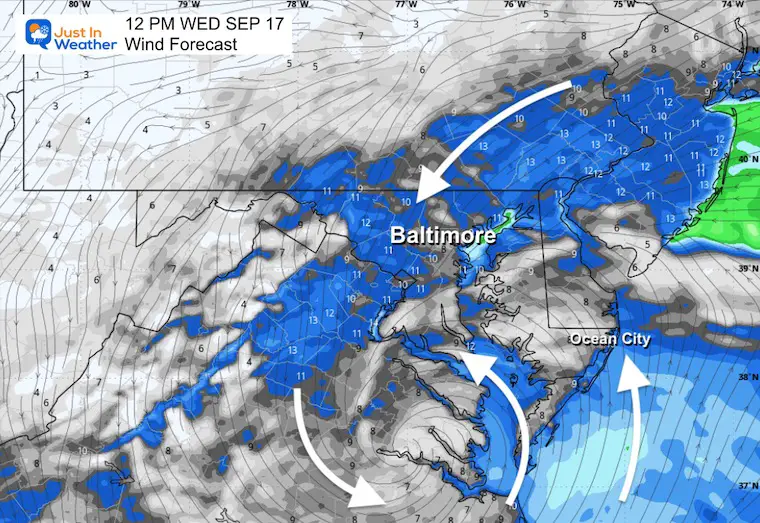
This report has the latest forecast maps along with Live Radar. Today will remain windy and cool.
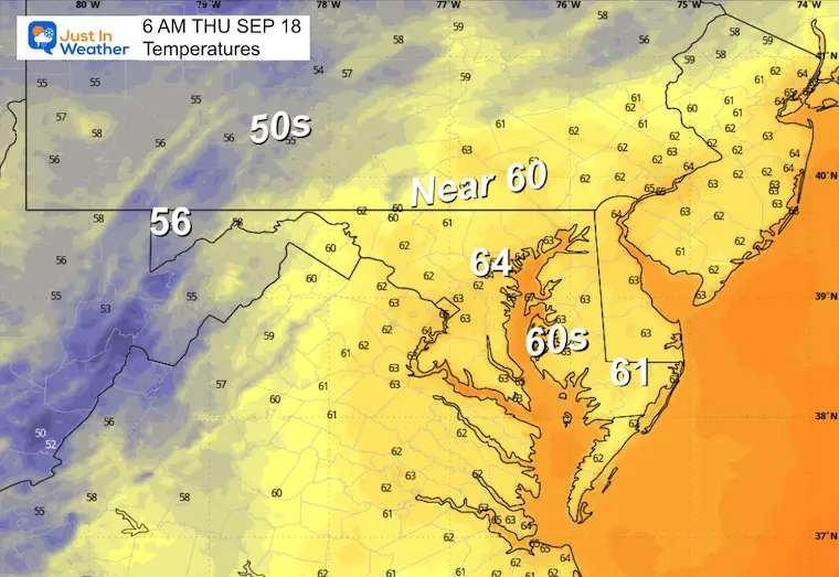
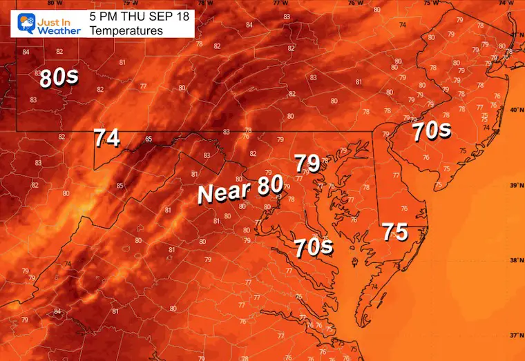
Tomorrow the sun will return, and warmer temperatures are still expected, with the long-range outlook warmer next week.
The Tropical Atlantic is getting closer to the next named storm. Tropical Depression Seven has been identified in the Eastern Atlantic.
Note: The Gale Warning remains off the Delaware Coast. Winds will be over 39 mph across the Southern Chesapeake Bay to the Virginia Tidewater region.
Small Craft Advisory: Central To Northern Chesapeake Bay and Atlantic Coast to New York.
Low Pressure was located just north of Norfolk, VA. This is the center of circulation of the storm. This brought over 8 inches of rain to Virginia Beach and continues to pump in bands of heavy rain to the north. That is what continues to push through parts of Delaware, Central Maryland, and Southern Pennsylvania.
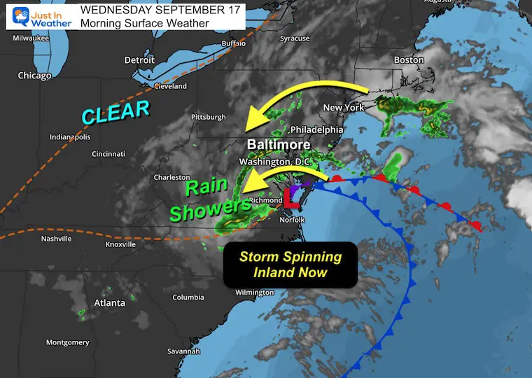
This circulation around the center of the Low will spin out inland and weaken. This will move eastward to the Atlantic and away on Thursday.
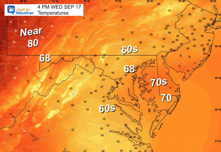
Yesterday: Low 60F; High 70F
Precipitation: 0.48”
Sunrise at 6:50 AM
Sunset at 7:11 PM
Normal Low in Baltimore: 59ºF
Record 44ºF in 1984
Normal High in Baltimore: 79ºF
Record 97ºF 1991
Rainfall Deficit at BWI
Subscribe for eMail Alerts
Sign up and be the first to know!
Maryland Trek 12 Concluded Saturday, August 9
Here is our final photo with 13 families represented alongside our team.
We have raised OVER $166,000 (and still climbing) for Just In Power Kids, with all money going to the programs.
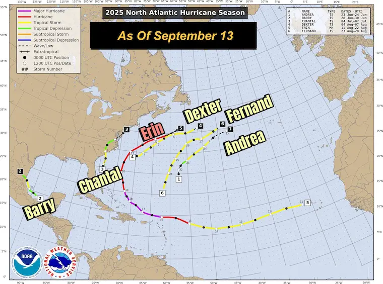
It has been 20 days since we have had NO STORMS NAMED during the peak season. The last time this happened was from August 28 to September 15 in 1939.
Tropical Depression Seven has winds of 35 mph. It is expected to be named by the weekend and become a hurricane. The only true impact may be near Bermuda.
A second system has moved off the African Coast.
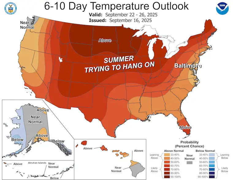
Summer-like temperatures will expand across much of the US next week.
Sign up and be the first to know!
Click to see more and ‘Book’ a visit to your school


The annual event: Hiking and biking 329 miles in 7 days between The Summit of Wisp to Ocean City.
Each day, we honor a kid and their family’s cancer journey.
Fundraising is for Just In Power Kids: Funding Free Holistic Programs. I never have and never will take a penny. It is all for our nonprofit to operate.
Click here or the image to donate:

I am aware there are some spelling and grammar typos and occasional other glitches. I take responsibility for my mistakes and even the computer glitches I may miss. I have made a few public statements over the years, but if you are new here, you may have missed it: I have dyslexia and found out during my second year at Cornell University. It didn’t stop me from getting my meteorology degree and being the first to get the AMS CBM in the Baltimore/Washington region. One of my professors told me that I had made it that far without knowing and to not let it be a crutch going forward. That was Mark Wysocki, and he was absolutely correct! I do miss my mistakes in my own proofreading. The autocorrect spell check on my computer sometimes does an injustice to make it worse. I can also make mistakes in forecasting. No one is perfect at predicting the future. All of the maps and information are accurate. The ‘wordy’ stuff can get sticky. There has been no editor who can check my work while writing and to have it ready to send out in a newsworthy timeline. Barbara Werner is a member of the web team that helps me maintain this site. She has taken it upon herself to edit typos when she is available. That could be AFTER you read this. I accept this and perhaps proves what you read is really from me… It’s part of my charm. #FITF