Tuesday, July 1, 2025
Morning Report
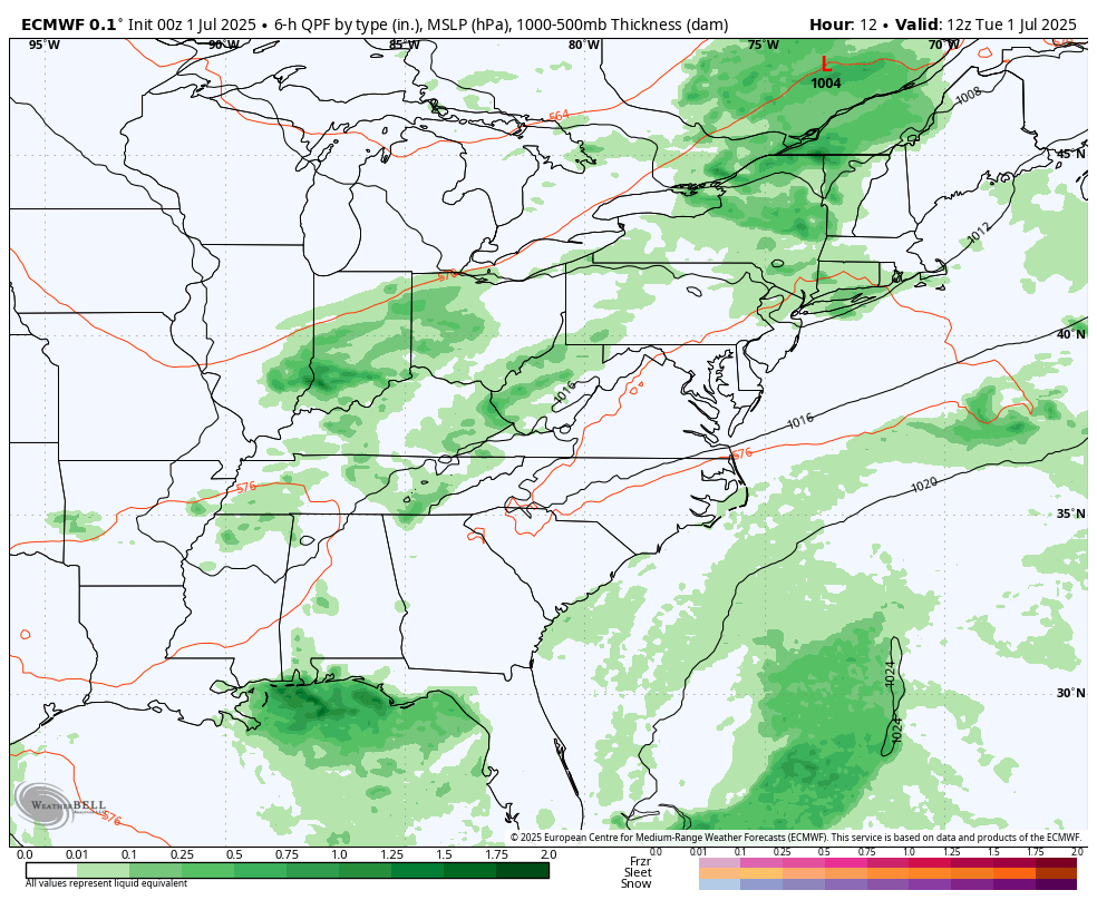
We have one more day with severe storms that will erupt this afternoon and evening. This will be more widespread than yesterday, but the storms will be moving as opposed to the nearly stalled cells that hit both Delaware beaches and Northeastern Maryland.
A new air mass will follow with sunshine and lower humidity into the holiday weekend.
Before we get to that, I want to show a brief recap of the storms yesterday.
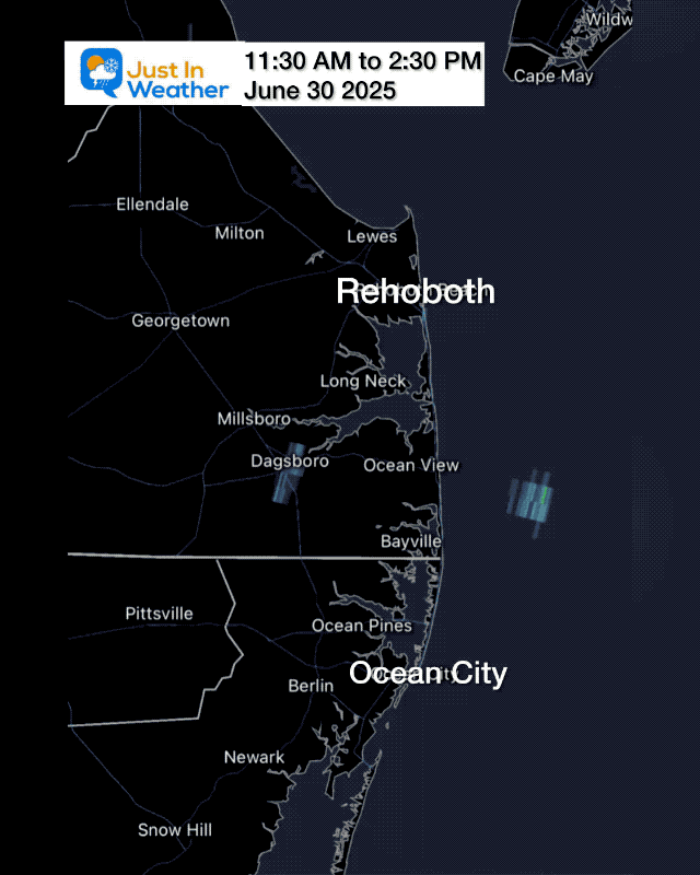
Stalled Storm By The Delaware Beaches
3-Hour Radar Loop
This developed on a sea breeze and dumped a few inches of rain. There was a possible tornado in Sussex County’s town of Franklin.
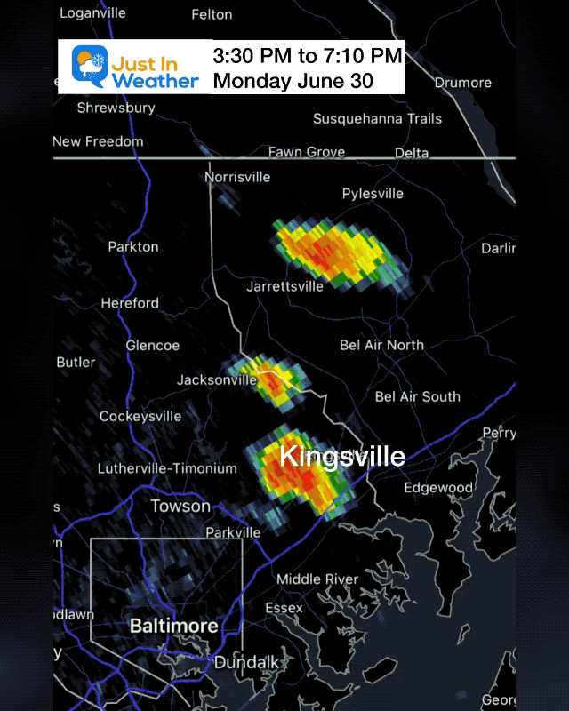
Flooding in Baltimore and Harford County
3-Hour Radar Loop
The storm over Kingsville in eastern Baltimore County nearly stalled and was followed by another line. This slowly expanded over Bel Air and eastward.
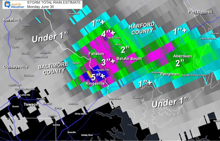
Rainfall Estimate
3 to over 5 inches of rain in the hardest hit areas north of Kingsville to Fallston and Bel Air.
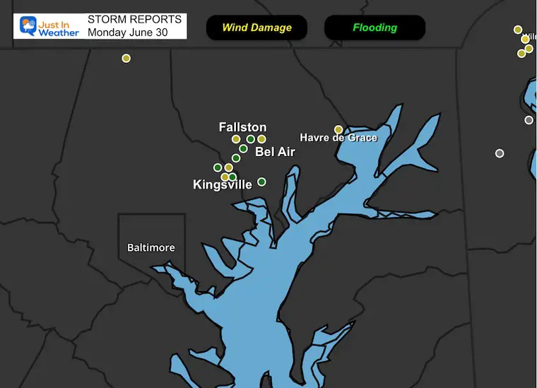
Storm Reports Monday
The focus is around Kingsville in Baltimore County and Fallston to Bel Air in Harford County.
Wind damage and local flooding.
Lightning Show
Possible Tornado?
Multiple tornado warnings were issued in this region. Here is a look at the rotation under the clouds in Abingdon.
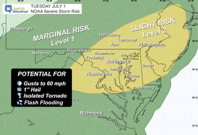
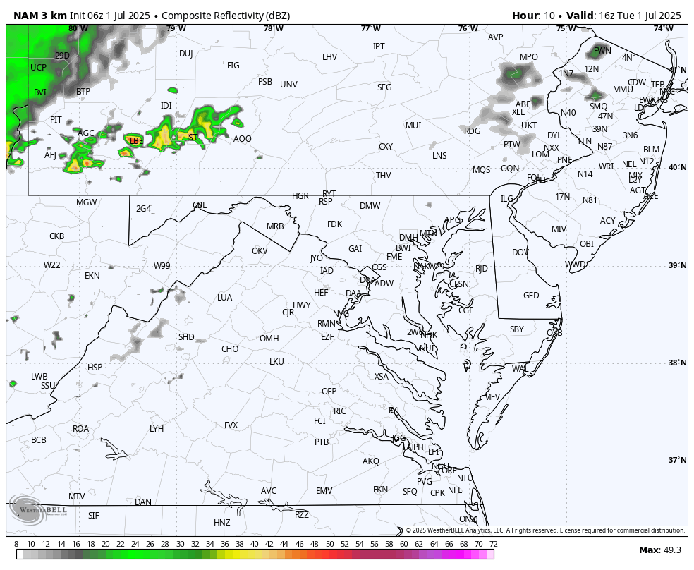
NOAA Severe Storm Risk TODAY
Any storm may contain dangerous lightning and local flash flooding.
A chance for a thundershower to grow to severe levels, which may include:
- Damaging Wind Gusts
- Large Hail
- Isolated Tornadoes
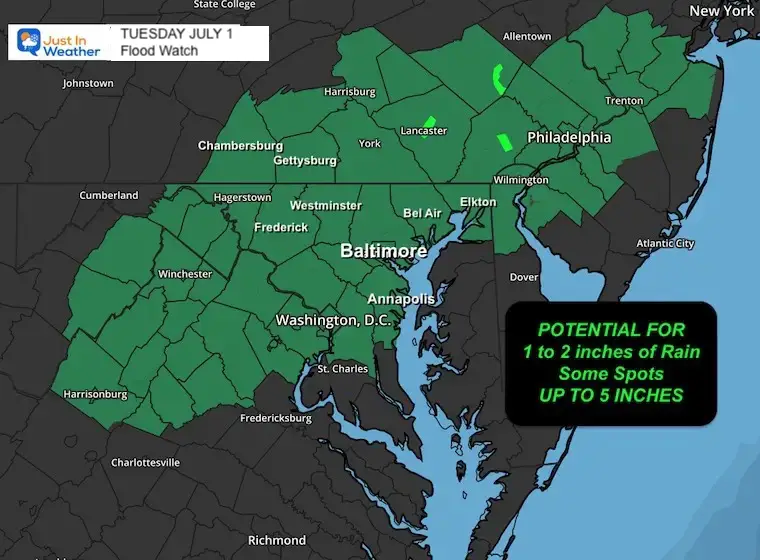
Flood Watch
- Many areas can expect 1 to 2 inches of rain.
- Once again, some spots may get up to 5 inches.
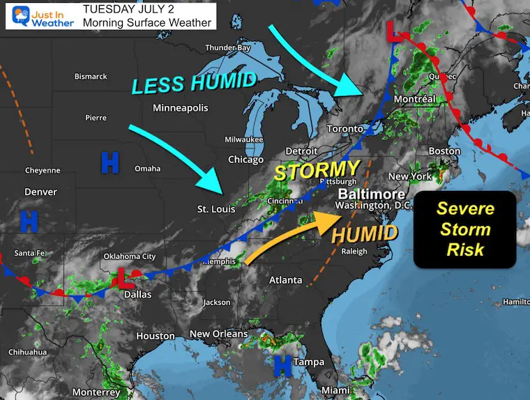
Morning Surface Weather
Very humid air is in place.
A strong cold front will arrive today with the expected line of storms.
On the other side, a new air mass with lower humidity will arrive for the holiday.
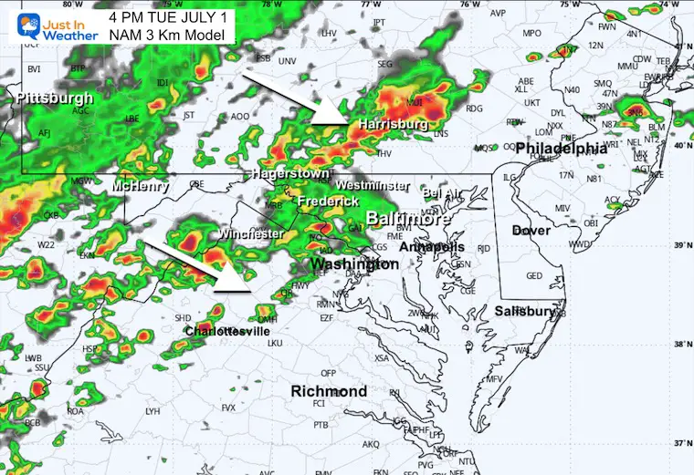
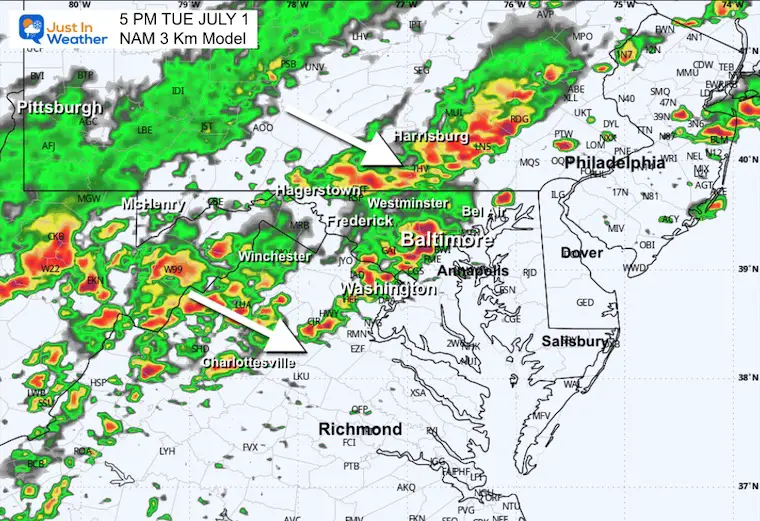
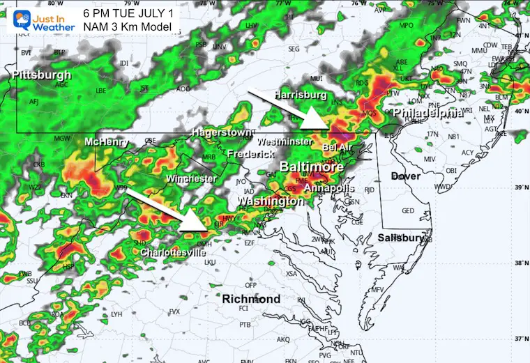
Storm Simulation: Monday to Wednesday
- Pulsing Rain in the afternoon and evening
- Peak Heavy Rain Tuesday Evening
- Wednesday: Dry And Less Humid
Live Radar and Lightning Widget
Radar Simulation: Noon to Midnight
Suggestions NOT a Promise. Use this as a general idea for timing, and that there will be a very strong line of storms.
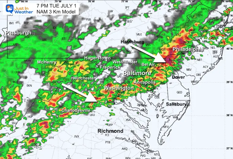
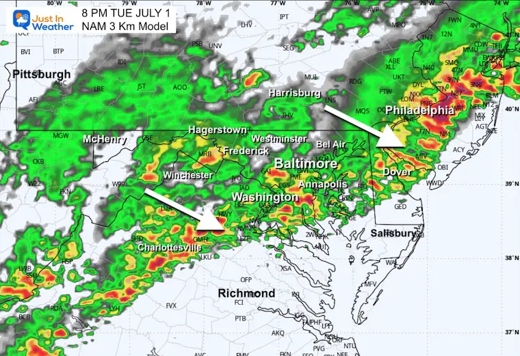
Snapshots
4 PM
5 PM
6 PM
7 PM
8 PM
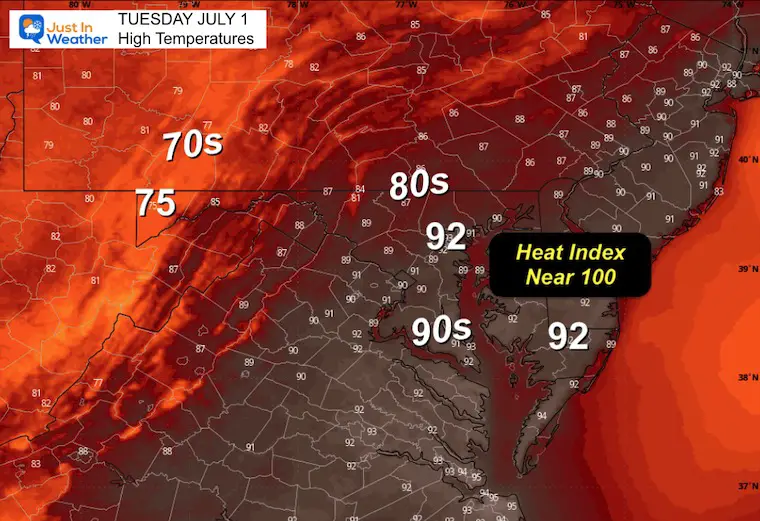
Afternoon High Temperatures
Subscribe for eMail Alerts
CLIMATE DATA: Baltimore
TODAY July 1
Sunrise at 5:44 AM
Sunset at 8:37 PM
Normal Low in Baltimore: 67ºF
Record 50ºF in 1988
Normal High in Baltimore: 88ºF
Record 103ºF 1901
Rainfall Deficit at BWI
- Ending 2024 = -8.00”
- Since Jan 1 = -2.13”
- We are STILL DOWN -10.13” INCLUDING LAST YEAR
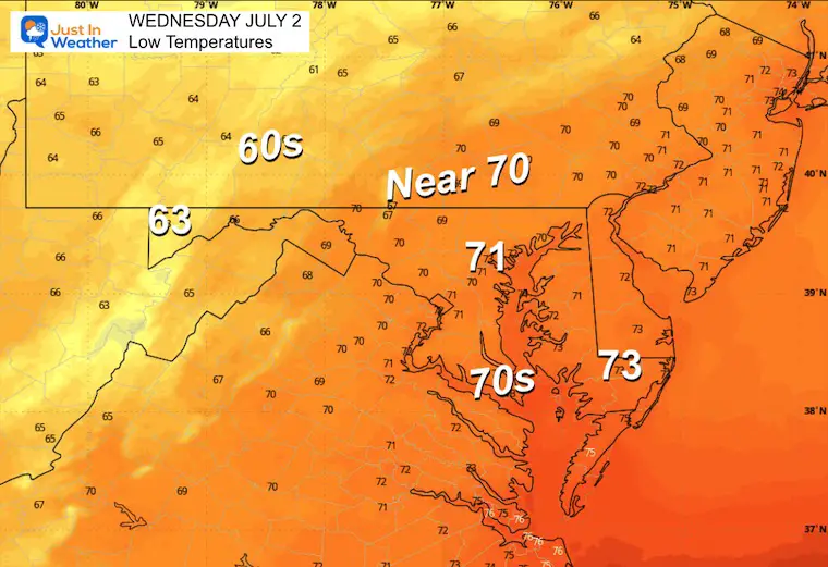
WEDNESDAY
Morning Low Temperatures
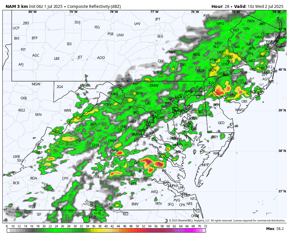
Morning Radar Snapshot
Rain to start the day…
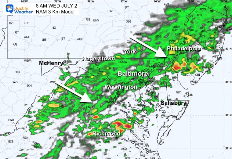
Radar Simulation: 6 AM to 8 PM
Rain will be drifting south with the front.
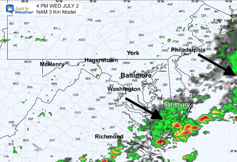
Afternoon Radar Snapshot
Rain will linger in southern Maryland as the north will clear.
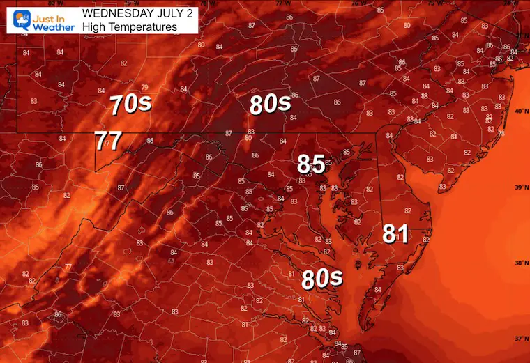
Afternoon High Temperatures
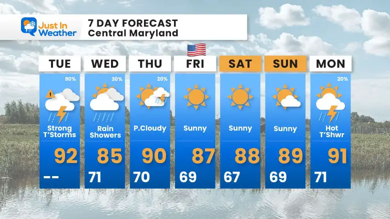
7 Day Forecast
- Today: Strong Storms and Possible Flooding
- Wednesday to July 4th Weekend: Sunny, Hot, and Less Humid
Subscribe for eMail Alerts
Please share your thoughts and best weather pics/videos, or just keep in touch via social media.
THANK YOU:
Baltimore Sun Magazine Readers Choice Best Of Baltimore
Maryland Trek 11 Day 7 Completed Sat August 10
We raised OVER $111,000 for Just In Power Kids – AND Still Collecting More
The annual event: Hiking and biking 329 miles in 7 days between The Summit of Wisp to Ocean City.
Each day, we honor a kid and their family’s cancer journey.
Fundraising is for Just In Power Kids: Funding Free Holistic Programs. I never have and never will take a penny. It is all for our nonprofit to operate.
Click here or the image to donate:

RESTATING MY MESSAGE ABOUT DYSLEXIA
I am aware there are some spelling and grammar typos and occasional other glitches. I take responsibility for my mistakes and even the computer glitches I may miss. I have made a few public statements over the years, but if you are new here, you may have missed it: I have dyslexia and found out during my second year at Cornell University. It didn’t stop me from getting my meteorology degree and being the first to get the AMS CBM in the Baltimore/Washington region. One of my professors told me that I had made it that far without knowing and to not let it be a crutch going forward. That was Mark Wysocki, and he was absolutely correct! I do miss my mistakes in my own proofreading. The autocorrect spell check on my computer sometimes does an injustice to make it worse. I also can make mistakes in forecasting. No one is perfect at predicting the future. All of the maps and information are accurate. The ‘wordy’ stuff can get sticky. There has been no editor who can check my work while writing and to have it ready to send out in a newsworthy timeline. Barbara Werner is a member of the web team that helps me maintain this site. She has taken it upon herself to edit typos when she is available. That could be AFTER you read this. I accept this and perhaps proves what you read is really from me… It’s part of my charm. #FITF


