Tuesday Night Update
June 24, 2025
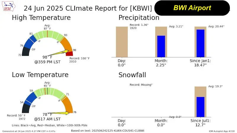
This recent heat wave may have produced some 100-degree temps, but the official number for Baltimore at BWI was 99℉ not reaching the record 100℉ set in 2010. If BWI stays above 76℉ by midnight, we will have the record warmest Low temperature for the date.
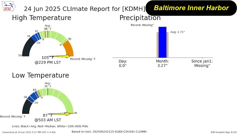
If you heard about a higher number, that was at The Inner Harbor Weather Station, which does not comply with NOAA standards and is thus not official. I do not usually mention it because I do not deem it accurate, but it did highlight the urban heat island:
- Low Temp = 87℉
- High Temp = 105℉
Wednesday Will Be A LITTLE Better
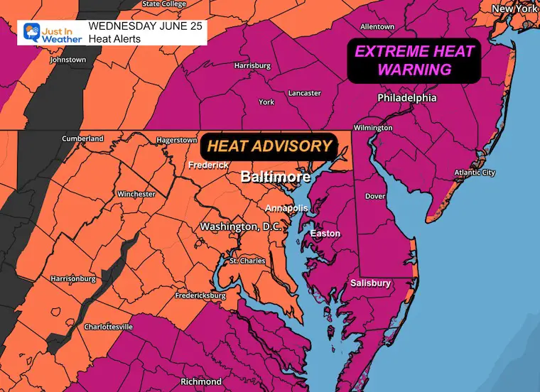
Heat Alerts:
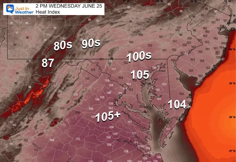
The Heat Advisory is a downgrade, with heat index values expected to stay below 105℉. This includes Central Maryland and Central Virginia.
A Heat Warning is posted for areas where it may reach 110℉: This includes Delmarva, Southern Pennsylvania, and metro Philadelphia.
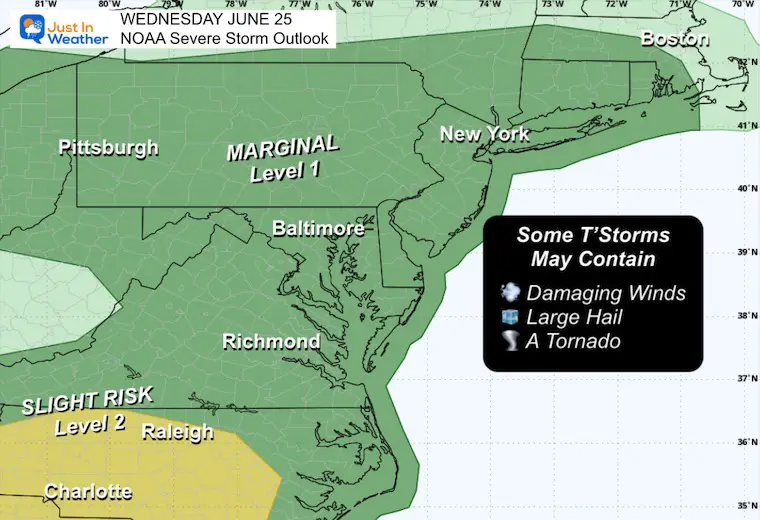
NOAA Severe Storm Risk
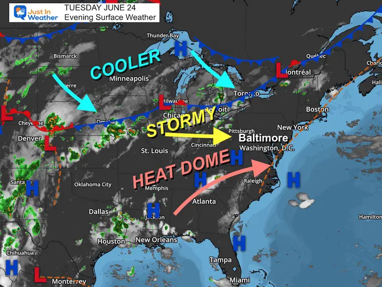
A line of thunderstorms will try to form ahead of a cold front… which will eventually cross the region and end the heat wave. The energy is limited, but the high heat and humidity can still ignite a few very strong storms capable of damaging wind, large hail, and an isolated tornado.
Tuesday Evening Surface Weather
This is where the cold front is located….
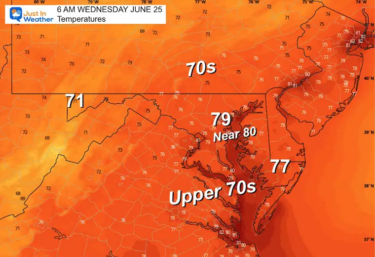
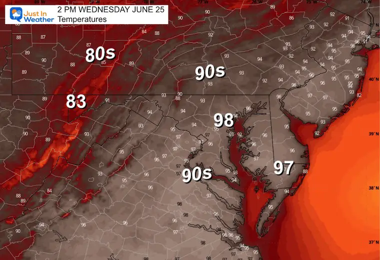
Wednesday Expectations
Morning Temperatures
Once again, the city may be in the 80s, while most of the suburban areas will be in the mid to upper 70s.
Afternoon Temperatures
Afternoon Heat Index
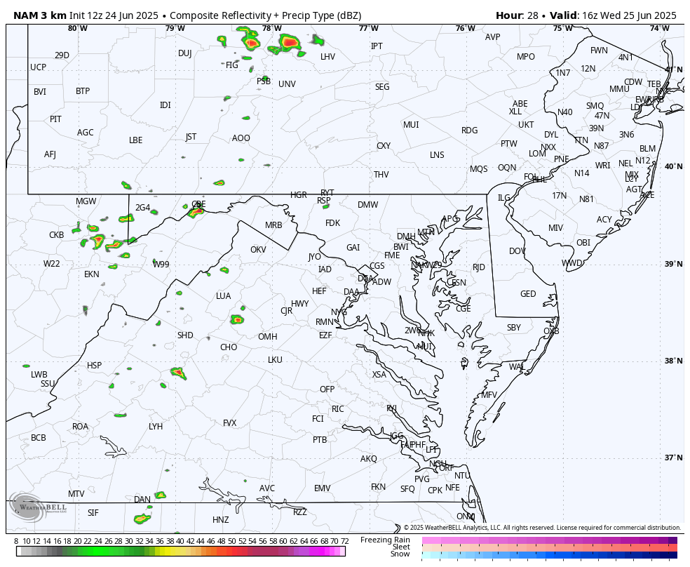
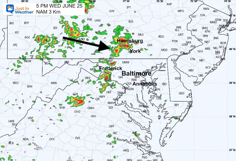
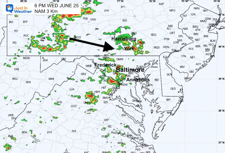
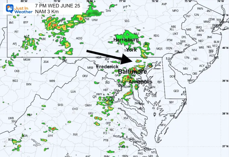
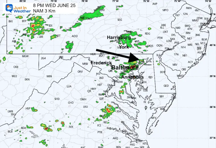
Radar Simulation Noon to 10 PM
We will watch the start of storms shortly after noon, then the typical time window between 3 PM and 8 PM.
Snapshots
5 PM
6 PM
7 PM
8 PM
Looking Ahead:
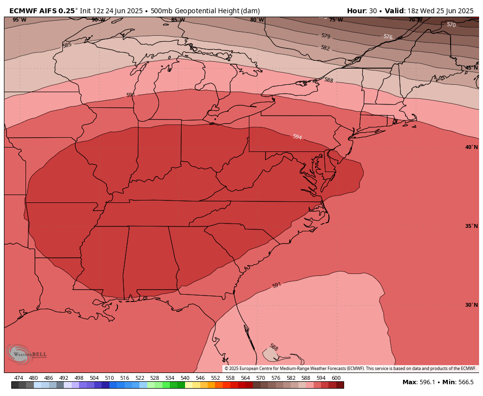
Breaking The Heat Dome
Jet Stream: 500mb Geopotential Heights
Wednesday to Sunday
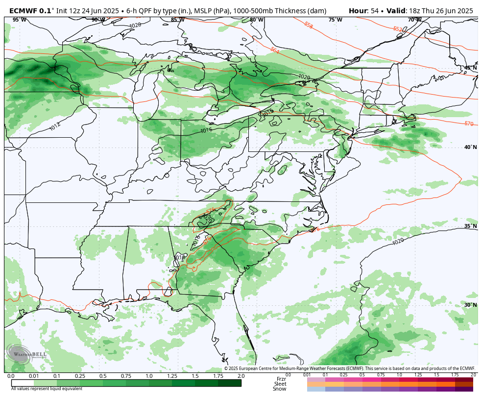
Storm Forecast:
Wednesday to Sunday
The expectation is for a daily cycle of afternoon and evening thunderstorms that will pulse up, then settle down after dark…only to return the next day.
Set the forecast on repeat for the rest of the week.
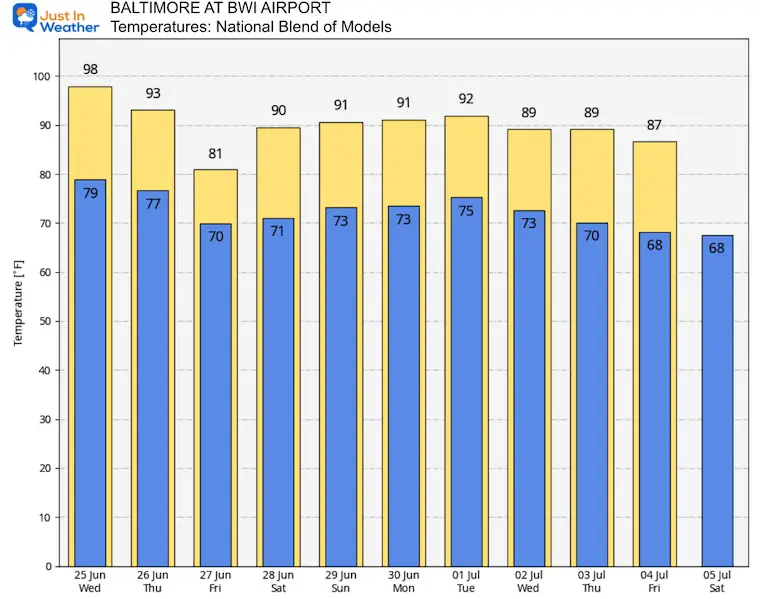
Temperature Outlook: National Blend of Models
Subscribe for eMail Alerts
Please share your thoughts and best weather pics/videos, or just keep in touch via social media.
THANK YOU:
Baltimore Sun Magazine Readers Choice Best Of Baltimore
Maryland Trek 11 Day 7 Completed Sat August 10
We raised OVER $111,000 for Just In Power Kids – AND Still Collecting More
The annual event: Hiking and biking 329 miles in 7 days between The Summit of Wisp to Ocean City.
Each day, we honor a kid and their family’s cancer journey.
Fundraising is for Just In Power Kids: Funding Free Holistic Programs. I never have and never will take a penny. It is all for our nonprofit to operate.
Click here or the image to donate:

RESTATING MY MESSAGE ABOUT DYSLEXIA
I am aware there are some spelling and grammar typos and occasional other glitches. I take responsibility for my mistakes and even the computer glitches I may miss. I have made a few public statements over the years, but if you are new here, you may have missed it: I have dyslexia and found out during my second year at Cornell University. It didn’t stop me from getting my meteorology degree and being the first to get the AMS CBM in the Baltimore/Washington region. One of my professors told me that I had made it that far without knowing and to not let it be a crutch going forward. That was Mark Wysocki, and he was absolutely correct! I do miss my mistakes in my own proofreading. The autocorrect spell check on my computer sometimes does an injustice to make it worse. I also can make mistakes in forecasting. No one is perfect at predicting the future. All of the maps and information are accurate. The ‘wordy’ stuff can get sticky. There has been no editor who can check my work while writing and to have it ready to send out in a newsworthy timeline. Barbara Werner is a member of the web team that helps me maintain this site. She has taken it upon herself to edit typos when she is available. That could be AFTER you read this. I accept this and perhaps proves what you read is really from me… It’s part of my charm. #FITF


