Thursday, June 19, Afternoon Update
We have had another Flood Watch issued this afternoon ahead of expected severe storms. Like yesterday, there may be an additional Severe Thunderstorm Watch issued as the risk level is higher than yesterday.
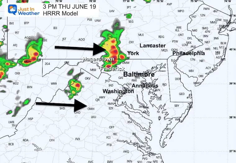
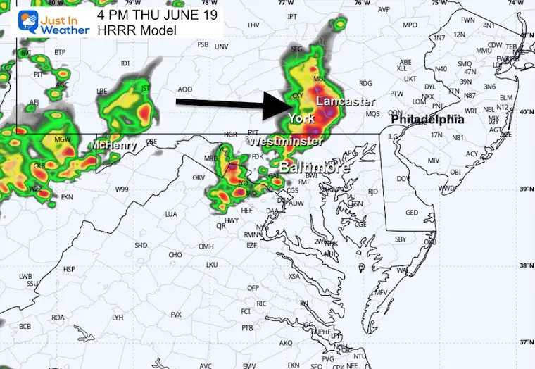
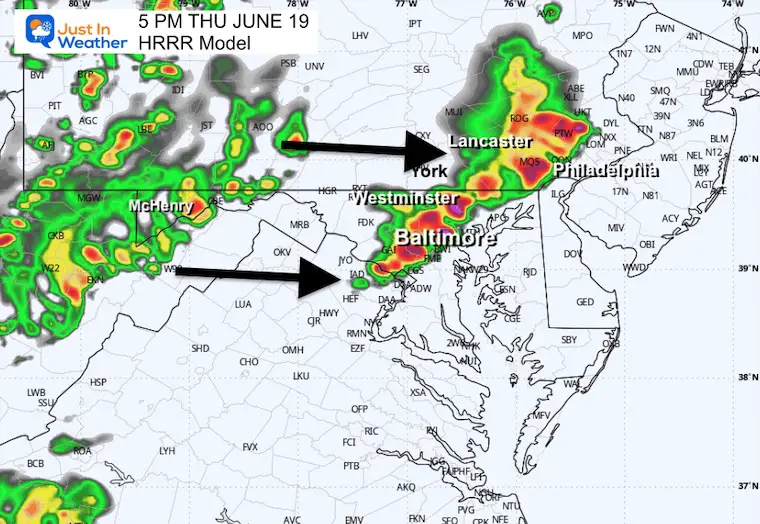
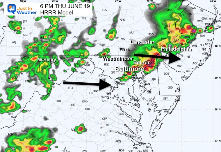
Storms will flare up between 3 PM and 7 PM. Some areas may experience multiple cells over that time window. Consider that yesterday, we did get the action starting up about 1 hour earlier than the simulations. So, please keep a wider timeline in mind for your plans.
This report will include the live radar and lightning widget to compare to the forecast simulation.
Additional Alerts To Consider:
- A WATCH will be issued when there is a greater POTENTIAL for severe storms. This will list counties and cover a 4 to 6-hour time window.
- A WARNING will be issued when A STORM FORMS AND IS BEING TRACKED! This will list towns in the path and usually is a 45-minute window.
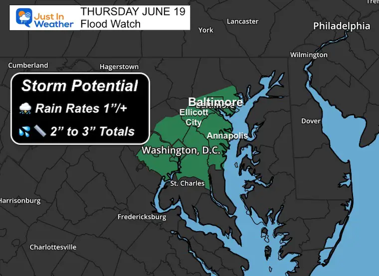
Flooding Potential
This is confined to the region where water levels are high from yesterday’s rainfall. Like the previous storms, rainfall rates may exceed 1”/Hour, and totals up to 3 inches are possible.
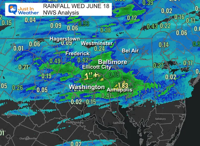
Rainfall Observed Yesterday
Heaviest rainfall was across Central Maryland, including metro Washington, Howard, and Anne Arundel Counties.
Flood Watch This Afternoon
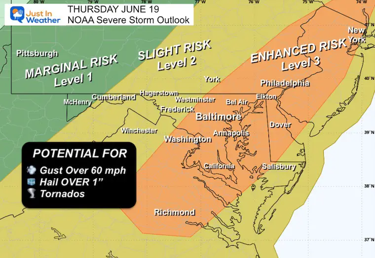
NOAA Severe Storm Outlook Today
The Level 3 Enhanced Risk includes metro Baltimore, Washington, and even Philadelphia.
Potential for storms to produce:
- Winds Gusts Over 60 mph
- Hail Over 1” in diameter
- A Few Tornadoes
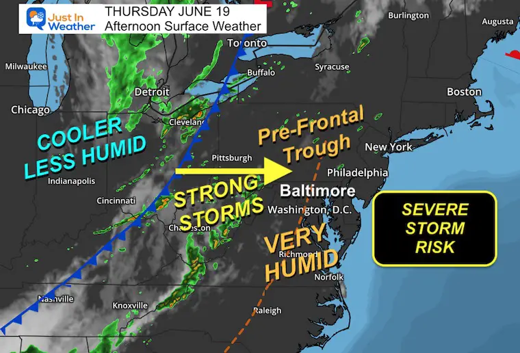
Afternoon Surface Weather
A cold front is the main energy maker. The pre-frontal trough highlighting the high humidity is the added influence that will help storms to grow once they form and reach near the big cities.
Sneak Peak
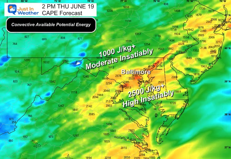
2 PM CAPE: Convective Available Potential Energy
This measures the chance for storms to turn severe.
- 1000 J/kg or higher = Moderate Instability
- 25000 J/kg or higher = High Instability
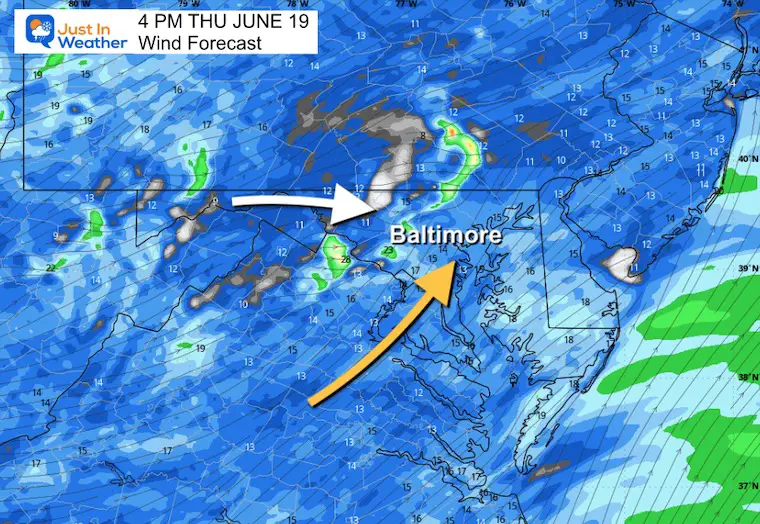
4 PM Wind Forecast
We have a Southwest flow, which is not ideal for severe weather. We usually peak with an easterly component to enhance storms. But we can get severe weather in this setup.
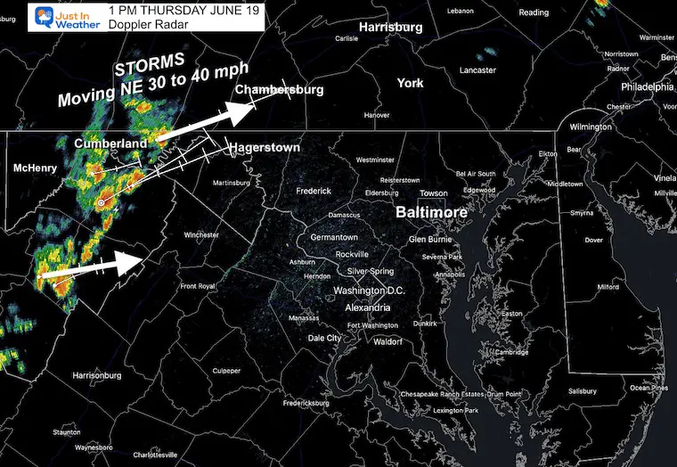
Doppler Radar Snapshot at 1 PM
The storm line was moving cells 30 to 40 mph to the Northeast, 30 to 60 minutes ahead of the model forecast simulation. Consider that with the timeline below.
Live Radar and Lightning Widget
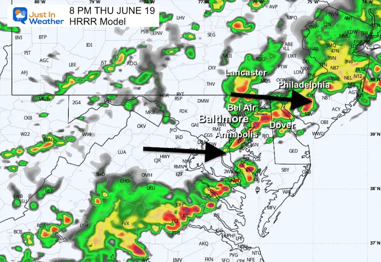
Radar Simulation 2 PM to 10 PM
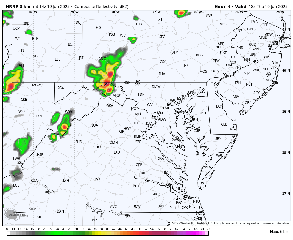
Snapshots
These are SUGGESTIONS and NOT Perfect. It is a guide for development.
Yesterday, this product was off by about 1 hour, with the actual storm line arriving earlier.
3 PM
4 PM
5 PM
6 PM
7 PM
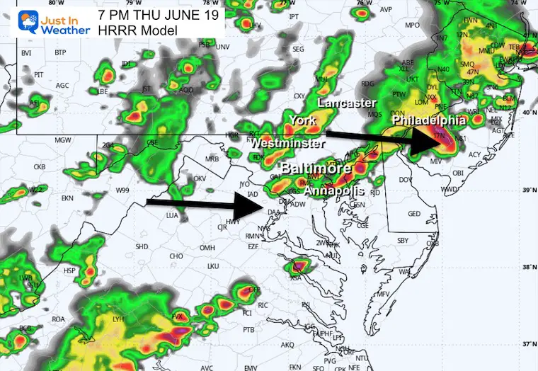
8 PM
Friday
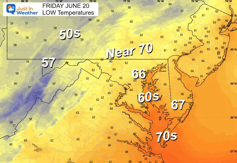
Morning Low Temperatures
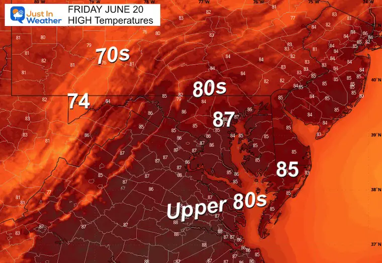
Afternoon High Temperatures
LOOKING AHEAD
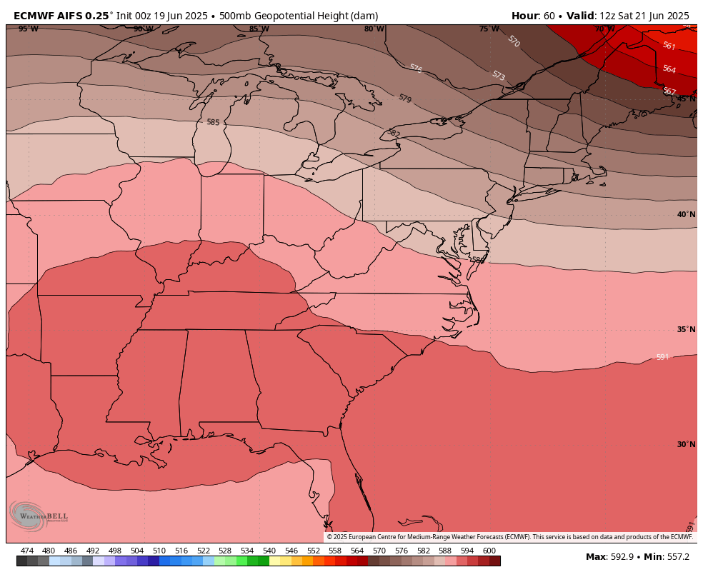
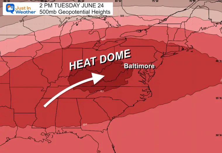
Jet Stream: 500mb Geopotential Heights
Saturday through Wednesday
Tuesday Snapshot: Heat Dome
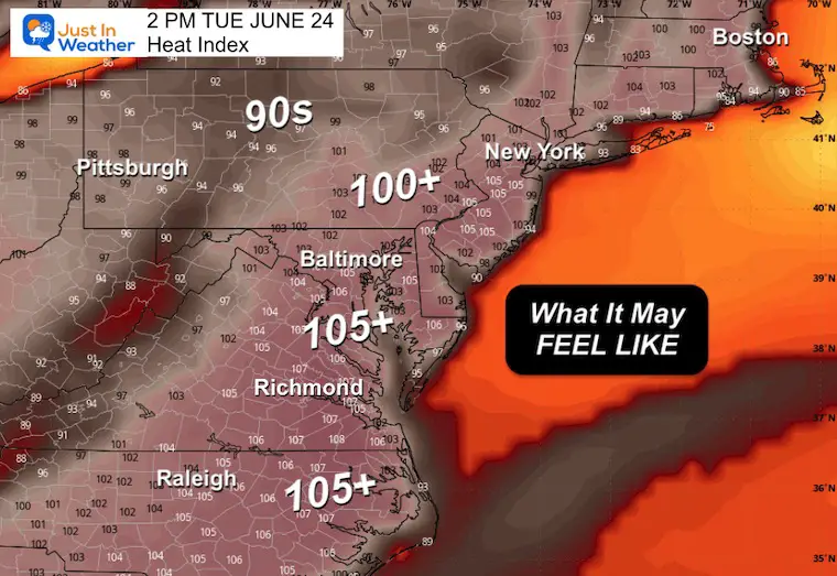
Forecast Afternoon Heat Index
Monday

Tuesday
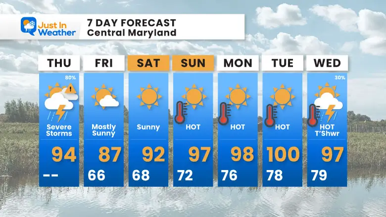
7 Day Forecast
- Severe Storm Risk Today
- Weekend: Hot and Dry
- Next Week: Dangerous Heat
Subscribe for eMail Alerts
Please share your thoughts and best weather pics/videos, or just keep in touch via social media.
THANK YOU:
Baltimore Sun Magazine Readers Choice Best Of Baltimore
Maryland Trek 11 Day 7 Completed Sat August 10
We raised OVER $111,000 for Just In Power Kids – AND Still Collecting More
The annual event: Hiking and biking 329 miles in 7 days between The Summit of Wisp to Ocean City.
Each day, we honor a kid and their family’s cancer journey.
Fundraising is for Just In Power Kids: Funding Free Holistic Programs. I never have and never will take a penny. It is all for our nonprofit to operate.
Click here or the image to donate:

RESTATING MY MESSAGE ABOUT DYSLEXIA
I am aware there are some spelling and grammar typos and occasional other glitches. I take responsibility for my mistakes and even the computer glitches I may miss. I have made a few public statements over the years, but if you are new here, you may have missed it: I have dyslexia and found out during my second year at Cornell University. It didn’t stop me from getting my meteorology degree and being the first to get the AMS CBM in the Baltimore/Washington region. One of my professors told me that I had made it that far without knowing and to not let it be a crutch going forward. That was Mark Wysocki, and he was absolutely correct! I do miss my mistakes in my own proofreading. The autocorrect spell check on my computer sometimes does an injustice to make it worse. I also can make mistakes in forecasting. No one is perfect at predicting the future. All of the maps and information are accurate. The ‘wordy’ stuff can get sticky. There has been no editor who can check my work while writing and to have it ready to send out in a newsworthy timeline. Barbara Werner is a member of the web team that helps me maintain this site. She has taken it upon herself to edit typos when she is available. That could be AFTER you read this. I accept this and perhaps proves what you read is really from me… It’s part of my charm. #FITF
Maryland Trek 12 August 3 to 9
This is an annual event: Hiking and biking 329 miles in 7 days between the Summit of Wisp to Ocean City.
Here are the kids we will honor each day as we cross Maryland.
Our full week team is set. We have our Day 4 all-bike ride open for registration.