Monday, June 2, 2025
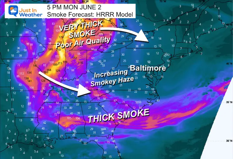
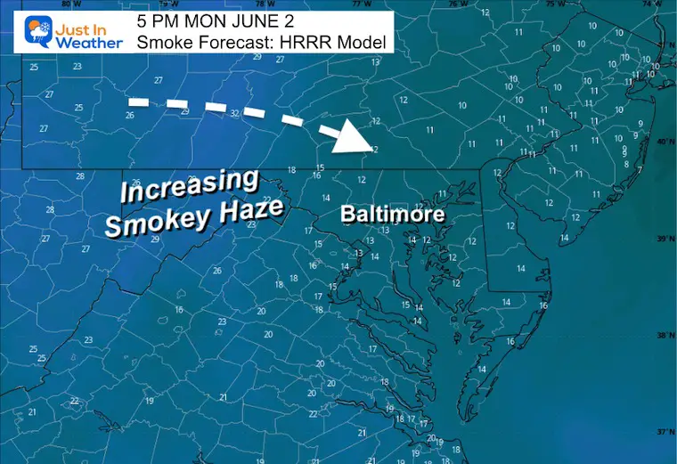
The main story has been this latest round of smoky haze high in the atmosphere from numerous Canadian wildfires. This is what caused the haze in the sky on Sunday. While it has improved, there will be some haze today, and unfortunately, there is a lot more that might be on the way over the next two days. It may play a role in our forecast temperatures with a dimming of the sun.
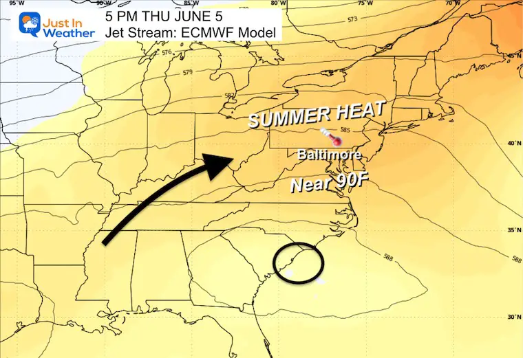
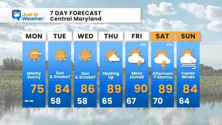
Summer heat will finally arrive, and make a run for 90°F later this week. It will grow more humid, but our chance for thunderstorms seems to be highest later on Saturday.
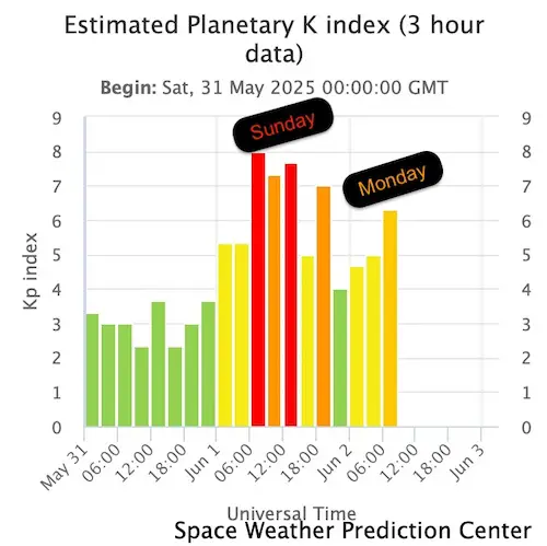
Aurora Update
You didn’t miss much. The activity did build, but it was close to daybreak, so the flare-up did not materialize for us, although a few did capture a hint of color. This was NOT the show expected.
It arrived earlier than expected on Sunday morning, and forecasting these events remains very challenging.
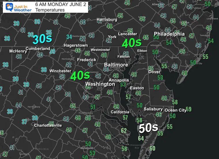
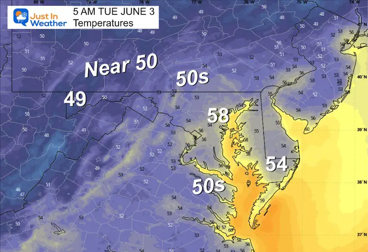
Morning Temperatures
This is unseasonably chilly. These Low Temperatures are running 10 to 15 degrees BELOW AVERAGE:
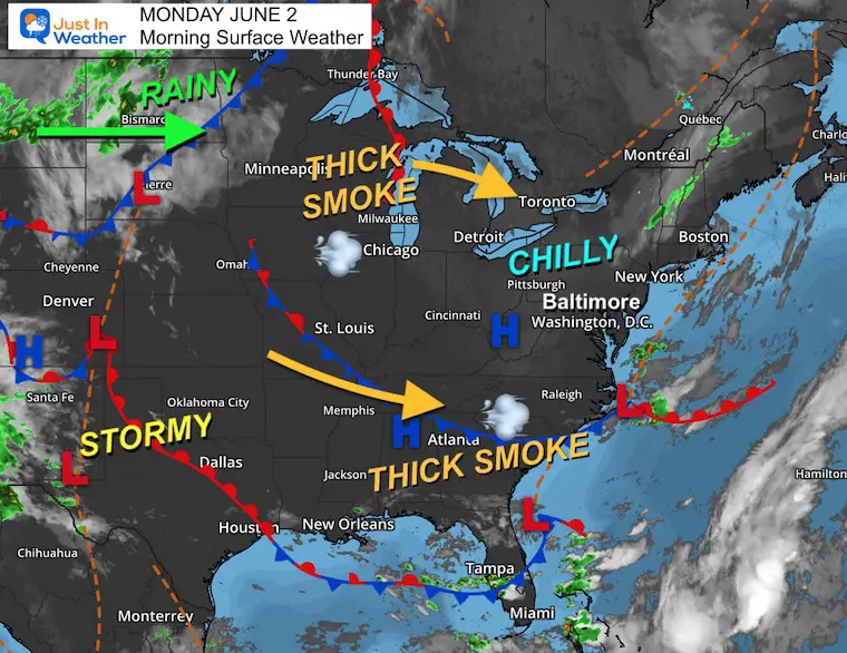
Morning Surface Weather
Our chilly start to June continues…
Under large high pressure that will give us a dry week, smoke from Canadian wildfires has been clustered across the Upper Midwest, and a band has spread into Coastal South Carolina and North Florida.
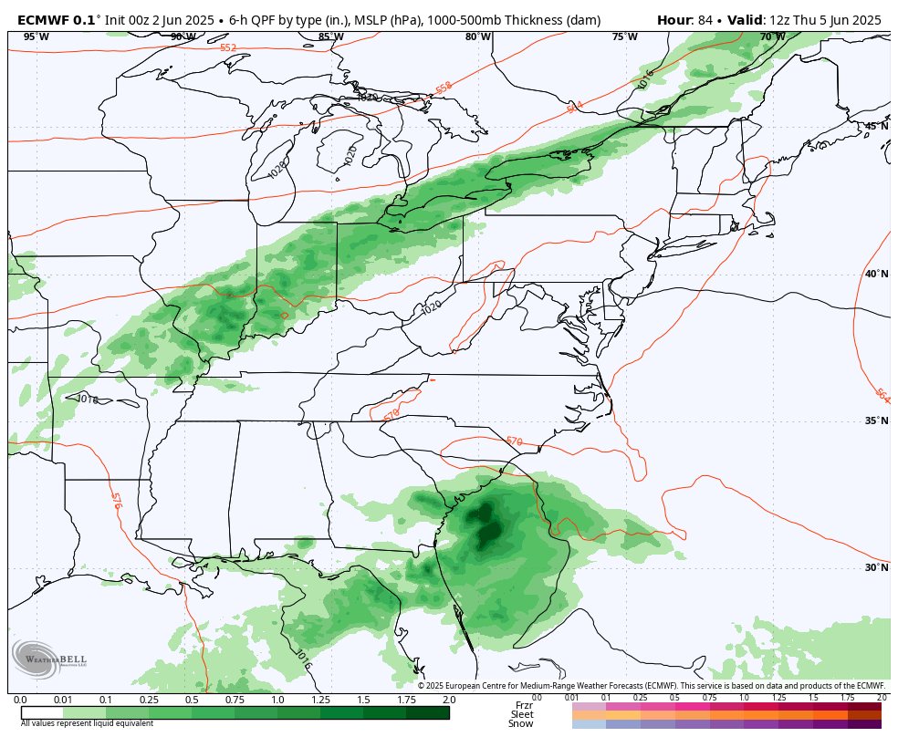
There is a weather system that will bring rain and will improve the air quality across the Northern Plains, but will push the smoke farther east and in our direction.
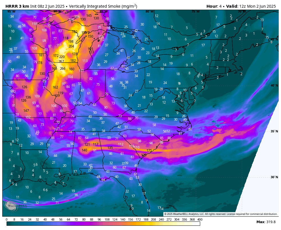
Wildfire Smoke Forecast
HRRR Model 8 AM to 10 PM
A return of a smoky haze will still allow the sun to shine and make for a vivid sunset.
The large cluster of smoke across the Midwest, centered on Michigan, is a legitimate threat to reach us on Tuesday and Wednesday.
Afternoon Snapshot
Clouds will develop today and mix with a hazy backdrop at times. This may also help produce a vivid sunset.
Closer Look
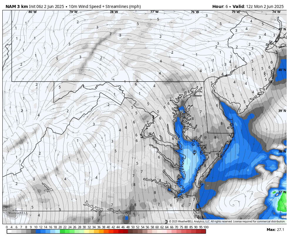
Wind Forecast
A light wind from the Northwest will keep the temps a little cooler than average and the humidity low.
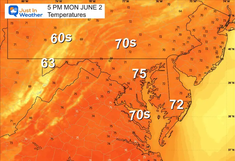
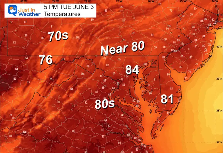
High Temperatures
CLIMATE DATA: Baltimore
TODAY June 2
Sunrise at 5:42 AM
Sunset at 8:28 PM
Normal Low in Baltimore: 59ºF
Record 44ºF in 1993
Normal High in Baltimore: 80ºF
Record 97ºF 2023
Rainfall Deficit at BWI
- Ending 2024 = -8.00”
- Since Jan 1 = -1.01”
- We are STILL DOWN -9.01” INCLUDING LAST YEAR
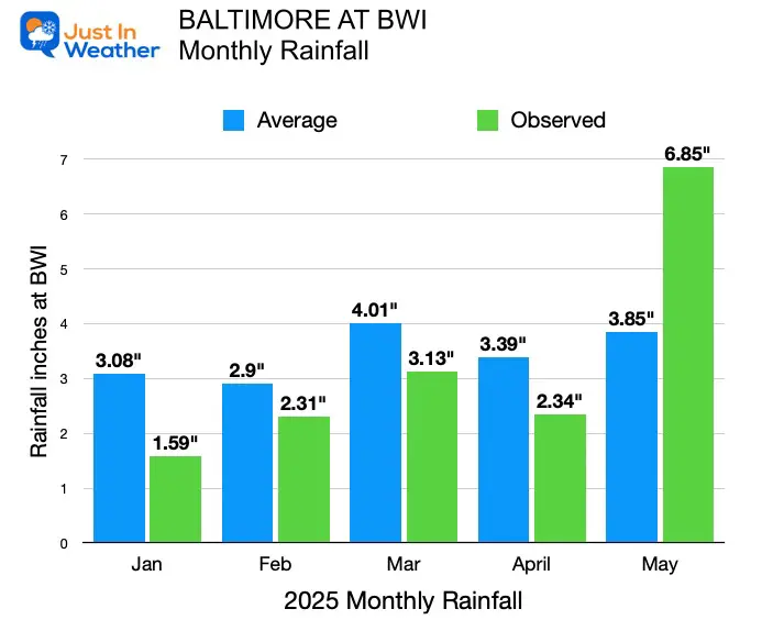
Rainfall Update
- May rainfall in Baltimore exceeded the average for the first time this year.
- May ‘Monthly Total” = 6.85”
- Normal May Total To Date = 3.83”
- NET GAIN +3.00”
Subscribe for eMail Alerts
TUESDAY
This is expected to be a sunny day, but we need to monitor the smoke plume that I expect will be an issue through Wednesday.
Morning Low Temperatures
Afternoon Temperatures
LOOKING AHEAD
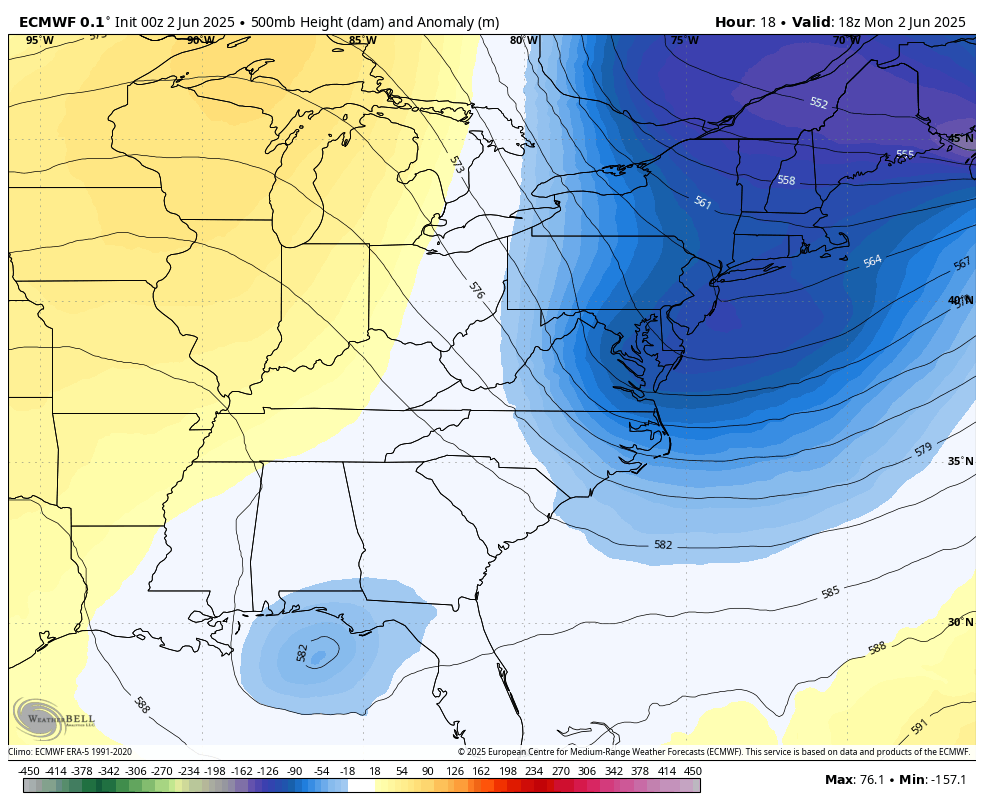
Jet Stream: Monday Afternoon to Thursday Afternoon
As a Ridge builds along the East Coast, we will get the return flow FROM the Southwest. This will pump in warmer air.
Snapshot Thursday
Finally, a taste of summer with temps near 90°F. This will bring up the humidity as well.
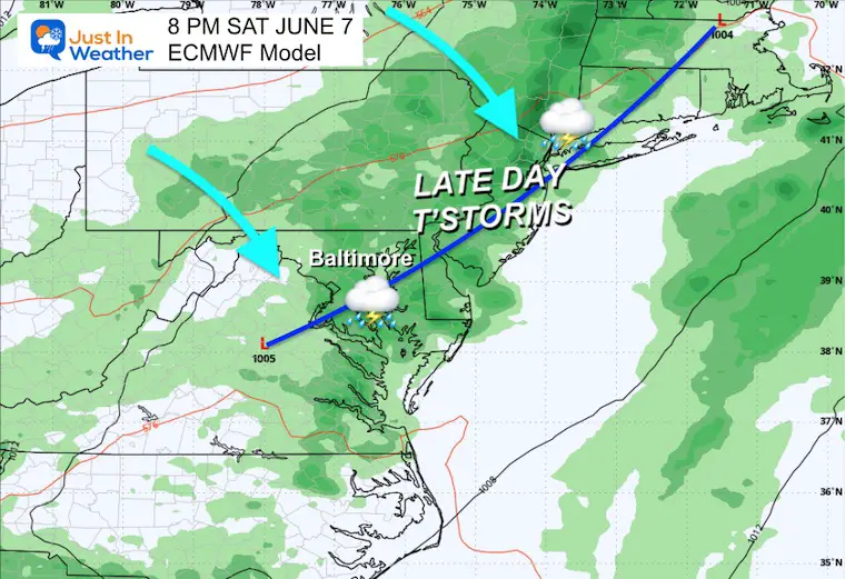
Storm Forecast: Thursday Morning to Sunday Afternoon
A slow-moving cold front will be to our west and north, possibly bringing a chance of late storms on Friday.
The better chance will be Saturday afternoon and evening, followed by cooler winds on Sunday.
Saturday Evening
This will not be a washout day, but plan for a disruption to the afternoon or evening plans with thunderstorms.
7 Day Forecast
Summer Heat For The Middle Of The Week
The chance for thunderstorms late Friday and Saturday will NOT be all-day events.
Subscribe for eMail Alerts
Please share your thoughts and best weather pics/videos, or just keep in touch via social media.
THANK YOU:
Baltimore Magazine Readers Choice Best Of Baltimore
Maryland Trek 11 Day 7 Completed Sat August 10
We raised OVER $111,000 for Just In Power Kids – AND Still Collecting More
The annual event: Hiking and biking 329 miles in 7 days between The Summit of Wisp to Ocean City.
Each day, we honor a kid and their family’s cancer journey.
Fundraising is for Just In Power Kids: Funding Free Holistic Programs. I never have and never will take a penny. It is all for our nonprofit to operate.
Click here or the image to donate:

RESTATING MY MESSAGE ABOUT DYSLEXIA
I am aware there are some spelling and grammar typos and occasional other glitches. I take responsibility for my mistakes and even the computer glitches I may miss. I have made a few public statements over the years, but if you are new here, you may have missed it: I have dyslexia and found out during my second year at Cornell University. It didn’t stop me from getting my meteorology degree and being the first to get the AMS CBM in the Baltimore/Washington region. One of my professors told me that I had made it that far without knowing and to not let it be a crutch going forward. That was Mark Wysocki, and he was absolutely correct! I do miss my mistakes in my own proofreading. The autocorrect spell check on my computer sometimes does an injustice to make it worse. I also can make mistakes in forecasting. No one is perfect at predicting the future. All of the maps and information are accurate. The ‘wordy’ stuff can get sticky. There has been no editor who can check my work while writing and to have it ready to send out in a newsworthy timeline. Barbara Werner is a member of the web team that helps me maintain this site. She has taken it upon herself to edit typos when she is available. That could be AFTER you read this. I accept this and perhaps proves what you read is really from me… It’s part of my charm. #FITF


