


October 30 Weather Severe Storm Risk With More Heavy Rain Then Windy Halloween
Thursday, October 30, 2025 We have quite a bit of turbulence this Thursday! A strong storm has been pumping in strong winds. There is a low-level jet stream at 10,000…
Tuesday, May 27, 2025
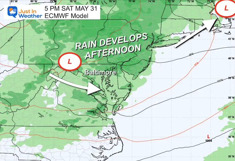
Clouds have already filled in ahead of a developing storm. This large system and persistent pattern will bring rain a little faster today, reaching the western suburbs of Washington and Baltimore by the end of the day.
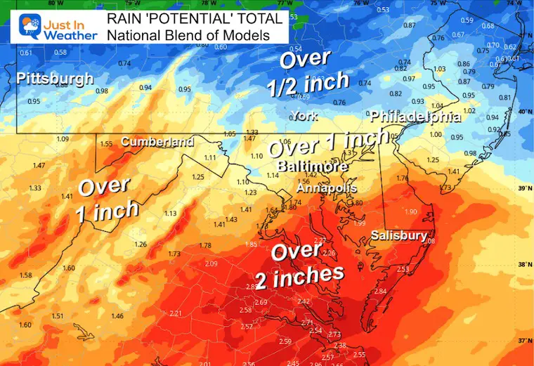
The main event will be on Wednesday, with steady rain that will be heavy at times. Low Pressure will pull in a strong wind from the East, making it a chilly and raw day as well.
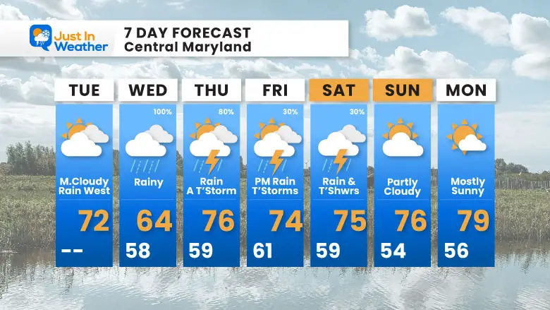
The setup from Thursday to Saturday keeps more rounds of rain and thunderstorms, with temperatures trying to warm a little.
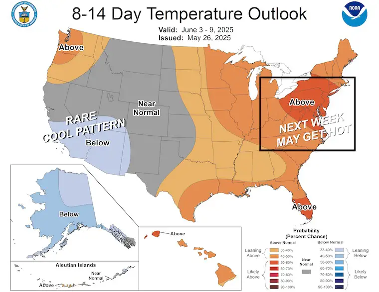
A pattern change may be noticeable Sunday with the sun returning, then we could see a hint of summer heat by the middle of next week.
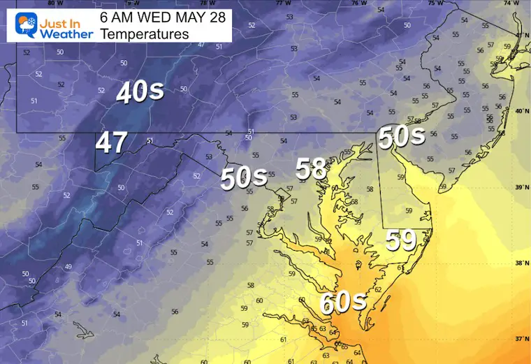
Remaining unseasonably chilly with temperatures in the 40s and 50s as clouds spread in.
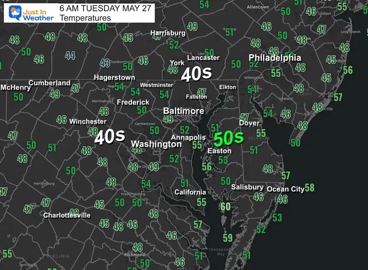
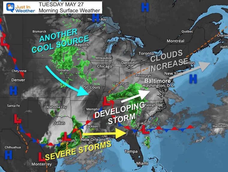
A large storm is developing in the persistent pattern. Clouds have already moved in and continue to advance through the Northeast as the system organizes. Plenty of moisture will fill in, and another source of cool and unsettled air feeds in from the Northern Plains.
The severe storm threat will remain across the Gulf States.
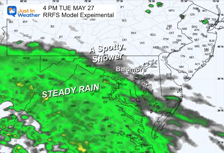
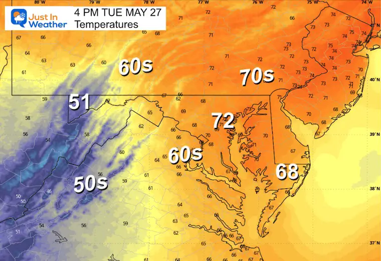
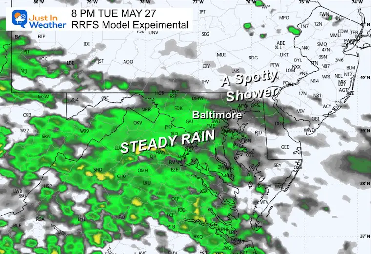
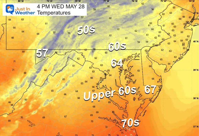
Steady rain expected to be approaching from the west and may be on the doorstep of Washington. Around Baltimore and Central Maryland some spotty showers will slowly expand into the evening.
Still cool, but more of the region reaches the 70s.
More showers are expected across metro Baltimore, with a slow movement to spread to the north and east.
Sunrise at 5:45 AM
Sunset at 8:24 PM
Normal Low in Baltimore: 57ºF
Record 43ºF in 1915; 1961
Normal High in Baltimore: 78ºF
Record 95ºF 1941; 1965
Drought UPDATE: Map Was Updated Thursday
Rainfall Deficit at BWI
Subscribe for eMail Alerts
Sign up and be the first to know!
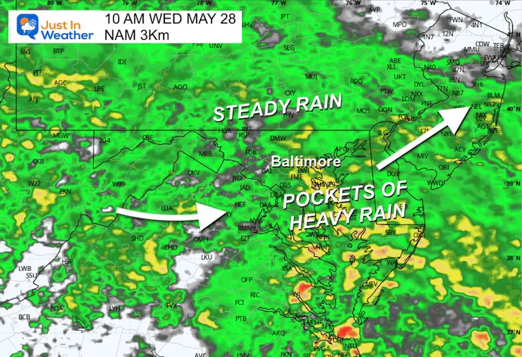
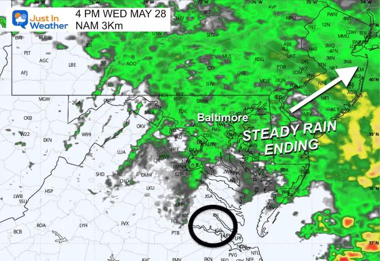
This will be a wet day with steady rain and some pockets that are heavy. It will pull away late afternoon and evening.
Low Pressure will pull winds FROM THE EAST.
Simply Put: A wet morning!
Watching the back edge of rain moving through as Low Pressure passes across Southern Maryland.
Low Pressure will pull the wind in from the ocean and gust to over 20 mph.
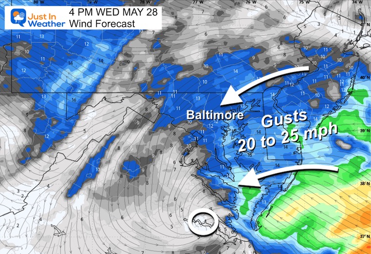
Chilly 60s with the rain and wind from the ocean.
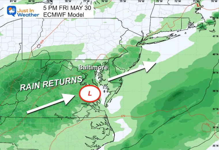
An active weather pattern will bring another round of rain with two areas of Low Pressure swinging through Friday and Saturday.
Rain Returns
That storm departs, ending that round of rain…
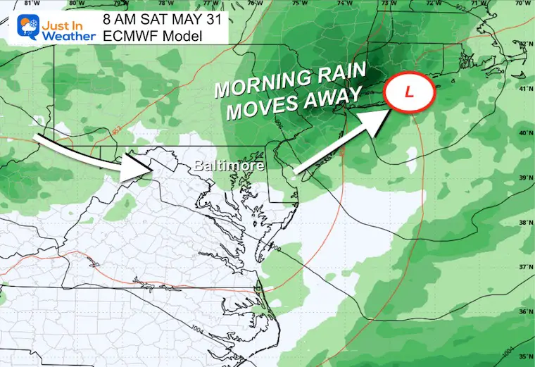
Another round of rain and thunderstorms.
June 3 to 9: POTENTIAL for summer heat to show up by the middle of NEXT WEEK. The goal here is for afternoon temperatures in the mid-80s to near 90°F.
Sign up and be the first to know!
Severe Weather: Storm Smart October and next spring Winter Weather FITF (Faith in the Flakes): November To March Click to see more and send a request for your school.

The annual event: Hiking and biking 329 miles in 7 days between The Summit of Wisp to Ocean City.
Each day, we honor a kid and their family’s cancer journey.
Fundraising is for Just In Power Kids: Funding Free Holistic Programs. I never have and never will take a penny. It is all for our nonprofit to operate.
Click here or the image to donate:

I am aware there are some spelling and grammar typos and occasional other glitches. I take responsibility for my mistakes and even the computer glitches I may miss. I have made a few public statements over the years, but if you are new here, you may have missed it: I have dyslexia and found out during my second year at Cornell University. It didn’t stop me from getting my meteorology degree and being the first to get the AMS CBM in the Baltimore/Washington region. One of my professors told me that I had made it that far without knowing and to not let it be a crutch going forward. That was Mark Wysocki, and he was absolutely correct! I do miss my mistakes in my own proofreading. The autocorrect spell check on my computer sometimes does an injustice to make it worse. I also can make mistakes in forecasting. No one is perfect at predicting the future. All of the maps and information are accurate. The ‘wordy’ stuff can get sticky. There has been no editor who can check my work while writing and to have it ready to send out in a newsworthy timeline. Barbara Werner is a member of the web team that helps me maintain this site. She has taken it upon herself to edit typos when she is available. That could be AFTER you read this. I accept this and perhaps proves what you read is really from me… It’s part of my charm. #FITF