Thursday, May 22, 2025
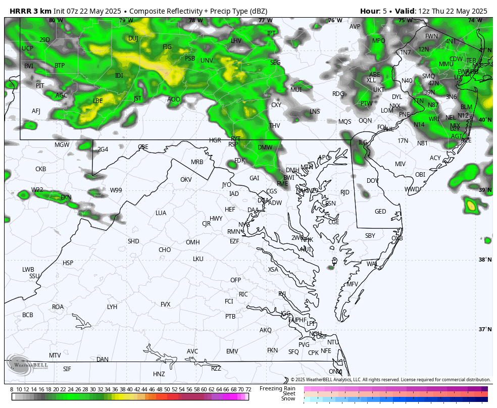
Today may feel like March instead of May as we begin the day with mist, drizzle, and fog. Steady rain will continue to track across the northern part of our region, near and north of the Pennsylvania line.
A Nor’easter/Coastal Storm is developing and moving away into New England. Yesterday it dropped 0.60 inches of rain in Baltimore as afternoon temperatures remained in the 50s.
This rare late-season system is rotating around a larger chilly upper-level storm and could begin to produce snow in the higher mountains of New England. For us, the unstable atmosphere will develop afternoon thunderstorms.
Gradually the chilly air will modify and we can expect sunshine with lower 70s over the holiday weekend.
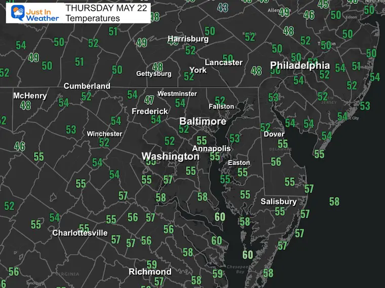
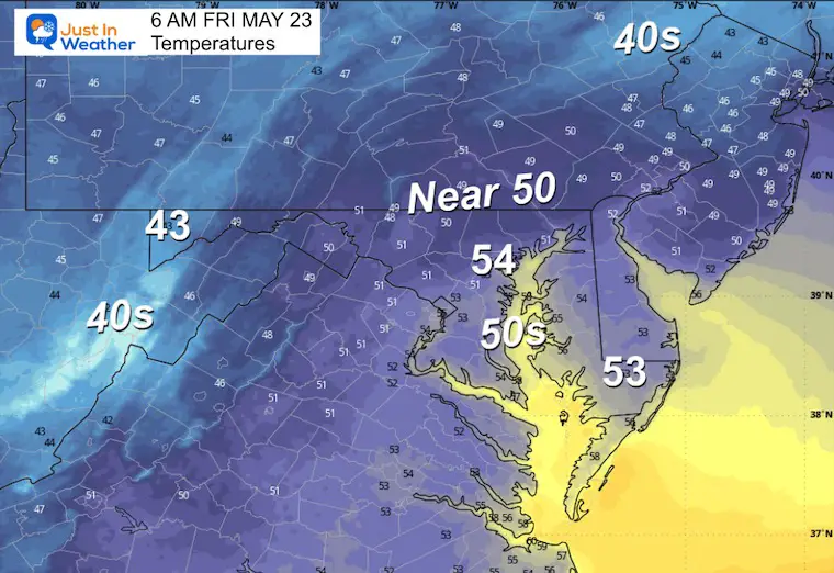
Morning Temperatures
Conditions: Damp with pockets of drizzle and fog!
Live Radar
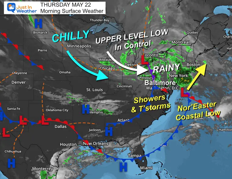
Morning Surface Weather
The developing Nor’easter/Coastal Storm may be the main story as it moves into New England. The coast will be pounded with chilly wind and rain, while the mountains may get a coating of snow above 1,500 ft.
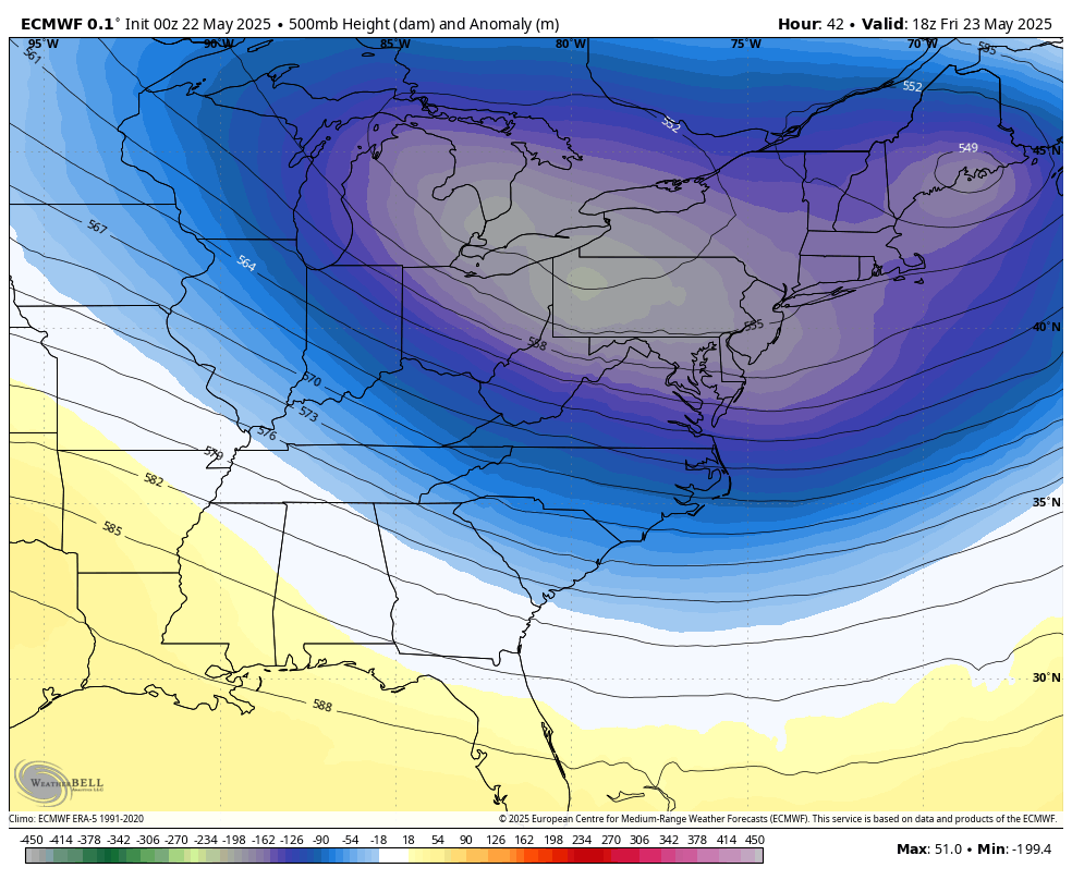
This is all being driven by an Upper-Level Low in the Eastern Great Lakes. This pocket of chilly air aloft will make the air unstable, igniting afternoon thunderstorms.
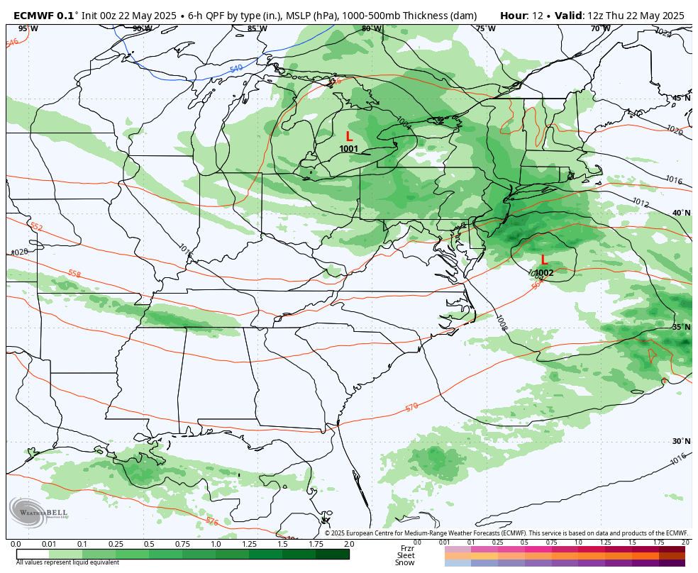
Storm Forecast: Today To Saturday
ECMWF Model
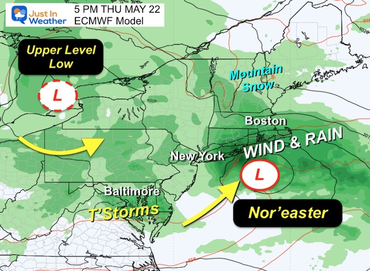
Afternoon Snapshot: Nor’easter
Snow Forecast
LOCAL FORECAST MAPS
Radar Simulation 8 AM to 8 PM
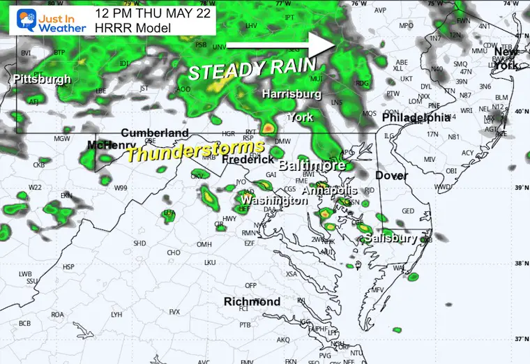
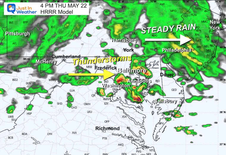
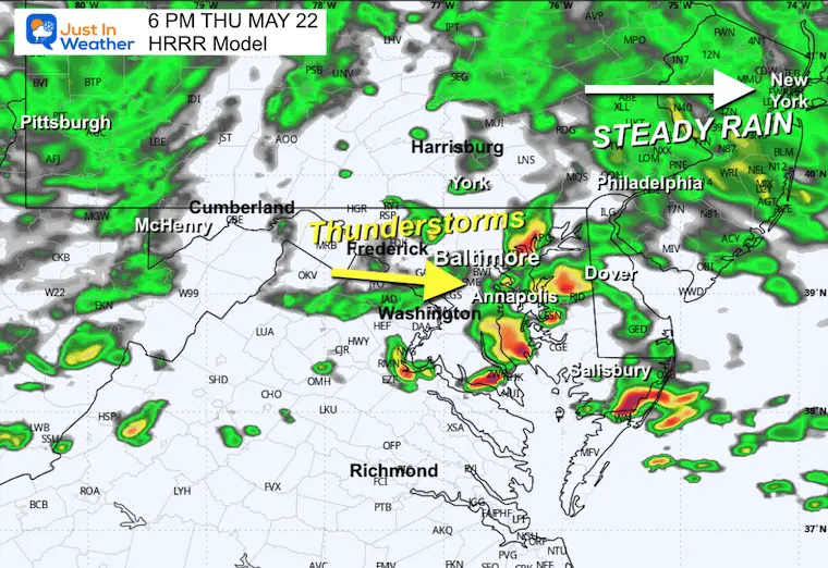
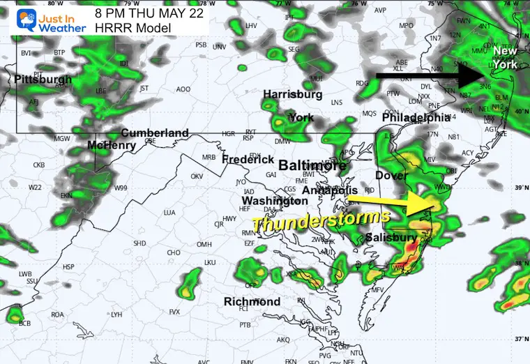
Moderate to heavy this morning, a lull begins at Noon to 2 PM, then another round of rain and thunderstorms after 7 PM.
Snapshots
Noon
4 PM
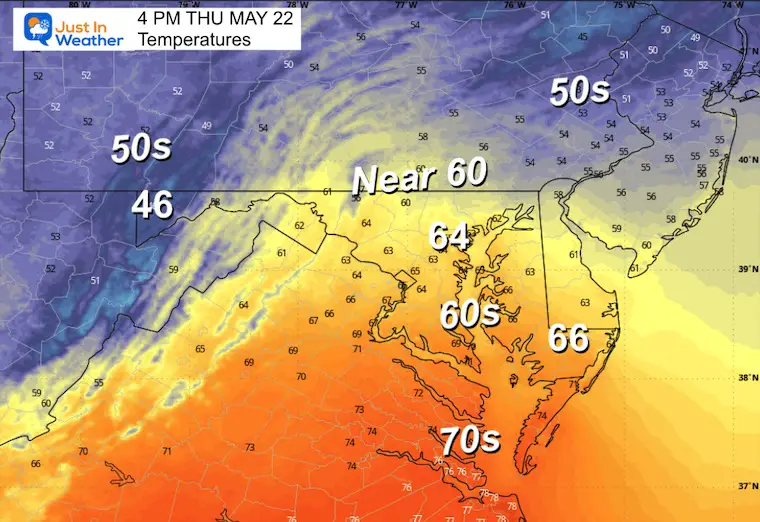
Afternoon Temperatures
These are at least 20 degrees cooler than average.
6 PM
8 PM
CLIMATE DATA: Baltimore
TODAY May 22
Sunrise at 5:48 AM
Sunset at 8:20 PM
Normal Low in Baltimore: 55ºF
Record 35ºF in 2002
Normal High in Baltimore: 77ºF
Record 98ºF 1941
Drought Reminder
Rainfall Deficit at BWI
- Ending 2024 = -8.00”
- Since Jan 1 = -2.15”
- We are DOWN -10.15” including last year
Subscribe for eMail Alerts
FRIDAY
Afternoon Showers and Developing Thunderstorms
Morning Low Temps
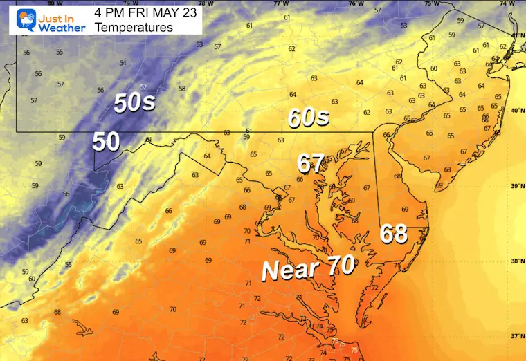
Afternoon High Temperatures
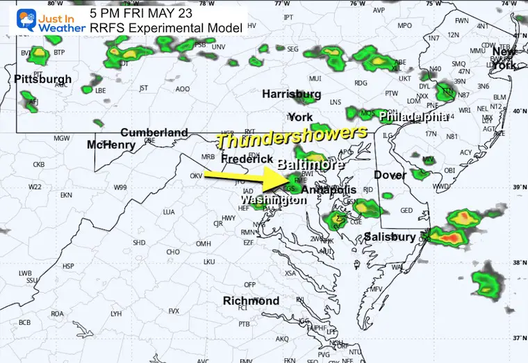
Radar Simulation: Noon to 10 PM
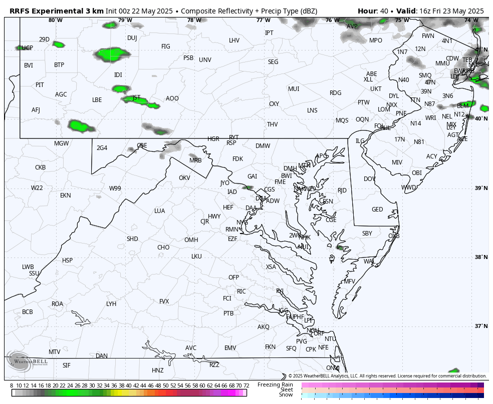
Snapshot at 5 PM
A few thundershowers will be scattered across the region.
Jet Stream: Saturday to Tuesday
We remain in an unseasonably cool pattern aloft. This keeps the unsettled air and temperatures below average through Memorial Day, then it will relax next week.
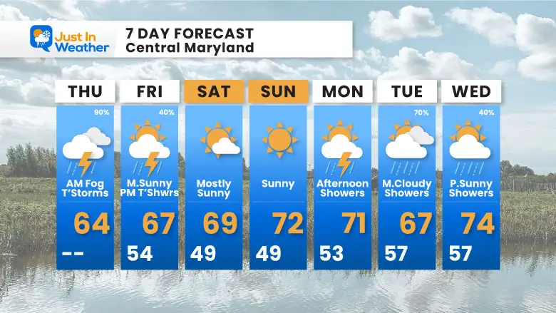
7 Day Forecast
- Thursday Showers and Thunderstorms Developing This Afternoon.
- Friday Afternoon Thundershowers
- Memorial Day Weekend: Cooler than average.
- Rain showers ‘possible’ Monday AFTERNOON
Subscribe for eMail Alerts
Please share your thoughts and best weather pics/videos, or just keep in touch via social media.
SCHEDULE A WEATHER BASED STEM ASSEMBLY
Severe Weather: Storm Smart October and next spring Winter Weather FITF (Faith in the Flakes): November To March Click to see more and send a request for your school.

THANK YOU:
Baltimore Magazine Readers Choice Best Of Baltimore
Maryland Trek 11 Day 7 Completed Sat August 10
We raised OVER $111,000 for Just In Power Kids – AND Still Collecting More
The annual event: Hiking and biking 329 miles in 7 days between The Summit of Wisp to Ocean City.
Each day, we honor a kid and their family’s cancer journey.
Fundraising is for Just In Power Kids: Funding Free Holistic Programs. I never have and never will take a penny. It is all for our nonprofit to operate.
Click here or the image to donate:

RESTATING MY MESSAGE ABOUT DYSLEXIA
I am aware there are some spelling and grammar typos and occasional other glitches. I take responsibility for my mistakes and even the computer glitches I may miss. I have made a few public statements over the years, but if you are new here, you may have missed it: I have dyslexia and found out during my second year at Cornell University. It didn’t stop me from getting my meteorology degree and being the first to get the AMS CBM in the Baltimore/Washington region. One of my professors told me that I had made it that far without knowing and to not let it be a crutch going forward. That was Mark Wysocki, and he was absolutely correct! I do miss my mistakes in my own proofreading. The autocorrect spell check on my computer sometimes does an injustice to make it worse. I also can make mistakes in forecasting. No one is perfect at predicting the future. All of the maps and information are accurate. The ‘wordy’ stuff can get sticky. There has been no editor who can check my work while writing and to have it ready to send out in a newsworthy timeline. Barbara Werner is a member of the web team that helps me maintain this site. She has taken it upon herself to edit typos when she is available. That could be AFTER you read this. I accept this and perhaps proves what you read is really from me… It’s part of my charm. #FITF


