May 20 2025
Tuesday Afternoon Update
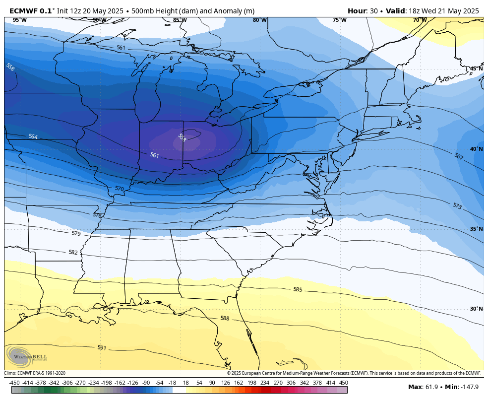
Yes, we are less than one week from Memorial Day, and the word Nor’easter has entered the weather conversation. A late-season pattern that could resemble winter will bring a pocket of unseasonably cool air in the jet stream to the Eastern US. The net result will be a storm system that will redevelop along the coast and track from the Mid-Atlantic to New England.
A severe storm outbreak to the south will be contrasted with a chilly rain in the Mid-Atlantic and Northeast. Temperatures may run 20 to 30 degrees below average for the next two days at least.
The unsettled pattern may still produce some thunderstorms in the cool air as it departs, then lead to a gradual calming while remaining cooler than average through the holiday weekend.
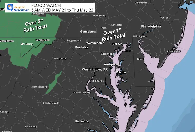
Flood Watch
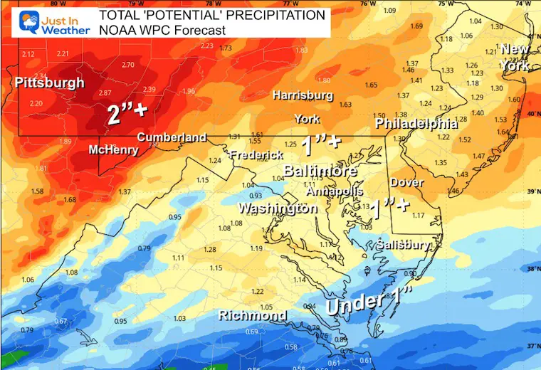
The heavy rain expected in the mountains may exceed 2 inches for the same areas that had extensive flooding last week.
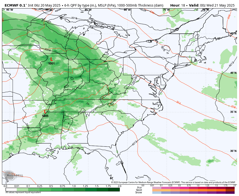
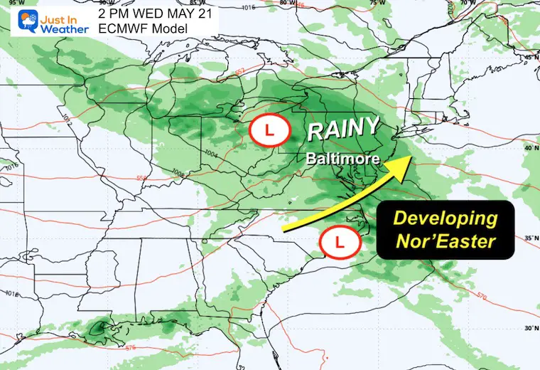
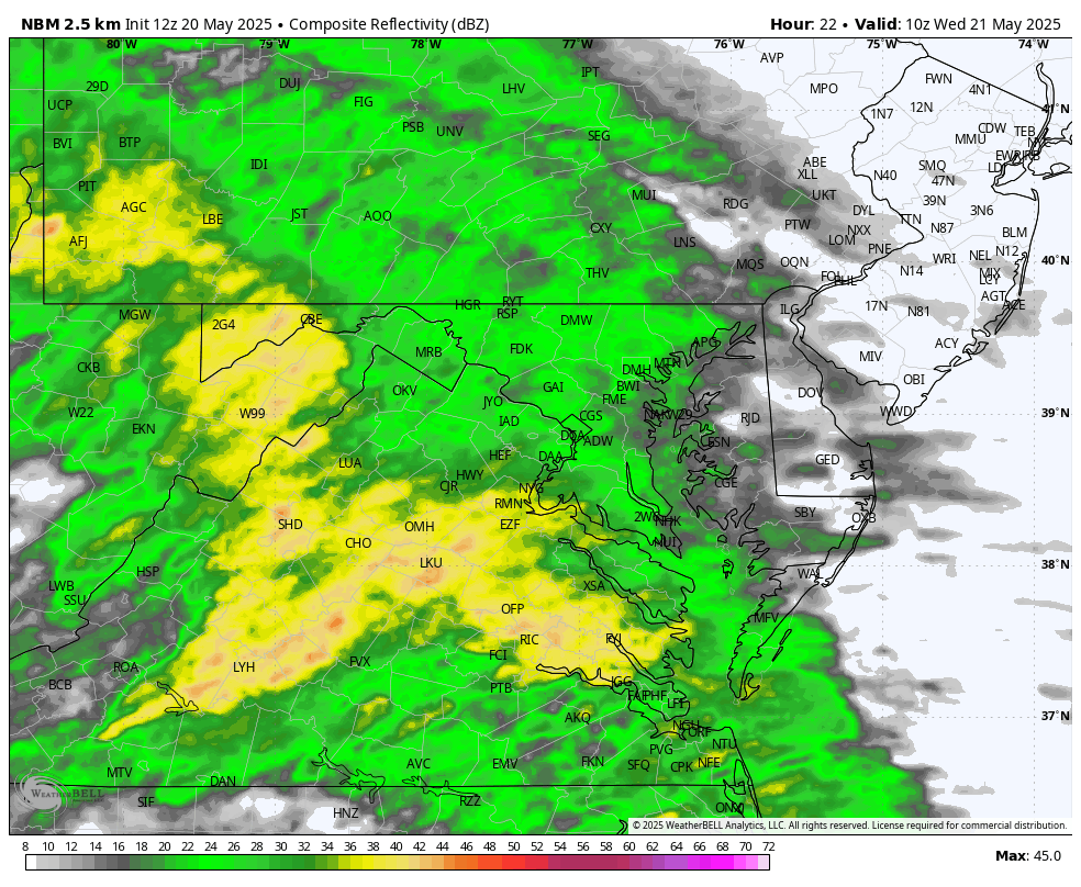
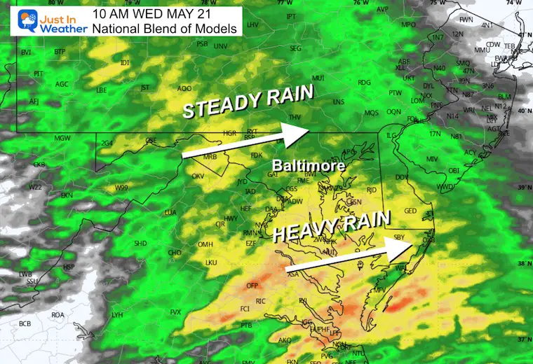
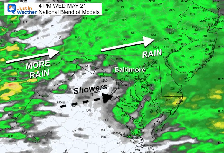
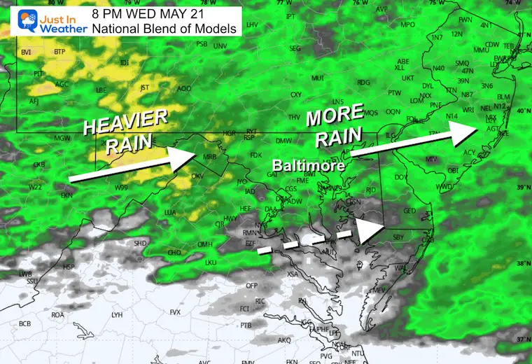
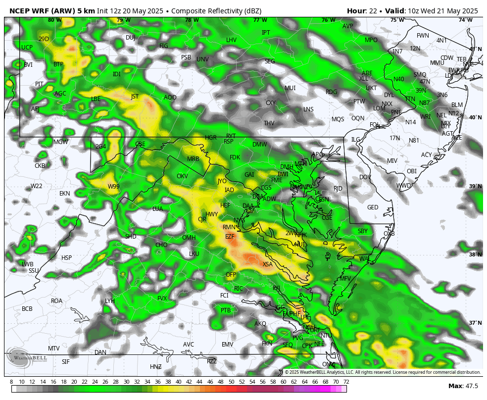
I wanted to compare a few computer models to show you the overlapping similarity, even though the specifics are uncertain. We can expect a steady and heavy rain to start on Wednesday, then a break to spotty showers, only to give way to a second surge Wednesday night.
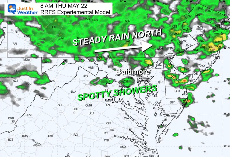
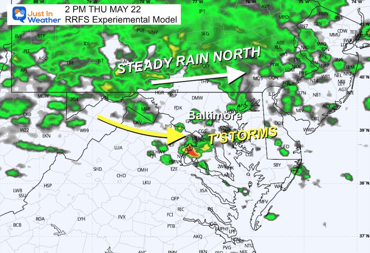
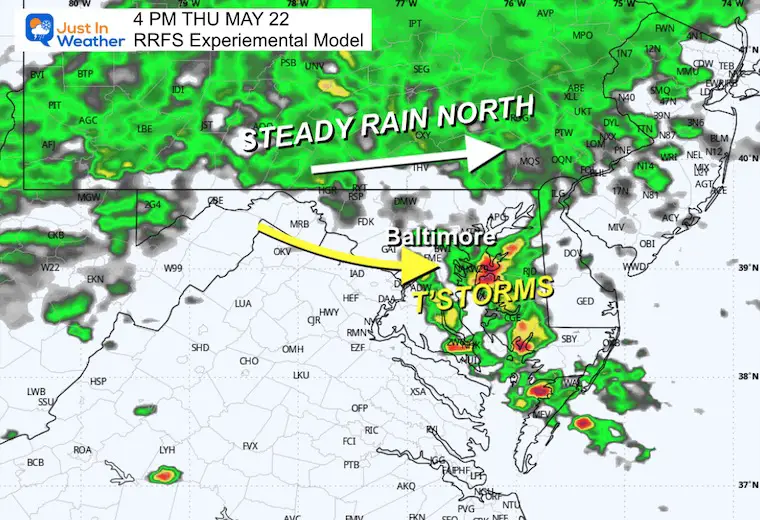
Thursday may keep the steady rain north of Baltimore, but showers will fill in along with some thunderstorms in the afternoon.
This may affect many area college graduation plans, including the Blue Angels annual flight over the Naval Academy Graduation in Annapolis.
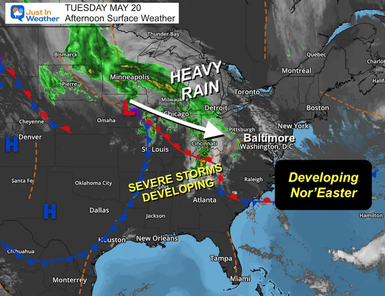
Surface Weather Tuesday Afternoon
Low Pressure is centered in Iowa, but this is a large system with energy sending steady and heavy rain in a large path from North Dakota to the Ohio Valley.
The Severe Storm Outbreak will be in the Tennessee River Valley later today.
Clouds have been increasing across the Mid-Atlantic, and the rain will arrive tonight.
Live Radar and Lightning Widget
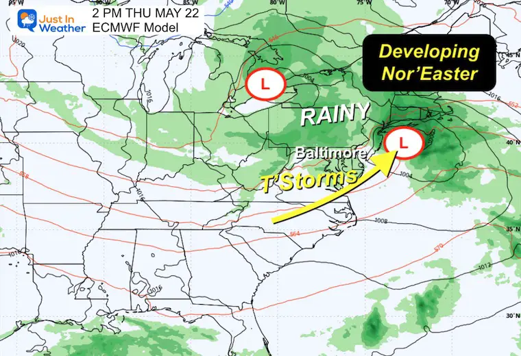
Storm Forecast: ECMWF Model
Snapshots Showing The Nor’easter Forming
Wednesday
Thursday
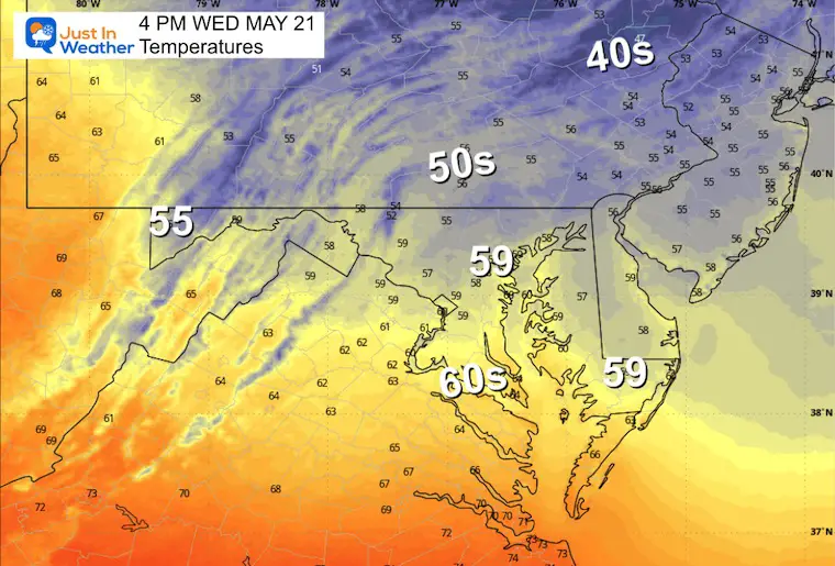
WEDNESDAY CHILL AND WIND
Afternoon High Temperatures
Nearly 20 degrees cooler than average for metro areas!!!
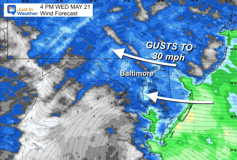
Wind Forecast
The surface air will be coming FROM the EAST, and winds could gust to 30 mph.
This will keep temps chilly AND add moisture to the storm.
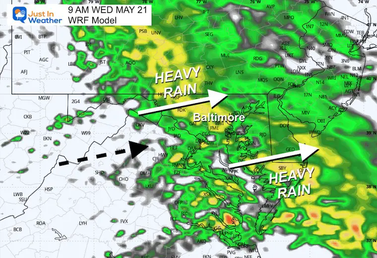
WEDNESDAY RAIN:
Comparing Two Models
There will be steady rain in the morning and a possible lull in the afternoon, but there will be spotty showers. Then, another round of heavier rain will develop in the evening and at night.
National Blend Of Models
6 AM to 8 PM
Snapshots
10 AM
4 PM
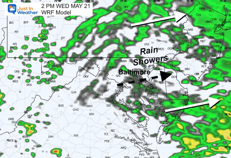
If there is a lull to spotty showers, it will be mid-afternoon. This may not be completely dry, but rather diminished activity.
8 PM
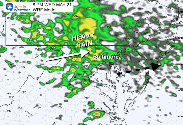
A second surge of rain arrives at night.
COMPARING
WRF Model
6 AM to 8 PM
9 AM
2 PM
8 PM
THURSDAY
This is when the Coastal Low will head towards New England. A little sunshine in the afternoon may support the unstable air, helping to bubble up thunderstorms.
Rapid Refresh Forecast System “Experimental”
6 AM to 8 PM
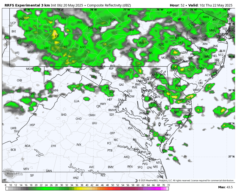
8 AM
2 PM
4 PM
Total Potential Rainfall
Rain showers may increase the totals on Friday and Saturday afternoon… but the bulk will occur through Thursday.
Jet Stream Forecast: Wednesday to Saturday
Watch the cold air core pass through New England this weekend following the storm. This has a winter look to it, but it is late May. Definitely NOT a pre-summer feel to the holiday weekend.
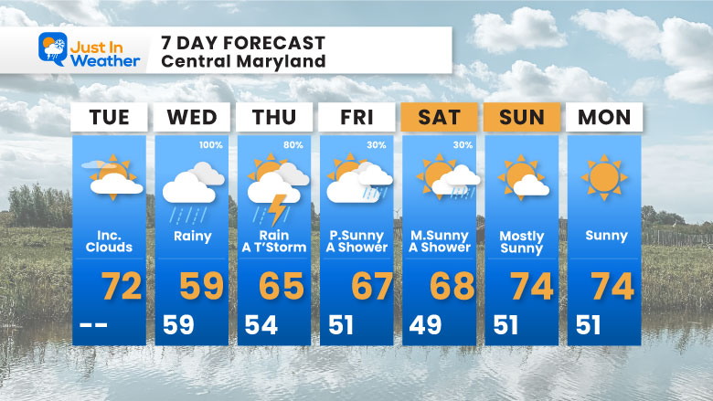
7 Day Forecast
- Wednesday will be a rainy AND chilly day, now expecting to stay in the 50s.
- Thursday, likely showers in the afternoon, MIGHT have some thunder.
- Friday remains cool with some afternoon rain showers.
- Memorial Day Weekend: Dry Sunday and Monday, but staying cool.
Subscribe for eMail Alerts
Please share your thoughts and best weather pics/videos, or just keep in touch via social media.
SCHEDULE A WEATHER BASED STEM ASSEMBLY
Severe Weather: Storm Smart October and next spring Winter Weather FITF (Faith in the Flakes): November To March Click to see more and send a request for your school.

THANK YOU:
Baltimore Magazine Readers Choice Best Of Baltimore
Maryland Trek 11 Day 7 Completed Sat August 10
We raised OVER $111,000 for Just In Power Kids – AND Still Collecting More
The annual event: Hiking and biking 329 miles in 7 days between The Summit of Wisp to Ocean City.
Each day, we honor a kid and their family’s cancer journey.
Fundraising is for Just In Power Kids: Funding Free Holistic Programs. I never have and never will take a penny. It is all for our nonprofit to operate.
Click here or the image to donate:

RESTATING MY MESSAGE ABOUT DYSLEXIA
I am aware there are some spelling and grammar typos and occasional other glitches. I take responsibility for my mistakes and even the computer glitches I may miss. I have made a few public statements over the years, but if you are new here, you may have missed it: I have dyslexia and found out during my second year at Cornell University. It didn’t stop me from getting my meteorology degree and being the first to get the AMS CBM in the Baltimore/Washington region. One of my professors told me that I had made it that far without knowing and to not let it be a crutch going forward. That was Mark Wysocki, and he was absolutely correct! I do miss my mistakes in my own proofreading. The autocorrect spell check on my computer sometimes does an injustice to make it worse. I also can make mistakes in forecasting. No one is perfect at predicting the future. All of the maps and information are accurate. The ‘wordy’ stuff can get sticky. There has been no editor who can check my work while writing and to have it ready to send out in a newsworthy timeline. Barbara Werner is a member of the web team that helps me maintain this site. She has taken it upon herself to edit typos when she is available. That could be AFTER you read this. I accept this and perhaps proves what you read is really from me… It’s part of my charm. #FITF


