March 15 2025
Saturday Morning Report
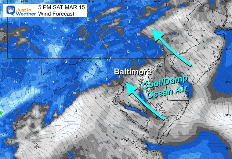
Locally, we remain stuck in the cool and damp ocean air. This brought the clouds back with fog and drizzle, and they will remain in place today. I was wrong to try to bring the warmer air in today, but it will arrive ahead of active weather tomorrow.
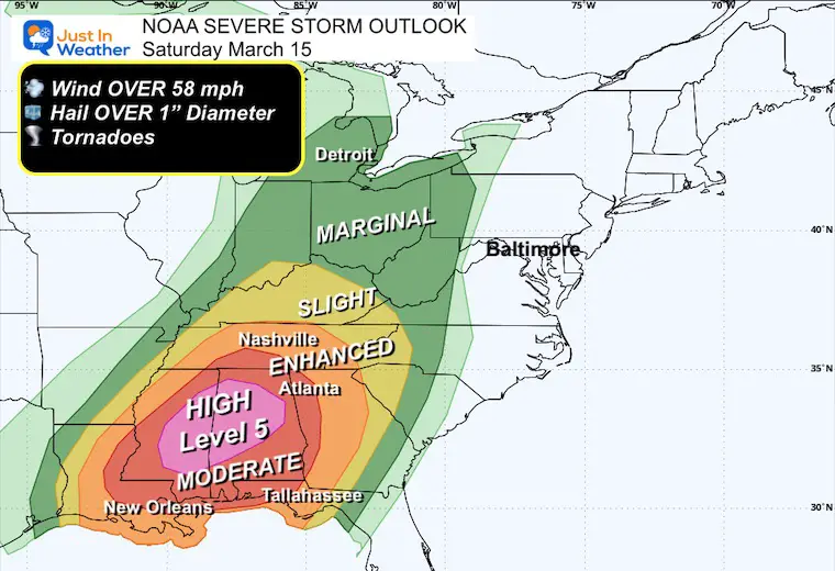
There is concern for rare Level 5 High Risk for severe storms in the Deep South today. This large storm is affecting the middle of our nation, which brought a deadly dust storm and tornadoes yesterday to the Central Plains. There is also a blizzard on the north side.
All will slide eastward and give us a stormy Sunday evening, then move off the coast Monday.
Dust Storm Photos
CLIMATE DATA: Baltimore
TODAY March 15
Sunrise at 7:18 AM
Sunset at 7:14 PM
Normal Low in Baltimore: 34ºF
Record 10ºF in 1993
Normal High in Baltimore: 54ºF
Record 82ºF 1990
Baltimore Seasonal Snow
12.7”
Rainfall Deficit at BWI
- Ending 2024 = -8.00”
- Since Jan 1 = -2.85”
- We are DOWN -10.85” including last year
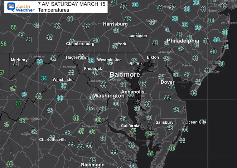
Morning Temperatures
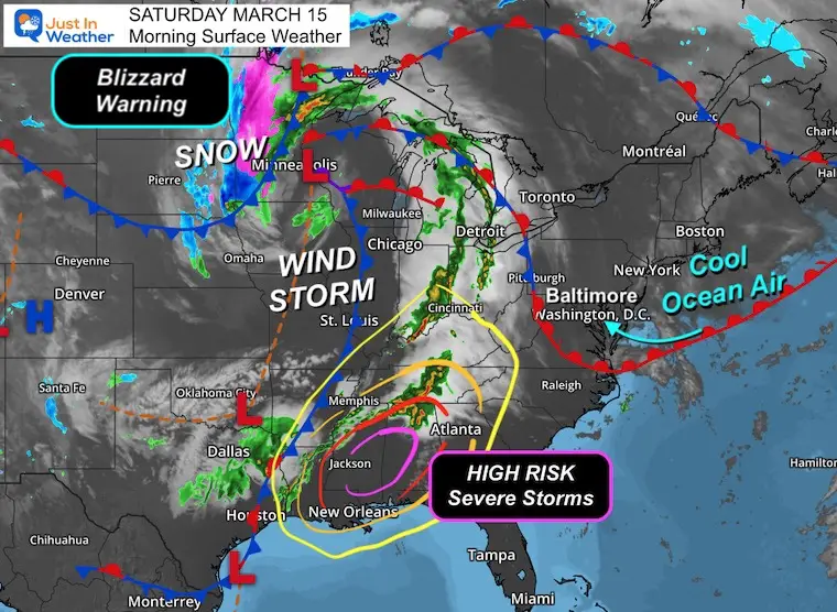
Morning Surface Weather
We are under the influence of the cool and damp ocean air. This has developed low clouds with fog and drizzle across parts of Central Maryland and near the coast.
The severe storms we will watch for a few days began to develop across the Deep South yesterday.
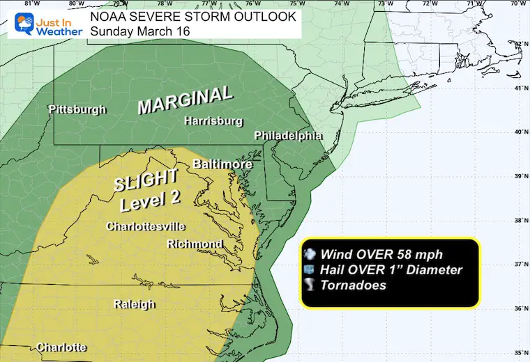
NOAA Severe Storm Outlook
Saturday
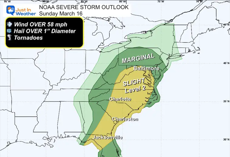
Sunday
Forecast Animation Today Through Monday
This storm will develop heavy rain and severe storms across the Midwest and Southeast, while a blizzard will rage on the north side.
This will weaken as it pushes our way, but it will still provide rain and some strong storms into Sunday and Monday for metro areas and the coast.
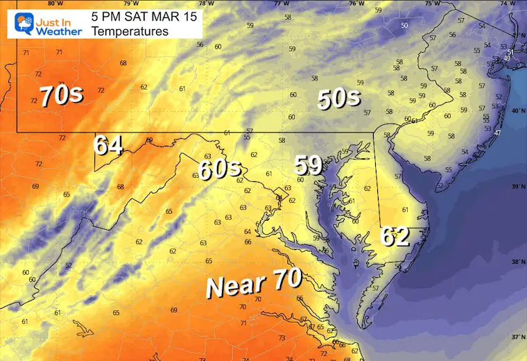
Afternoon Snapshot at 5 PM
Wind
Temperatures
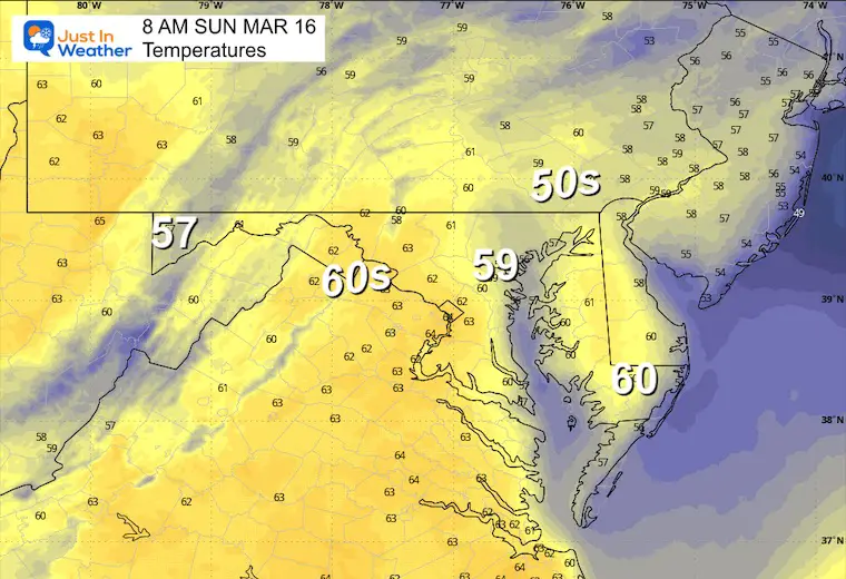
SUNDAY WEATHER
Morning Temperatures
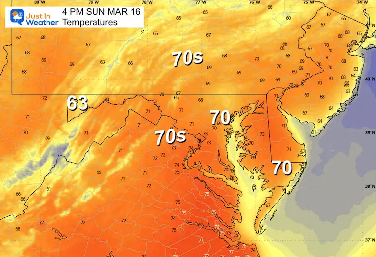
Afternoon Temperatures
NOAA Severe Storm Outlook
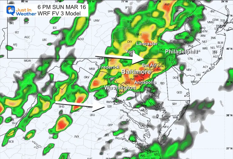
Radar Simulation 8 AM to 8 AM Monday
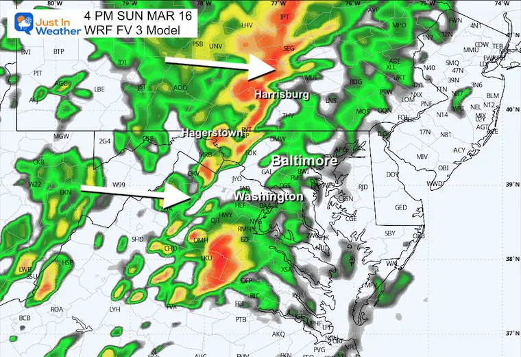
WRF FV3 Model
Sunday Afternoon
Showers may be off and on all day, but the stronger storms will be developing in the afternoon.
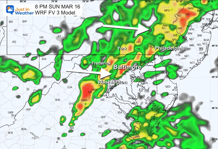
Sunday Evening
Heavier rain and strong to severe thunderstorms.
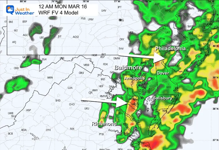
Sunday Night
Midnight – Early Monday Morning
The cold front will take the rain and storms off the coast, allowing for clearing behind it.
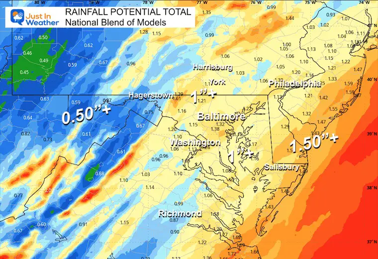
Rain Total Potential
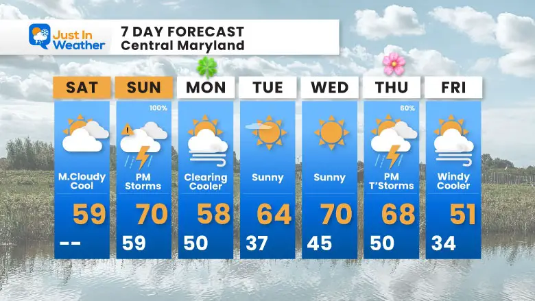
7 Day Forecast
Our storm focus will be Sunday afternoon and night. This will briefly bring in warmer air, then cool again as we clear out on Monday.
Warming again mid-week ahead of the next chance for storms on Thursday.
Subscribe for eMail Alerts
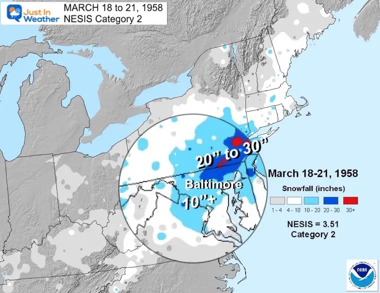
March Madness: History of Extreme Weather and Late Season Snow
Click here for the full report:
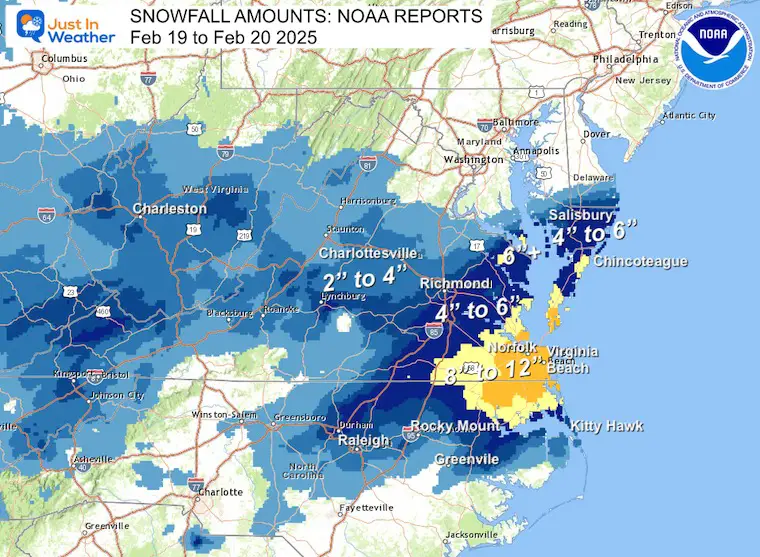
SNOW REPORTS THIS SEASON
Click on the maps for that full report.
Just A Bit Outside Feb 19
Brief Recap Of The Record Snow For Virginia and the abrupt change from the longer range potential track.
February 11 Snow Report And Grade My Forecast
click here or the map for more

January 19 Snow Report

January 11 Snow Report

January 6 Snow Report

Previous Snow

ALSO SEE
Recent Snow Reports
La Nina Advisory January 2025
Full Report

MY WINTER OUTLOOK
My Winter Outlook Report

FITF Gear on Sale

In Case You Missed This
The Faith In The Flakes Dec 5 Origin Story

Please share your thoughts and best weather pics/videos, or just keep in touch via social media.
SCHEDULE A WEATHER BASED STEM ASSEMBLY
Severe Weather: Storm Smart October and next spring Winter Weather FITF (Faith in the Flakes): November To March Click to see more and send a request for your school. 
THANK YOU:
Baltimore Magazine Readers Choice Best Of Baltimore
Maryland Trek 11 Day 7 Completed Sat August 10
We raised OVER $104,000 for Just In Power Kids – AND Still Collecting More
The annual event: Hiking and biking 329 miles in 7 days between The Summit of Wisp to Ocean City.
Each day, we honor a kid and their family’s cancer journey.
Fundraising is for Just In Power Kids: Funding Free Holistic Programs. I never have and never will take a penny. It is all for our nonprofit to operate.
Click here or the image to donate:

RESTATING MY MESSAGE ABOUT DYSLEXIA
I am aware there are some spelling and grammar typos and occasional other glitches. I take responsibility for my mistakes and even the computer glitches I may miss. I have made a few public statements over the years, but if you are new here, you may have missed it: I have dyslexia and found out during my second year at Cornell University. It didn’t stop me from getting my meteorology degree and being the first to get the AMS CBM in the Baltimore/Washington region. One of my professors told me that I had made it that far without knowing and to not let it be a crutch going forward. That was Mark Wysocki, and he was absolutely correct! I do miss my mistakes in my own proofreading. The autocorrect spell check on my computer sometimes does an injustice to make it worse. I also can make mistakes in forecasting. No one is perfect at predicting the future. All of the maps and information are accurate. The ‘wordy’ stuff can get sticky. There has been no editor who can check my work while writing and to have it ready to send out in a newsworthy timeline. Barbara Werner is a member of the web team that helps me maintain this site. She has taken it upon herself to edit typos when she is available. That could be AFTER you read this. I accept this and perhaps proves what you read is really from me… It’s part of my charm. #FITF


