March 4, 2025
Tuesday Morning Report
The clash of seasons will be full-blown on the weather maps this week. It will explode with a possible tornado outbreak later today and tonight. That energy will push our way into the Mid-Atlantic and Southeast on Wednesday. The back side of the same storm will produce a blizzard across the Rockies to the Northern Plains.
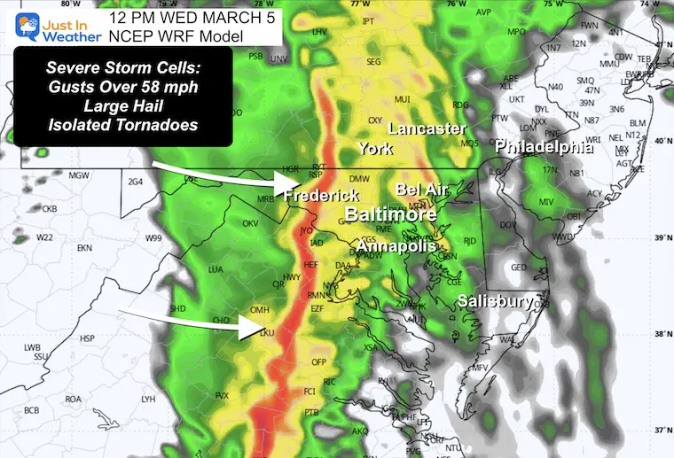
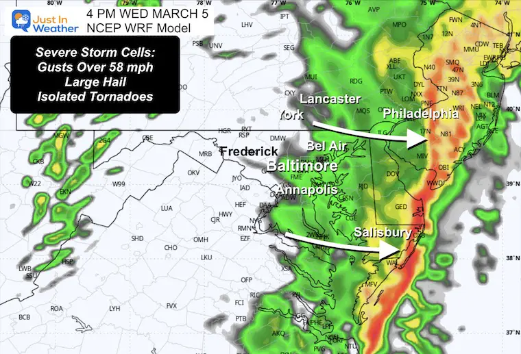
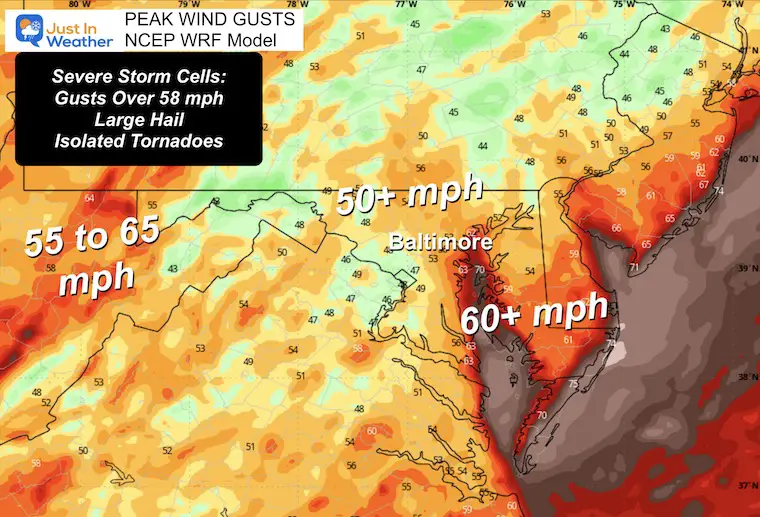
Severe Storm Cells can produce:
- Damaging Winds OVER 58 mph
- Large Hail OVER 1-inch diameter
- Isolated Tornadoes
Storm Alerts: Maybe issued for severe storms, tornadoes, and flooding.
- Watch: Potential For Development. The time frame is usually 4 to 6 hours and will include a cluster of counties.
- Warning: Identified storm cell. The time frame is usually 45 minutes and will include towns in the path.
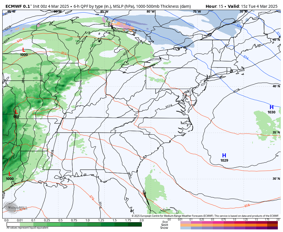
We need rain, and some storm cells will produce close to 1 inch… still not enough for our 10-inch deficit since last year. However, a burst in a short period of time with solid soil can run off more easily and produce local flooding.
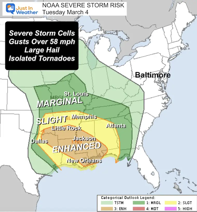
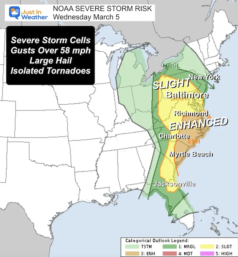
NOAA SEVERE STORM OUTBREAK
Slight Risk = Level 2 of 5. Widespread thunderstorms with a few cells that can turn severe. But NOT ALL.
Enhanced Risk = Level 3 of 5. This means a tornado outbreak is more likely.
Today
Tomorrow
Morning Surface Weather
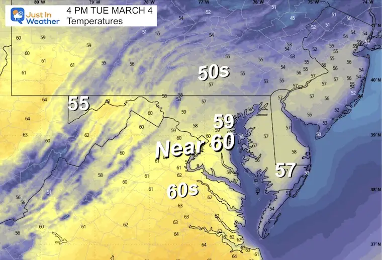
Warmer air will flow in today for the Mid-Atlantic. The storm is organizing with a line of severe storms already this morning that will get charged with daytime heating as it moves east.
The cold side will expand snow and blizzard conditions from the Central Rockies to the Northern Plains.
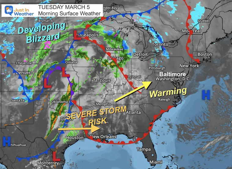
Storm Forecast Tuesday to Thursday
Local Forecast Maps Below
CLIMATE DATA: Baltimore
TODAY March 4
Sunrise at 6:34 AM
Sunset at 6:03 PM
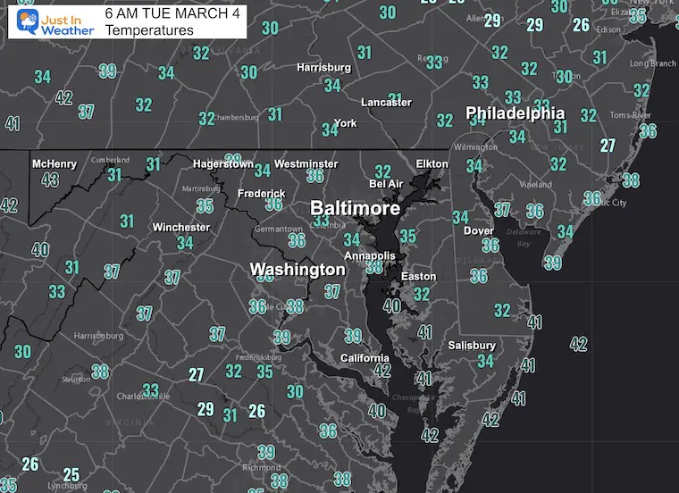
Normal Low in Baltimore: 31ºF
Record 5ºF in 2014
Normal High in Baltimore: 51ºF
Record 78ºF 1923
Baltimore Seasonal Snow
12.7”
DROUGHT UPDATE
Rainfall Deficit at BWI
- Ending 2024 = -8.00”
- Since Jan 1 = -2.44”
- We are DOWN -10.44” including last year
Local Morning Temperatures
High Temperatures
WEDNESDAY WEATHER
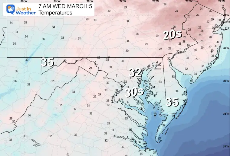
Morning Temperatures
A seasonally cold start to the day.
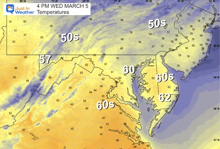
Afternoon Temperatures
We may remain warm after the storm line passes…
Radar Simulation: NCEP WRF Model
Wednesday: 7 AM to 7 PM
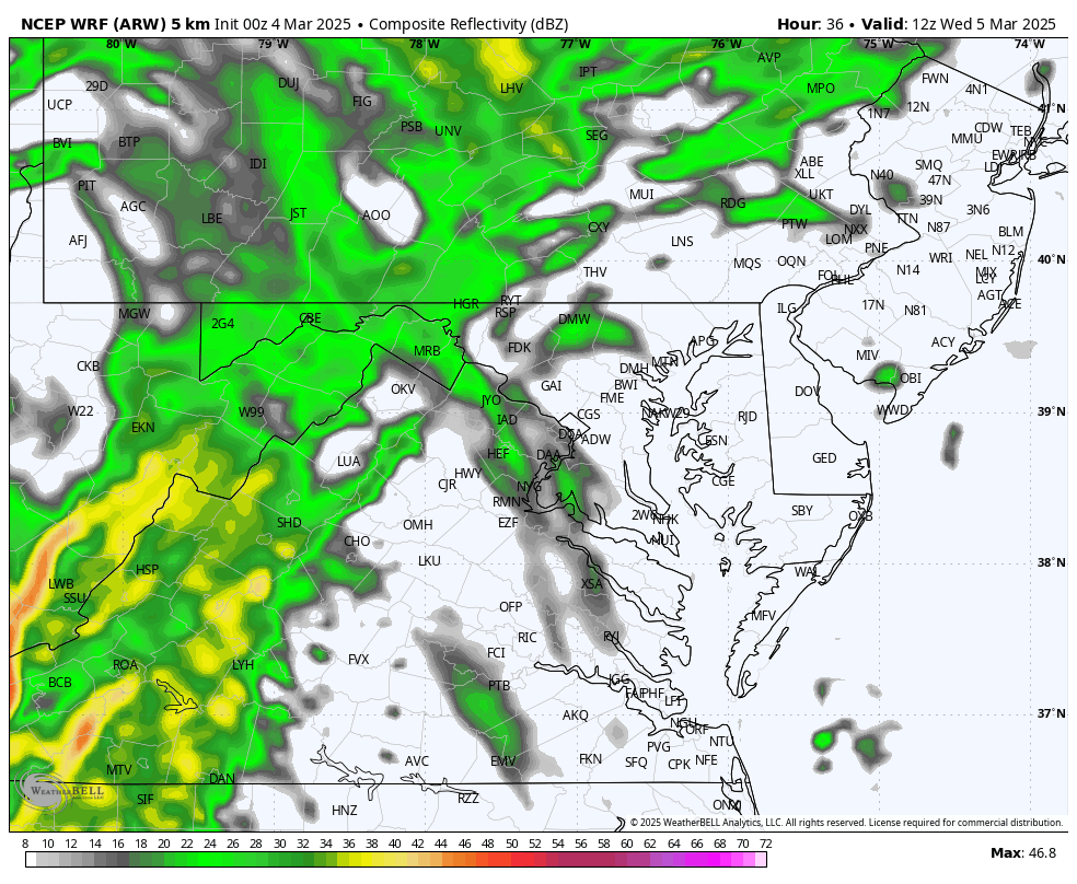
Suggested Timeline Snapshots
12 PM
2 PM

4 PM
Peak Wind Gusts
This is a broad brush of winds, but individual severe storm cells can produce 60 to 70 mph gusts.
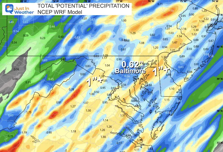
Rainfall Potential
This is subject to individual storm cells. The odds are a range of 0.50” to 1.00” rain, but as storm cells pulse along that line, there will be spots that are below and above those marks.
Jet Stream Forecast: Wednesday March 5 to Sunday March 9
The surge of cold air will be followed by a winter-looking pattern.

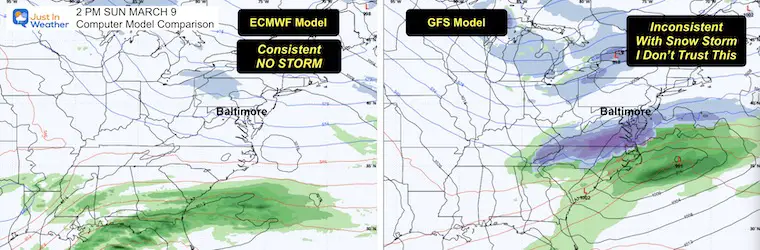
Weekend Snow Storm? I Don’t Think So
The set up with the cold air is not seen the same way between the European and GFS Models.
The ECMWF has consistently shown no storm, while the GFS has been trying and then losing a coastal snow event. Like much of this winter, I believe this inconsistency in model projections has low confidence. That is why I have NOT played this up like you may have seen on other pages.
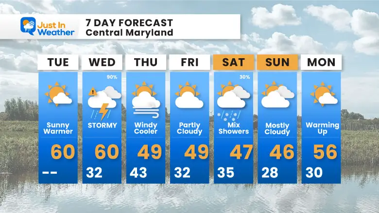
7 Day Forecast
After the severe storms pass, colder winds will flow back in.
This weekend may bring showers with a mix of rain and snow… I remain skeptical of much more.
Subscribe for eMail Alerts
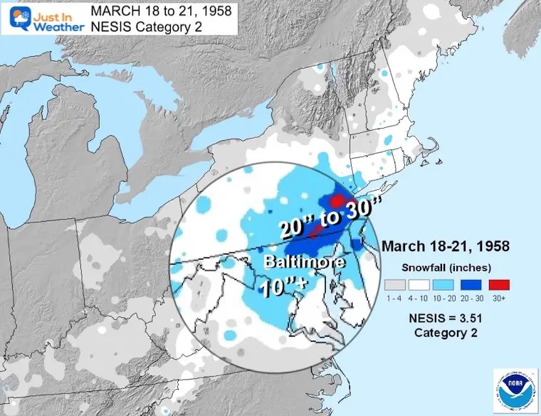
March Madness: History of Extreme Weather and Late Season Snow
Click here for the full report:
SNOW REPORTS THIS SEASON
Click on the maps for that full report.
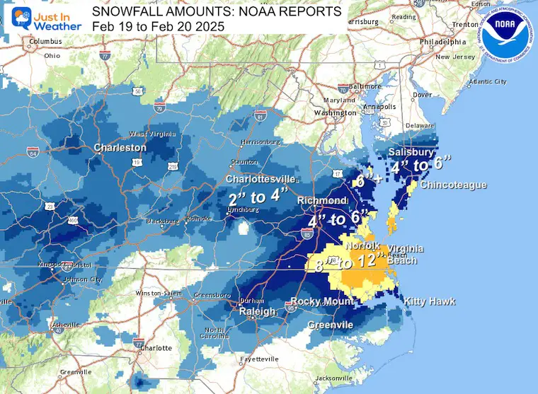
Just A Bit Outside Feb 19
Brief Recap Of The Record Snow For Virginia and the abrupt change from the longer range potential track.
February 11 Snow Report And Grade My Forecast
click here or the map for more

January 19 Snow Report

January 11 Snow Report

January 6 Snow Report

Previous Snow

ALSO SEE
Recent Snow Reports
La Nina Advisory January 2025
Full Report 
MY WINTER OUTLOOK
My Winter Outlook Report

FITF Gear on Sale

In Case You Missed This
The Faith In The Flakes Dec 5 Origin Story

Please share your thoughts and best weather pics/videos, or just keep in touch via social media.
SCHEDULE A WEATHER BASED STEM ASSEMBLY
Severe Weather: Storm Smart October and next spring Winter Weather FITF (Faith in the Flakes): November To March Click to see more and send a request for your school. 
THANK YOU:
Baltimore Magazine Readers Choice Best Of Baltimore
Maryland Trek 11 Day 7 Completed Sat August 10
We raised OVER $104,000 for Just In Power Kids – AND Still Collecting More
The annual event: Hiking and biking 329 miles in 7 days between The Summit of Wisp to Ocean City.
Each day, we honor a kid and their family’s cancer journey.
Fundraising is for Just In Power Kids: Funding Free Holistic Programs. I never have and never will take a penny. It is all for our nonprofit to operate.
Click here or the image to donate:

RESTATING MY MESSAGE ABOUT DYSLEXIA
I am aware there are some spelling and grammar typos and occasional other glitches. I take responsibility for my mistakes and even the computer glitches I may miss. I have made a few public statements over the years, but if you are new here, you may have missed it: I have dyslexia and found out during my second year at Cornell University. It didn’t stop me from getting my meteorology degree and being the first to get the AMS CBM in the Baltimore/Washington region. One of my professors told me that I had made it that far without knowing and to not let it be a crutch going forward. That was Mark Wysocki, and he was absolutely correct! I do miss my mistakes in my own proofreading. The autocorrect spell check on my computer sometimes does an injustice to make it worse. I also can make mistakes in forecasting. No one is perfect at predicting the future. All of the maps and information are accurate. The ‘wordy’ stuff can get sticky. There has been no editor who can check my work while writing and to have it ready to send out in a newsworthy timeline. Barbara Werner is a member of the web team that helps me maintain this site. She has taken it upon herself to edit typos when she is available. That could be AFTER you read this. I accept this and perhaps proves what you read is really from me… It’s part of my charm. #FITF


