More Snow To Discuss With Arctic Air And The Buzz Around The Polar Vortex Next Week
Tuesday, January 14 2025
With the anticipation of one of the coldest air masses in years on the way, there will be some active weather. I want to address a few things in this report, which has two reasons behind it:
- A couple of my clients have been asking about the potential snow events as it affects their business plans. So I will be paying close attention and want to share my thoughts with you.
- Sunday evening is the Ravens playoff game in Buffalo. In my home base Baltimore area, there may be some game watch parties that could be impacted if we do get snow.
Let’s take a look:
Headlines:
- Thursday will see snow showers or even steady light snow across the northern half of our region.
- Saturday may bring rain showers ahead of the arctic front.
- Sunday is primed to produce snow in the cold air after the front passes.
- Raven Game watch parties may be affected.
- Monday is MLK Day, so schools and many businesses will be closed, and the residual effects will be mitigated.
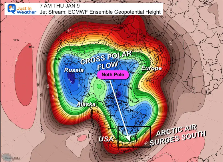
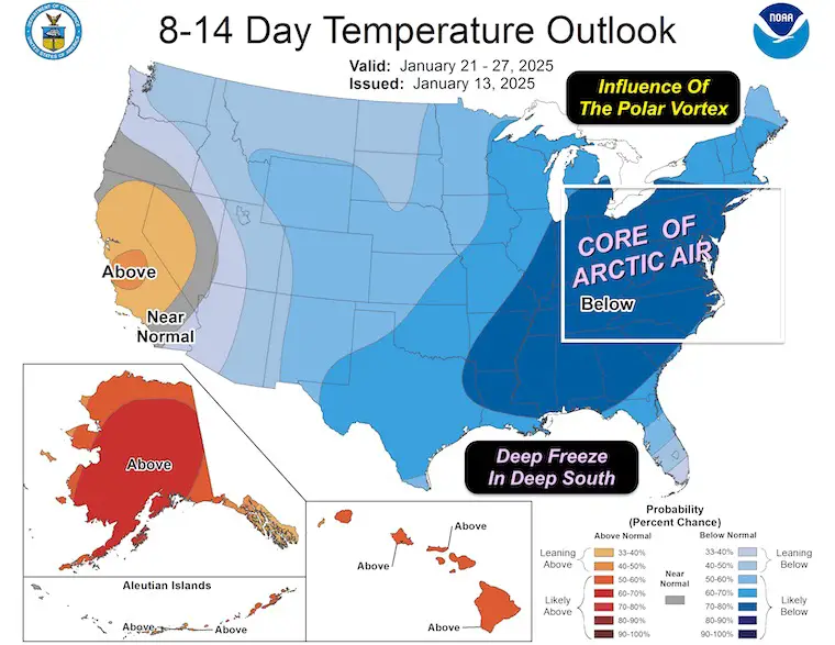
- The Polar Vortex: It’s not exactly coming to the US. A lobe will skim Southern Canada and push arctic air deep into the Eastern US.
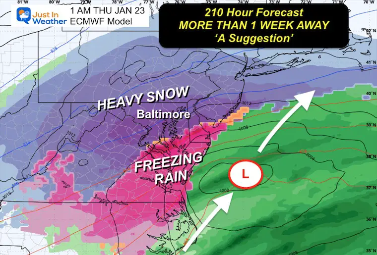
- There is a ‘HINT’ of a larger coastal storm next week. I do not like to show weather maps more than one week away… but this type of air mass will historically try to develop something, and I want to use this benchmark for comparison going forward.
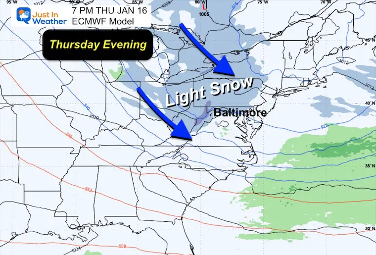
Thursday Evening
The next impulse will bring light snow into the region. This will result in snow showers, but there is potential for a band of light, steady snow to produce a coating or small accumulation.
Looking At The Weekend
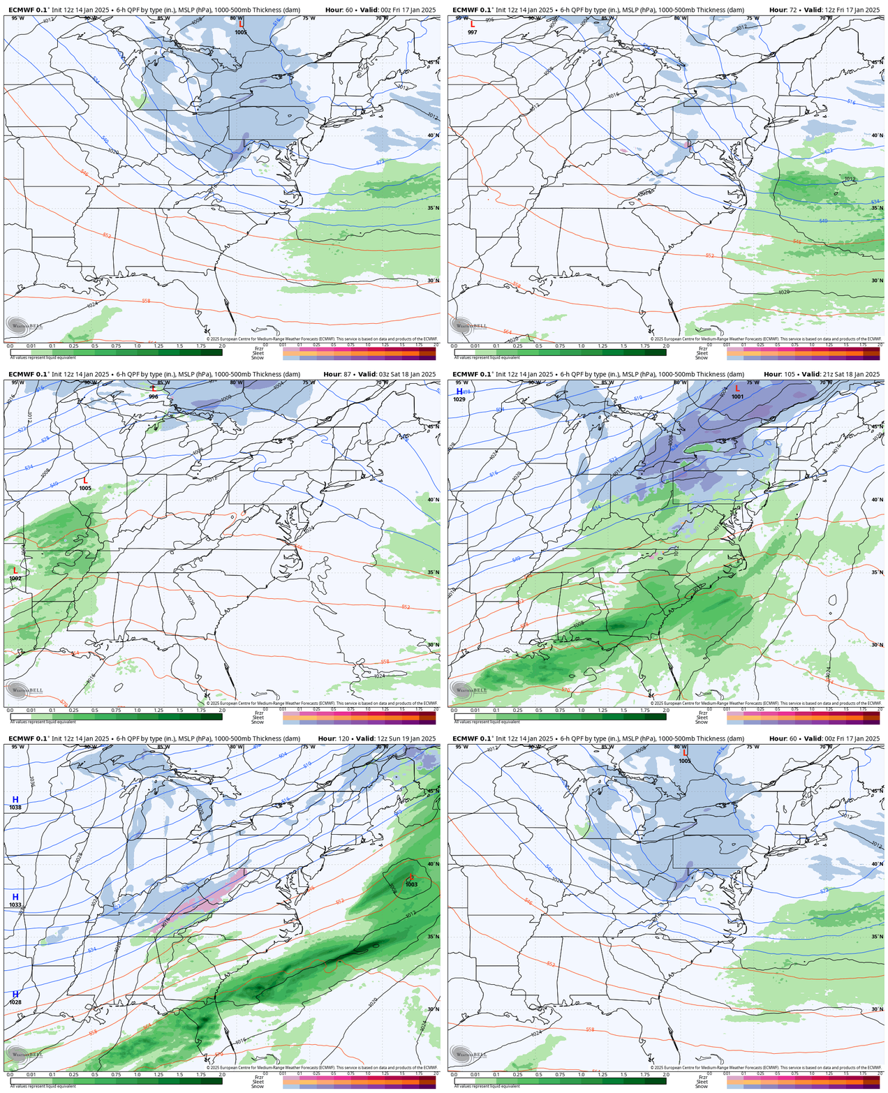
Here is the forecast animation from Thursday Night to Sunday Morning. This will help show how the light rain on Saturday will move through, allowing for colder air to follow.
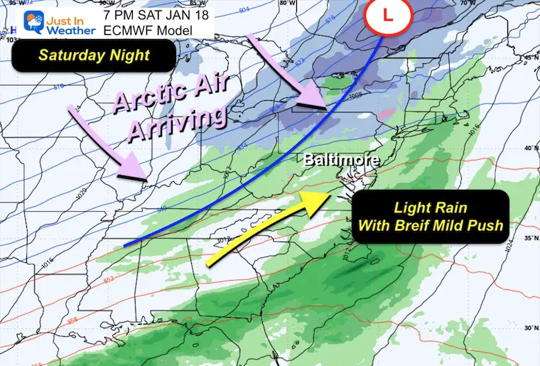
Saturday Night Surface Weather
Heading into the weekend, warmer air will flow into the Mid-Atlantic, causing rain showers before the next round of cold air arrives.
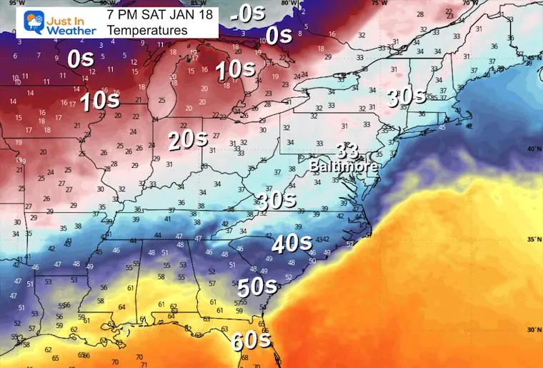
Saturday Night Temperatures
The leading edge of Arctic air will be crossing the Northern Plains and dropping to both the Gulf Coast and East Coast of the US.
SUNDAY WEATHER
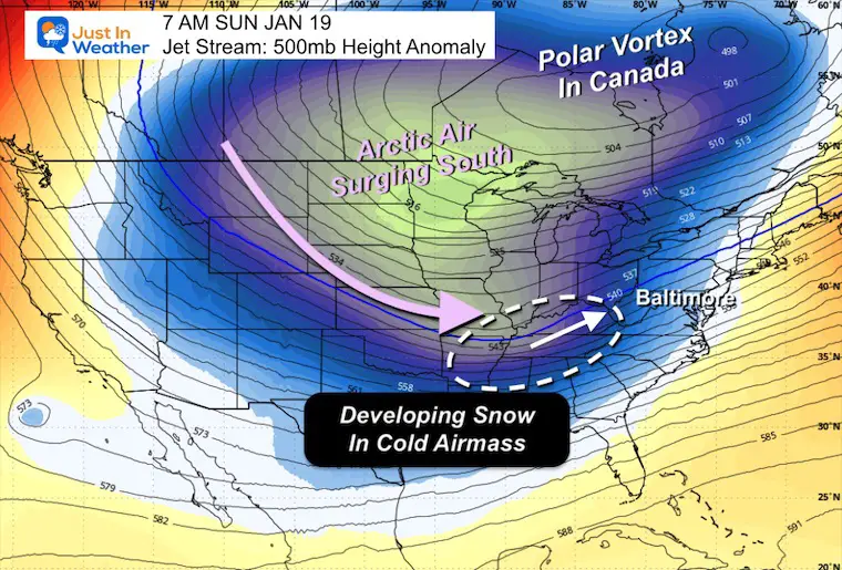
Sunday Morning Jet Stream at 500mb
This map does reflect temperatures around 18,000 Ft. I need to clarify that the actual Polar Vortex is not represented here, and it will be in Southeastern Canada. The ‘Influence’ will push the core of arctic air into the US and our way.
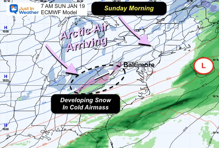
Sunday Morning Surface Weather
As this arctic air interacts with the frontal boundary, it will develop a cluster of light snow and freezing rain. This is the region to watch to grow and move to the Northeast.
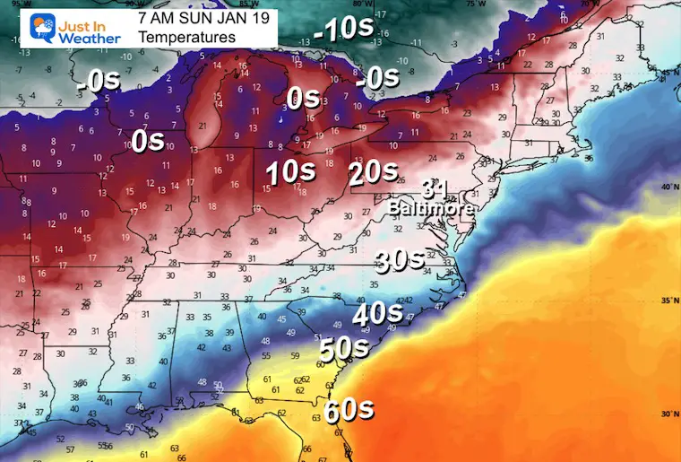
Sunday Morning Temperatures
Here, we get the idea of the cold air. While we will be just into the freezing air, single digits and below zero temperatures will continue to move our way…. It will take a few days until the coldest of the air reaches the East Coast.
Sunday Night
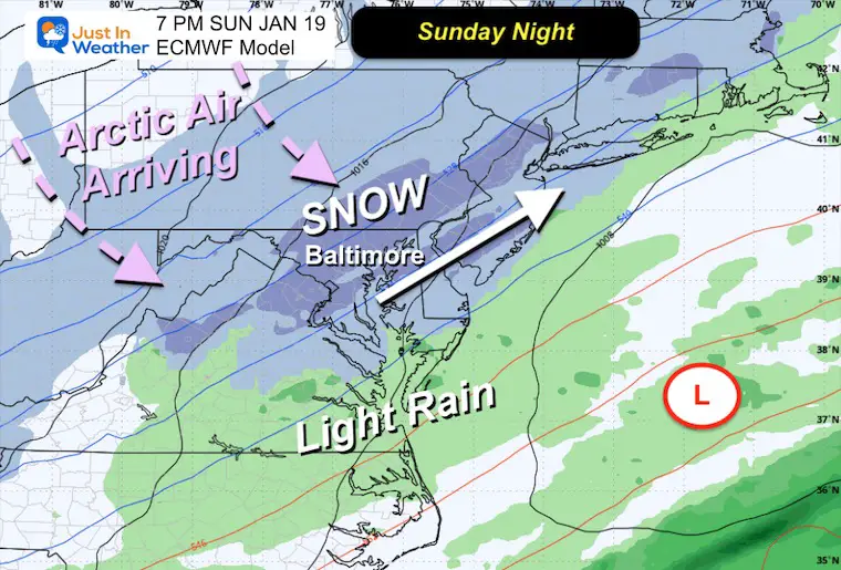
I am using the European ECMWF Model based on being the most reliable all winter within this time frame.
Here, we see that impulse of snow tracking directly over metro Baltimore, Central Maryland, and the Mid-Atlantic.
If this plays out, there will be snow starting mid-day that could last into the night.
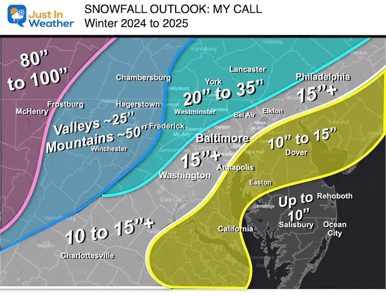
Temperatures will be in the 20s or colder, so the snow will be light, and all that falls can stick. However, it is too early to talk about accumulation numbers. I reserve the first look at that until 72 hours ahead… If this holds, I will give my first call for snowfall on Thursday.
NOTE: This is the time of the Ravens game, so watch parties may need a backup plan.
Model Comparisons
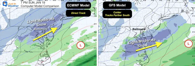
The Euro vs. the GFS Model… which has not shown good performance (so far) in the 5-day forecast window. Then why show it? Well, many weather apps use this model, so it may reflect what is on your phone. I also still hold out options since no computer guidance is always correct.
ECMWF Model 7 AM Sun to 7 AM Thu
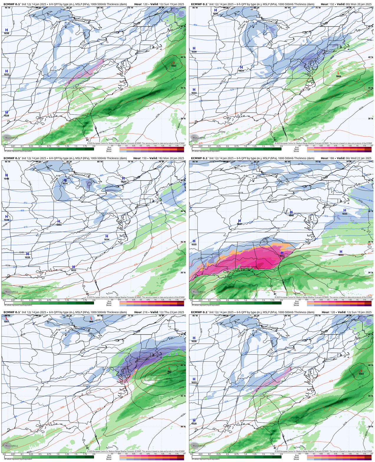
Here, we will see the first impulse of Sunday snow. Then, as the arctic air hits the Gulf Coast, a new storm can form.
If this does play out, then it has the potential to ride the jet stream on the edge of that arctic air up the East Coast.
If this does occur, the timing for snow could be Wednesday into Thursday.
Snapshot 1 AM Thursday, January 23
This is an ideal major snowstorm season setup up AND I do not believe it (yet)
NOTE: This is a 210-Hour Forecast, longer than one week away. This is beyond my comfort zone and not in my policy to show. I am posting it here in this article for posterity. I will not show it on social media until we hit that 7-day window.
If this does hold, then this model will get a lot of credit. However, I expect there will be some adjustments based on the timing of energy along the way.
My guess is that something different will occur… Often, we end up with a storm earlier than first shown…
I will be making changes in each model run for both timing and if this trends in any direction with the track.
NOAA Temperature Outlook
Valid Jan 21 to Jan 27
Subscribe for eMail Alerts
Weather posts straight to your inbox
Sign up and be the first to know!
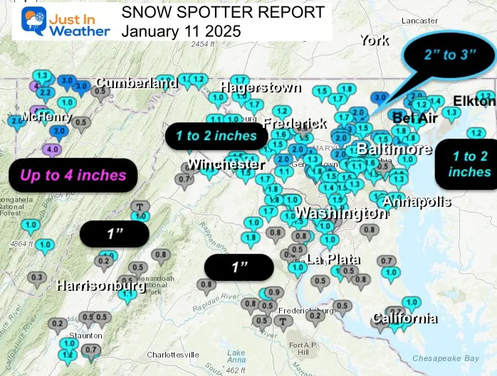
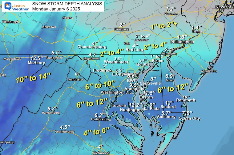
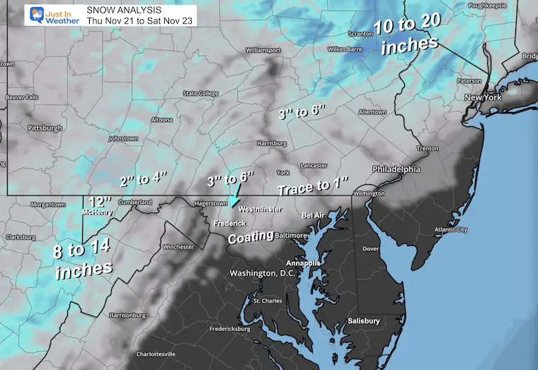
SNOW REPORTS THIS SEASON
Click on the maps for that full report.
January 11 Snow Report
January 6 Snow Report
Previous Snow
November 22 Snow Report
ALSO SEE
Arctic Outbreak For January
If you missed it, here is my detailed report from December 30 about why this IS A BIG DEAL!
MY WINTER OUTLOOK
FITF Gear on Sale
In Case You Missed This
The Faith In The Flakes Dec 5 Origin Story
Please share your thoughts and best weather pics/videos, or just keep in touch via social media.
-
Facebook: Justin Berk, Meteorologist
-
Twitter
-
Instagram
SCHEDULE A WEATHER BASED STEM ASSEMBLY
Severe Weather: Storm Smart October and next spring Winter Weather FITF (Faith in the Flakes): November To March Click to see more and send a request for your school.
THANK YOU:
Baltimore Magazine Readers Choice Best Of Baltimore
Maryland Trek 11 Day 7 Completed Sat August 10
We raised OVER $104,000 for Just In Power Kids – AND Still Collecting More
The annual event: Hiking and biking 329 miles in 7 days between The Summit of Wisp to Ocean City.
Each day, we honor a kid and their family’s cancer journey.
Fundraising is for Just In Power Kids: Funding Free Holistic Programs. I never have and never will take a penny. It is all for our nonprofit to operate.
Click here or the image to donate:
RESTATING MY MESSAGE ABOUT DYSLEXIA
I am aware there are some spelling and grammar typos and occasional other glitches. I take responsibility for my mistakes and even the computer glitches I may miss. I have made a few public statements over the years, but if you are new here, you may have missed it: I have dyslexia and found out during my second year at Cornell University. It didn’t stop me from getting my meteorology degree and being the first to get the AMS CBM in the Baltimore/Washington region. One of my professors told me that I had made it that far without knowing and to not let it be a crutch going forward. That was Mark Wysocki, and he was absolutely correct! I do miss my mistakes in my own proofreading. The autocorrect spell check on my computer sometimes does an injustice to make it worse. I also can make mistakes in forecasting. No one is perfect at predicting the future. All of the maps and information are accurate. The ‘wordy’ stuff can get sticky. There has been no editor who can check my work while writing and to have it ready to send out in a newsworthy timeline. Barbara Werner is a member of the web team that helps me maintain this site. She has taken it upon herself to edit typos when she is available. That could be AFTER you read this. I accept this and perhaps proves what you read is really from me… It’s part of my charm. #FITF


