Monday September 30, 2024
Morning Report
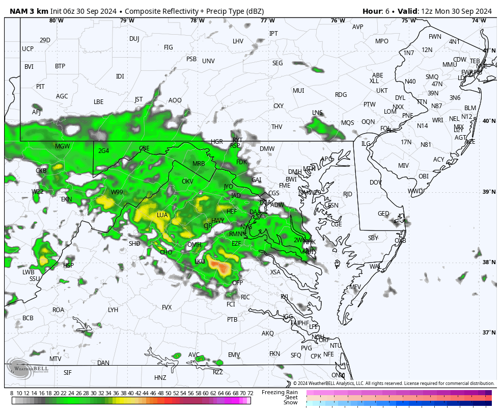
The work week starts off wet with bands of rain from central Maryland and westward, while there is drizzle and fog around the bay and eastward.
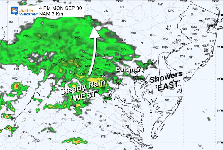
The remaining energy from Helene will move through today and tomorrow, expanding the rain to the east. More rain will fall tomorrow, which may affect the Baltimore Orioles’ first home game.
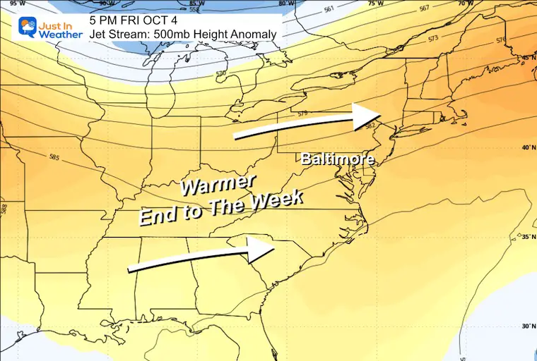
The pattern will break, and the sun and warmer temps will be back for the end of the week.
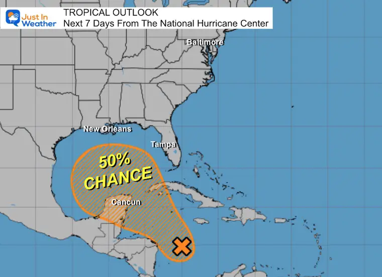
Looking farther ahead, there is a chance for another tropical storm forming in the Gulf of Mexico next weekend, but this one is NOT the same.
Live Radar Widget
Monday morning starts with mist and fog, along with spotty showers. They may not all show on radar, but we can see some of the rain.
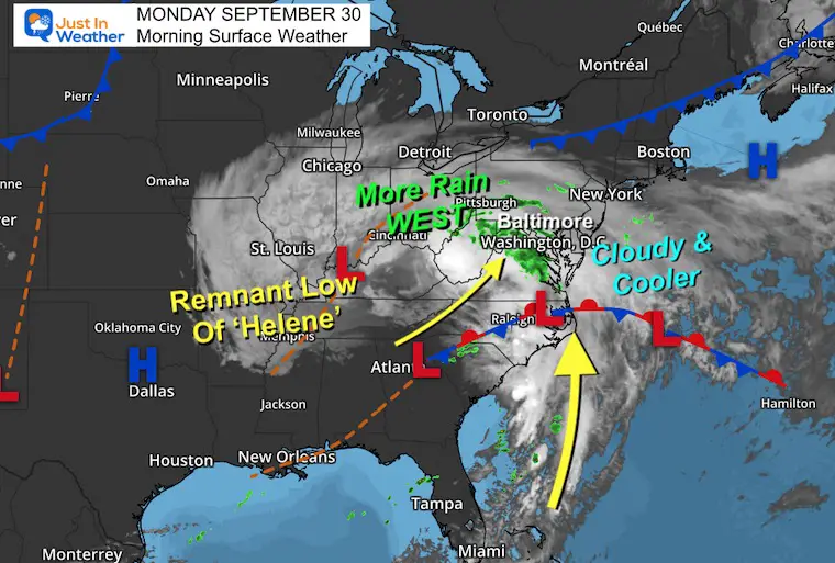
Morning Surface Weather
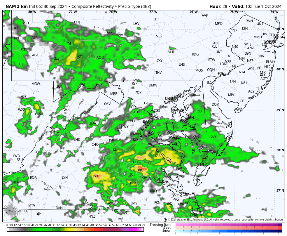
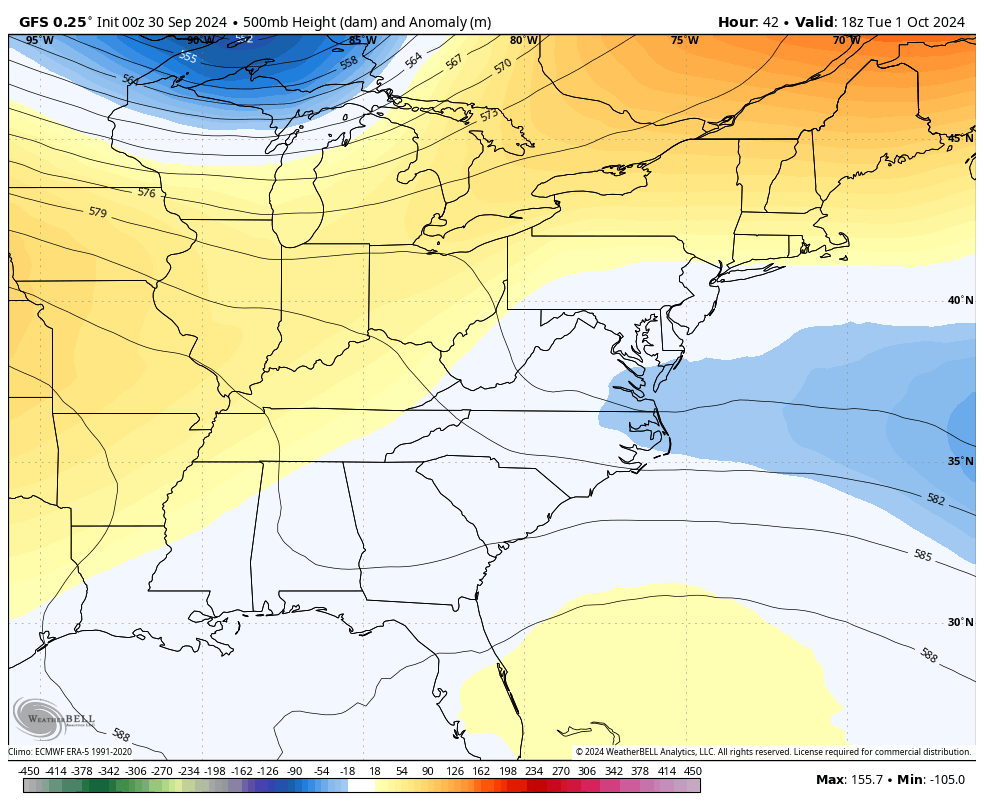
The remains of Helene are still spinning across The Ohio Valley. Bands of rain are steady farther inland and pivoting into Central Maryland. The larger circulation is still pulling tropical moisture up along the East Coast to the North.
This will take two more days to finally move through and off the East Coast.
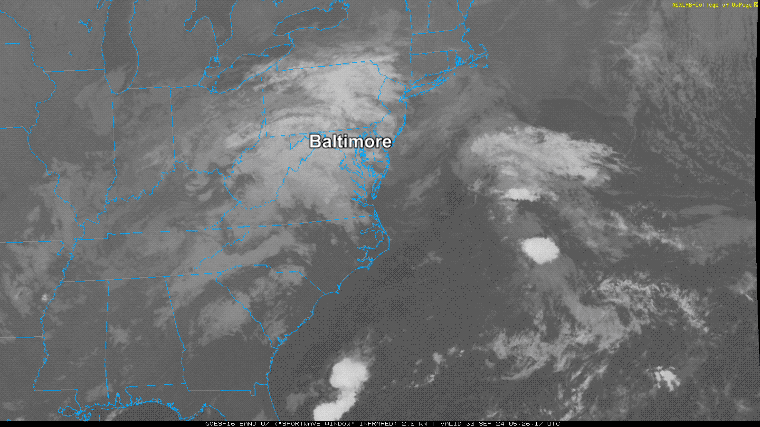
Morning Satellite Loop
The large-scale circulation shows the spin of the Remnant Low from Helene (merging with the Upper-Level Low) and the influence of clouds across the Eastern US.
Radar Simulation 8 AM to Midnight
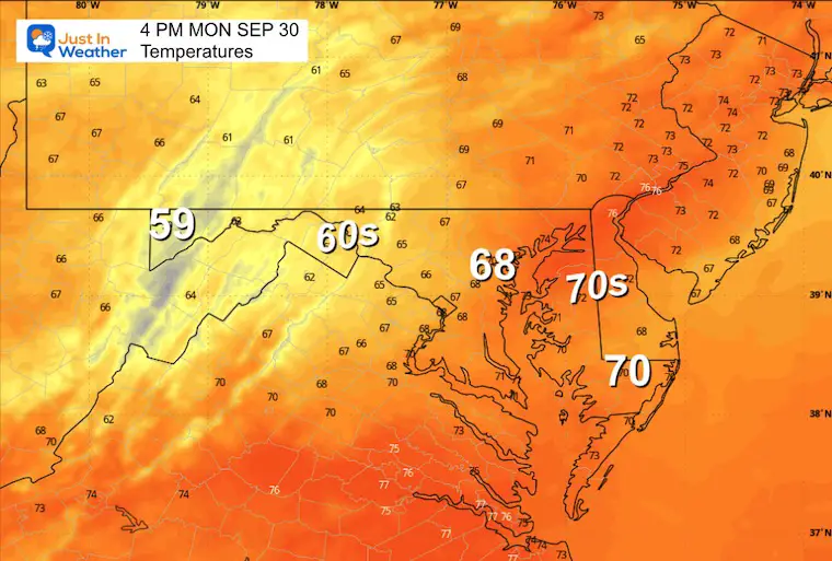
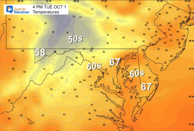
Snapshot at 4 PM
Afternoon Temperatures
EXTENDED AND TROPICAL FORECASTS BELOW
CLIMATE DATA: Baltimore
TODAY September 30
Sunrise at 7:02 AM
Sunset at 6:50 PM
Normal Low in Baltimore: 53ºF
Record 39ºF in 1888
Normal High in Baltimore: 74ºF
Record 92ºF 1986
TUESDAY OCTOBER 1
Temperatures:
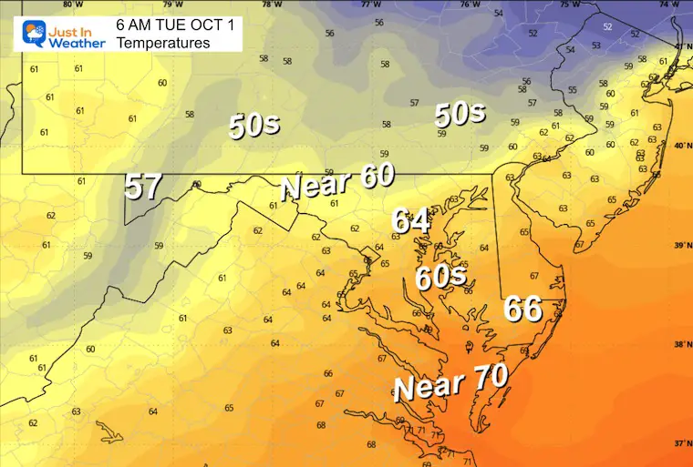
The small range from morning to afternoon is a result of the added moisture in the air.
Morning Low
Morning Radar Snapshot
The morning is likely to start off wet.
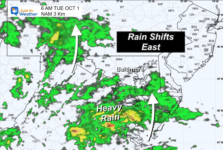
Rain Simulation: 6 AM to 8 PM
More rain will expand east, and may be heavy at times.
Afternoon High
LOOKING AHEAD: Jet Stream
Tuesday Afternoon to Friday Afternoon
After this storm moves off the coast, it will open up a warmer flow from the Jet Stream.
Friday
This may be the best day of the week. The upper air flow supports sunshine and temps back to the 80s.
Tropical Outlook From National Hurricane Center
As of this morning, there is still a 50% chance that ‘something’ will develop in the next 7 days! This is the same region where Helene came from, but it is NOT the same thing!!
NOTE: It is IMPOSSIBLE to plot a tropical event BEFORE there is a central Low Pressure identified and plotted on a map. So, any forecast tracks you may have seen are bogus.
NEXT MONDAY: 8 DAYS AWAY
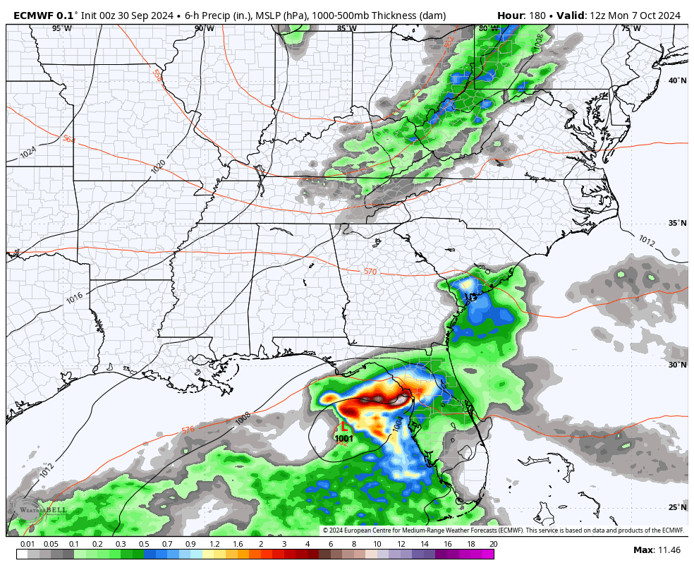
ECMWF Model
This shows something off Florida’s west coast, moving EASTWARD and crossing Florida.
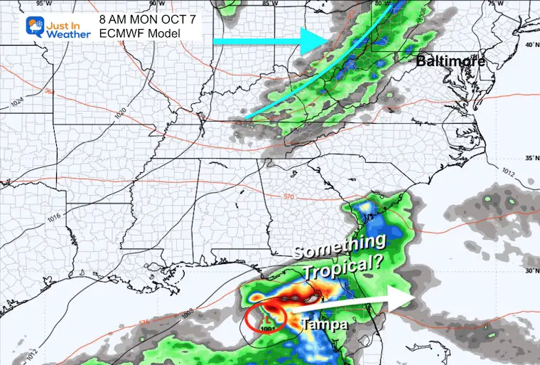
Animation: October 7 to 9
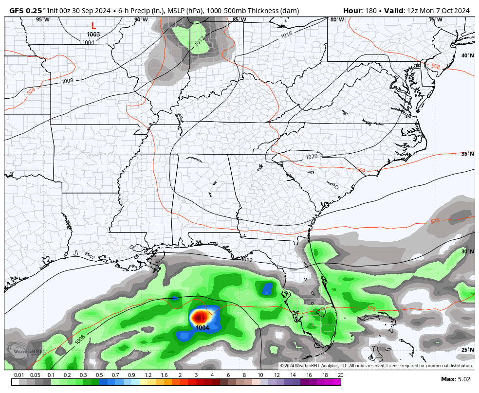
GFS Model
This shows something in the central Gulf of Mexico, less organized, farther away, and leading ahead of the primary low….This is also moving EASTWARD crossing Florida.
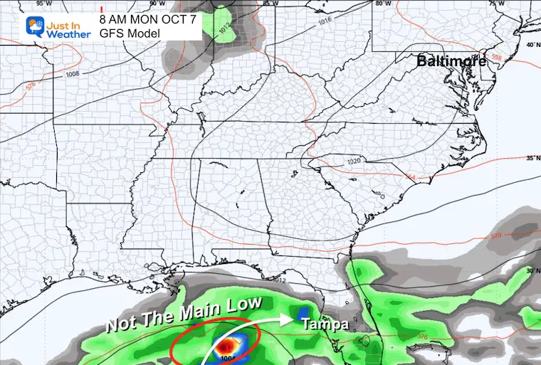
Animation: October 7 to 9
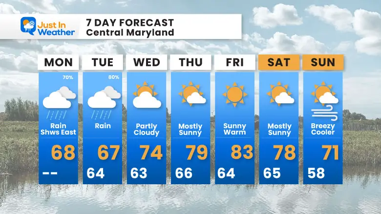
7 Day Forecast
The remains of Helene are still affecting us with rain for a few days.
The steady and even heavy rain will be more widespread and shift eastward on Tuesday. Then it will break up, and with the sun returning, temps will warm up to end the work week.
Note this may affect the playoff game schedule for the Orioles at Camden Yards.
Please share your thoughts and best weather pics/videos, or just keep in touch via social media.
SCHEDULE A WEATHER BASED STEM ASSEMBLY
Severe Weather: Storm Smart October and next spring
Winter Weather FITF (Faith in the Flakes): November To March
Click to see more and send a request for your school.

ALSO SEE
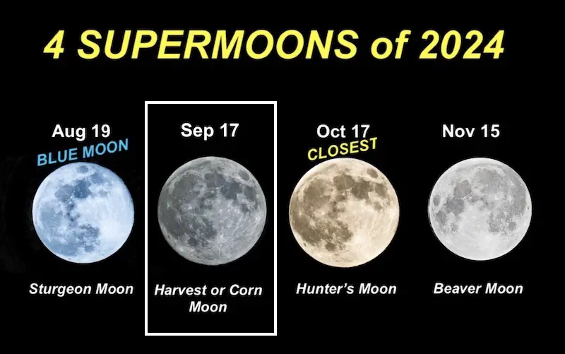
SECOND OF FOUR FULL SUPERMOONS
Click to see the full report:
THANK YOU:
Baltimore Magazine Readers Choice Best Of Baltimore
Maryland Trek 11 Day 7 Completed Sat August 10
We raised OVER $104,000 for Just In Power Kids – AND Still Collecting More
The annual event: Hiking and biking 329 miles in 7 days between The Summit of Wisp to Ocean City.
Each day, we honor a kid and their family’s cancer journey.
Fundraising is for Just In Power Kids: Funding Free Holistic Programs. I never have and never will take a penny. It is all for our nonprofit to operate.
Click here or the image to donate:

RESTATING MY MESSAGE ABOUT DYSLEXIA
I am aware there are some spelling and grammar typos and occasional other glitches. I take responsibility for my mistakes and even the computer glitches I may miss. I have made a few public statements over the years, but if you are new here, you may have missed it: I have dyslexia and found out during my second year at Cornell University. It didn’t stop me from getting my meteorology degree and being the first to get the AMS CBM in the Baltimore/Washington region.
One of my professors told me that I had made it that far without knowing and to not let it be a crutch going forward. That was Mark Wysocki, and he was absolutely correct! I do miss my mistakes in my own proofreading. The autocorrect spell check on my computer sometimes does an injustice to make it worse. I also can make mistakes in forecasting. No one is perfect at predicting the future. All of the maps and information are accurate. The ‘wordy’ stuff can get sticky.
There has been no editor who can check my work while writing and to have it ready to send out in a newsworthy timeline. Barbara Werner is a member of the web team that helps me maintain this site. She has taken it upon herself to edit typos when she is available. That could be AFTER you read this. I accept this and perhaps proves what you read is really from me… It’s part of my charm. #FITF


