August 30 Cooler Ocean Winds And Lightning By The Beaches: NOAA Severe Risk Saturday Night
Friday, August 30, 2024
Morning Report
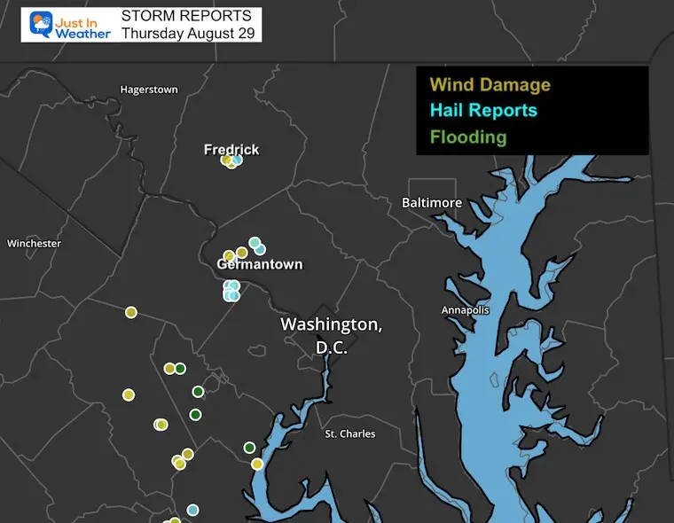
The storms that erupted around Frederick, Maryland, and parts of Montgomery County on Thursday led to some local damage reports. The overnight brought a larger complex and incredible lightning show to the beaches. Some of this continued early this morning, making some vacationers’ starts rough.
Today we will get a sustained East Wind from the ocean. This wind keeps the cooler and moist air in place producing a cloudy sky.
Saturday will bring us back to warm air and a risk for severe storms in the evening and at night. Then, on Labor Day, we will all get a fresh air mass with cooler air to help mark the end of summer.
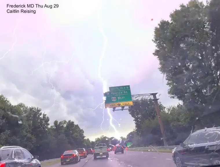
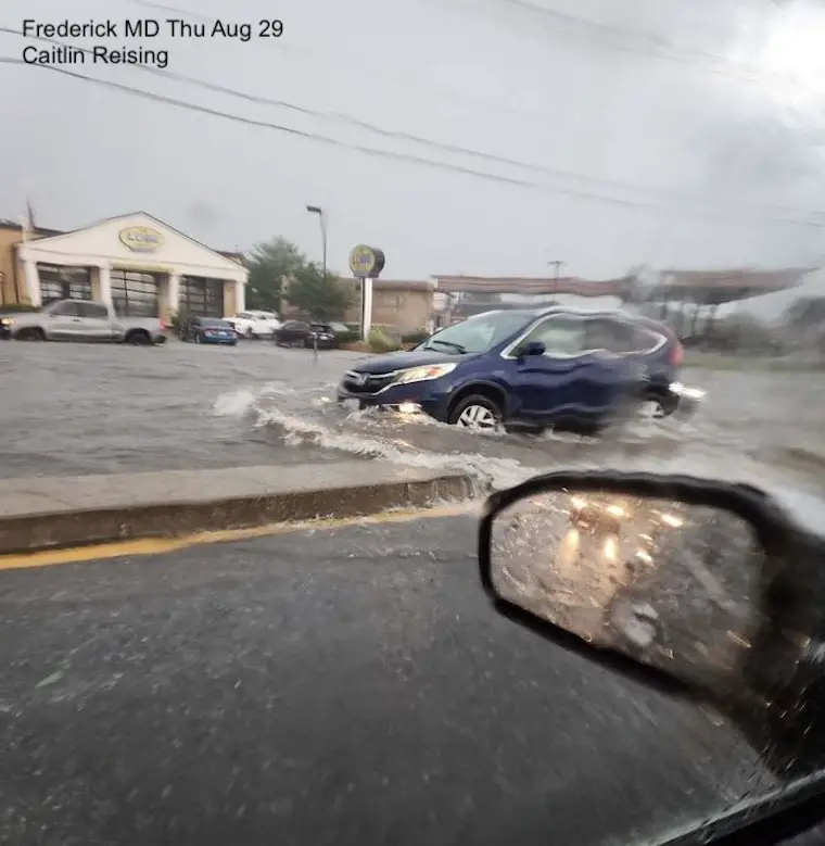
Frederick MD Storm Photos
Lightning and Street Flooding seen by Caitlin Reising
Storm Report Comments
See my Facebook Post
Storm Reports From Thursday
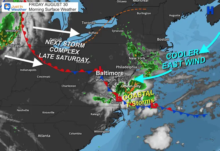
Morning Surface Weather
That same stationary front is meandering in place. A wave of Low Pressure helped cause the severe storm in Frederick, MD and kept the storms going near the beaches this morning.
LIVE RADAR WIDGET
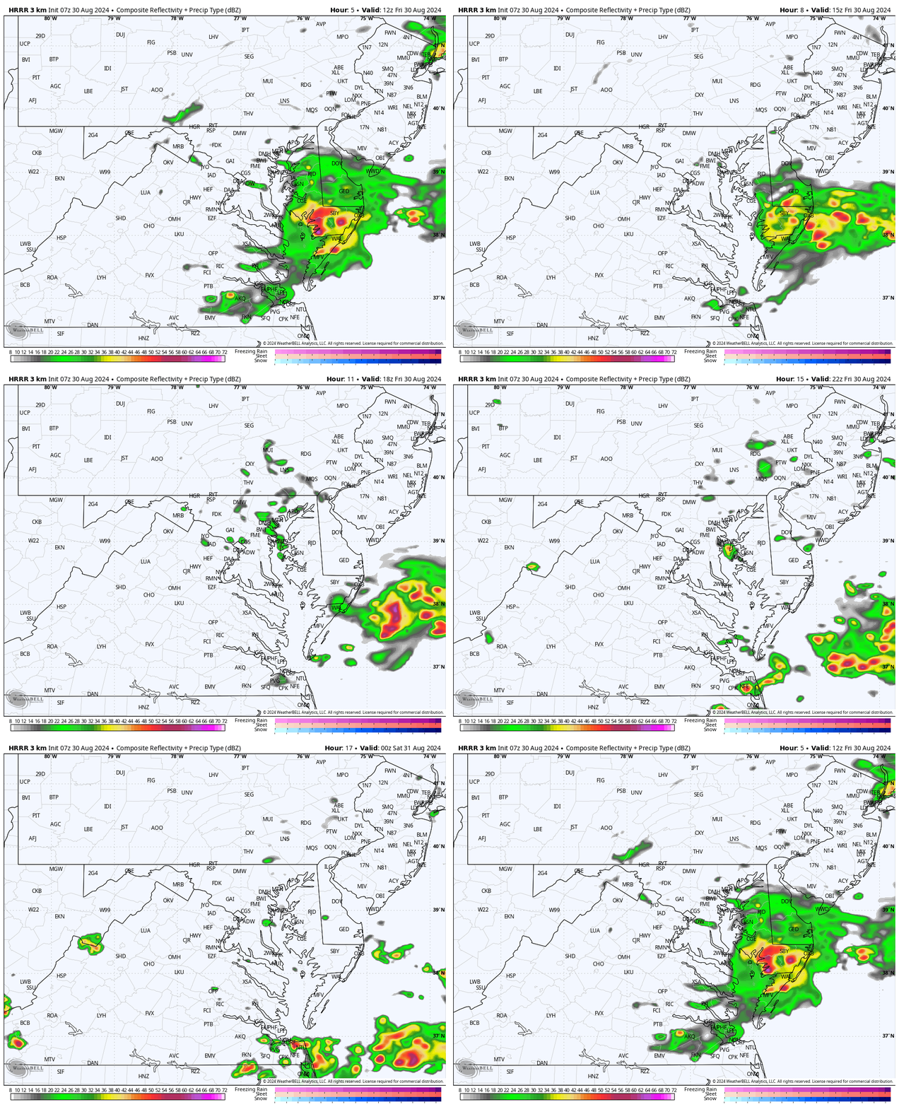
Radar Simulation 8 AM to 8 PM
Storms linger a little longer near the Beaches. With the high moisture and unstable air, we may see spotty showers in the afternoon.
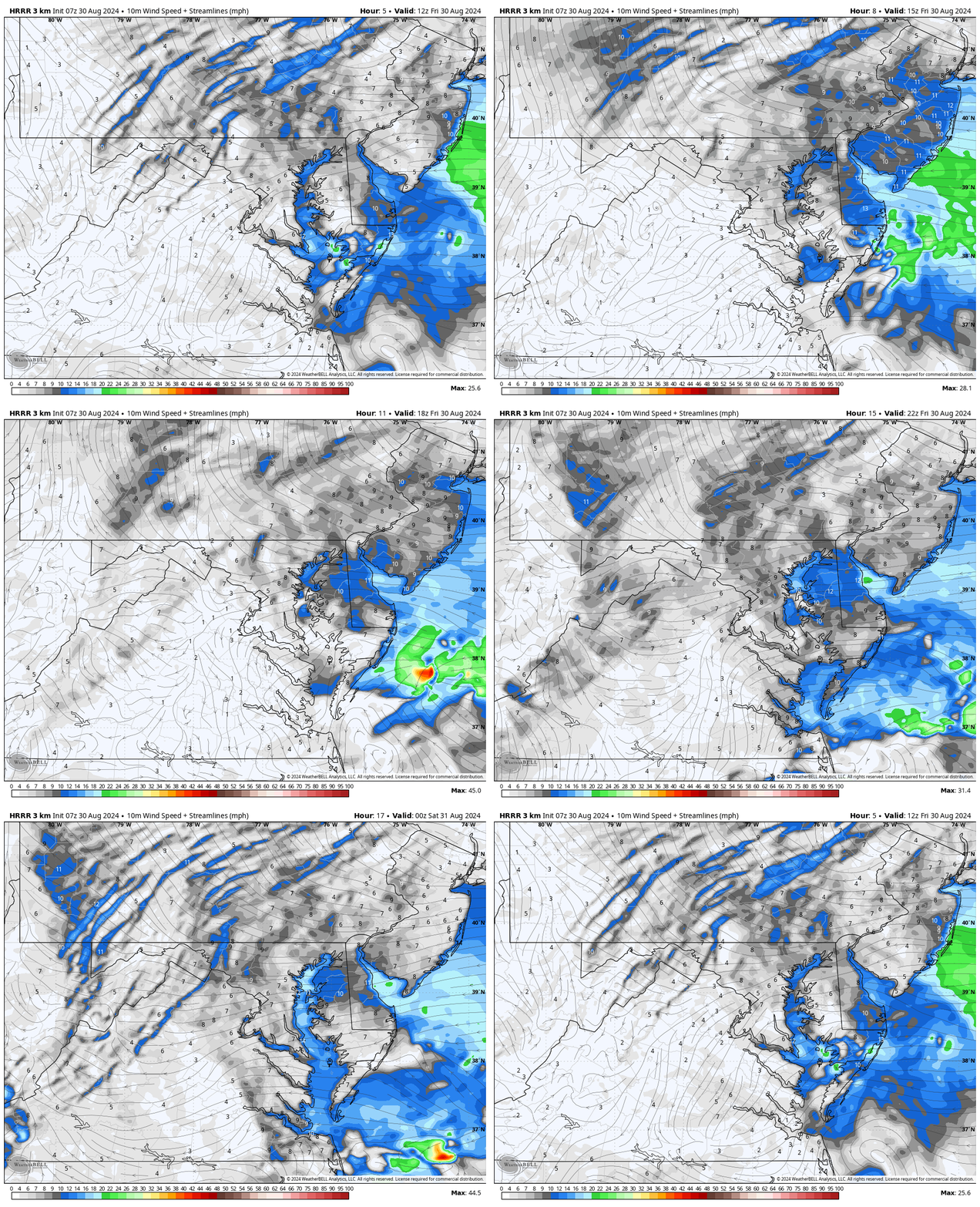
Wind Forecast 8 AM to 8 PM
- These winds increasing FROM the East and Northeast will do two things:
- Cooler temperatures
- Rip Currents along the beaches
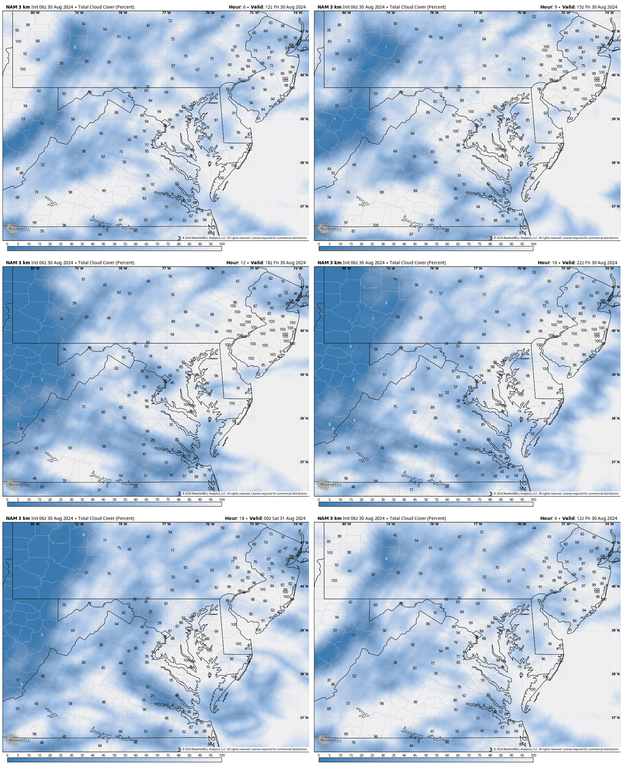
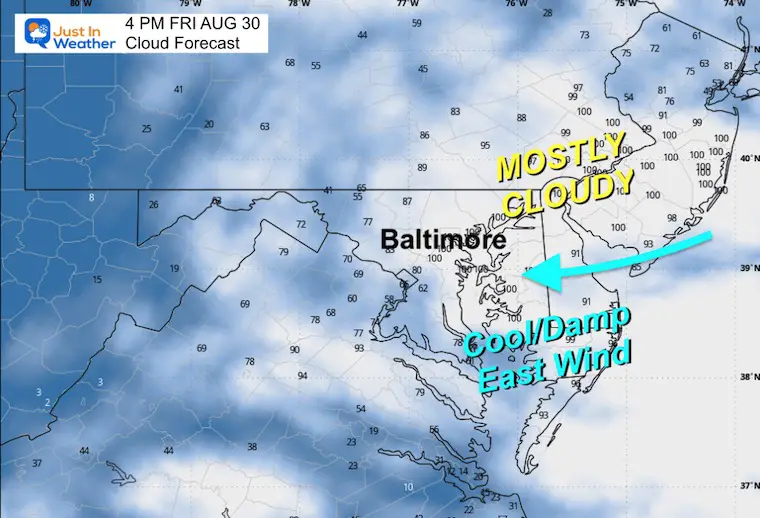
Cloud Forecast 8 AM to 8 PM
Mostly Cloudy!
Snapshot at 4 PM
The east wind will keep the unstable moist air in place.
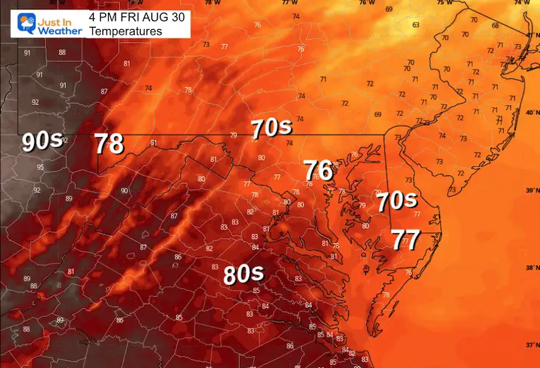
Temperatures
If there are some breaks of sun by you, then a slight boost in temps are possible. But most remain cooler.
August High Temperatures breakdown in Baltimore so far
- 100s = 2
- 90s = 7
- 80s = 17
- 70s = 3
Comparing historic heat waves that have NOT been challenged for more than half a century.
1968 August Record Heat Wave
- 23rd = 98ºF
- 24th = 98ºF
- 25th = 97ºF
1948 August Record Heat Wave
- 26th = 101ºF
- 27th = 102ºF
- 28th = 101ºF
1953 August Record Heat Wave
- 29th = 100ºF
- 30th = 101ºF
- 31st = 102ºF
EXTENDED FORECAST BELOW
CLIMATE DATA: Baltimore
TODAY August 30
Sunrise at 6:34 AM
Sunset at 7:39 PM
Normal Low in Baltimore: 64ºF
Record 45ºF in 1986
Normal High in Baltimore: 85ºF
Record 101ºF 1953
Summer Hot Day Totals At BWI
8 Days at or above 100ºF
41 Days total at or above 90ºF
SATURDAY AUGUST 31
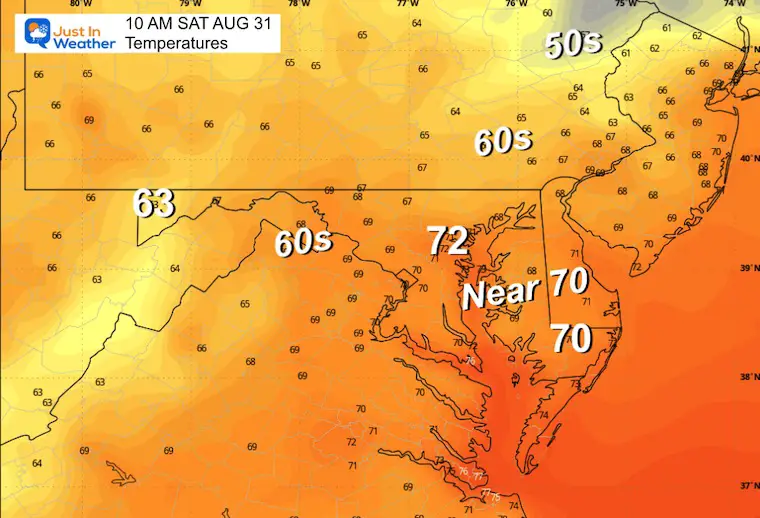
Morning Temperatures
A foggy start is likely due to the added humidity. This also keeps the temperatures close to where they were the prior afternoon.
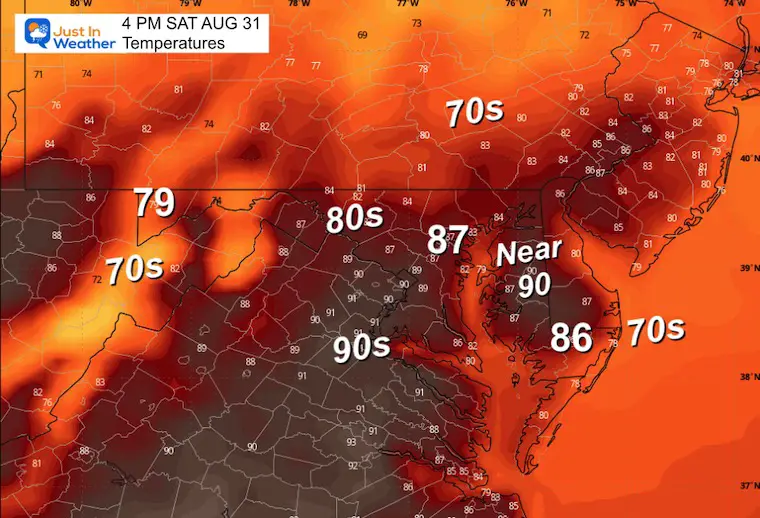
Afternoon Temperatures
Warming back up with more sunshine. Also, high humidity.
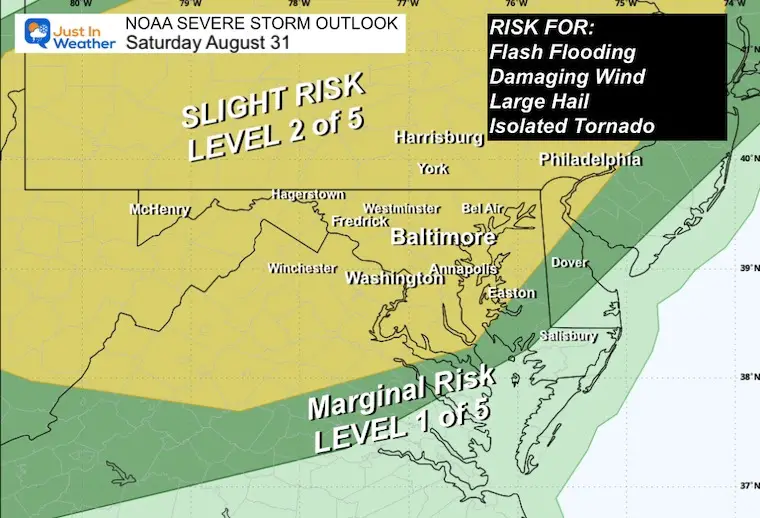
NOAA Severe Storm Risk
The timing for this to push through southern PA and Maryland is after dark.
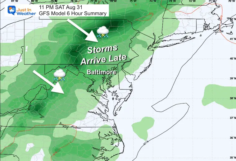
Saturday Night
The best chance for the storm line to cross the Mid-Atlantic will be after dark and overnight.
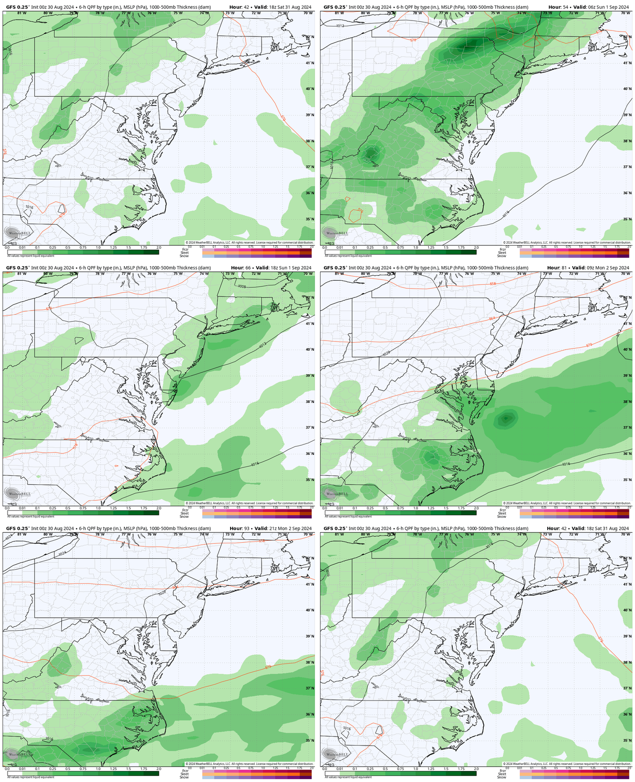
Labor Day Weekend Forecast: Saturday to Monday
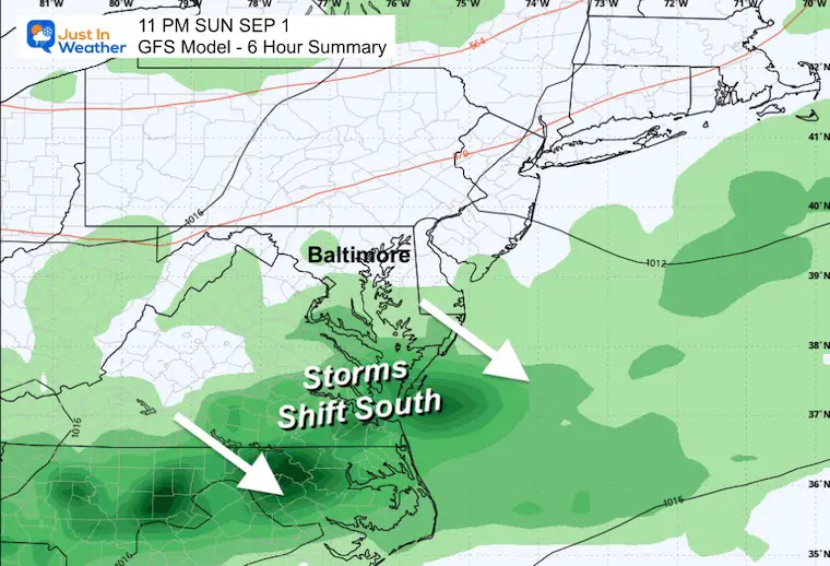
Sunday Night
Shifting the focus of rain and storms to the south.
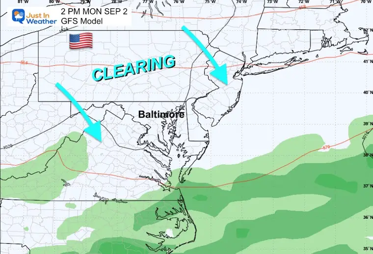
Labor Day Monday
Clearing and improving weather.
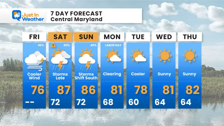
7 Day Forecast
Briefly warmer this weekend with the best chance for strong to severe storms Saturday night! The storms shift south on Sunday, and then cooler air builds in for all on Labor Day through next week.
Next week: Clearing and sustained cooler temperatures.
Please share your thoughts and best weather pics/videos, or just keep in touch via social media.
-
Facebook: Justin Berk, Meteorologist
-
Twitter
-
Instagram
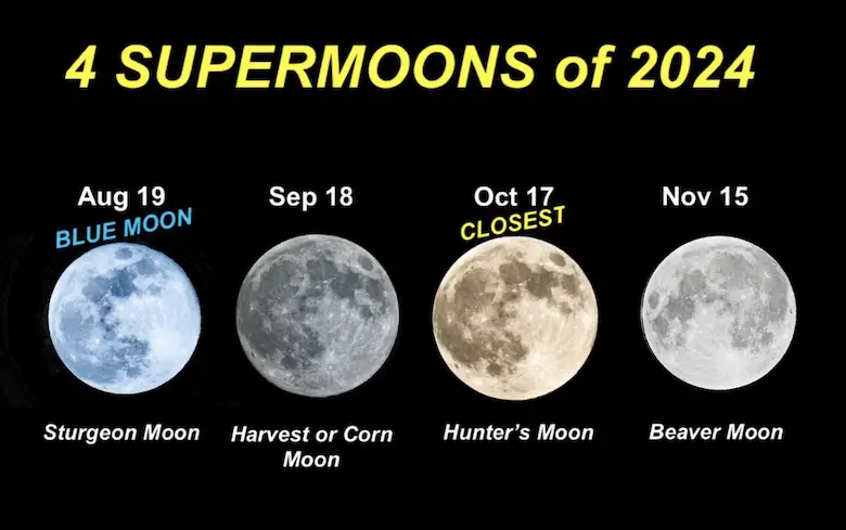
Four Supermoons In A Row
See more about the 4 Supermoons Through November here:
THANK YOU:
Baltimore Magazine Readers Choice Best Of Baltimore
Maryland Trek 11 Day 7 Completed Sat August 10
We raised OVER $104,000 for Just In Power Kids – AND Still Collecting More
The annual event: Hiking and biking 329 miles in 7 days between The Summit of Wisp to Ocean City.
Each day, we honor a kid and their family’s cancer journey.
Fundraising is for Just In Power Kids: Funding Free Holistic Programs. I never have and never will take a penny. It is all for our nonprofit to operate.
Click here or the image to donate:
RESTATING MY MESSAGE ABOUT DYSLEXIA
I am aware there are some spelling and grammar typos and occasional other glitches. I take responsibility for my mistakes and even the computer glitches I may miss. I have made a few public statements over the years, but if you are new here, you may have missed it: I have dyslexia and found out during my second year at Cornell University. It didn’t stop me from getting my meteorology degree and being the first to get the AMS CBM in the Baltimore/Washington region.
One of my professors told me that I had made it that far without knowing and to not let it be a crutch going forward. That was Mark Wysocki, and he was absolutely correct! I do miss my mistakes in my own proofreading. The autocorrect spell check on my computer sometimes does an injustice to make it worse. I also can make mistakes in forecasting. No one is perfect at predicting the future. All of the maps and information are accurate. The ‘wordy’ stuff can get sticky.
There has been no editor who can check my work while writing and to have it ready to send out in a newsworthy timeline. Barbara Werner is a member of the web team that helps me maintain this site. She has taken it upon herself to edit typos when she is available. That could be AFTER you read this. I accept this and perhaps proves what you read is really from me… It’s part of my charm. #FITF


