August 13 Morning Rocket Launch From NASA Wallops Island And Tropical Storm Ernesto Warning For Puerto Rico
Tuesday August 13 2024
Morning Report
We have a clear to partly cloudy sky across the region to start the day. This rather uneventful pattern will continue however, there are some showers in the mountains.
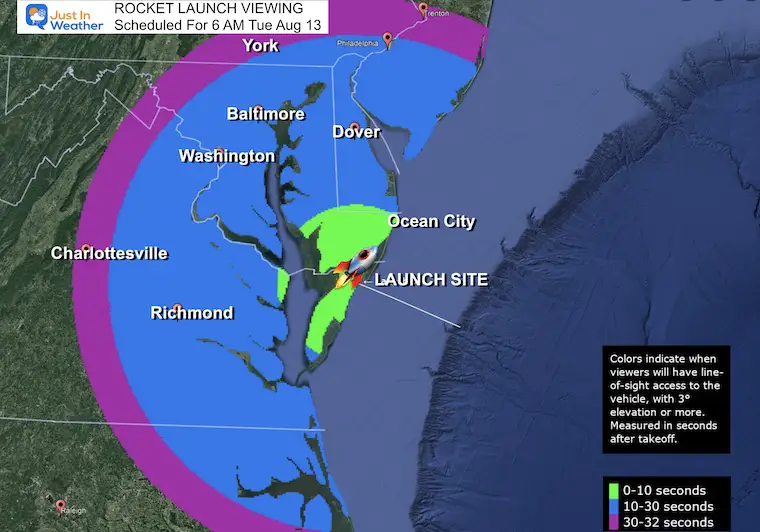
This morning may feature a rocket launch from Wallops Island, and I will be on the beach looking for it by the time you read this post. Info on the planned 6 AM event is below, and I will follow up with any visuals if we get them.
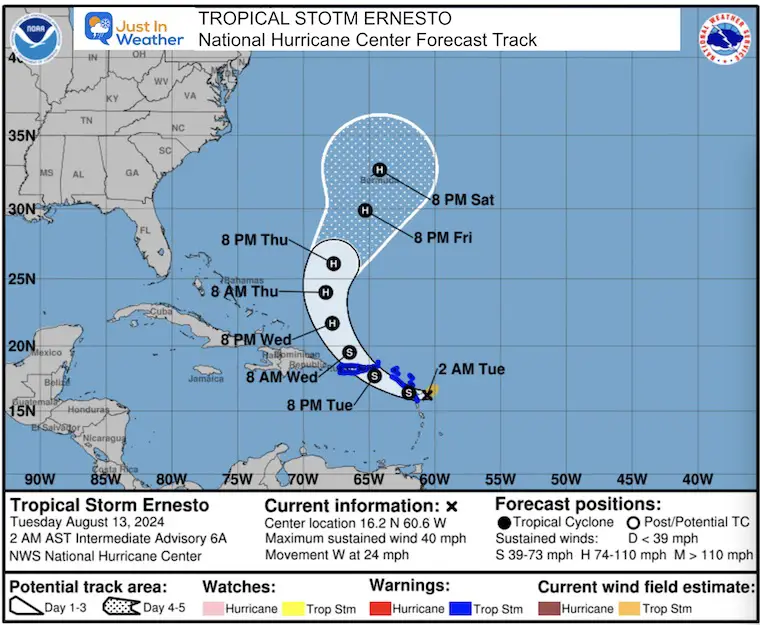
Tropical Storm Ernesto has prompted warnings for The Virgin Islands and Puerto Rico. It will then turn north and could reach Bermuda as a hurricane this weekend. More on that below.
Northern Lights
While there was a tremendous show Sunday Night, last night did not produce what was expected. Here is a recap of the top photos I received.
Beach Confession
I am still in Ocean City resting for a few days following The Maryland Trek 11 completion. Yesterday morning we captured this video of dolphins swimming close to the beach at sunrise.
Rocket Launch
There is a scheduled 6 AM launch from Wallops Island. I will be on the beach looking for anything and will follow up if we capture anything good.
Viewing Online: https://www.youtube.com/live/_uM-sn_xRU
Morning Surface Weather
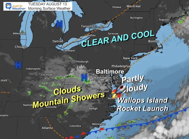
High Pressure is in control, but a smattering of clouds remains mixed in across our southern sections. A disturbance has allowed scattered showers to continue over the mountains.
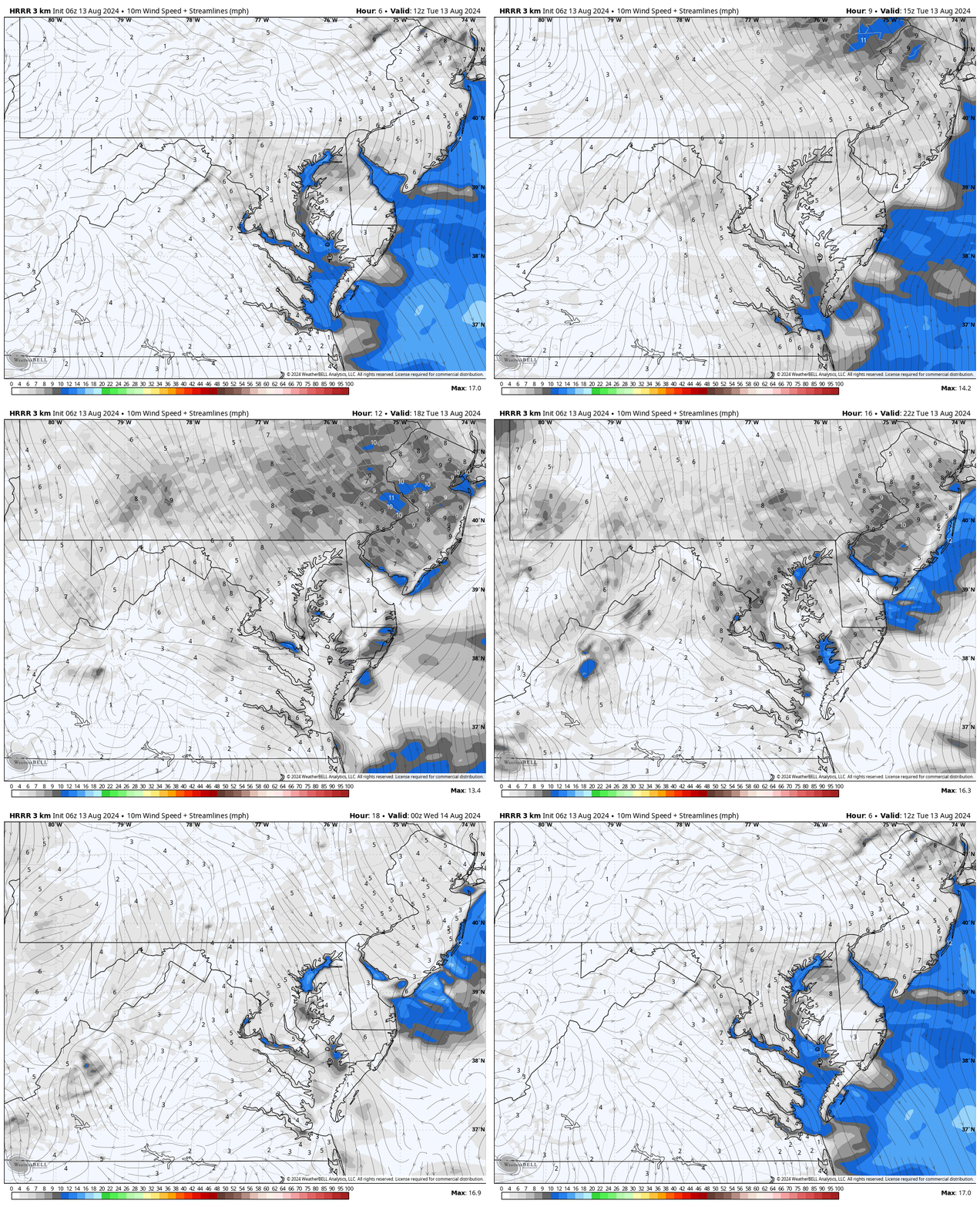
Wind Animation 8 AM to 8 PM
There is enough energy in the atmosphere near the old front that some showers may try to develop later near and south of Washington.
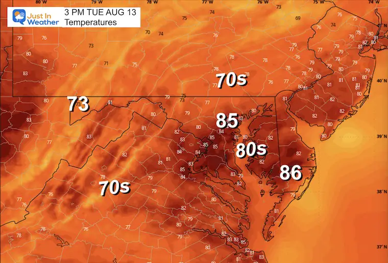
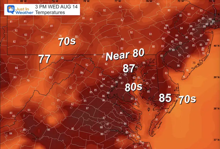
Afternoon Temperatures
Another pleasant day with low humidity
Maryland Trek 11 Day 7 Completed Sat August 10
We raised OVER $101,000 for Just In Power Kids – AND Still Collecting More
The annual event: Hiking and biking 329 miles in 7 days between The Summit of Wisp to Ocean City.
Each day, we honor a kid and their family’s cancer journey.
Fundraising is for Just In Power Kids: Funding Free Holistic Programs. I never have and never will take a penny. It is all for our nonprofit to operate.
Click here or the image to donate:
CLIMATE DATA: Baltimore
TODAY August 13
Sunrise at 6:18 AM
Sunset at 8:04 PM
Normal Low in Baltimore: 66ºF
Record 54ºF in 1950
Normal High in Baltimore: 87ºF
Record 99ºF 2002
Summer Hot Day Totals At BWI
8 Days at or above 100ºF
39 Days total at or above 90ºF
THANK YOU:
Baltimore Magazine Readers Choice Best Of Baltimore
WEDNESDAY AUGUST 14
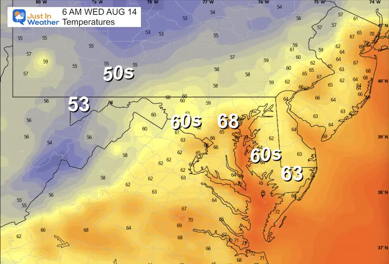
This may be another nearly flawless day with sunshine, light wind, and low humidity.
Morning Temperatures
Afternoon Temperatures
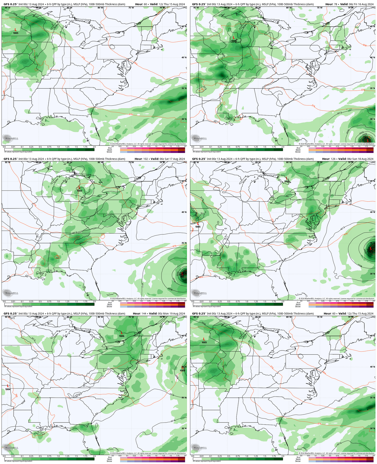
Weather Outlook Thursday to Sunday
The pulsing thunderstorms will arrive in our region Friday night, then Saturday and Sunday afternoons and evenings.
Look on the right side of the map and see Ernesto pass well offshore.
TROPICAL STORM ERNESTO
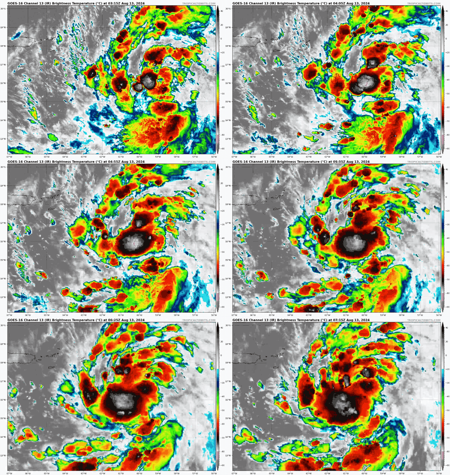
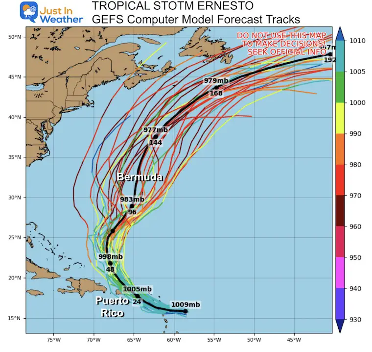
This storm is moving over the Eastern Caribbean and will turn north towards Bermuda. It is expected to become a Hurricane by Thursday and may reach a Cat 2 or 3 when nearing Bermuda this weekend.
Satellite Loop
Wider View
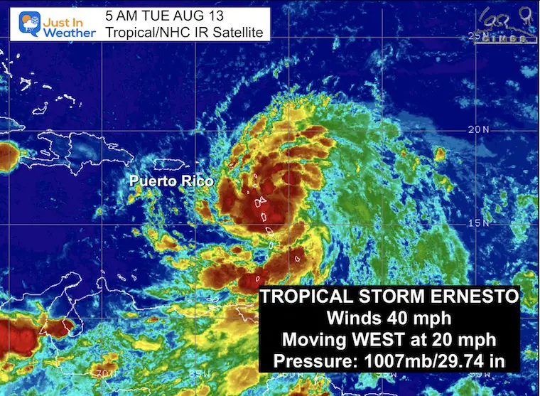
5 AM Stats From National Hurricane Center
———————————————-
- LOCATION…16.2N 61.3W
- ABOUT 10 MI…15 KM SE OF GUADELOUPE
- ABOUT 350 MI…565 KM ESE OF SAN JUAN PUERTO RICO
- MAXIMUM SUSTAINED WINDS…40 MPH…65 KM/H
- PRESENT MOVEMENT…W OR 280 DEGREES AT 20 MPH…31 KM/H
- MINIMUM CENTRAL PRESSURE…1007 MB…29.74 INCHES
SUMMARY OF WATCHES AND WARNINGS IN EFFECT:
A Tropical Storm Warning is in effect for…
- St. Kitts, Nevis, Montserrat, Antigua, Barbuda, and Anguilla
- Guadeloupe
- St. Martin and St. Barthelemy
- Sint Maarten
- British Virgin Islands
- U.S. Virgin Islands
- Puerto Rico
- Vieques
- Culebra
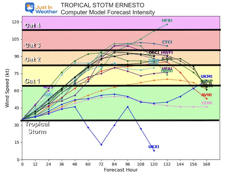
Computer Model Forecast Intensity
Agreement on reaching Hurricane Category 2 or 3 peak intensity.
Computer Model Forecast Tracks
Forecast Timing
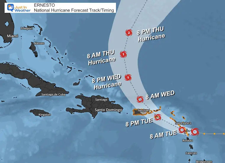
National Hurricane Center Forecast Track
7 Day Forecast
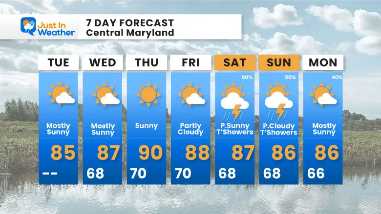
Very quiet local weather continues. The best chance for thunderstorms will peak over the weekend afternoons and evenings.
Please share your thoughts and best weather pics/videos, or just keep in touch via social media.
-
Facebook: Justin Berk, Meteorologist
-
Twitter
-
Instagram
RESTATING MY MESSAGE ABOUT DYSLEXIA
I am aware there are some spelling and grammar typos and occasional other glitches. I take responsibility for my mistakes and even the computer glitches I may miss. I have made a few public statements over the years, but if you are new here, you may have missed it: I have dyslexia and found out during my second year at Cornell University. It didn’t stop me from getting my meteorology degree and being the first to get the AMS CBM in the Baltimore/Washington region.
One of my professors told me that I had made it that far without knowing and to not let it be a crutch going forward. That was Mark Wysocki, and he was absolutely correct! I do miss my mistakes in my own proofreading. The autocorrect spell check on my computer sometimes does an injustice to make it worse. I also can make mistakes in forecasting. No one is perfect at predicting the future. All of the maps and information are accurate. The ‘wordy’ stuff can get sticky.
There has been no editor who can check my work while writing and to have it ready to send out in a newsworthy timeline. Barbara Werner is a member of the web team that helps me maintain this site. She has taken it upon herself to edit typos when she is available. That could be AFTER you read this. I accept this and perhaps proves what you read is really from me… It’s part of my charm. #FITF


