Thursday July 18 2024
Morning Report
Baltimore hit 100ºF yesterday at BWI, which was not a record. However the stats for BWI now show 4 days in a row and a total of 6 days this year at or above 100ºF , AND 29 days total at or above 90ºF.
Record Highs Recently Tied
Sunday July 14: 101ºF in 2024 tied 1895 AND 1954
Monday July 15: 102ºF in 2024 tied 1995
Tuesday July 16: 104ºF in 2024 tied 1988
Not a record
Wednesday July 17: 100ºF
Daily Trivia
The record extreme temperatures on this date were set only two years apart last decade.
Record HIGH 104ºF 2012
Record LOW 57ºF in 2014
Weather Outlook
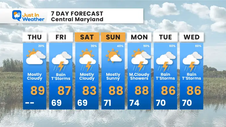
We are in the process of breaking the heat wave. With most of our region remaining in the 80s today, it may actually feel cool. The forecast high temperatures in our 7-day outlook keep us in the 80s each day. This includes the return of unsettled weather and perhaps some needed rain next week.
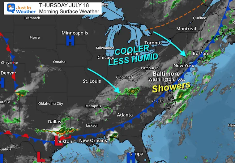
Morning Surface Weather
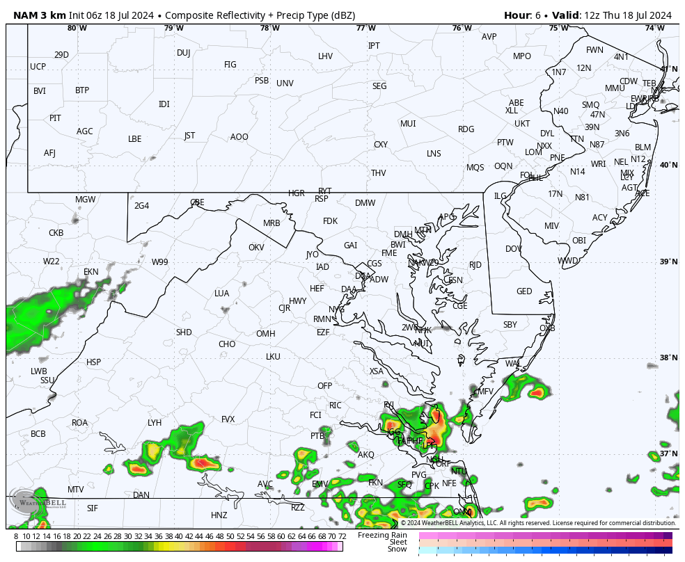
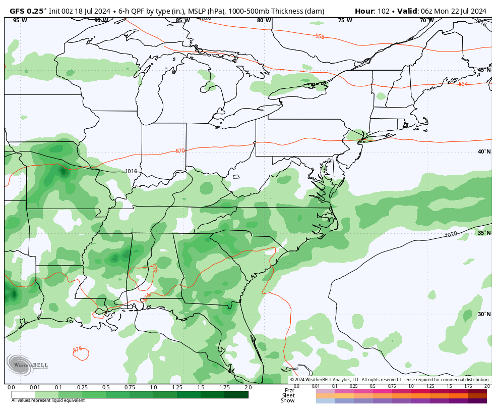
The cold front has moved through much of our region and lingers along the coast this morning. This will be the focus for more showers and perhaps a thunderstorm this evening.
Our weather will quiet down for the most part through the weekend, perhaps with some afternoon thundershowers on Saturday. Then, more rain is possible next week.
Live Radar Widget
Simulated Radar
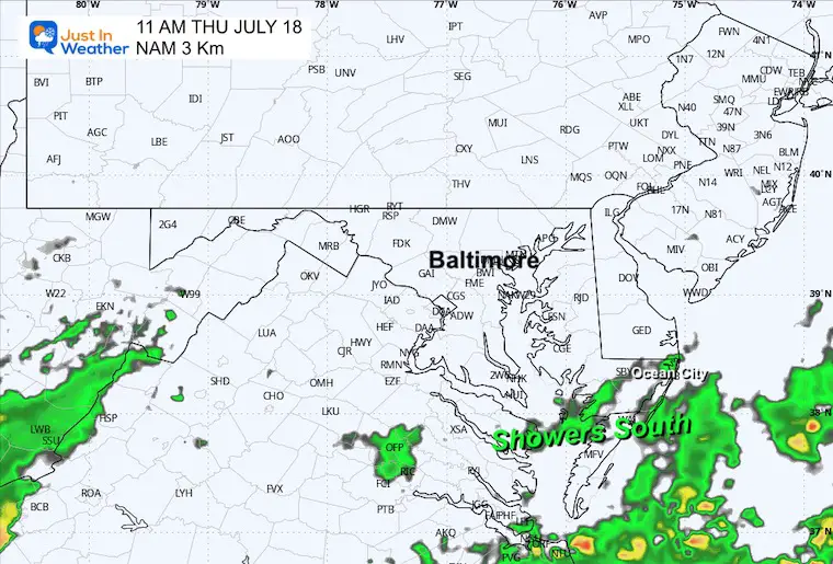
Late Thursday Morning
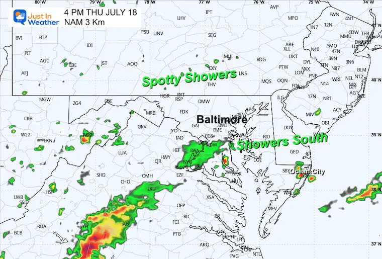
Thursday Afternoon
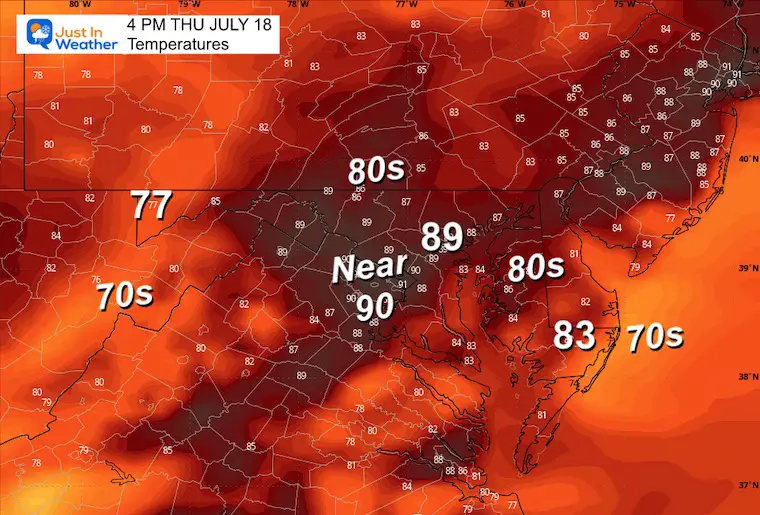
Afternoon Temperatures
Most areas in the 80s.
Radar Simulation 8 AM to 8 PM
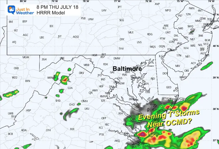
11 PM HRRR Model
Here, we see the potential for a thunderstorm near and south of Ocean City, MD, in the evening.
CLIMATE DATA: Baltimore
TODAY July 18
Sunrise at 5:56 AM
Sunset at 8:30 PM
Normal Low in Baltimore: 68ºF
Record 57ºF in 2014
Normal High in Baltimore: 89ºF
Record 104ºF 2012
FRIDAY JULY 19
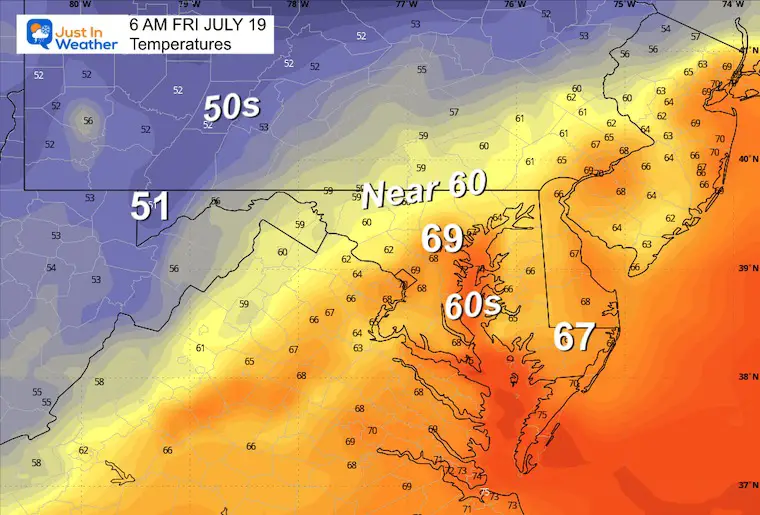
Morning Temperatures
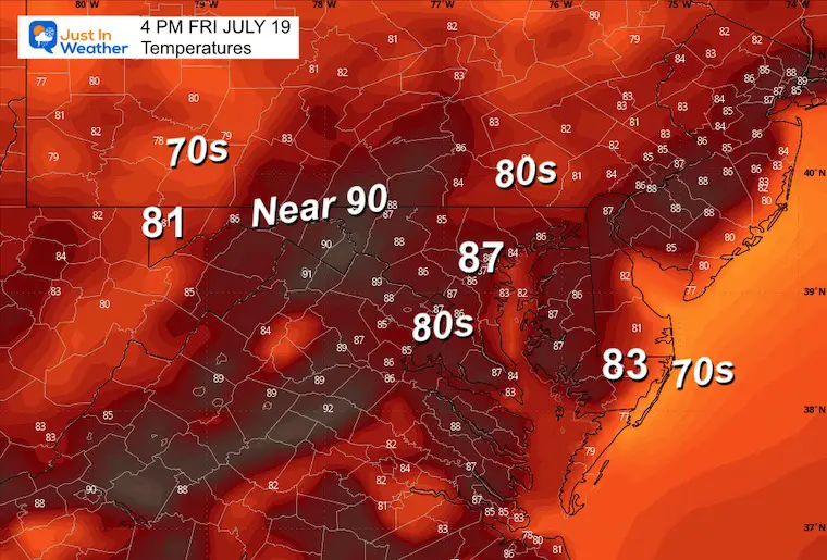
Afternoon Temperatures
LOOKING AHEAD
Saturday may bring some afternoon showers or thunderstorms. Then, we will shift the focus to daily showers and thunderstorms with needed rain Monday through Wednesday next week.
7 Day Forecast
Please share your thoughts and best weather pics/videos, or just keep in touch via social media.
RESTATING MY MESSAGE ABOUT DYSLEXIA
I am aware there are some spelling and grammar typos and occasional other glitches. I take responsibility for my mistakes and even the computer glitches I may miss. I have made a few public statements over the years, but if you are new here, you may have missed it: I have dyslexia and found out during my second year at Cornell University. It didn’t stop me from getting my meteorology degree and being the first to get the AMS CBM in the Baltimore/Washington region.
One of my professors told me that I had made it that far without knowing and to not let it be a crutch going forward. That was Mark Wysocki, and he was absolutely correct! I do miss my mistakes in my own proofreading. The autocorrect spell check on my computer sometimes does an injustice to make it worse. I also can make mistakes in forecasting. No one is perfect at predicting the future. All of the maps and information are accurate. The ‘wordy’ stuff can get sticky.
There has been no editor who can check my work while writing and to have it ready to send out in a newsworthy timeline. Barbara Werner is a member of the web team that helps me maintain this site. She has taken it upon herself to edit typos when she is available. That could be AFTER you read this. I accept this and perhaps proves what you read is really from me… It’s part of my charm. #FITF


