Wednesday, July 17 2024
Late Afternoon Update
The heat wave is about to break. After four days in a row at or over 100ºF (in Baltimore), a strong cold front is gaining intensity in a hurry this afternoon into the evening.
There are no promises, but I can state this with proof below: The models have underestimated how strong this storm line will be. I will show you the comparison at 5 PM from Doppler Radar to the short-range forecast…., and then what is suggested through the evening. Please note it is for timing, but I am concerned there may be more storm damage repeats today covering large areas from metro Washington through Central Maryland.
The parameters include wind sheer, which would allow storm rotation. This, in turn, would lead to stronger and longer-lasting thunderstorms with the potential for large hail and tornadoes. This is what prompted NOAA to expand their SLIGHT RISK for severe storms into Maryland, including Baltimore and Washington, D.C.
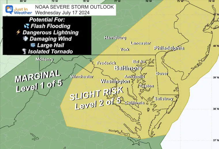
NOAA Severe Storm Risk
The Slight Risk is Level 2 of 5 includes Baltimore/Washington into Southern Maryland and all of Delmarva.
Potential for: Winds over 58 mph, large hail over 1-inch diameter, isolated tornados.
Alert Review
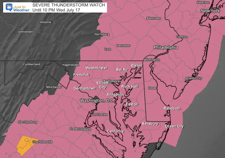
If any severe weather is anticipated, one of the two following alerts may be issued:
Watch: This means it MAY HAPPEN! It will last 4 to 6 hours and cover many counties.
Warning: This means IT IS HAPPENING NOW: This will usually cover 45 minutes and list specific towns in the path and counties impacted.
Severe Thunderstorm Watch Until 10 PM
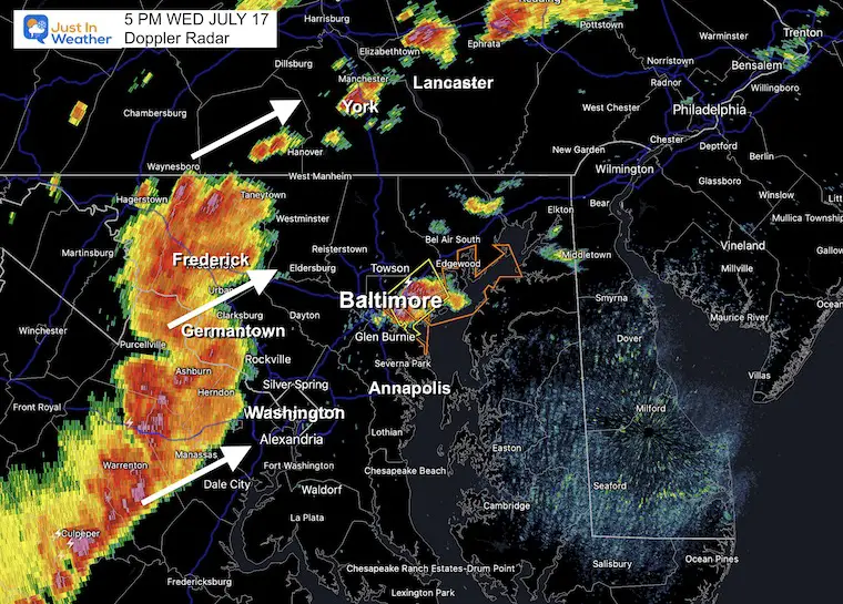
5 PM Set Up
DOPPLER RADAR
This is a solid storm line that runs from the Maryland border with Pennsylvania through Frederick County through central Virginia west of Washington, D.C.
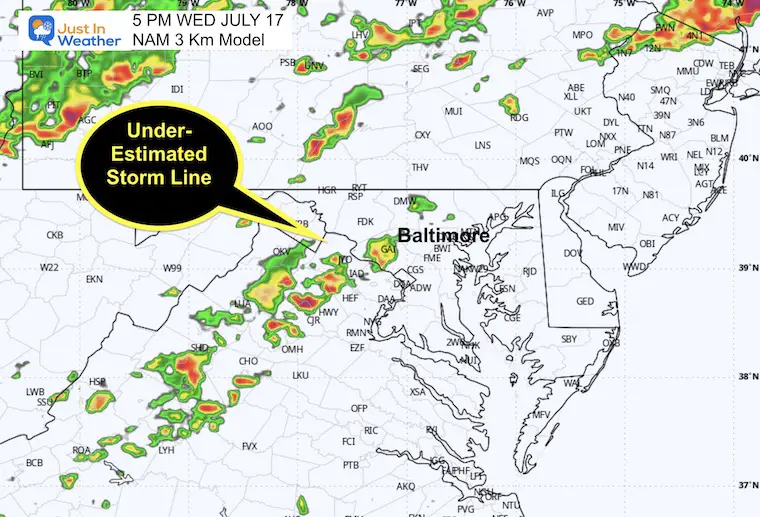
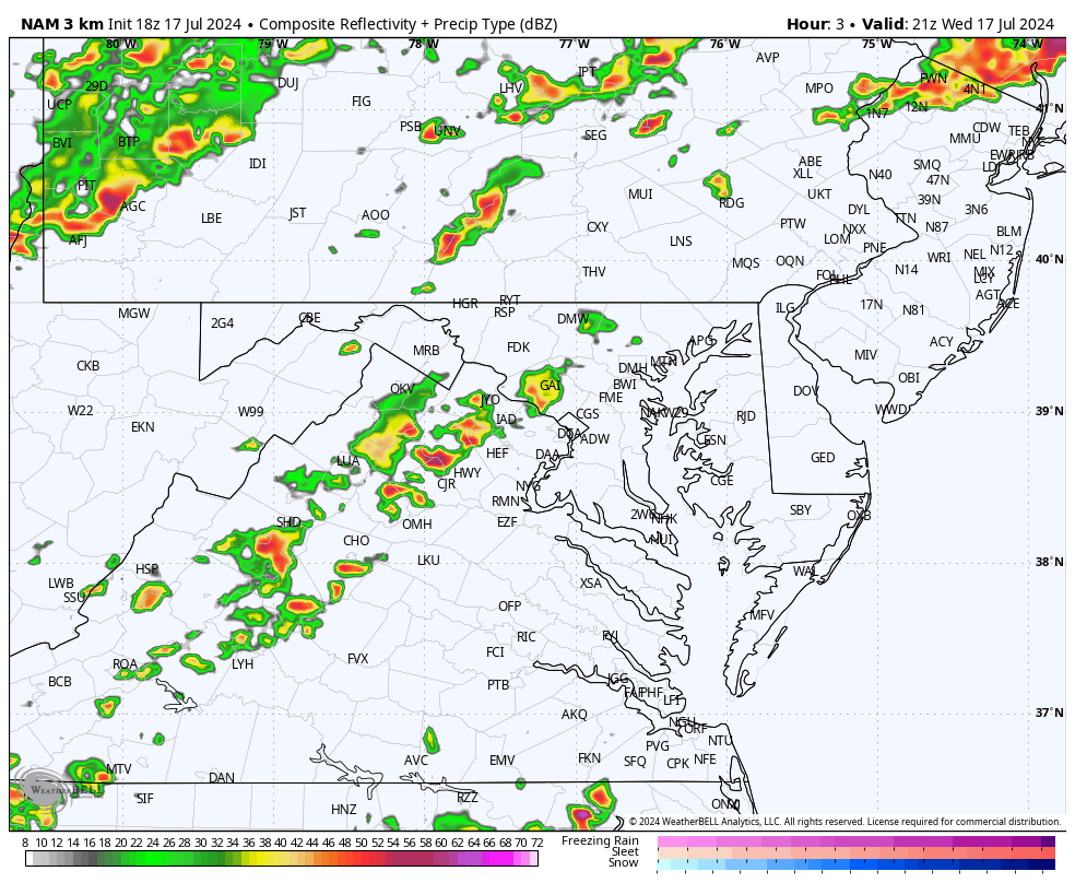
NAM 3 Km Model
This is the better performing of the two high resolution models.. and has understated that storm line!
Note the simulation below will underplay what we will see this evening.
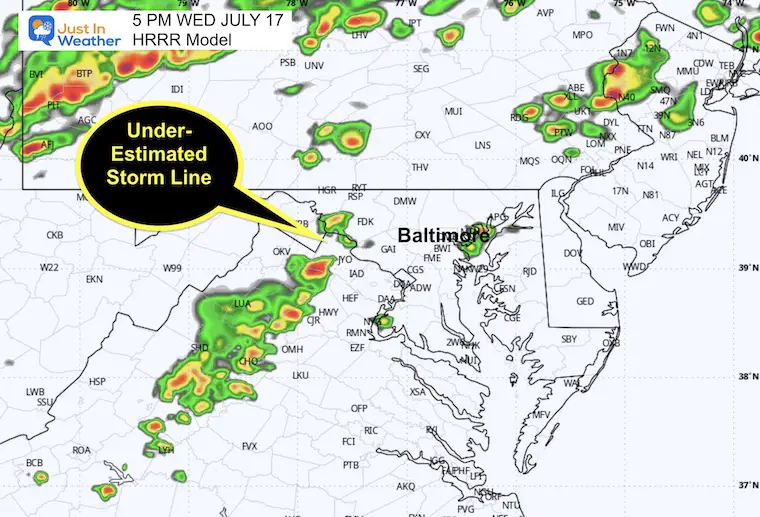
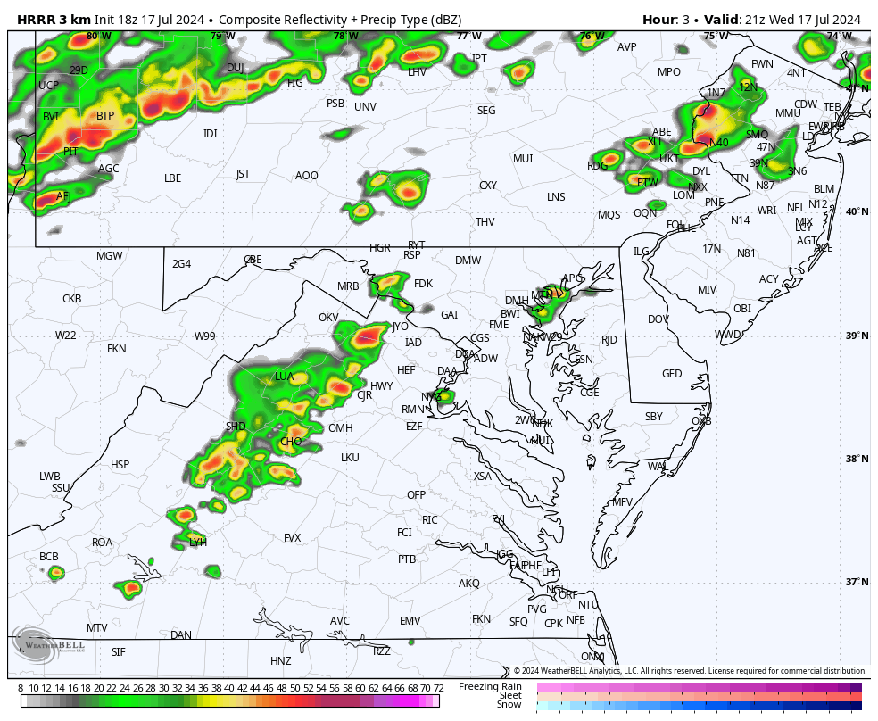
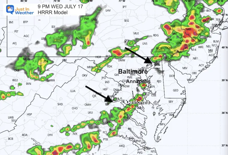
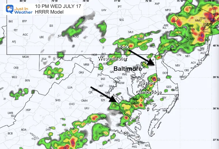
HRRR Model
This shows even less action at this time along the line.
Live Radar and Lightning
Radar Simulations
Estimating the storm activity. So, going forward, it is likely to be more active than shown here.
Forecast Animation 5 PM to Midnight
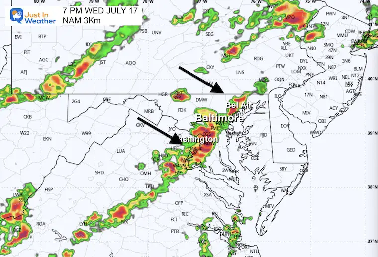
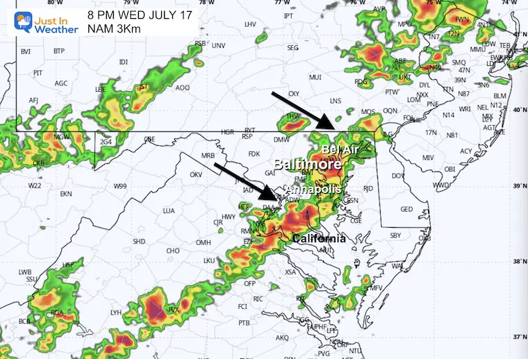
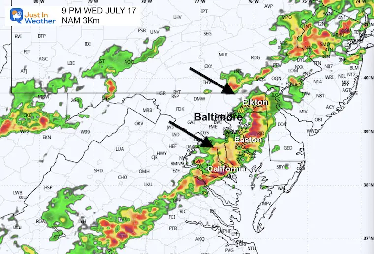
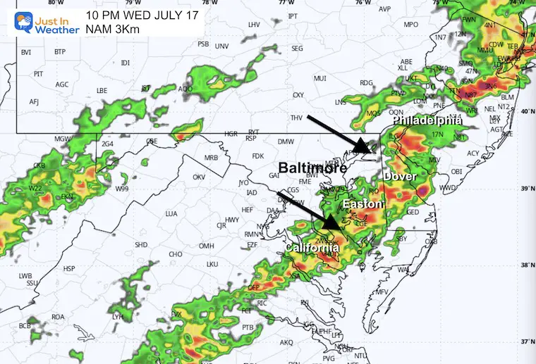
NAM 3 Km
7 PM Snapshot (SUGGESTION)
8 PM Snapshot (SUGGESTION)
9 PM Snapshot (SUGGESTION)
10 PM Snapshot (SUGGESTION)
Forecast Animation 5 PM to Midnight
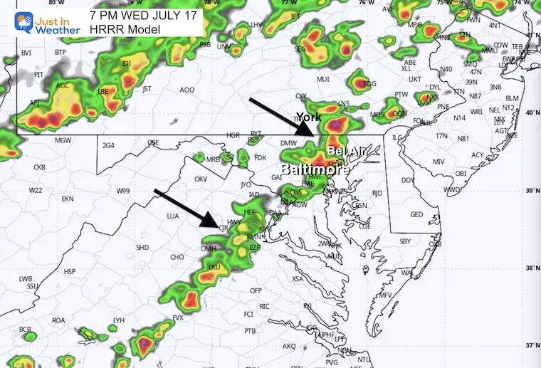
HRRR Model
7 PM Snapshot (SUGGESTION)
9 PM Snapshot (SUGGESTION)
10 PM Suggestion
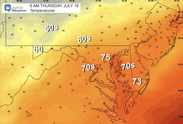
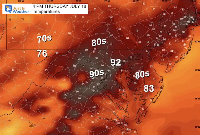
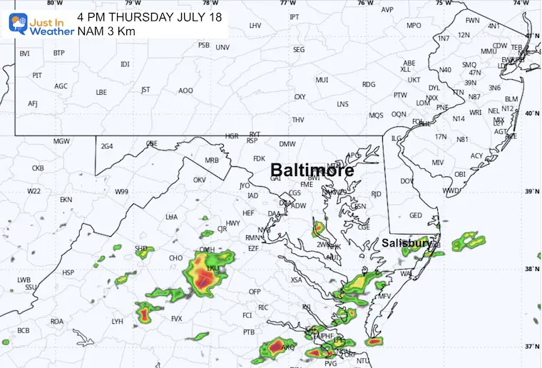
THURSDAY JULY 18
Morning Temperatures
Afternoon Temperatures
Radar Simulation at 4 PM
Some showers and T’storms in Southern Maryland as the front and energy shifts south!
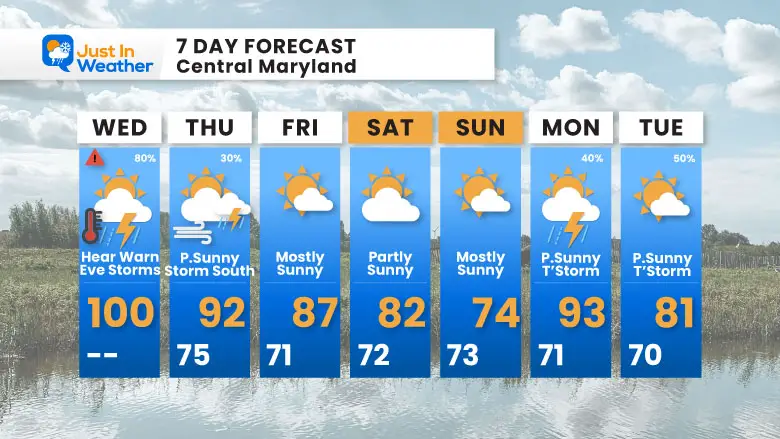
7 Day Forecast
Heat Advisory and Risk for Severe Weather Today. Then, we trend back closer to near-normal weather.
Please share your thoughts and best weather pics/videos, or just keep in touch via social media.
RESTATING MY MESSAGE ABOUT DYSLEXIA
I am aware there are some spelling and grammar typos and occasional other glitches. I take responsibility for my mistakes and even the computer glitches I may miss. I have made a few public statements over the years, but if you are new here, you may have missed it: I have dyslexia and found out during my second year at Cornell University. It didn’t stop me from getting my meteorology degree and being the first to get the AMS CBM in the Baltimore/Washington region.
One of my professors told me that I had made it that far without knowing and to not let it be a crutch going forward. That was Mark Wysocki, and he was absolutely correct! I do miss my mistakes in my own proofreading. The autocorrect spell check on my computer sometimes does an injustice to make it worse. I also can make mistakes in forecasting. No one is perfect at predicting the future. All of the maps and information are accurate. The ‘wordy’ stuff can get sticky.
There has been no editor who can check my work while writing and to have it ready to send out in a newsworthy timeline. Barbara Werner is a member of the web team that helps me maintain this site. She has taken it upon herself to edit typos when she is available. That could be AFTER you read this. I accept this and perhaps proves what you read is really from me… It’s part of my charm. #FITF


