


Final Call For Snowfall Ending Sunday December 14 As An Overachiever
Saturday Evening Update December 13 This is right up to the blocks as the starters pistol is about to go off. Yes, I ran track in high school and college.…
Wednesday, July 17 2024
Morning Report
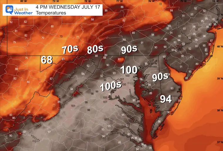
Baltimore at BWI hit 104ºF yesterday, tying the record set on the same date in 1988. This was the hottest day of this heat wave and of the year. It is also among the top 10 hottest days on record locally (since 1880). The latest numbers for BWI show 5 days at or above 100ºF AND 28 days total at or above 90ºF. Today, we are expected to be close to 100ºF, and near but maybe just below another record.
Sunday July 14: 101ºF in 2024 tied 1895 AND 1954
Monday July 15: 102ºF in 2024 tied 1995
Tuesday July 16: 104ºF in 2024 tied 1988
NEXT RECORD TO WATCH
Wednesday July 17: 101ºF in 1988
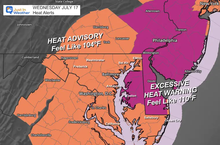
Heat Alerts: Including The Humidity To Calculate Heat Index/Feels Like Temps
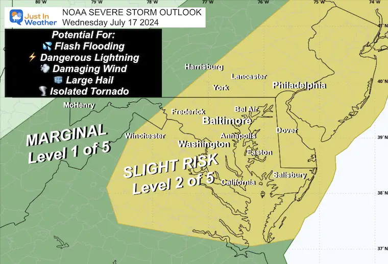
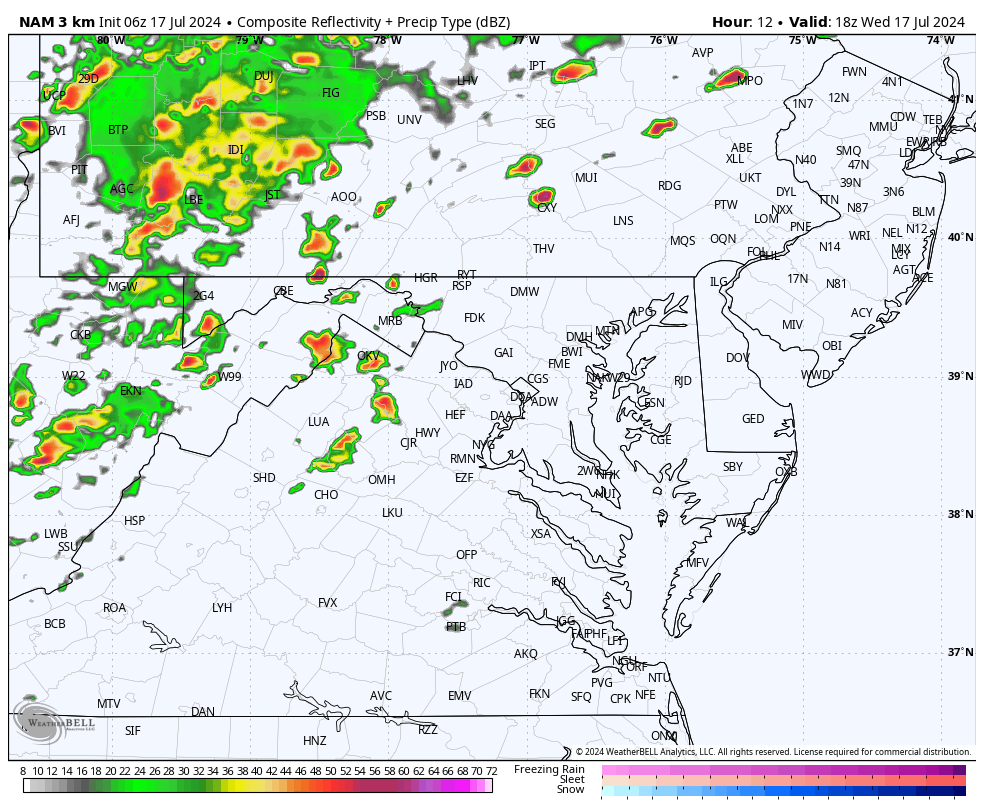
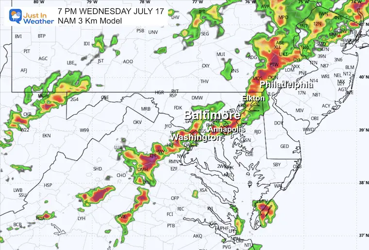
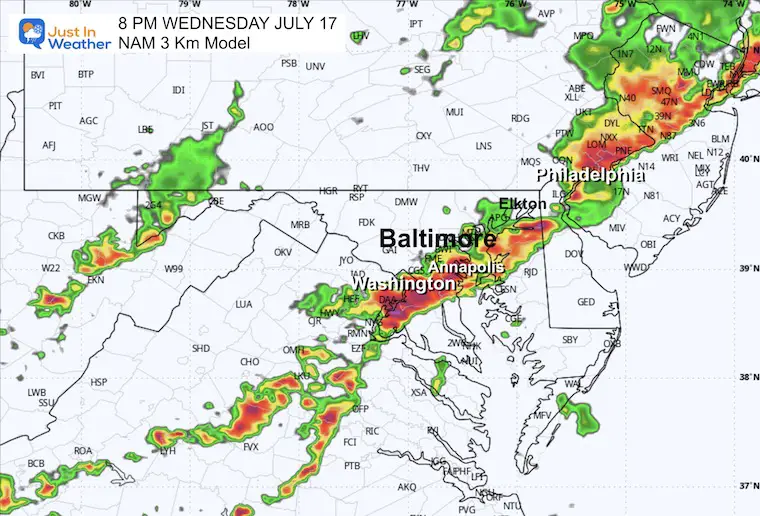
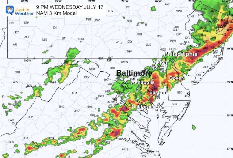
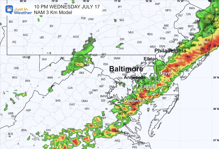
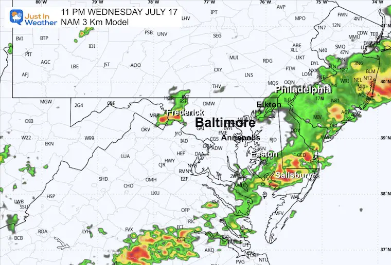
The main risk will be damaging winds and flash flooding; However, hail and tornadoes still remain a threat.
Also, it is important to be mindful of vivid and dangerous cloud-to-ground lightning!
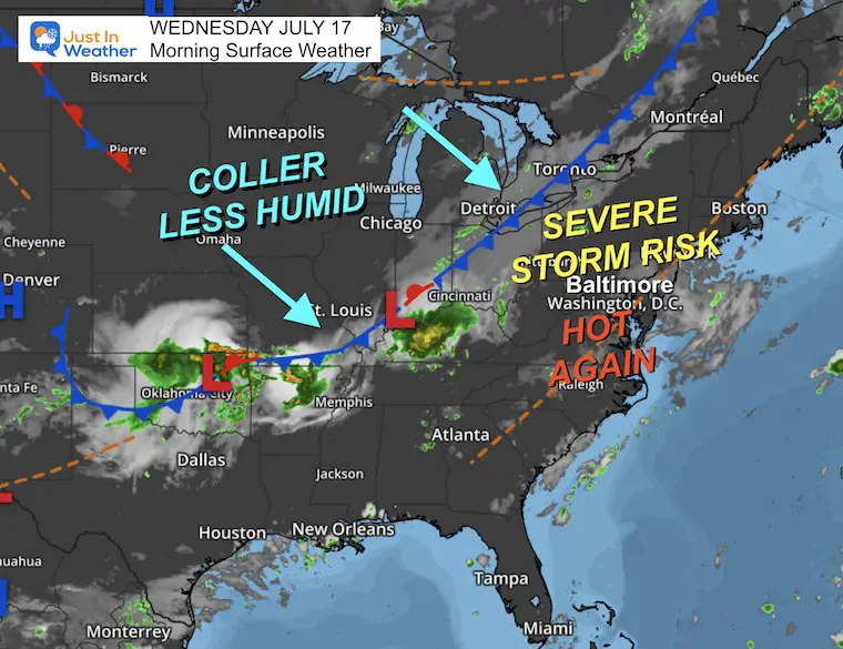
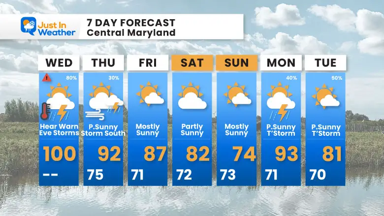
The cold front still is to our west. It will trigger our line of strong to severe storms as it moves through later today and tonight. Cooler weather will bring us back closer to normal, even a little cooler by Saturday.
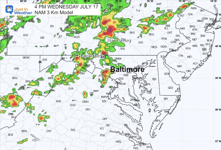
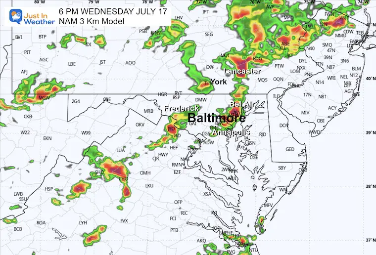
This model has proven itself to be the most accurate with the warmest solutions.
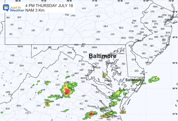
Looking for thunderstorms to develop after 1 PM. Compare to the Radar Simulation Forecast below.
Sunrise at 5:55 AM
Sunset at 8:31 PM
Normal Low in Baltimore: 68ºF
Record 58ºF in 1987
Normal High in Baltimore: 89ºF
Record 101ºF 1988
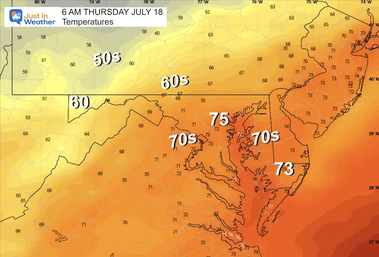
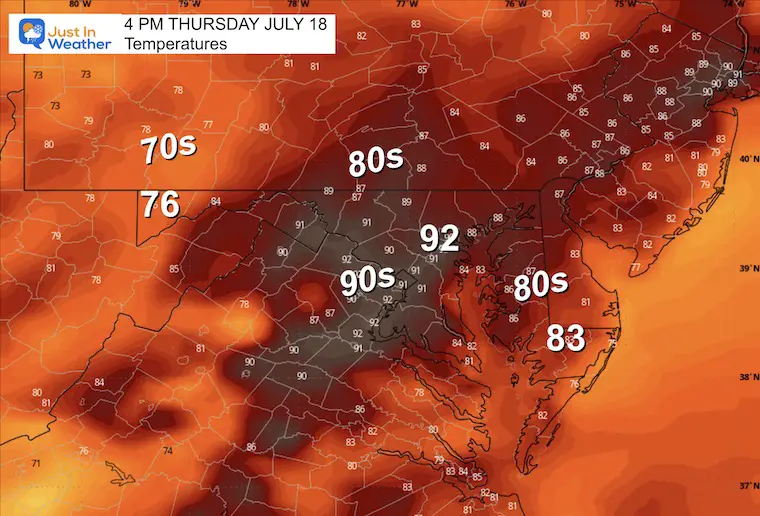
THURSDAY JULY 18
Some showers and T’storms in Southern Maryland as the front and energy shifts south!
Heat Advisory and Risk for Severe Weather Today. Then we trend back closer to near normal weather.
NEXT RECORD TO WATCH
Wednesday July 17: 101ºF in 1988
I am aware there are some spelling and grammar typos and occasional other glitches. I take responsibility for my mistakes and even the computer glitches I may miss. I have made a few public statements over the years, but if you are new here, you may have missed it: I have dyslexia and found out during my second year at Cornell University. It didn’t stop me from getting my meteorology degree and being the first to get the AMS CBM in the Baltimore/Washington region.
One of my professors told me that I had made it that far without knowing and to not let it be a crutch going forward. That was Mark Wysocki, and he was absolutely correct! I do miss my mistakes in my own proofreading. The autocorrect spell check on my computer sometimes does an injustice to make it worse. I also can make mistakes in forecasting. No one is perfect at predicting the future. All of the maps and information are accurate. The ‘wordy’ stuff can get sticky.
There has been no editor who can check my work while writing and to have it ready to send out in a newsworthy timeline. Barbara Werner is a member of the web team that helps me maintain this site. She has taken it upon herself to edit typos when she is available. That could be AFTER you read this. I accept this and perhaps proves what you read is really from me… It’s part of my charm. #FITF