Wednesday July 10 2024
Afternoon Update
We have an energetic set up in the atmosphere today to produce strong storms with the potential to turn severe. Many areas in our region have a Heat Index over 100ºF, proving the function of high heat AND humidity. That is the fuel for strong thunderstorms and possibly supercells. Add in a strong cold front connected to the remnant Low or Ghost of former Hurricane Beryl and we have a trigger to ignite the explosive development mid afternoon into this evening.
The parameters include wind sheer, which would allow storm rotation. That would lead to stronger and longer lasting thunderstorms with the potential for large hail and tornadoes. This is what prompted NOAA to expand their SLIGHT RISK for severe storms into Maryland: Including Baltimore and Washington DC.
Peak timing for these storms will be between 5 PM and 9 PM.
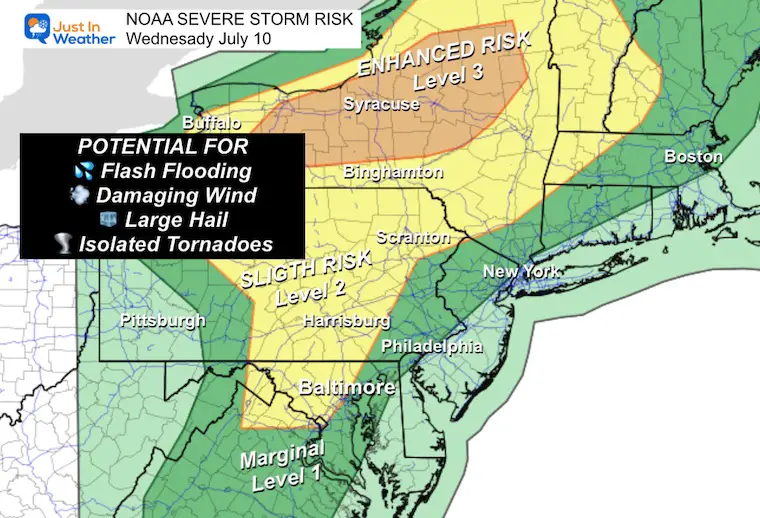
NOAA Severe Storm Risk
The Slight Risk is Level 2 of 5 includes Baltimore/Washington and points to the west and north. The higher Enhanced Risk is closer to Beryl’s core Low in Central New York.
Potential for: Winds over 58 mph, large hail over 1 inch diameter, isolated tornados.
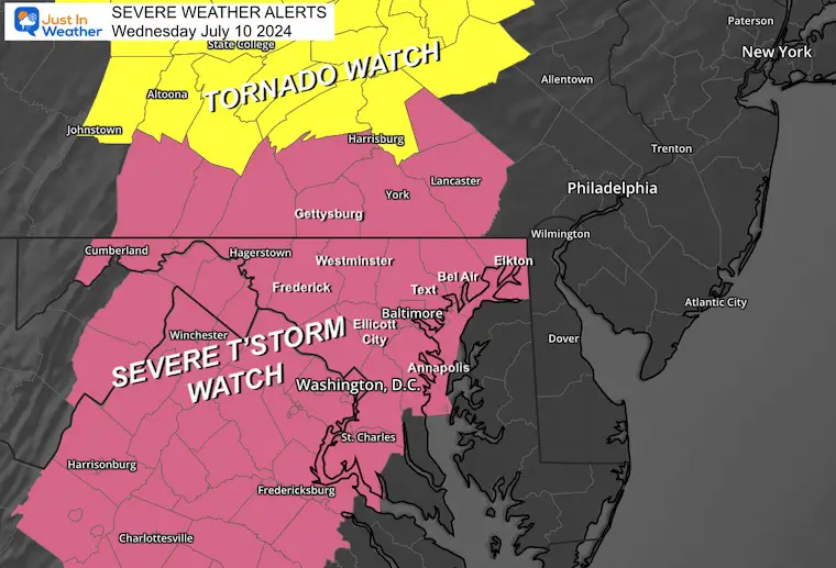
Severe Thunderstorm and Tornado Watches
The Severe Thunderstorm watch includes most of our region up to 10 PM
The Tornado Watch up to 9 PM includes Central Pennsylvania North of Harrisburg up to Central New York.
Alert Review
If any severe weather is anticipated, one of the two following alerts may be issued:
Watch: This means is MAY HAPPEN! This will be for 4 to 6 hours and cover many counties.
Warning: This means IT IS HAPPENING NOW: This will usually cover 45 minutes and list specific towns in the path and counties impacted.
Afternoon Set Up
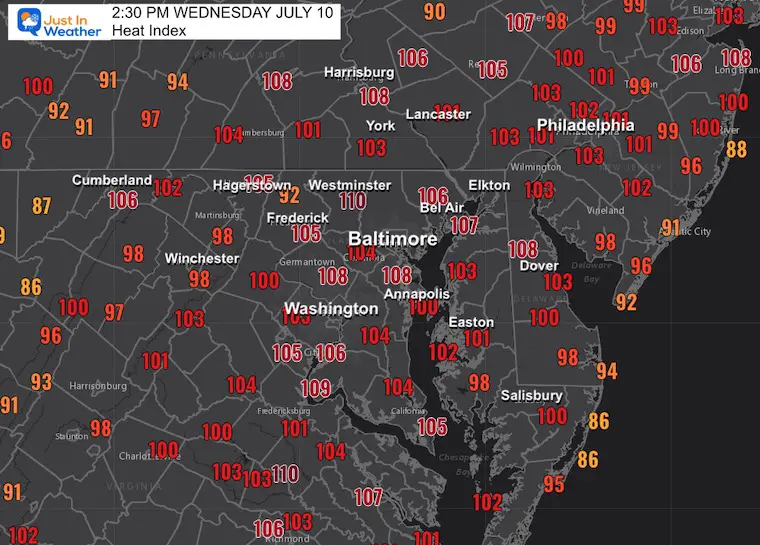
Heat Index at 2:30 PM
This is the combination of temperatures and high humidity. That added moisture does provide additional energy with rapidly rising air to produce higher cloud tops and more intense storms.
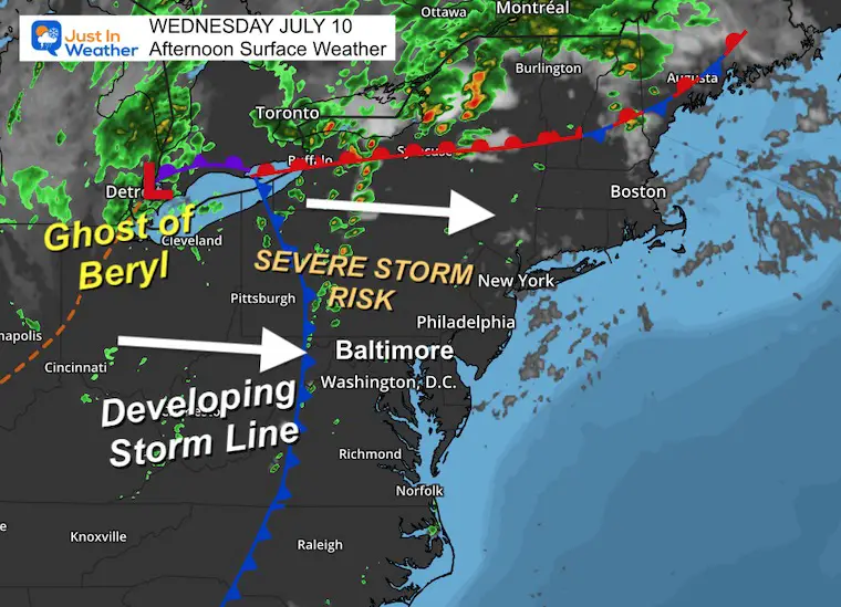
Surface Weather
The core Low of what was once Hurricane Beryl was over Detroit. A trailing cold front extended into western Pennsylvania and Maryland. This is expected to develop a solid line of strong to severe storms close to or after 4 PM.
Live Radar and Lightning
Radar Simulaiton
estimating the storm activity. So going forward it is likely to be more active than shown here.
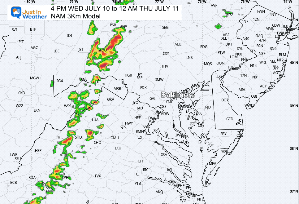
Forecast Animation 4 PM to Midnight
Note that this is a suggestion. In recent weeks we have had more activity and it has arrived a little faster than shown on this product. So please allow a 30 to 60 minute buffer.
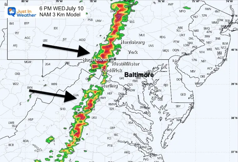
6 PM Snapshot (SUGGESTION)
Strong and solid line of storms may line up near I-81. During this hour alerts may include Hagerstown to Harrisburg areas.
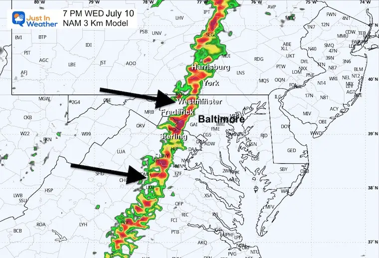
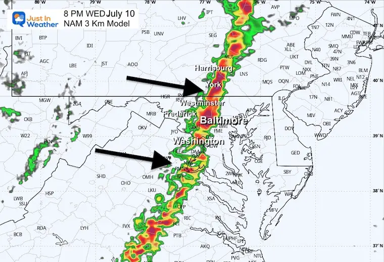
7 PM Snapshot (SUGGESTION)
This strong to severe line of storms may include Sterling VA, Frederick, Westminster and Harrisburg.
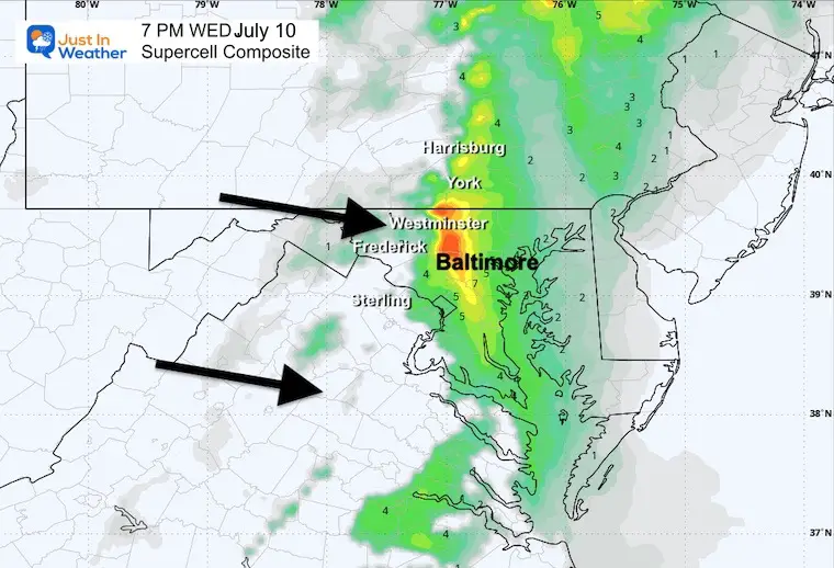
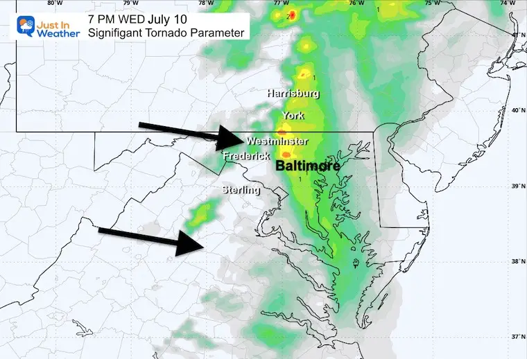
SEVERE PARAMETERS
These elements support but do not promise severe cell passing through Carroll County MD ad York Co PA.
Supercell Composite
Tornado Parameter
8 PM Snapshot (SUGGESTION)
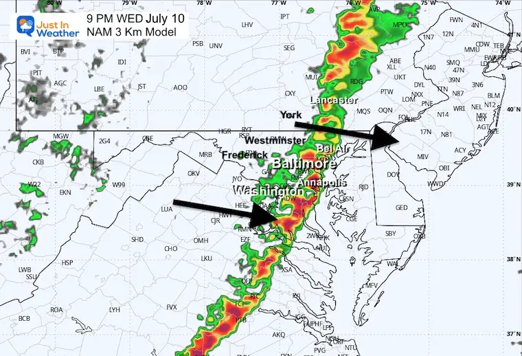
9 PM Snapshot (SUGGESTION)
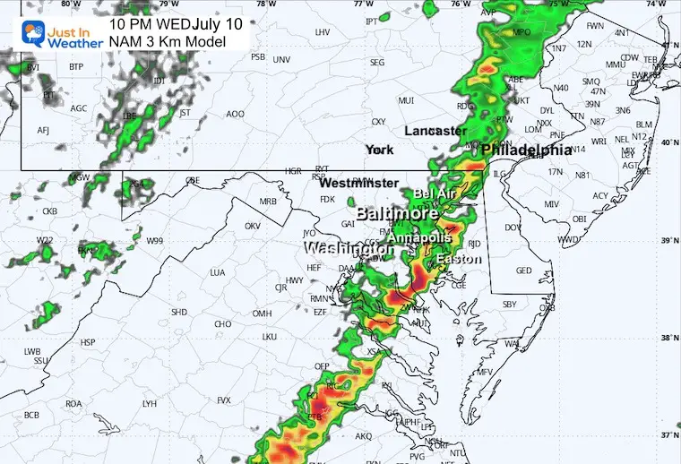
10 PM Snapshot (SUGGESTION)
THURSDAY JULY 11
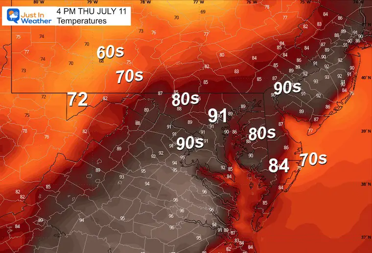
SLIGHT REDUCTION of heat and humidity. The line of storms will shift closer to the beaches in the afternoon and evening.
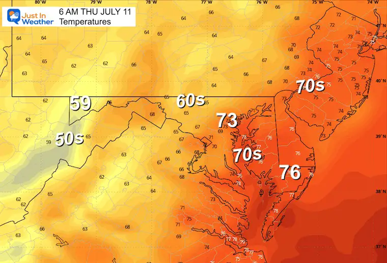
Morning Temperatures
Afternoon Temperatures
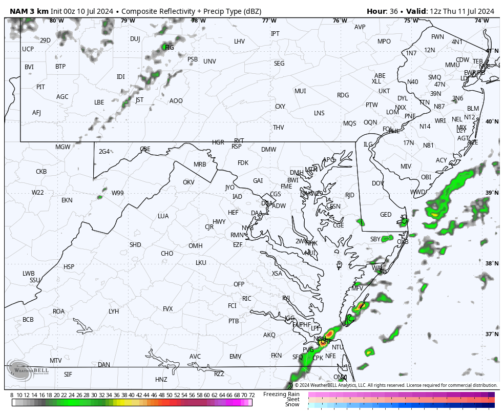
Radar Simulation ‘Suggestion’
8 AM to 8 PM
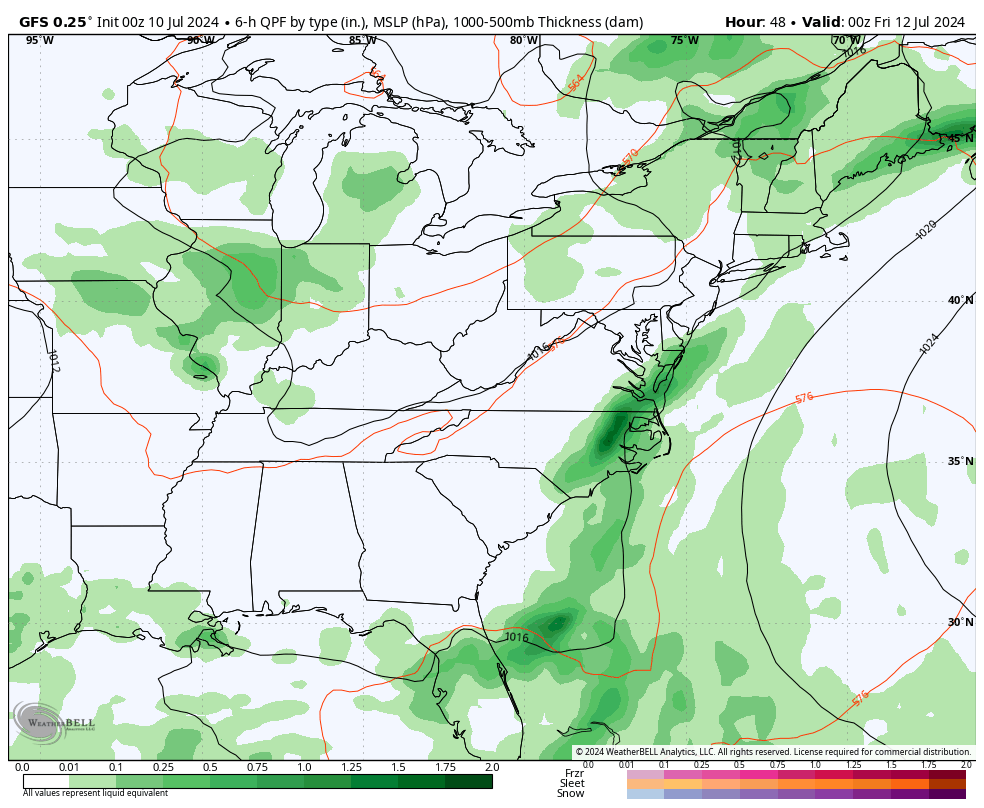
Local Impact: Thursday to Sunday Night
Beryl’s remains to our North and a trailing frontal boundary will keep the unstable air across the region…The widespread storm expectation will be Friday and again Sunday night.
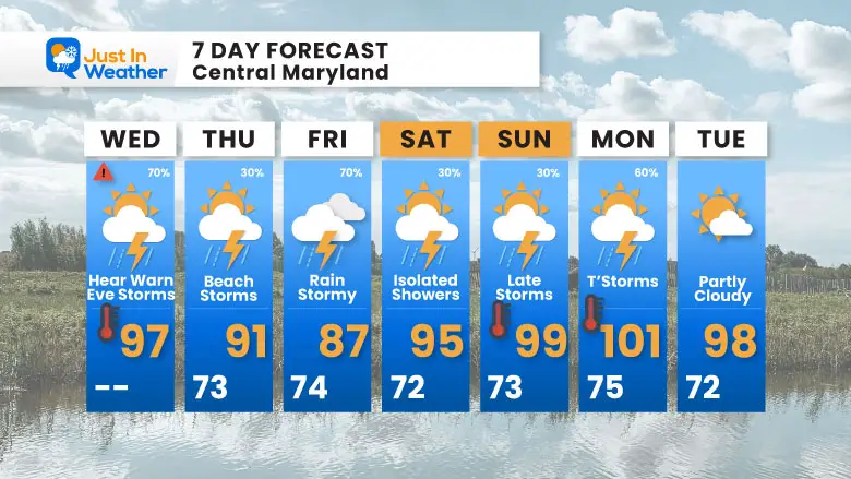
7 Day Forecast
The shift of strong storms to the beach on Thursday will build back across the region on Friday. High heat and unstable air will continue into early next week.
Please share your thoughts and best weather pics/videos, or just keep in touch via social media
RESTATING MY MESSAGE ABOUT DYSLEXIA
I am aware there are some spelling and grammar typos and occasional other glitches. I take responsibility for my mistakes and even the computer glitches I may miss. I have made a few public statements over the years, but if you are new here, you may have missed it: I have dyslexia and found out during my second year at Cornell University. It didn’t stop me from getting my meteorology degree and being the first to get the AMS CBM in the Baltimore/Washington region.
One of my professors told me that I had made it that far without knowing and to not let it be a crutch going forward. That was Mark Wysocki, and he was absolutely correct! I do miss my mistakes in my own proofreading. The autocorrect spell check on my computer sometimes does an injustice to make it worse. I also can make mistakes in forecasting. No one is perfect at predicting the future. All of the maps and information are accurate. The ‘wordy’ stuff can get sticky.
There has been no editor who can check my work while writing and to have it ready to send out in a newsworthy timeline. Barbara Werner is a member of the web team that helps me maintain this site. She has taken it upon herself to edit typos when she is available. That could be AFTER you read this. I accept this and perhaps proves what you read is really from me… It’s part of my charm. #FITF


