Tuesday Evening June 13
If this was mid winter, we might be talking about a good pattern for snow lovers. In Mid-June instead we are watching a cool drought with desperation for any little rain.
Our region is averaging about 8 inches below normal rainfall. We definitely do NOT need that made up all at once. What we could use are a few days with steady rain. That is not what we have in store, but a few chances for any rain will be helpful.
Temperatures have been cooler than average and will get more support with this weather pattern at least for the next week or two.
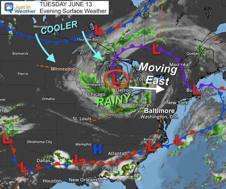
Tuesday Evening Surface Weather
Low Pressure has been spinning around central Michigan. Around this is a solid region of that steady rain I mentioned. The problem is that as this storm system moves east, it will cross the New York/Pennsylvania border to our north.
That tends to allow the rain to reach the mountains, then break up east as the air flows downslope towards the major urban areas.
The cooler air will let afternoon sun to pop thundershowers.
What will follow will be cool (and pleasant) air for the foreseeable future.
The good news after our limited rain will be that we avoid heat waves and slow the evaporation from the ground moisture.
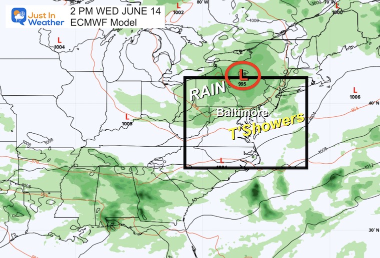
ECMWF Model
Animation Tuesday Afternoon to Thursday Morning

Snapshot at 2 PM
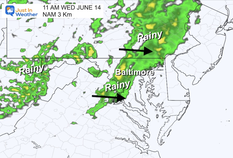
The Surface Low Pressure will be along the Pennsylvania and Central New York border. This is not an ideal location for our region. Rain will seem to fade as it crosses over the mountains and experiences down-sloping. This will break up the showers across central Maryland and The Chesapeake Bay.
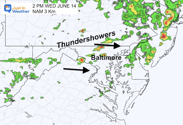
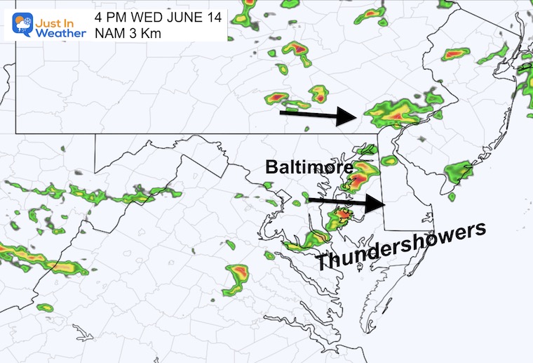
However, there will be afternoon instability helping to develop scattered thundershowers.
Why Thunder “showers” and NOT ThunderStorms?
I purposely chose this term given the sensitivity to the drought. A storm is more intense AND can drop more rain. These showers are likely to last less time and drop less rain. Not the drought buster we need, but they may provide a brief needed drink to the thirsty areas they pass.
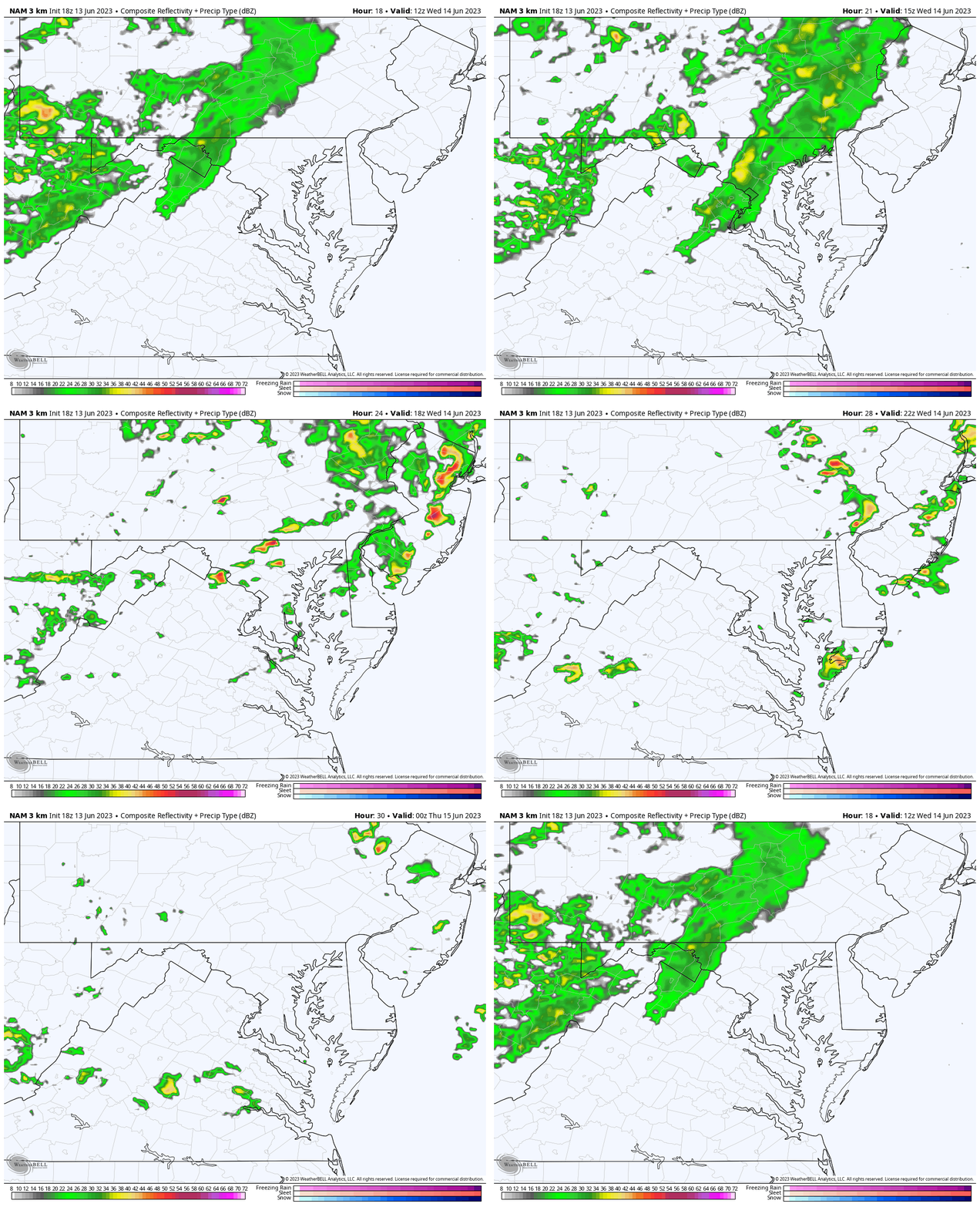
NAM 3 Km Model
Animation: 8 AM to 8 PM
Snapshot at 11 AM
Snapshot at 2 PM
Snapshot at 4 PM
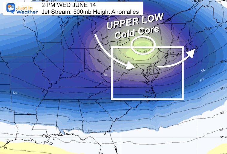
Jet Stream Snapshot: 2 PM
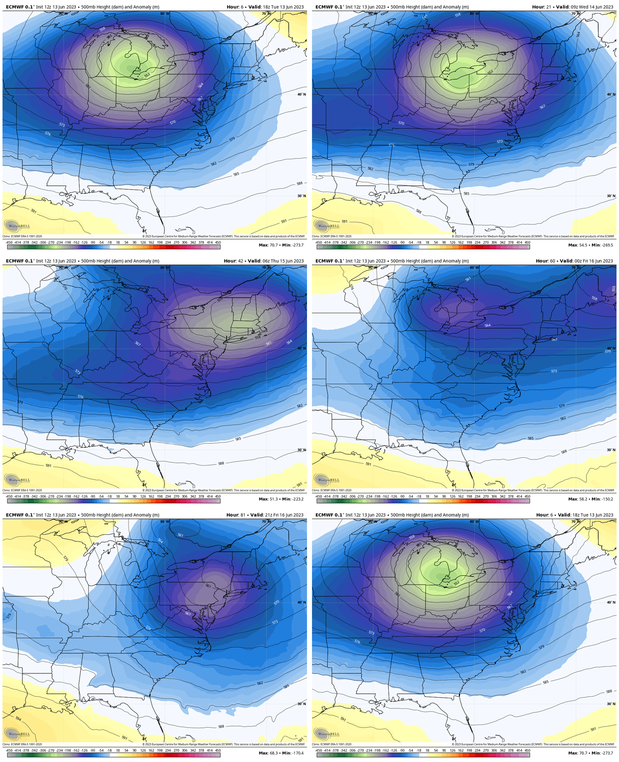
The reason for this rain is the cooler pool of air aloft. That Upper Low will be passing to our north, but setting up the stage for the pattern for a while.
Jet Stream Animation Through Friday Evening
If this was winter, we would be in good shape for snow. In mid-June, this keeps temps cooler and establishes a few more chances for rain. The next one may be on Friday with the next short wave/disturbance swinging through.
This is NOT a drought busting pattern. However, it does slow down the evaporation of whatever we have left in the soil.
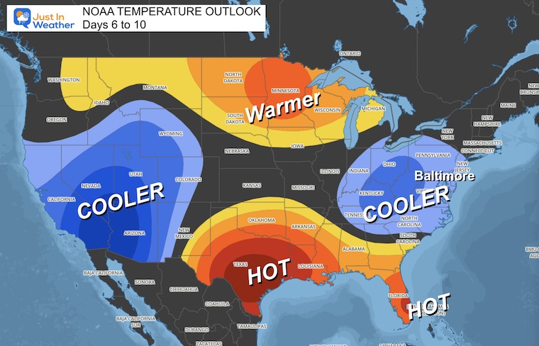
NOAA Temperature Outlook
The 6 to 10 Day average will keep our region cooler than average. This is not the same as a winter map where it would be cold. There is a very high sun angle that will counter the air mass. So the result may be averaging just a few degrees colder than average.
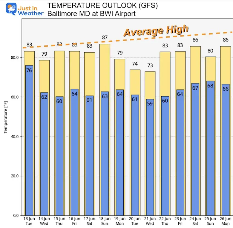
Temperature Forecast Suggestion
This is from the GFS Deterministic Model Output. While Baltimore climate data suggests a trend to high temps of 88ºF by the end of this period, all the numbers remain cooler.
This product is NOT perfect, but a solid suggestion to match the outlook. Cool and comfortable, not cold by any means.
Subscribe for eMail Alerts
Weather posts straight to your inbox
Sign up and be the first to know!
Also See:
La Niña Has Ended. El Niño May Return By Fall
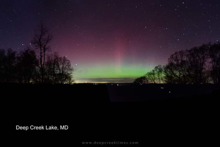
Aurora Photos From Maryland, Delaware, and Virginia
Please share your thoughts, and best weather pics/videos, or just keep in touch via social media
-
Facebook: Justin Berk, Meteorologist
-
Twitter
-
Instagram
RESTATING MY MESSAGE ABOUT DYSLEXIA
I am aware there are some spelling and grammar typos, and occasional other glitches. I take responsibility for my mistakes, and even the computer glitches I may miss. I have made a few public statements over the years, but if you are new here you may have missed it: I have dyslexia, and found out during my second year at Cornell University. It didn’t stop me from getting my meteorology degree, and being first to get the AMS CBM in the Baltimore/Washington region. One of my professors told me that I had made it that far without knowing, and to not let it be a crutch going forward. That was Mark Wysocki and he was absolutely correct! I do miss my mistakes in my own proofreading. The autocorrect spell check on my computer sometimes does an injustice to make it worse. I also can make mistakes in forecasting. No one is perfect predicting the future. All of the maps and information are accurate. The ‘wordy’ stuff can get sticky. There has been no editor that can check my work when I needed it and have it ready to send out in a newsworthy timeline. Barbara Werner is a member of the web team that helps me maintain this site. She has taken it upon herself to edit typos, when she is able. That could be AFTER you read this. I accept this and perhaps proves what you read is really from me… It’s part of my charm.
#FITF


