High Wind Watch Expanded: Power Outages Expected
March 31, 2023
Friday Afternoon Update
The storm system moving through over the next two days will be carrying a surge of very high winds. The main event will be an eruption of severe storms this afternoon across the Mid Western states. What is left over will swing through late Saturday, but given the diminished energy and late time of day, our risk of thunderstorms turning severe will be marginal. However, with wind gusts forecast to get close to 60 mph, there may be severe thunderstorm alerts (watches and warnings) issued.
While I encourage paying close attention to updates and perhaps adjusting any outdoor plans, here is a quick look at how this may play out.
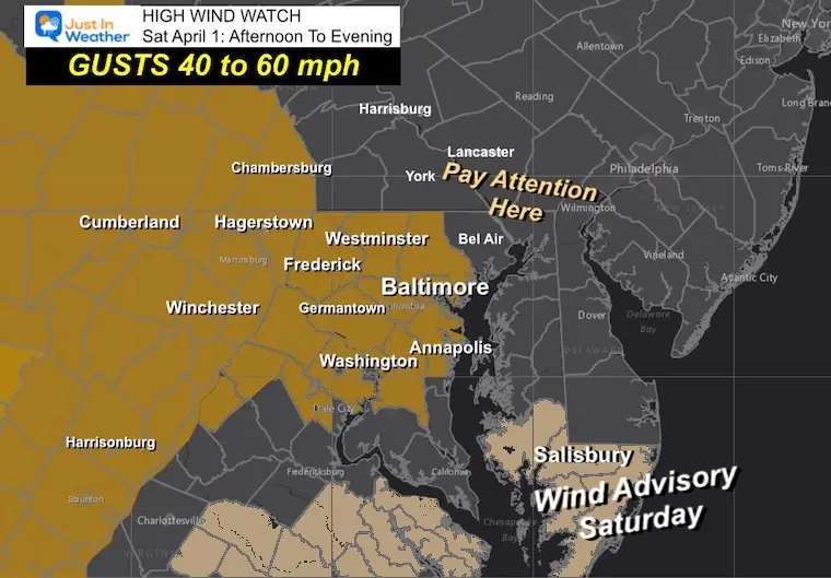
High Wind Watch/Wind Advisory
The potential for winds to reach 60 mph has been extended to include Baltimore, Washington, and Annapolis. While the NWS Office in State College, PA, has not (yet) included southern PA, I would still pay attention for this to possibly expand to York, Harrisburg, and Lancaster.
A Wind Advisory is in effect starting at Midnight for the Lower Eastern Shore of Maryland and Southeast Virginia.
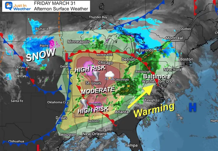
Friday Afternoon Set Up
Low Pressure is located in Iowa, with a very strong cold front trailing to Dallas. This will help ignite strong to severe storms this afternoon. A large tornado outbreak is possible from Iowa south to include St. Louis and Memphis.
Locally, a warm front is moving through central Maryland. This will bring our region a warm up today and tonight.
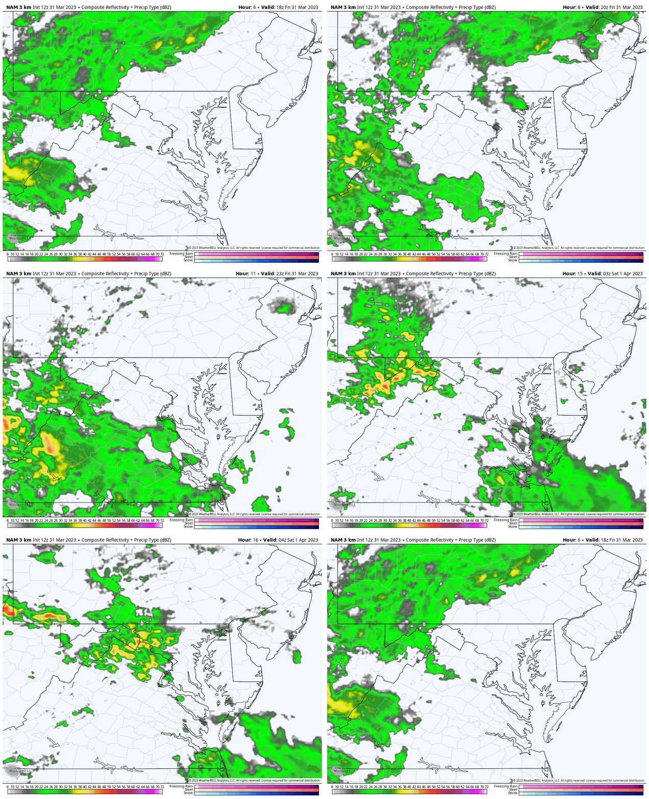
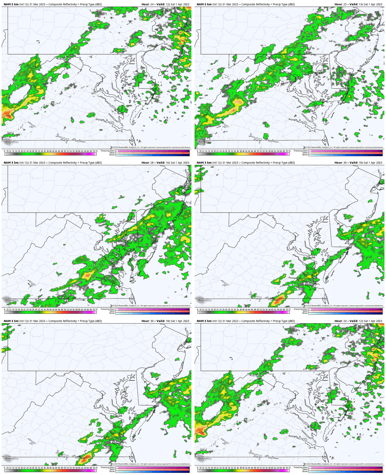
Radar Simulation
2 PM to Midnight
Showers will be scattered through tonight. So you might get rained on, but hit or miss.
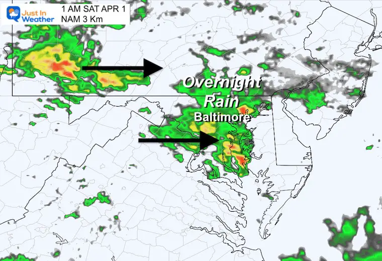
Overnight Rain
We may have a better chance of heavier showers after midnight through morning.
Saturday: Storm Day
- Morning: Showers and Breezy
- Afternoon: A break early… Turning Windy
- Evening: Squall Line may include severe thunderstorms.
Radar Simulation
8 AM to 2 PM
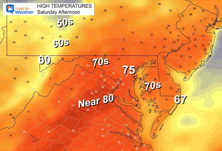
High Temperatures
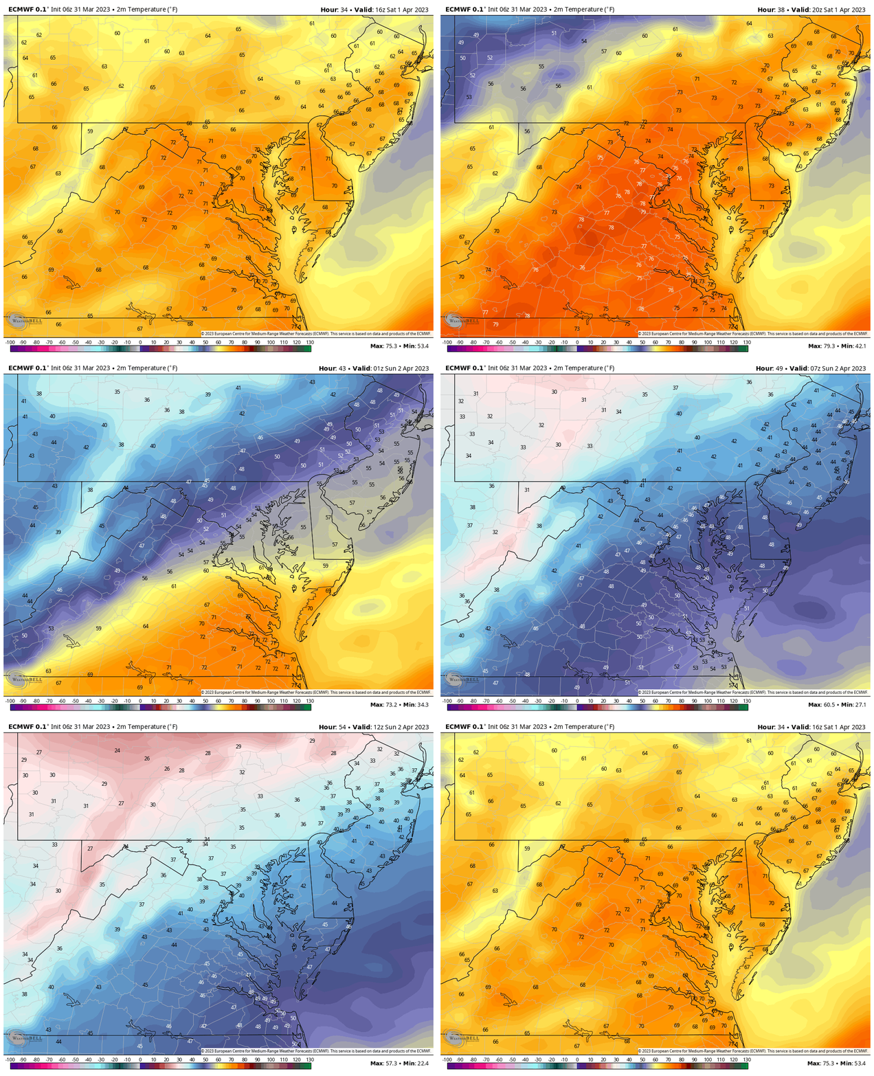
Between the morning rain and evening storm line, the wind will surge in very warm temps for a few hours. This may provide added fuel for the storms.
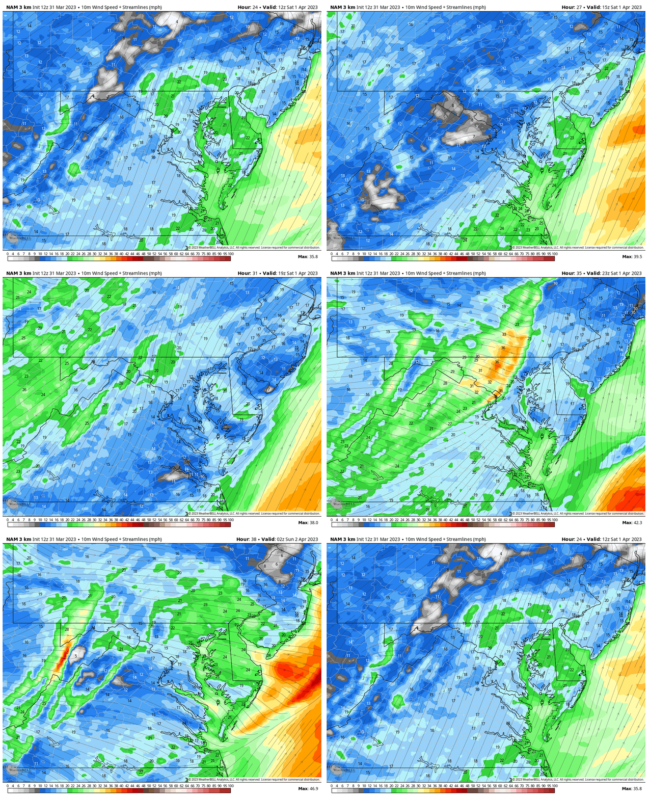
Wind Forecast
8 AM to 10 PM
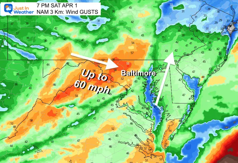
Notice the winds will be from the south in the morning and increase in the afternoon. The wind shift will come with a squall line later in the day and evening.
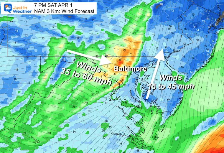
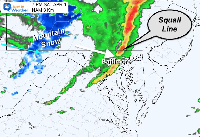
Squall Line Forecast
Winds (1 minute average)
Wind Gusts (peak 3 to 10 seconds)
Radar Simulation
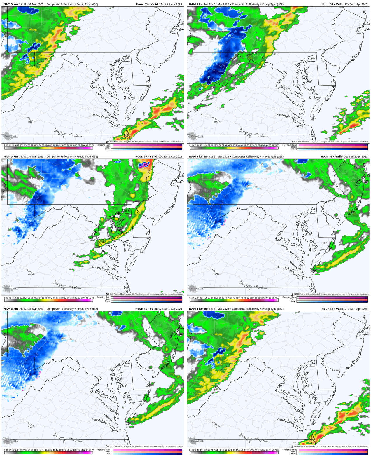
This product can be off by 1 to 2 hours. So consider this to enter central Maryland between 5 PM and 8 PM. The tendency is for storm cells to arrive earlier.
This line may prompt Severe Storm Alerts.
Most likely wind gusts to 60 mph. These may down trees and power lines.
Also possible: Dangerous lightning and large hail.
Severe Weather Alert Types
Watch: It might happen. This would include many counties for a few hours.
Warning: It IS HAPPENING NOW and being tracked with specific towns and timing.
Radar Simulation
5 PM to 10 PM
Power Outage Tracking Resources
From PowerOutages.us
Click to see the latest numbers for:
Maryland
Pennsylvania
Virginia
West Virginia
Delaware
Temperature Forecast
Saturday Afternoon to Sunday Morning
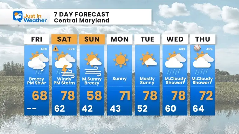
A dramatic cool down will follow the storm, and set us up for just one cool day. We will warm back up again next week.
Extended Forecast (from this morning)
STEM Assemblies/In School Fields Trips Are Back
Click to see more and ‘Book’ a visit to your school
Please share your thoughts, best weather pics/videos, or just keep in touch via social media
-
-
Facebook: Justin Berk, Meteorologist
-
Twitter: @JustinWeather
-
Instagram: justinweather
-
RESTATING MY MESSAGE ABOUT DYSLEXIA
I am aware there are some spelling and grammar typos, and occasional other glitches. I take responsibility for my mistakes, and even the computer glitches I may miss.
I have made a few public statements over the years, but if you are new here you may have missed it:
I have dyslexia, and found out during my second year at Cornell University. It didn’t stop me from getting my meteorology degree, and being first to get the AMS CBM in the Baltimore/Washington region. One of my professors told me that I had made it that far without knowing, and to not let it be a crutch going forward. That was Mark Wysocki and he was absolutely correct!
I do miss my mistakes in my own proofreading. The autocorrect spell check on my computer sometimes does an injustice to make it worse. I also can make mistakes in forecasting. No one is perfect predicting the future.
All of the maps and information are accurate. The ‘wordy’ stuff can get sticky.
There has been no editor that can check my work when I needed it and have it ready to send out in a newsworthy timeline. Barbara Werner is a member of the web team that helps me maintain this site. She has taken it upon herself to edit typos, when she is able. That could be AFTER you read this.
I accept this and perhaps proves what you read is really from me…
It’s part of my charm.
#FITF


