January 17 2023
Tuesday Morning Report
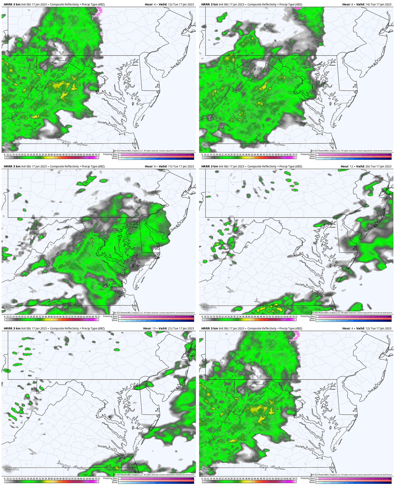
Back to work and school from the long holiday weekend and back to the winter rain. There is a disturbance trying to cross the mountains, but it is bumping into dry air. The net result will be showers, mostly this morning through midday. However it may look worse on radar than what actually falls. I have the radar widget below to compare to the simulation forecast map.
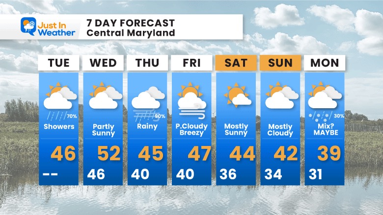
The next event will bring more rain on Thursday, but the trend I have seen is not as mild. Does that mean something?
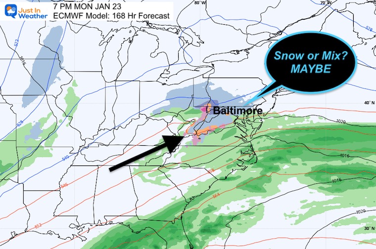
On the horizon, the European Model has been showing some snow or wintry mix early next week. I have not paid much attention to it, but it is time to watch. At the bottom of this post, you will see that projection. At this point, I am simply showing it to you and keeping an open mind. Next week is the time frame we have been discussing for a change…
Headlines
- Today: Showers mainly this morning to midday
- Thursday: Heavier rain.
- Signal of Pattern Change
Climate Trivia
Tied for the coldest day on record in Baltimore, this date in 1982, Baltimore dropped to -7ºF
The record High was 68ºF in 1913
Morning Temperatures
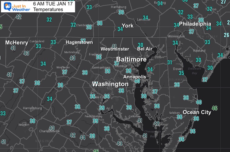
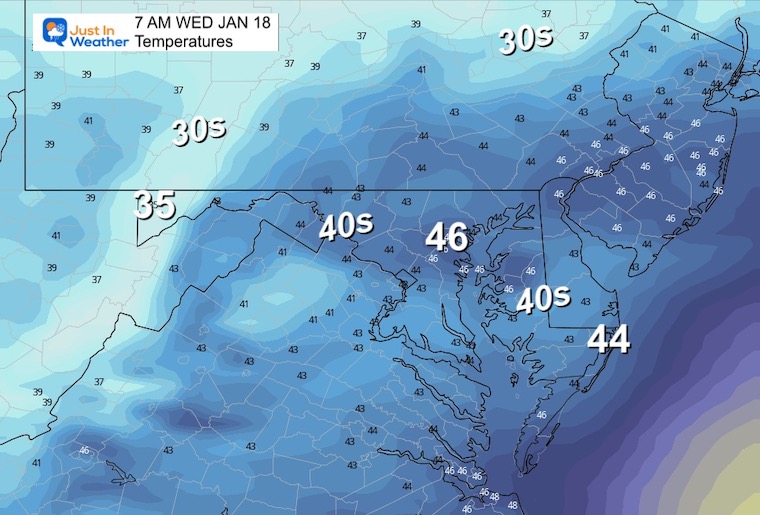
I wanted to show this first to highlight that temps are above freezing. Any hint of wintry precipitation on the weather map may produce sleet in the mountains and northern areas, but roads will remain wet.
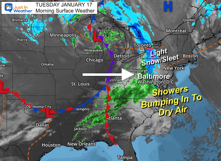
Morning Surface Weather
The same storm track to the Great Lakes. That is the reason for our lack of wintry weather as we end up on the warmer side. Today, the leading edge of precipitation is producing a band of rain, with some sleet mixed in. Track with the radar and simulation below.
LIVE Radar Widget
This is NOT in winter mode, so we can’t determine rain vs. anything else. Please note this is very sensitive, so the more likely locations getting rain (or stuff) to the ground is where the shade is green.
Radar Simulation:
HRRR Model 7 AM to 3 PM
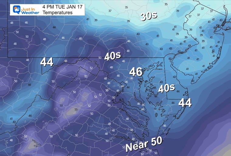
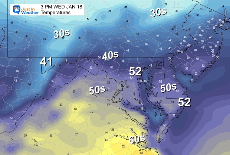
3 PM Temperatures
Subscribe for eMail Alerts
Weather posts straight to your inbox
Sign up and be the first to know!
CLIMATE DATA
TODAY January 17
Normal Low in Baltimore: 26ºF
Record -7ºF in 1982
SNOW: 2.5” 1985
Normal High in Baltimore: 43ºF
Record 68ºF 1913
Wednesday
Morning
Afternoon
Storm Simulation
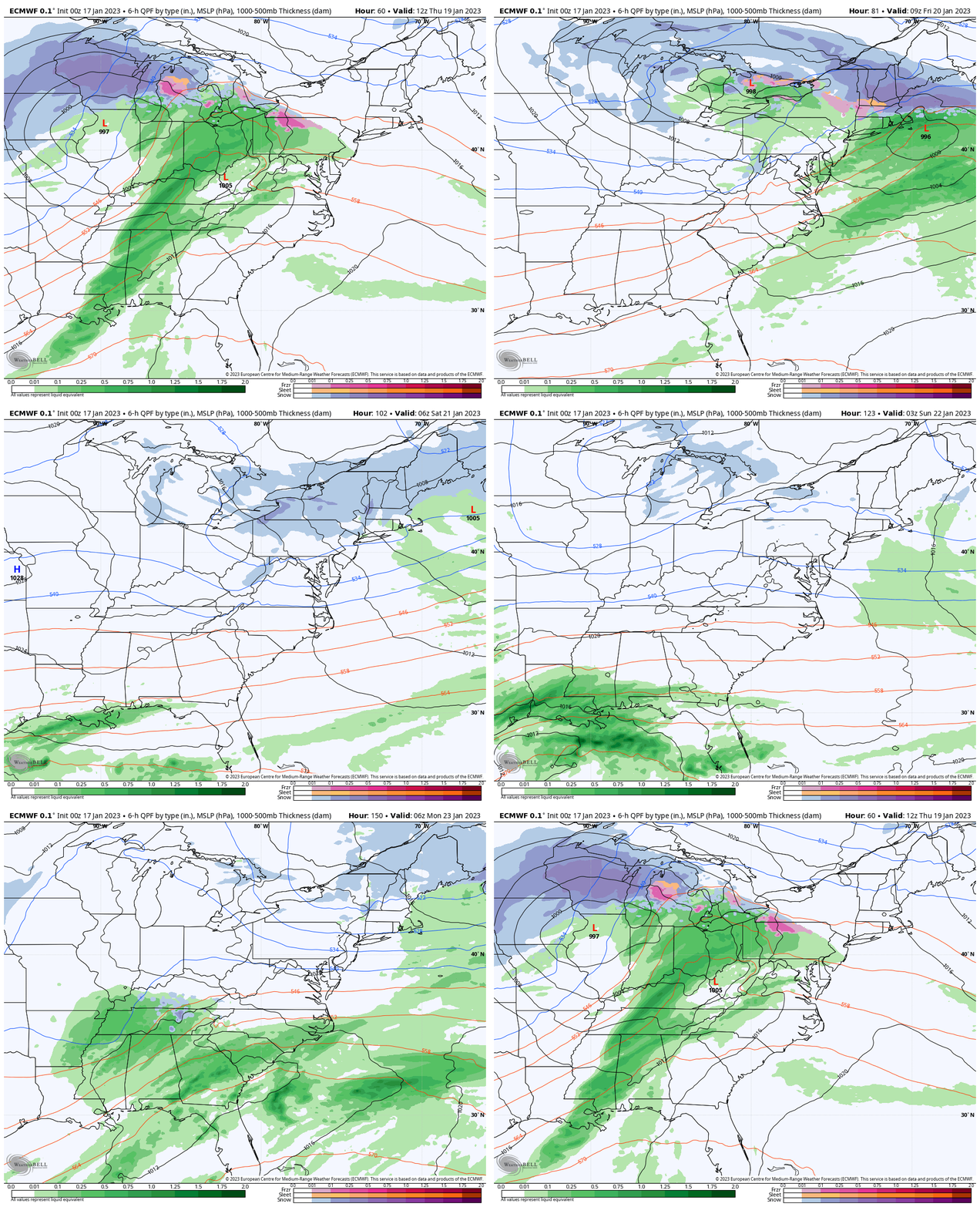
ECMWF Model 7 AM THU to 7 PM MON
I am showing the long loop to highlight the shift in storm track. The first system has been like the last month, tracking to the Great Lakes and bringing us rain. It may be heavy at times along with gusty winds.
Snapshot: Monday Evening
The European Model keeps showing the next system developing out of the Gulf Coast States, and ‘possibly’ bringing in some light snow or a mix on Monday. It looks light for now, but something interesting to watch.
7 Day Forecast
The bigger rain event will be Thursday. Temperatures will remain mild, however have trended cooler.
Please share your thoughts, best weather pics/videos, or just keep in touch via social media
-
Facebook: Justin Berk, Meteorologist
-
Twitter: @JustinWeather
-
Instagram: justinweather


