Thursday May 30 2019
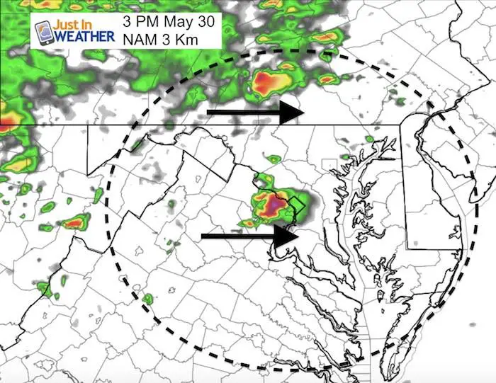
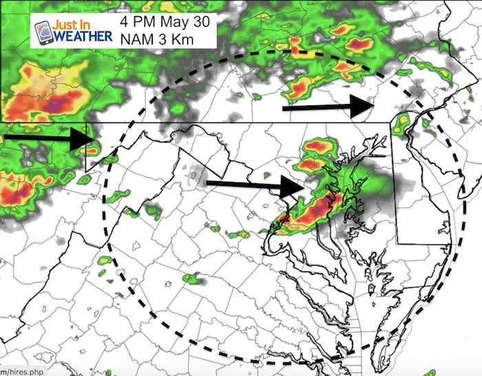
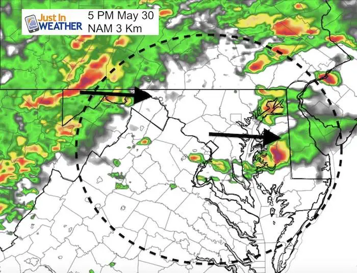
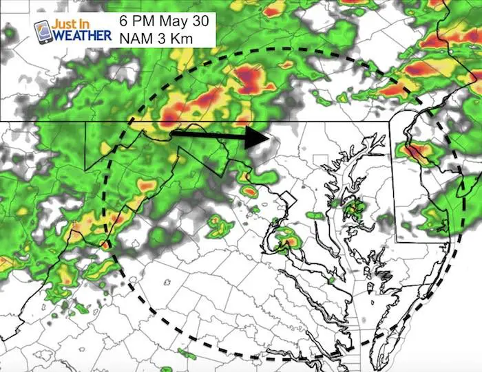
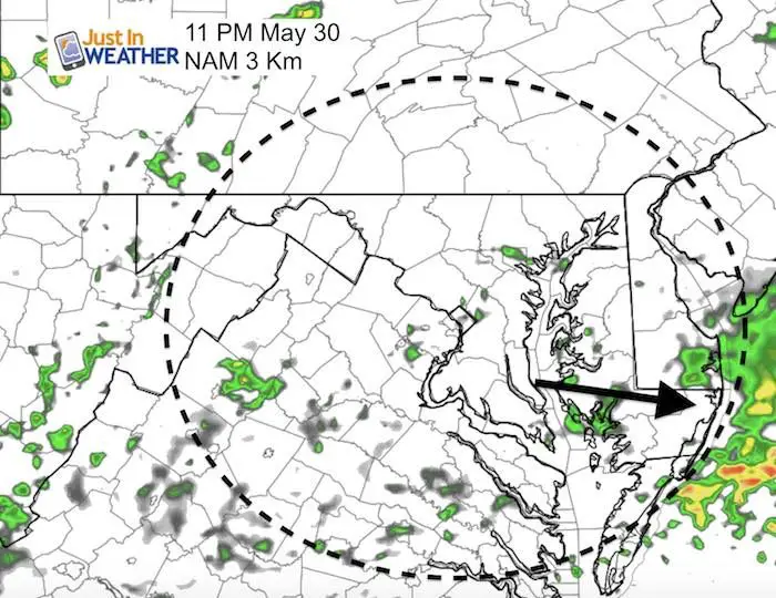
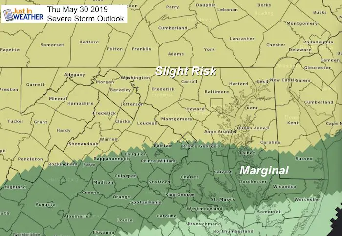
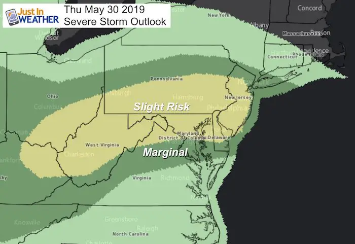
Here we go again! The Storm Prediction Center has our region in the Slight Risk category for storms to turn severe today. This term may be misleading. We will have multiple rounds of storms developing after 2 PM through the evening. Many of these will have the ability to turn severe. What is most important is that we consider the risk area has dropped south a little to cover more of central Maryland.
Timing Today:
- After 2 PM Central MD and Southern PA
- After 4 PM Eastern Shore and Delmarva
- After 6 PM Beaches
NOON UPDATE! Click here to see the latest short range model comparison
Severe Storm Risk Thursday
[adrotate group=”4″]
Severe Storm Qualifier:
- Winds over 58 mph
- Large hail over 1 inch diameter
- Isolated Tornados
Please note that as we get closer, these are potential alerts to be issued.
Severe Thunderstorm Watch: A broad area and window with a 4 to 6 hour time frame. This means it MIGHT happen.
Severe Thunderstorm Warning: A focused area like a county usually with a 30 to 60 minute time frame. This means it IS HAPPENING NOW.
Tornado Warning: A focused area and time frame. This would list towns in a likely path within a 15 to 45 minute window.
Notes:
I do not like to focus on the southern line as we saw the past few days. Some severe storms did break out south of the Watch area and risk region. So we all must be on the lookout and keep checking for updates as the storms develop.
Damage in Baltimore County will be investigated today to confirm if it was a tornado or microburst.
This will be an abbreviated post a I am still without power. I need to conserve battery on my computer until I can get more fuel for my generator or real power is restored.
Wider View
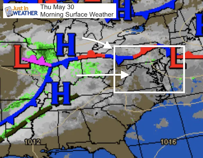
Morning Set Up
The stationary front in PA has been very active and will drop south today. The main event in the mid west will be pushing to the east to ignite multiple rounds of storms this afternoon and evening.
IR Satellite Loop
4 hours ending 6:16 AM
[adrotate group=”4″]
Local Weather Stats: Thursday May 30, 2019 in Baltimore
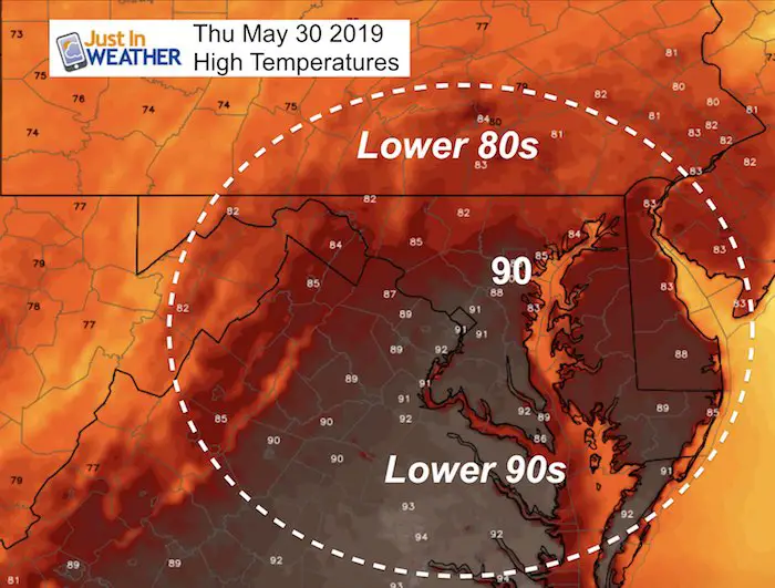
Wednesday brought a high temperature of 94ºF to BWI. Today will be near 90ºF again.
Average High: 78ºF
Record High: 98ºF in 2011
Average Low: 57ºF
Record Low: 38ºF in 1996
Sunrise: 5:43 AM
Sunset 8:27 PM
*Daylight = 1:14 longer than yesterday
*Bay Water Temperature = 72ºF at Thomas Pt. Light House
Weather Forecast Below
Keep In Touch Every Day
Just in case you don’t get all posts on your social media feed, stay up to date with the latest info…
Click here to sign up for email alerts…. Be the first to hear any new weather.
High Temperatures Today
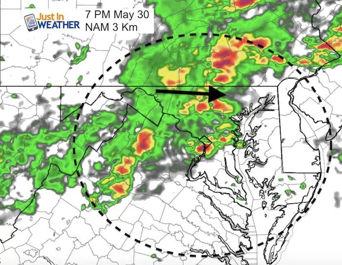
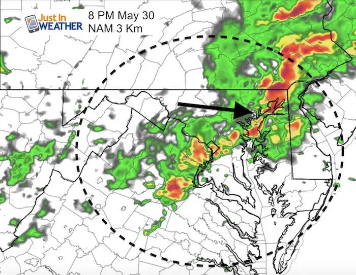
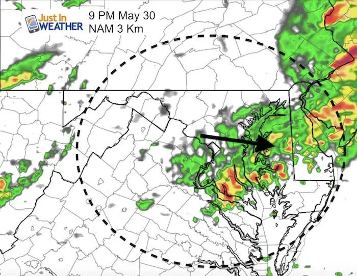
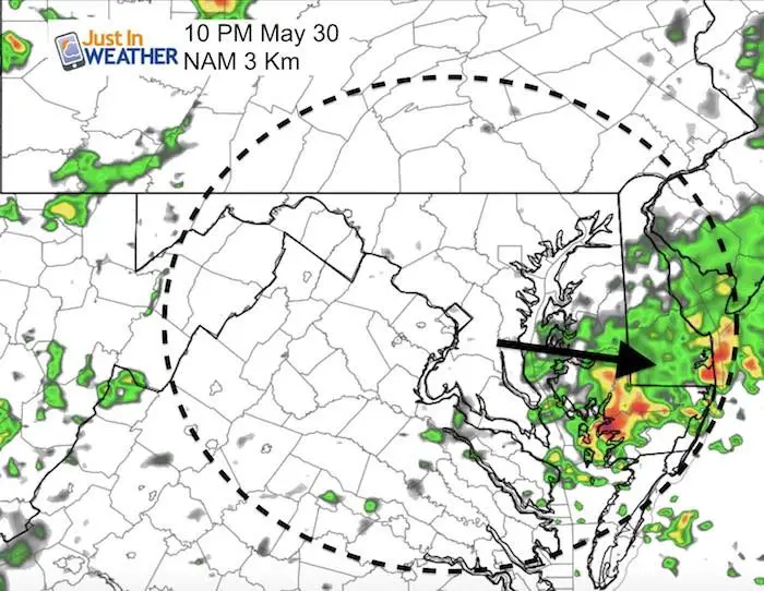
Radar Simulation —> slider
This model is the best guidance for today, but it is far from perfect! Yesterday there was a clear error in the storms verifying about 1 hour earlier than shown in the timeline.
We need to watch after 2 PM for development to track multiple cells through the evening.
[adrotate group=”4″]
Join My Team: Maryland Trek 6
Our look got an upgrade, but we have the same purpose. Please click the logo take a look at our new page.
- Consider joining our team for the week, a single day, or even as a sponsor.
Support Our Nonprofit:
Proceeds go to our programs Providing FREE holistic care for kids in cancer treatment and up to 5 years post treatment and caregivers.

Shine On
Proceeds from all sales go to Just In Power Kids. Click the image to shop and show your support.
Love Maryland Shirts and Hoodies
This shirt was designed by my ‘bonus’ daughter Jaiden. The hoodie has been the biggest hit, so our promotion has been extended until the end of this week.
|
||
|
Show your love for Maryland and make this 14 year old artist and her mom extra proud
|
Please share your thoughts, best weather pics/video, or just keep in touch via social media
-
Facebook: Justin Berk, Meteorologist
-
Twitter: @JustinWeather
-
Instagram: justinweather
Related Links:


