Sunday, January 11, 2026
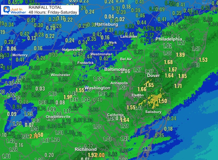
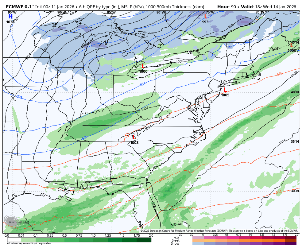
Lots of things to focus on in this report. The rainfall lived up to expectations with many areas getting near or above one inch in the last two days. This next phase will be the colder winds and a return to feeling like winter again.
With the push of cold winds, a few clusters of heavy showers may contain bursts of snow or ice pellets mixed with rain. These squalls are likely to pass early in the afternoon.
More impactful will be the weather in the mountains, where A Wind Advisory and a Winter Weather Advisory have been issued. So be careful traveling across Western Maryland and West Virginia to Western PA.
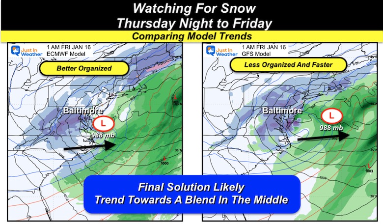
Looking Ahead: That snow potential for Thursday Night to Friday Morning has more support; however, I am still not seeing a major storm. The European Model is looking more organized, while the GFS is less (as expected). I see a blend between the two as our most likely outcome.
See it all below.
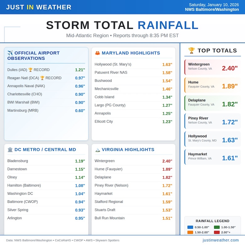
Rainfall Notes
Washington’s top airports both surpassed 1” and set new daily records. Baltimore was just under 1”.
Two Day Rainfall Map
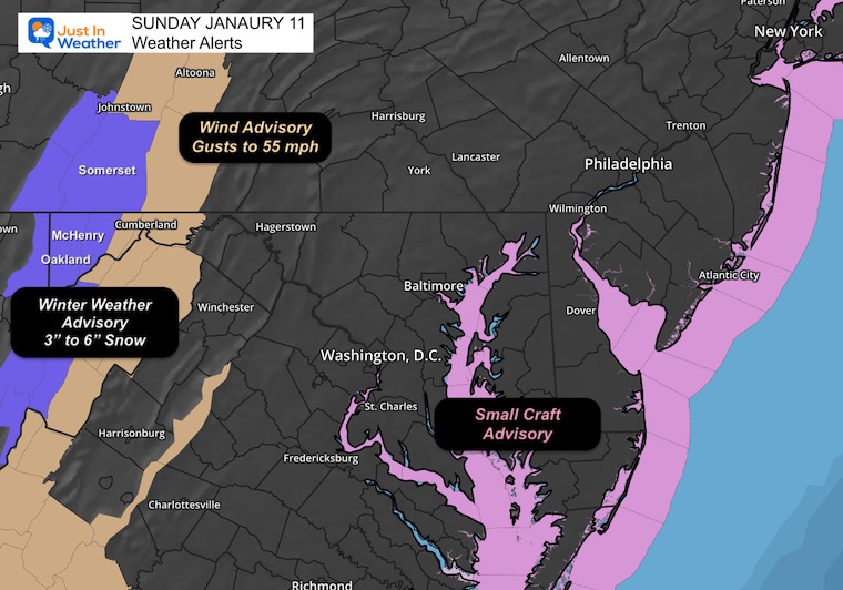
Weather Alerts Today
- Winter Weather Advisory: 3 to 6 inches of snow across the high ridges including Garrett County, MD
- Wind Advisory: Gusts to 50 mph
MOUNTAIN CAM:
WESTERN MARYLAND
This webcam is positioned at The Greene Turtle Deep Creek Lake and shows Wisp Resort, including a zoomed-in view of Squirrel Cage, The Face, the terrain park, Boulder, the mountain coaster, the tubing park and a shot of McHenry Cove at Deep Creek Lake!
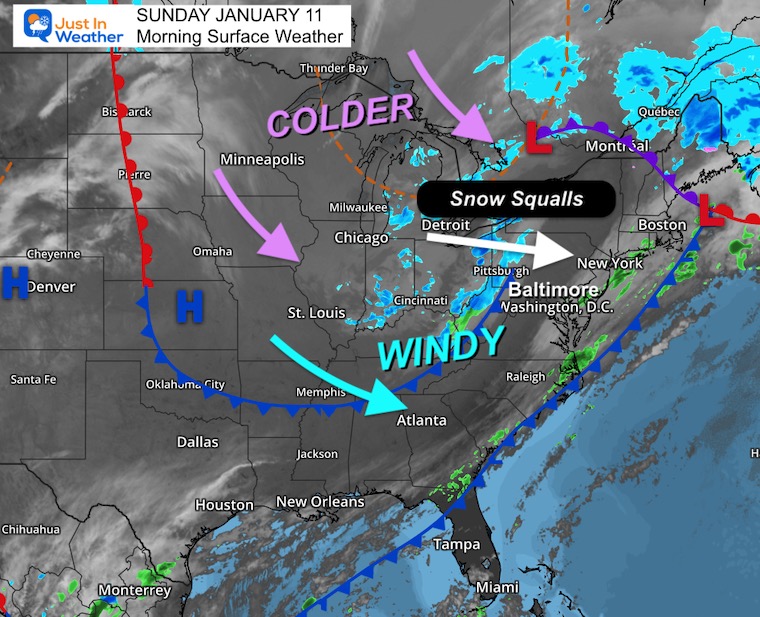
Morning Surface Weather
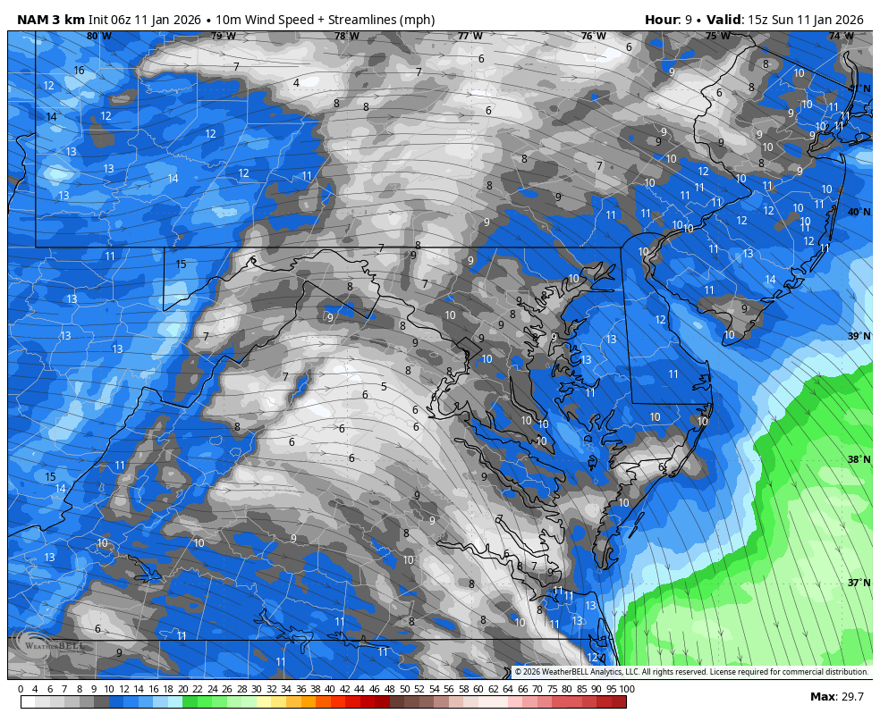
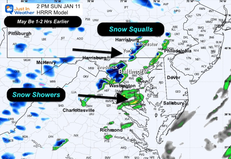
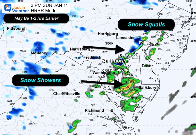
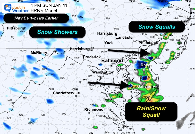
For Baltimore and the Mid-Atlantic: Windy conditions today as the cold front pushes through. Watch for snow squalls this afternoon! A line of snow squalls is moving from the Great Lakes toward our region and could bring a brief burst of snow with gusty winds and reduced visibility.
- Snow Squalls: A band of snow squalls stretching from Detroit toward Pittsburgh is heading our way. Expect a quick shot of snow possible this afternoon with rapidly changing conditions.
- Windy: Strong winds behind the cold front will make it feel much colder.
- Colder Air Arriving: A reinforcing shot of cold air is diving south from Canada. More cold air will follow later in the week.
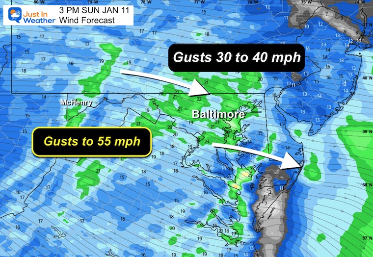
Wind Forecast 10 AM to Midnight
Winds will get stronger during the afternoon and evening.
Afternoon Snapshot
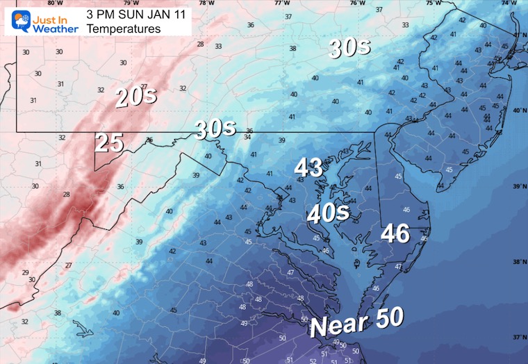
Afternoon Temperatures
Wind Chills

Radar Simulation 10 AM to 8 PM
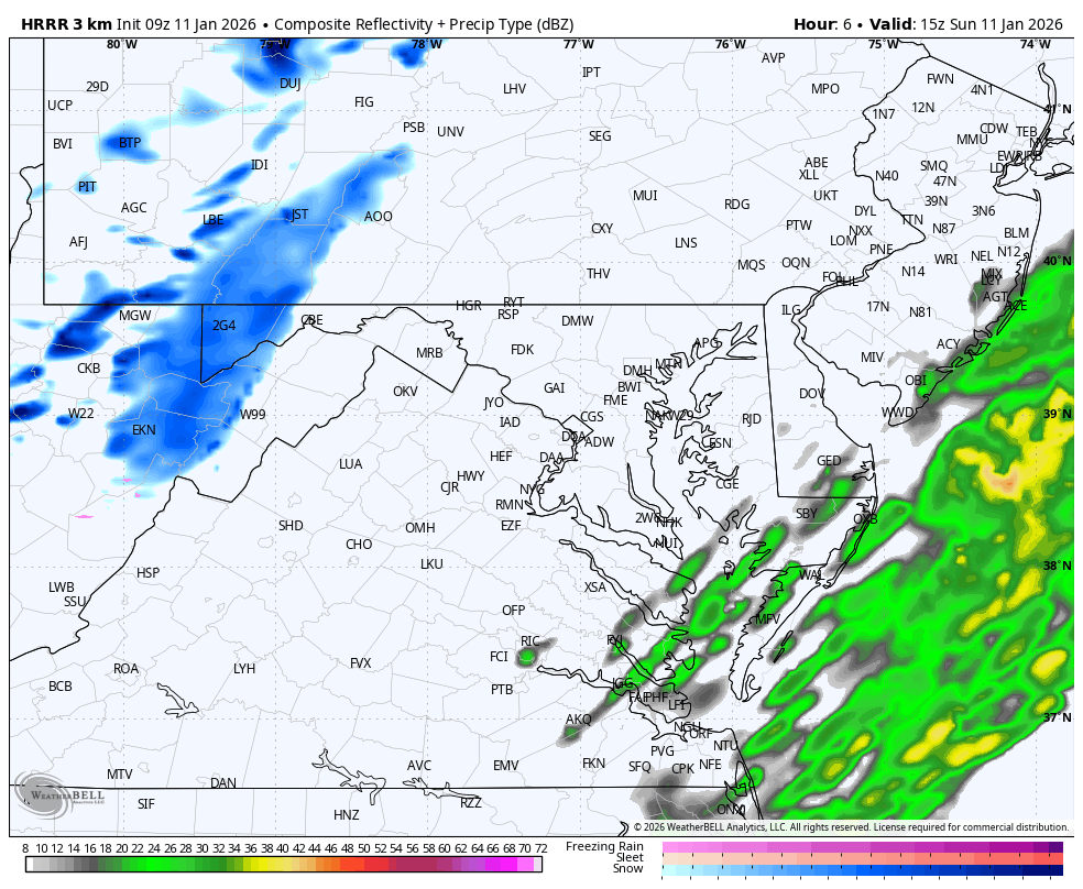
Afternoon Snapshots
This model can sometimes be 1 to 2 hours slower than what we end up seeing:
2 PM
3 PM
4 PM
CLIMATE DATA: Baltimore
Yesterday: Low 44°F; High 51°F
Precipitation: 0.90″
Season Snow Total: 2.0″
Snow Depth: 0″
Top Wind Gust: 21 mph
TODAY January 11
Sunrise at 7:26 AM
Sunset at 5:04 PM
Normal Low in Baltimore: 26ºF
Record Low: 1ºF in 1982
Normal High in Baltimore: 43ºF
Record High: 73ºF in 1975
Rainfall Deficit at BWI
- Prior 2 Years (2024 + 2025) = -16.91″
- Since Jan 1, 2026 = -0.07″
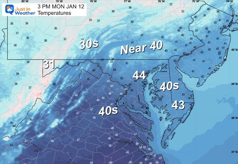
MONDAY
Back to the cold.
Morning Temperatures

Afternoon Temperatures
Looking Ahead For Snow?
Wednesday Afternoon to Friday Afternoon
This is the more reliable European Model, and it is looking a little more organized with Low Pressure in the Mid-Atlantic developing snow.
Timing is Thursday Night to Friday Morning.
Model Comparison
You may have seen the GFS model from other weather people. That is why I am addressing it here and doubling down on low confidence. This model appears faster and less organized than the prior run.
I believe there will be more adjustments AND the most likely solution will be a BLEND between the two we see here.
Yes, I see some snow accumulation, but I would NOT call this a major storm!
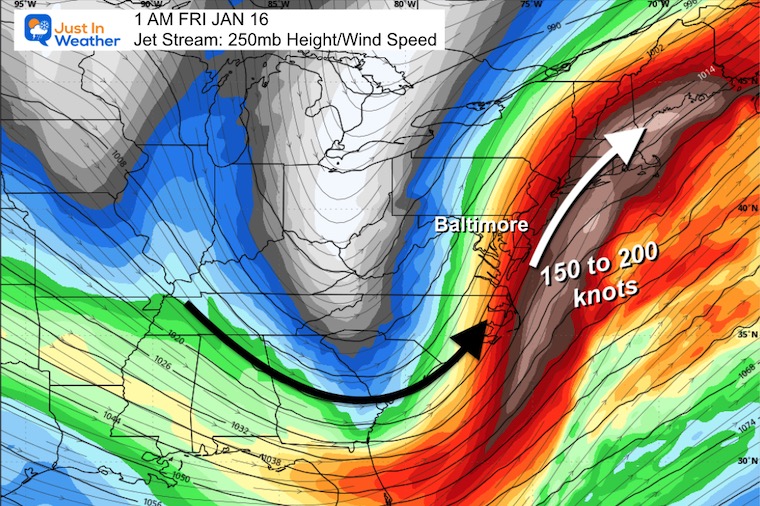
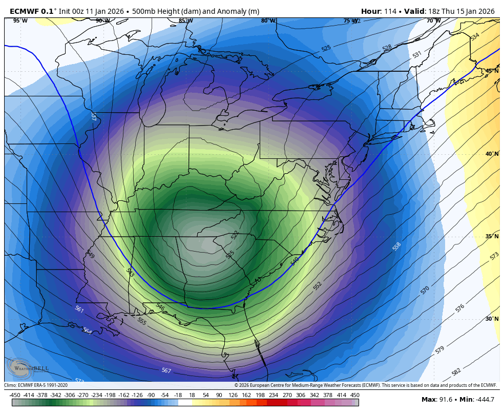
Jet Stream Snapshot
250 mb/Around 30,000+ Ft
Let’s Start Higher…
At this 250 mph level, 30,000+ Ft aloft, the orientation of fastest winds is too far East. This carries the system farther East and does not allow the system to fully blossom and stay nearby.
This is why I see it not becoming a major event at this time.
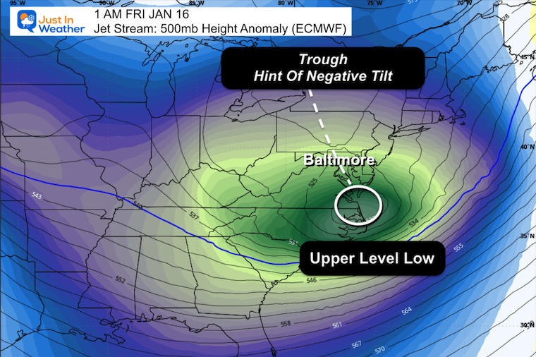
500 mb/Around 18,000+ Ft
The main element to watch here will be the jet stream.
At this 500mb level, we see the Upper Low and Negatively Tilted Trough. But there is no support above this level to allow it to take hold close to the coast.
Jet Stream Forecast Jan 15 to Jan 20
This 5-day window will bring a few chances for snow. This is NOT the only option ahead. Just the focus at this time.
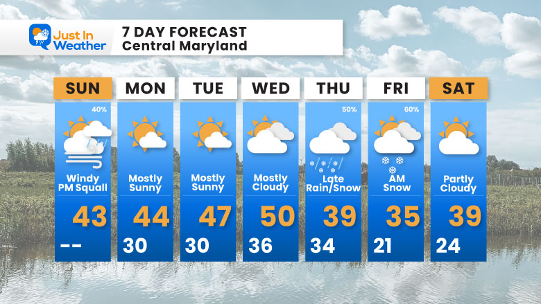
7-Day Forecast
Winter is coming back!
Thursday into Friday looks like an interesting system with rain changing to snow, and Friday morning snow looks promising, but I still would NOT call this a major storm!
Faith In The Flakes!
- Sunday: Windy with PM squall possible (40%). High 43°F.
- Monday: Mostly sunny. High 44°F, Low 30°F.
- Tuesday: Mostly sunny. High 47°F, Low 30°F.
- Wednesday: Mostly cloudy. High 50°F, Low 36°F.
- Thursday: Late rain/snow (50%). High 39°F, Low 34°F.
- Friday: AM snow (60%). High 35°F, Low 21°F.
- Saturday: Partly cloudy. High 39°F, Low 24°F.
Subscribe for email Alerts
FAITH IN THE FLAKES STORE
NOW OPEN FOR THE SEASON
click here

Snow Report December 14 and Grade My Forecast
In case you missed it, click this image for brief summary of the final snow totals from the last event.

Snow Report December 5 to 6 and Grade My Forecast
In case you missed it, click this image for brief summary of the final snow totals from the last event.

My Winter Outlook For Above-Average Snow
Click here for the full report

La Niña Advisory
This was issued October 9, as expected: A weak and short-lived event to start winter may play a different role this winter.

In Case You Missed It
Woolly Bear Caterpillar Winter Folklore
These are NOT all the same caterpillar!

Winter Outlook From 2 Farmers’ Almanacs

STEM Assemblies/In School Fields Trips Are Back
Click to see more and ‘Book’ a visit to your school

THANK YOU:
Baltimore Sun Magazine Readers’ Choice Best Of Baltimore

Maryland Trek 12 Day 7 Completed Sat August 9
UPDATED: We raised OVER $170,000 for Just In Power Kids – AND Still Collecting More
The annual event: Hiking and biking 329 miles in 7 days between The Summit of Wisp to Ocean City.
Each day, we honor a kid and their family’s cancer journey.
Fundraising is for Just In Power Kids: Funding Free Holistic Programs. I never have and never will take a penny. It is all for our nonprofit to operate.
Click here or the image to donate:

RESTATING MY MESSAGE ABOUT DYSLEXIA
I am aware there are some spelling and grammar typos and occasional other glitches. I take responsibility for my mistakes and even the computer glitches I may miss. I have made a few public statements over the years, but if you are new here, you may have missed it: I have dyslexia and found out during my second year at Cornell University. It didn’t stop me from getting my meteorology degree and being the first to get the AMS CBM in the Baltimore/Washington region. One of my professors told me that I had made it that far without knowing and to not let it be a crutch going forward. That was Mark Wysocki, and he was absolutely correct! I do miss my mistakes in my own proofreading. The autocorrect spell check on my computer sometimes does an injustice to make it worse. I can also make mistakes in forecasting. No one is perfect at predicting the future. All of the maps and information are accurate. The ‘wordy’ stuff can get sticky. There has been no editor who can check my work while writing and to have it ready to send out in a newsworthy timeline. Barbara Werner is a member of the web team that helps me maintain this site. She has taken it upon herself to edit typos when she is available. That could be AFTER you read this. I accept this and perhaps proves what you read is really from me… It’s part of my charm. #FITF
Please share your thoughts and best weather pics/videos, or just keep in touch via social media.


