


New Years Day Snow Squall And Falling Temps Entering 2026
Wednesday, December 31 New Year's Eve Update Closing out the year, we have a strong clipper to our north. This is going to drag a distinct push of arctic air…
Friday, January 2, 2026
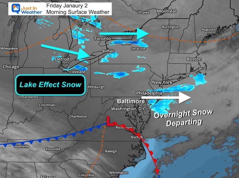
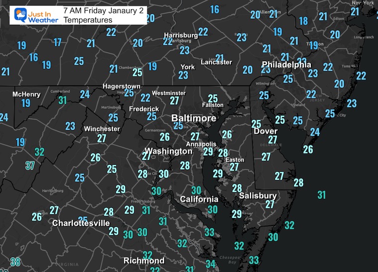
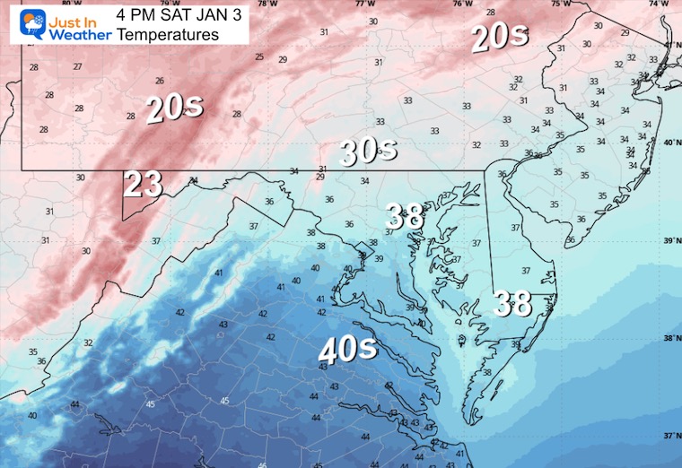
After the New Year’s Day Morning Snow Squall, the cold air mass has been firmly in place. One more system passed through overnight with flurries and light snow. This makes three mornings in a row.
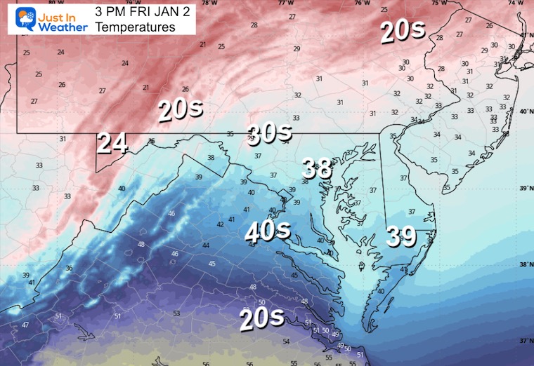
Once again, sunshine will build in today.
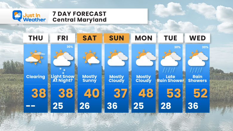
As things quiet down, there is one more potential event Saturday night. I have been watching this small low-pressure system passing off the Carolina coast with Maryland on the northern edge. The latest update has suppressed it, but we will take a look below.
Next week, that pattern will relax and allow warmer air to flow in for a few days.
We had a third night with light snow. This was NOT like the New Year’s Day snow squall. It may have dropped a coating in some areas, and it is moving away. Any early clouds will again give way to more sunshine.
WESTERN MARYLAND
Wind is still in full force in this region. A fresh coating to few inches of snow has blanketed the region.
This webcam is positioned at The Greene Turtle Deep Creek Lake and shows Wisp Resort, including a zoomed-in view of Squirrel Cage, The Face, the terrain park, Boulder, the mountain coaster, the tubing park and a shot of McHenry Cove at Deep Creek Lake!
Yesterday: Low 22°F; High 37°F
Precipitation: Trace
Season Snow Total: 2.0″
Snow Depth: Trace
Top Wind Gust: 46 mph
Sunrise at 7:26 AM
Sunset at 4:56 PM
Normal Low in Baltimore: 27ºF
Record Low: 0ºF in 1968
Normal High in Baltimore: 44ºF
Record High: 71ºF in 1876
Rainfall Deficit at BWI
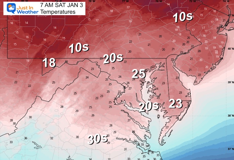
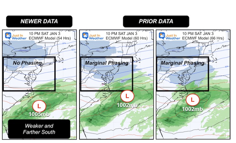
We are still tracking a southern system that will track Low Pressure off the Carolina Coast. There is inconsistent data about the track and interaction with the northern branch system, resulting in a chance for light snow.
This would be more like overnight and on the light side.
The latest data from the ECMWF Model has suppressed a weaker Low Pressure farther south. Compare the plot for 10 PM to the prior model runs.
Again, this is not a major event. I use these as tests going forward for larger systems… but follow the policy to not abandon with one abrupt run. If it is gone with the morning model suite, then it’s off the table.
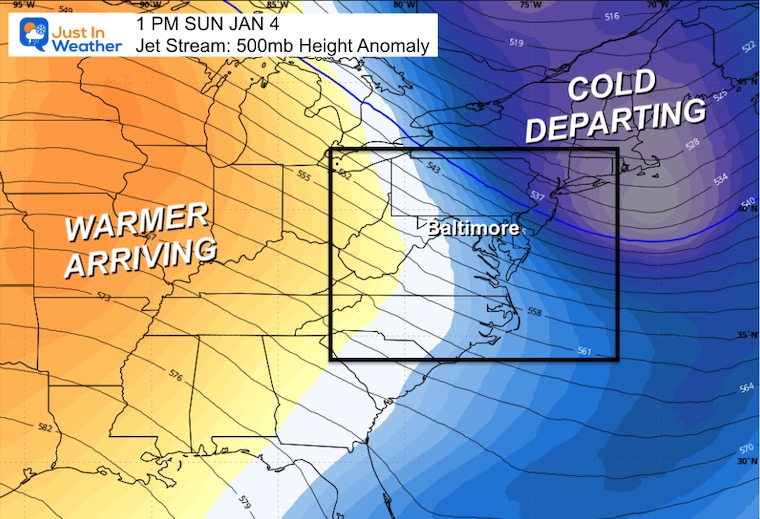
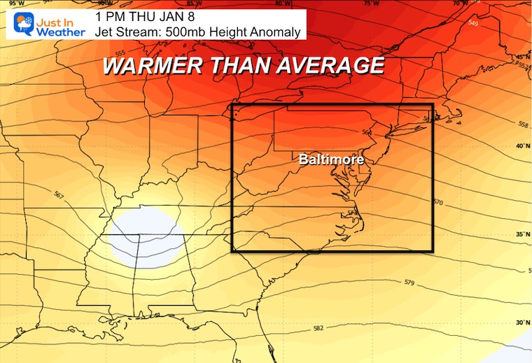
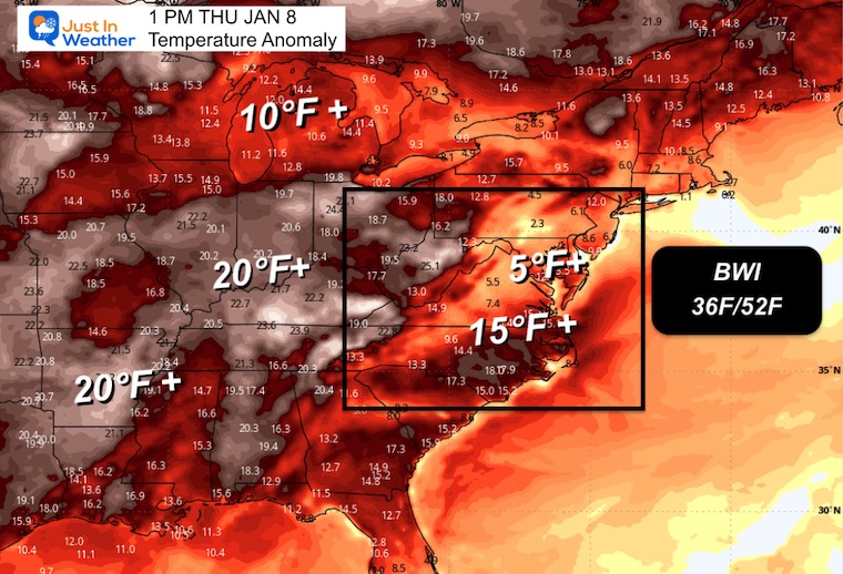
The jet stream is going to take a break for the Eastern US, which is common in cold patterns.
The Central US is having a record warm winter, and this supports more of that.
Some mild air will build in here later in the week, but far from any records.
Cold air departing the Eastern US.
Subscribe for email Alerts
Sign up and be the first to know!

In case you missed it, click this image for brief summary of the final snow totals from the last event.

In case you missed it, click this image for brief summary of the final snow totals from the last event.

Click here for the full report

This was issued October 9, as expected: A weak and short-lived event to start winter may play a different role this winter.

These are NOT all the same caterpillar!


Click to see more and ‘Book’ a visit to your school


The annual event: Hiking and biking 329 miles in 7 days between The Summit of Wisp to Ocean City.
Each day, we honor a kid and their family’s cancer journey.
Fundraising is for Just In Power Kids: Funding Free Holistic Programs. I never have and never will take a penny. It is all for our nonprofit to operate.
Click here or the image to donate:

I am aware there are some spelling and grammar typos and occasional other glitches. I take responsibility for my mistakes and even the computer glitches I may miss. I have made a few public statements over the years, but if you are new here, you may have missed it: I have dyslexia and found out during my second year at Cornell University. It didn’t stop me from getting my meteorology degree and being the first to get the AMS CBM in the Baltimore/Washington region. One of my professors told me that I had made it that far without knowing and to not let it be a crutch going forward. That was Mark Wysocki, and he was absolutely correct! I do miss my mistakes in my own proofreading. The autocorrect spell check on my computer sometimes does an injustice to make it worse. I can also make mistakes in forecasting. No one is perfect at predicting the future. All of the maps and information are accurate. The ‘wordy’ stuff can get sticky. There has been no editor who can check my work while writing and to have it ready to send out in a newsworthy timeline. Barbara Werner is a member of the web team that helps me maintain this site. She has taken it upon herself to edit typos when she is available. That could be AFTER you read this. I accept this and perhaps proves what you read is really from me… It’s part of my charm. #FITF