Sunday December 28, 2025
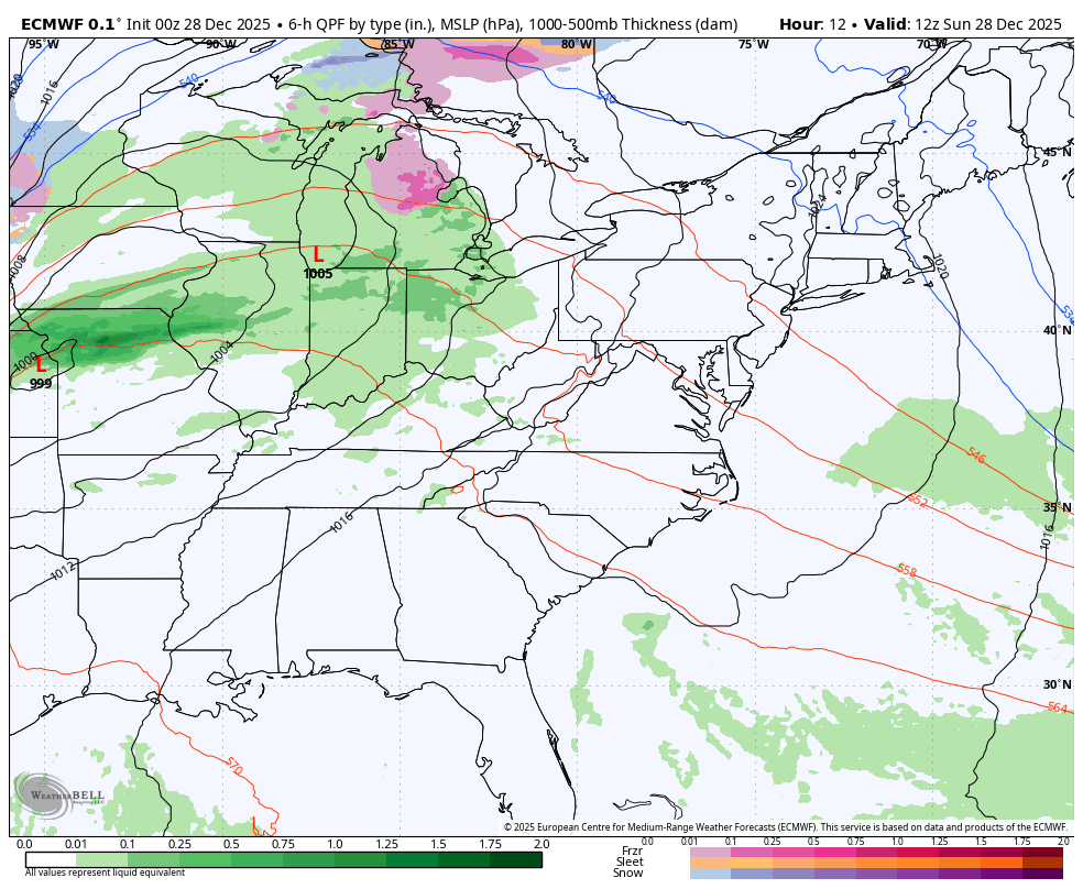
A strong storm passing through the Great Lakes will stay north of us but still affect our weather. This will be a bomb cyclone, meaning the pressure will drop more than 24 mb in 24 hours. The net result will bring freezing rain to Northern Pennsylvania and Metro New York, and a legitimate Ice Storm to Northern New England.
Across the Great Lakes, expect widespread blizzard conditions with heavy snow and strong winds.
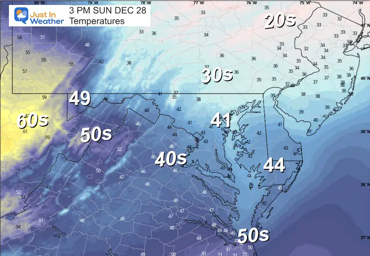
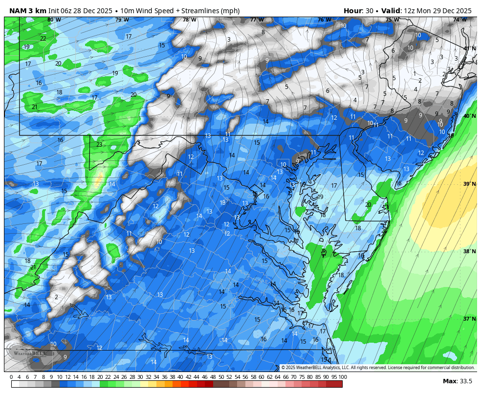
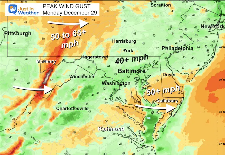
For our region, spotty rain showers today, and only a narrow band of rain on Monday. The WIND will be the main story, and a High Wind Watch for the mountains is expected to be updated soon with winds that may exceed 65 mph.
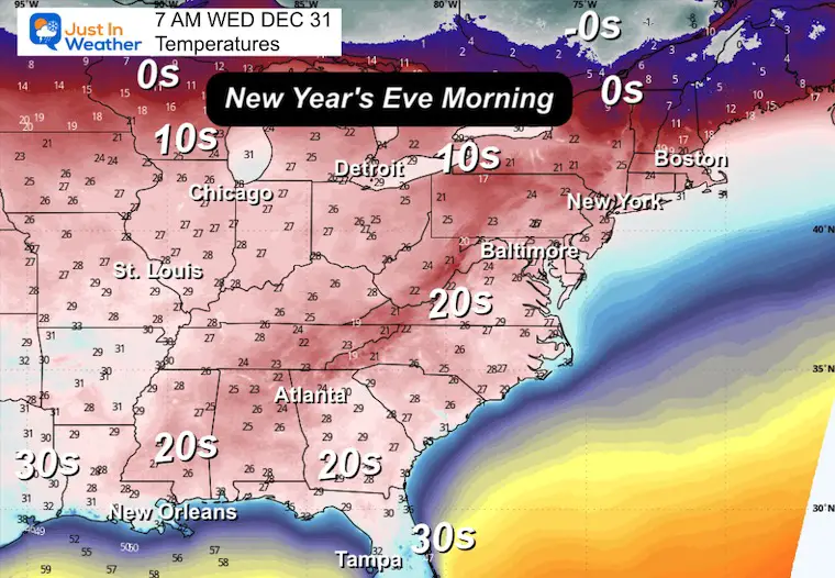
Much colder air will follow, and we all get in on that. By Wednesday Morning (New Year’s Eve), the 30s will make their way into Central Florida!
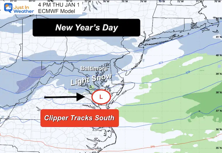
In that cold air, a Clipper will track through Virginia, bringing a chance for light snow and minor accumulation to Central Maryland.
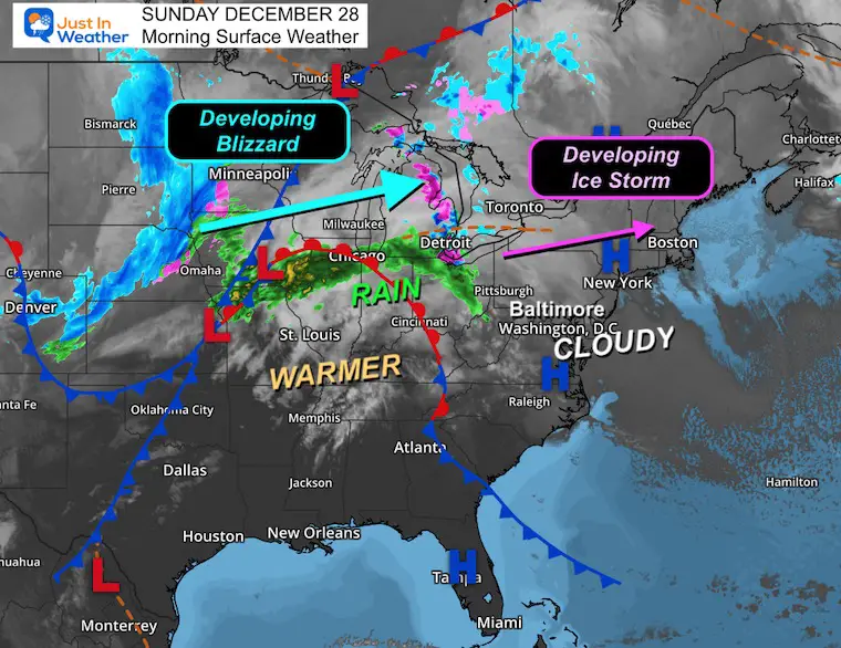
Morning Surface Weather
We remain cloudy and cool, and just on the southern edge of the storm that will do this to our north:
- Developing Blizzard for the Upper Midwest and Great Lakes.
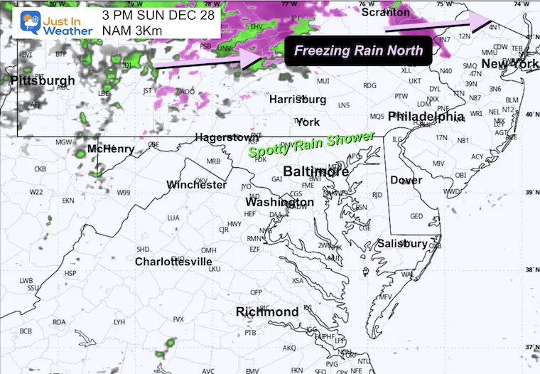
- Freezing Rain will fall later today from Northern Pennsylvania through New York in many areas that got snow the other day.
- An ice storm is expected tomorrow in Northern New England.
Storm Forecast: Sunday Morning to Monday Evening
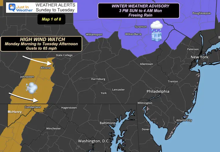
Weather Alerts
FREEZING RAIN Sunday Night: Poconos to New York in many areas that just got snow.
HIGH WIND WATCH Mon-Tue: Gusts to 65 mph (or higher) in the mountains.
Local Weather
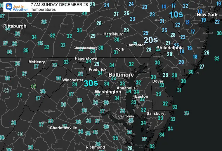
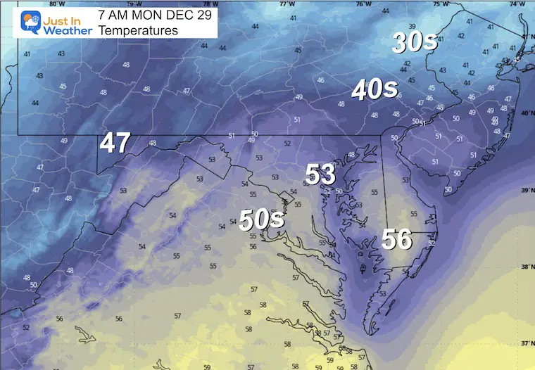
Morning Temperatures
Afternoon Temperatures
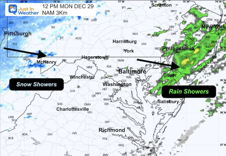
Afternoon Radar Simulation
Spotty rain showers with the focus for Freezing Rain through Northern Pennsylvania.
MOUNTAIN CAM:
WESTERN MARYLAND
Wind is still in full force in this region. A fresh coating of a few inches of snow has blanketed the region.
This webcam is positioned at The Greene Turtle Deep Creek Lake and shows Wisp Resort, including a zoomed-in view of Squirrel Cage, The Face, the terrain park, Boulder, the mountain coaster, the tubing park and a shot of McHenry Cove at Deep Creek Lake!
CLIMATE DATA: Baltimore
Yesterday: Low 34°F; High 40°F
Precipitation: 0.00″
Season Snow Total: 2.0″
Snow Depth: 0″
Top Wind Gust: 23 mph
TODAY December 28
Sunrise at 7:25 AM
Sunset at 4:52 PM
Normal Low in Baltimore: 27ºF
Record Low: 10ºF in 1950/2017
Normal High in Baltimore: 45ºF
Record High: 74ºF in 1946
Rainfall Deficit at BWI
* Ending 2024 = -8.00″
* Since Jan 1 = -8.60″
* We are STILL DOWN -16.60″ INCLUDING LAST YEAR
MONDAY
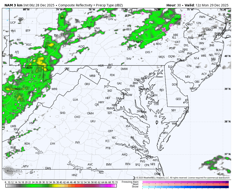
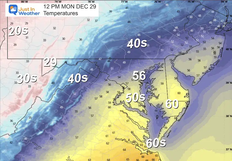
This will be a turbulent day! A warm morning with a cold front passing midday. The rain will be minimal, but expanding as it passes east of the Bay.
STRONG WINDS will bring in colder air and develop snow into the Western Maryland Mountains.
Morning Temperatures
Radar Simulation: 7 AM to Midnight
Noon Snapshots
Temperatures
Radar Simulation
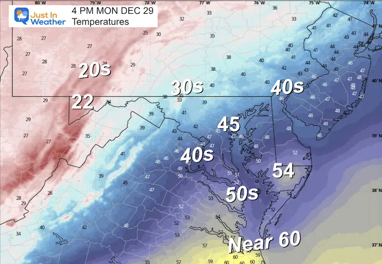
Afternoon Snapshot
Temperatures
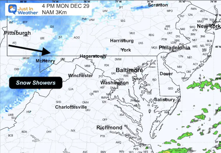
Radar Simulation
WIND FORECAST
7 AM to Midnight
PEAK WIND GUSTS
Yes, winds may top over 65 mph in the mountains.
Over 50 mph on Delmarva, while many metro areas will be in the 40+ mph category.
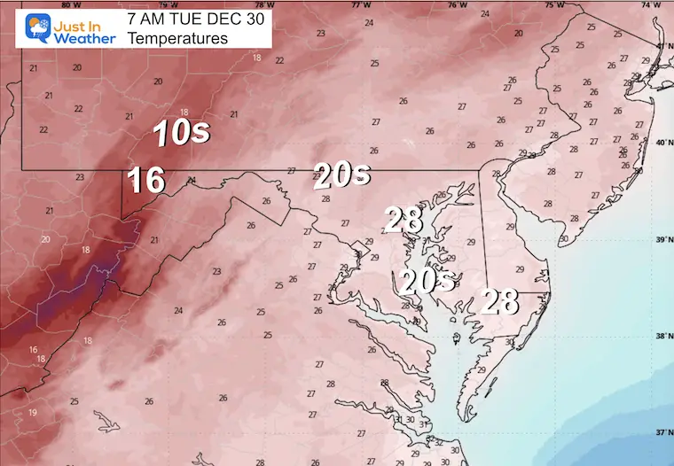
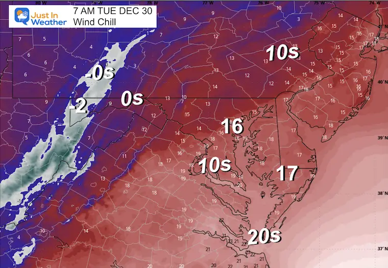
Tuesday Morning
Temperatures
Wind Chills
WIDE VIEW WEDNESDAY MORNING
The cold air will expand into Florida with below-freezing temps along the Panhandle, and 30s south of Orlando!
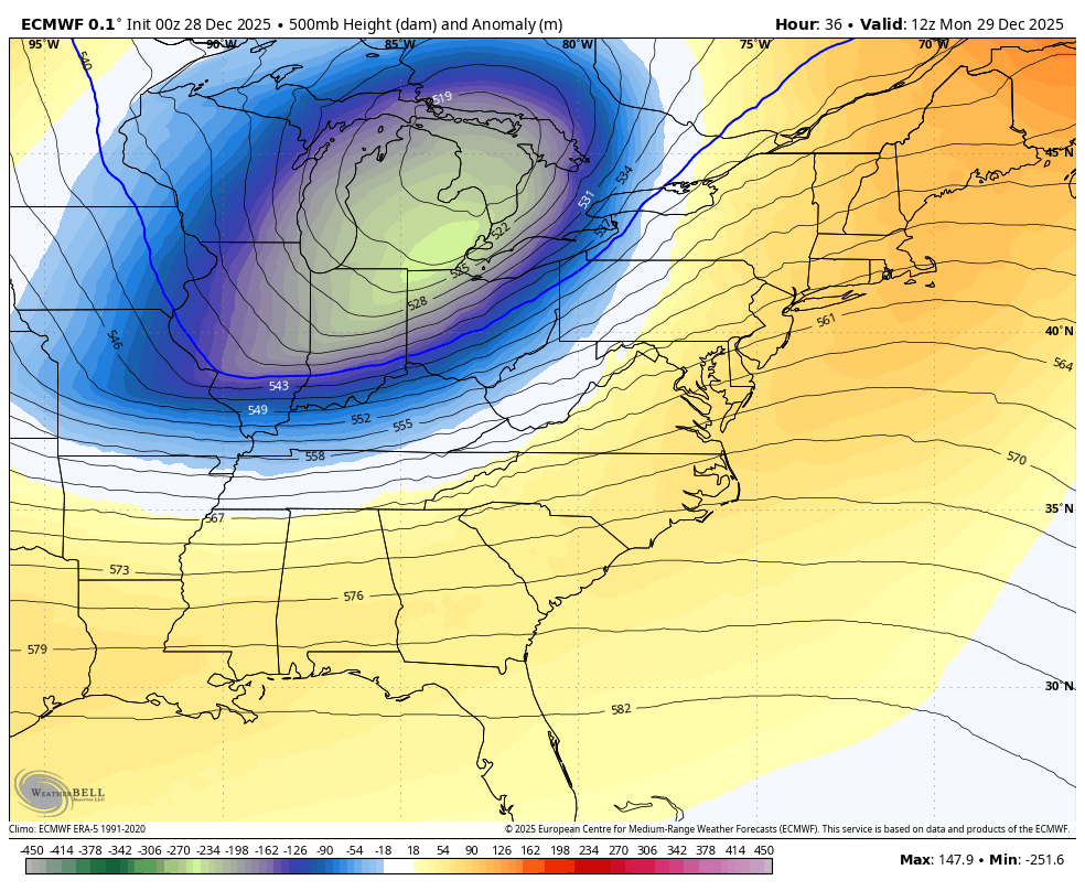
Jet Stream Forecast: Monday to Friday
The surge of Arctic Air into the New Year.
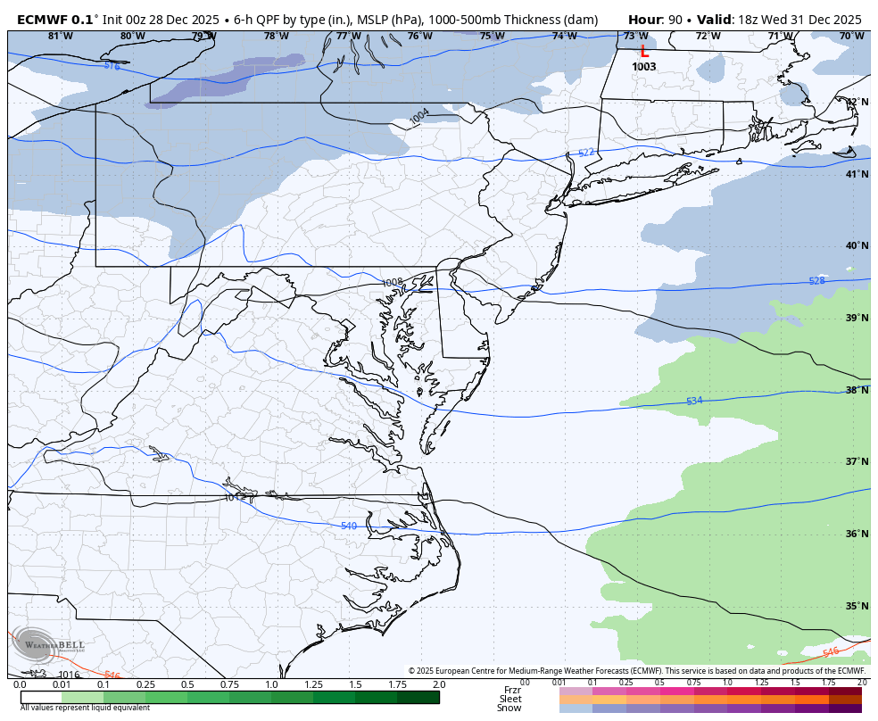
Clipper: Wednesday Afternoon to Thursday Night
New Year’s Day
This clipper is expected to pass through Central Virginia. That is a prime location to place snow on the north side through much of Maryland.
This looks like a light snow event with minor accumulation.
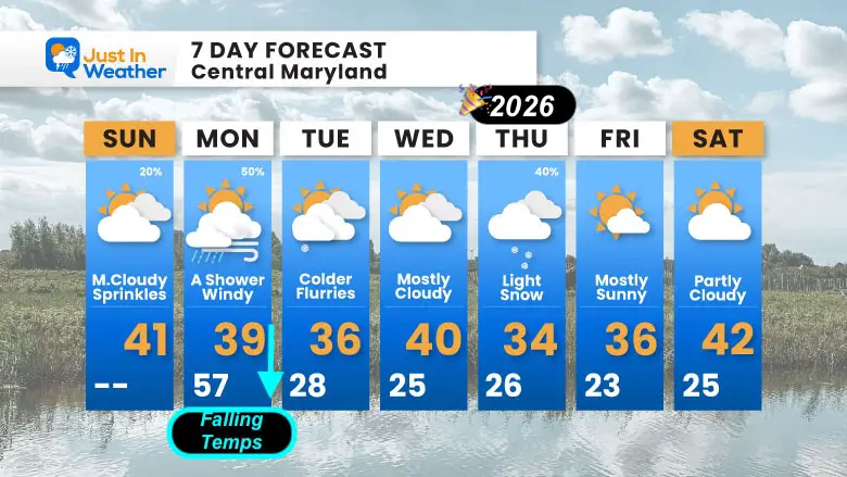
7 Day Forecast: Central Maryland
- Sunday: Mostly Cloudy, Sprinkles | High 41°F | 20% chance rain
- Monday: A Shower, Windy, Falling Temps | High 57°F → 39°F | 50% chance rain
- Tuesday: Colder, Flurries | High 36°F / Low 28°F
- Wednesday: Mostly Cloudy | High 40°F / Low 25°F
- Thursday: Light Snow | High 34°F / Low 26°F | 40% chance precipitation
- Friday: Mostly Sunny | High 36°F / Low 23°F
- Saturday: Partly Cloudy | High 42°F / Low 25°F
Subscribe For email Alerts
FAITH IN THE FLAKES STORE
NOW OPEN FOR THE SEASON
click here

Snow Report December 14 and Grade My Forecast
In case you missed it, click this image for brief summary of the final snow totals from the last event.

Snow Report December 5 to 6 and Grade My Forecast
In case you missed it, click this image for brief summary of the final snow totals from the last event.

My Winter Outlook For Above-Average Snow
Click here for the full report

La Niña Advisory
This was issued October 9, as expected: A weak and short-lived event to start winter may play a different role this winter.

In Case You Missed It
Woolly Bear Caterpillar Winter Folklore
These are NOT all the same caterpillar!

Winter Outlook From 2 Farmers’ Almanacs

STEM Assemblies/In School Fields Trips Are Back
Click to see more and ‘Book’ a visit to your school

THANK YOU:
Baltimore Sun Magazine Readers’ Choice Best Of Baltimore

Maryland Trek 12 Day 7 Completed Sat August 9
UPDATED: We raised OVER $170,000 for Just In Power Kids – AND Still Collecting More
The annual event: Hiking and biking 329 miles in 7 days between The Summit of Wisp to Ocean City.
Each day, we honor a kid and their family’s cancer journey.
Fundraising is for Just In Power Kids: Funding Free Holistic Programs. I never have and never will take a penny. It is all for our nonprofit to operate.
Click here or the image to donate:

RESTATING MY MESSAGE ABOUT DYSLEXIA
I am aware there are some spelling and grammar typos and occasional other glitches. I take responsibility for my mistakes and even the computer glitches I may miss. I have made a few public statements over the years, but if you are new here, you may have missed it: I have dyslexia and found out during my second year at Cornell University. It didn’t stop me from getting my meteorology degree and being the first to get the AMS CBM in the Baltimore/Washington region. One of my professors told me that I had made it that far without knowing and to not let it be a crutch going forward. That was Mark Wysocki, and he was absolutely correct! I do miss my mistakes in my own proofreading. The autocorrect spell check on my computer sometimes does an injustice to make it worse. I can also make mistakes in forecasting. No one is perfect at predicting the future. All of the maps and information are accurate. The ‘wordy’ stuff can get sticky. There has been no editor who can check my work while writing and to have it ready to send out in a newsworthy timeline. Barbara Werner is a member of the web team that helps me maintain this site. She has taken it upon herself to edit typos when she is available. That could be AFTER you read this. I accept this and perhaps proves what you read is really from me… It’s part of my charm. #FITF
Please share your thoughts and best weather pics/videos, or just keep in touch via social media.


