Sunday Morning, December 14
At first glance, this forecast worked out well. The snow did gradually develop from north to south overnight and early this morning. While some southern areas had wet pavement, thundersnow was observed at BWI between 4 and 5 AM. This burst helped to overtake the warmer ground.
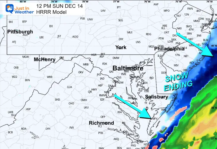
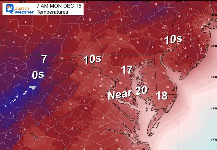
Snow is still falling across Central Maryland and will be ending from North to South. Then we trade off to bitterly cold winds, making it feel like close to zero all day.
In this report, I have the preliminary snow maps as of 6:30 AM and the live radar to track the progress.
Our forecast winds and temperatures will be the focus.
HEADLINES
- Winter Weather Advisory Will End
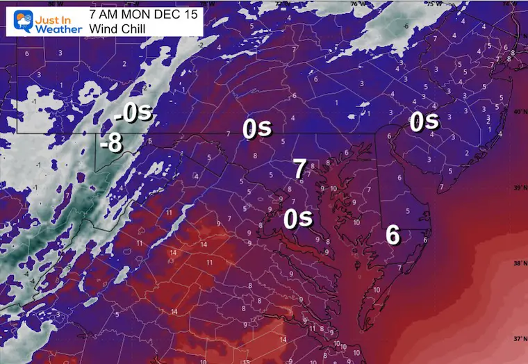
- Wind Chills Near 0°F
- ThunderSnow Observed Early This Morning
- Snow Totals Appear To Match My Final Call
- Totals Trending to the High End Of My Ranges
- Brutal Wind Chills Today to Monday Morning
- Warmer Mid Week
- Late Week Rain/T’storm
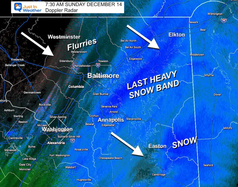
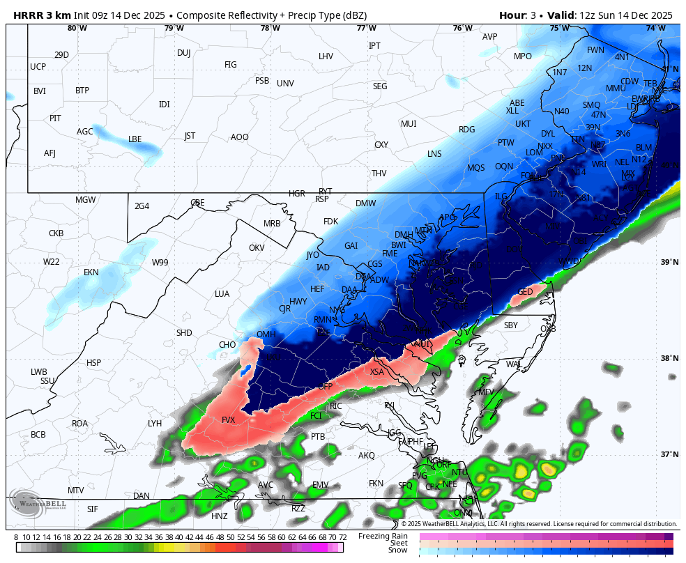
Doppler Radar at 7:30 AM
- The last heavy snow band was moving east of Baltimore.
- Flurries ending inland
- A few more hours of snow for the Eastern Shore.
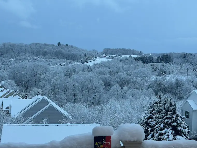
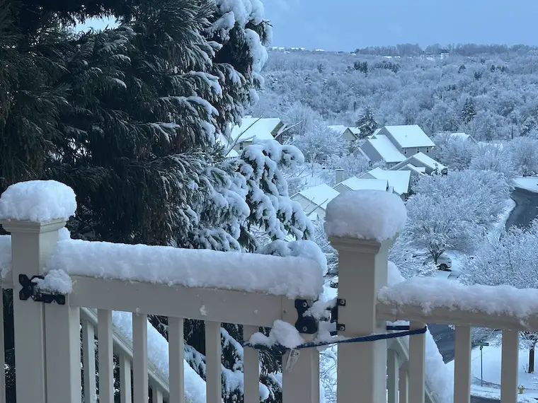
My First Daylight Snow Photos
About 5 inches near the Maryland/Pennsylvania line.
In case you missed it:
Early Morning Report Of ThunderSnow
Many corroborating reports and photos:
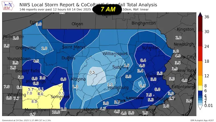
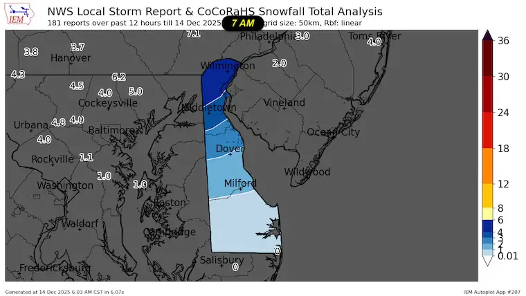
Preliminary Snow Report Maps
This was generated at 7 AM. I will have a formal report map when available.
Maryland
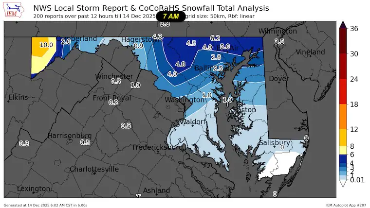
Pennsylvania
Delaware
Compare to: My FINAL Call For Snowfall Map

VIDEO
Why Measure in MULTIPLE Places?
WINTER WEATHER ALERTS
The Winter Weather Advisory will remain for Lower Delmarva through the morning.

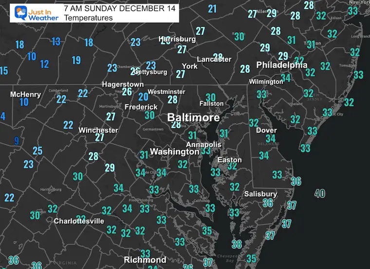
Morning Temperatures
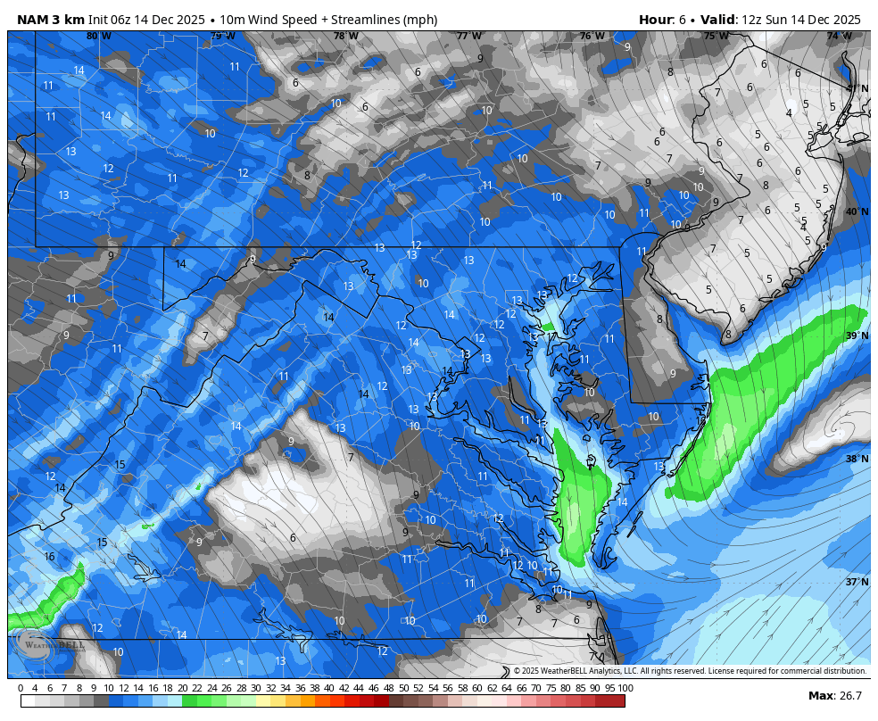
Morning Surface Weather
There is more snow on the Eastern Shore of Maryland than shown on this map.

Live Radar Widget
Radar Simulation
Snapshot at Noon
Snow moving away from the beaches.
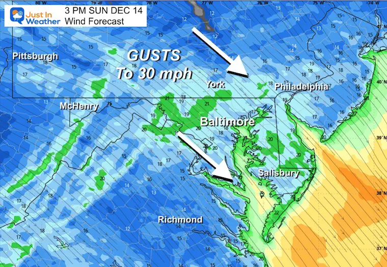
Wind Forecast 7 PM to Midnight
Afternoon Snapshot
Gusts to 30 mph.
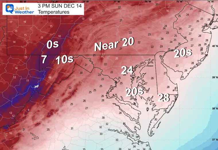
Afternoon Temperatures
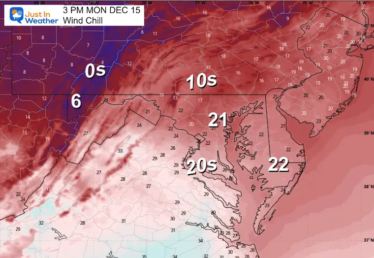
Afternoon Wind Chill

CLIMATE DATA: Baltimore
Yesterday: Low 20F; High 42F
Precipitation: 0.00” – None reached the airport by midnight
Snow = 0
Season Snow Total: 1.0” (as of yesterday)
Top Wind Gust: 15 mph
TODAY December 14
Sunrise at 7:18 AM
Sunset at 4:45 PM
Normal Low in Baltimore: 30ºF
Record 11ºF in 1960
Normal High in Baltimore: 48ºF
Record 71ºF in 1881; 1929
Rainfall Deficit at BWI
- Ending 2024 = -8.00”
- Since Jan 1 = 7.51”
- We are STILL DOWN -15.51” INCLUDING LAST YEAR
Subscribe for eMail Alerts
FAITH IN THE FLAKES STORE
NOW OPEN FOR THE SEASON
click here

FINAL DAY
If It Snows On Christmas: Jarrettsville Furniture Special
MONDAY TEMPERATURES AND WIND
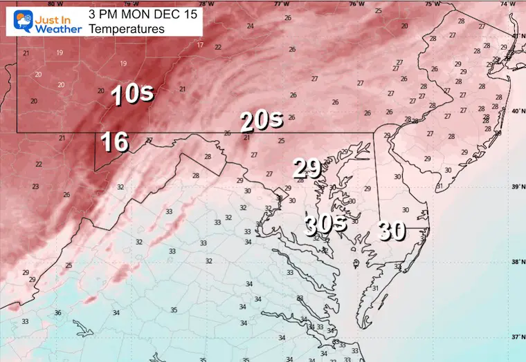
The temperature will be cold and falling during the afternoon.
Morning Temperatures
Morning Wind Chills
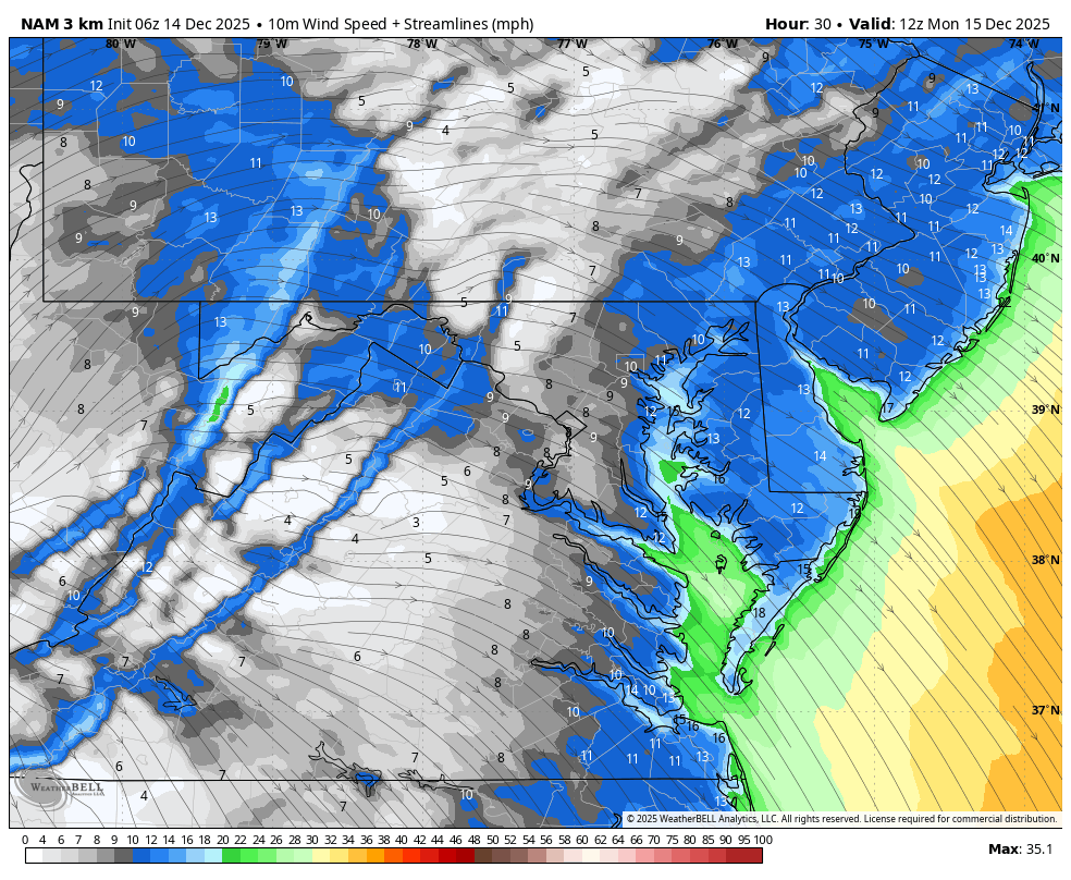
Wind Forecast 7 AM to 7 PM
Afternoon Temperatures
Afternoon Wind Chills
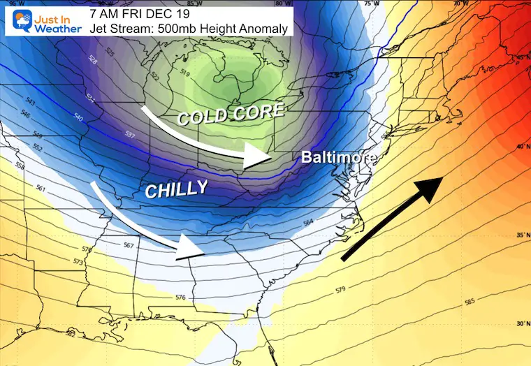
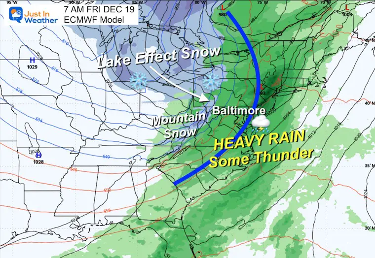
Looking Later In The Week
Jet Stream Forecast Sunday to Friday Morning
A warm-up ahead of the next storm.
Snapshot Friday Morning
Storm Forecast
Thursday Morning to Friday Night
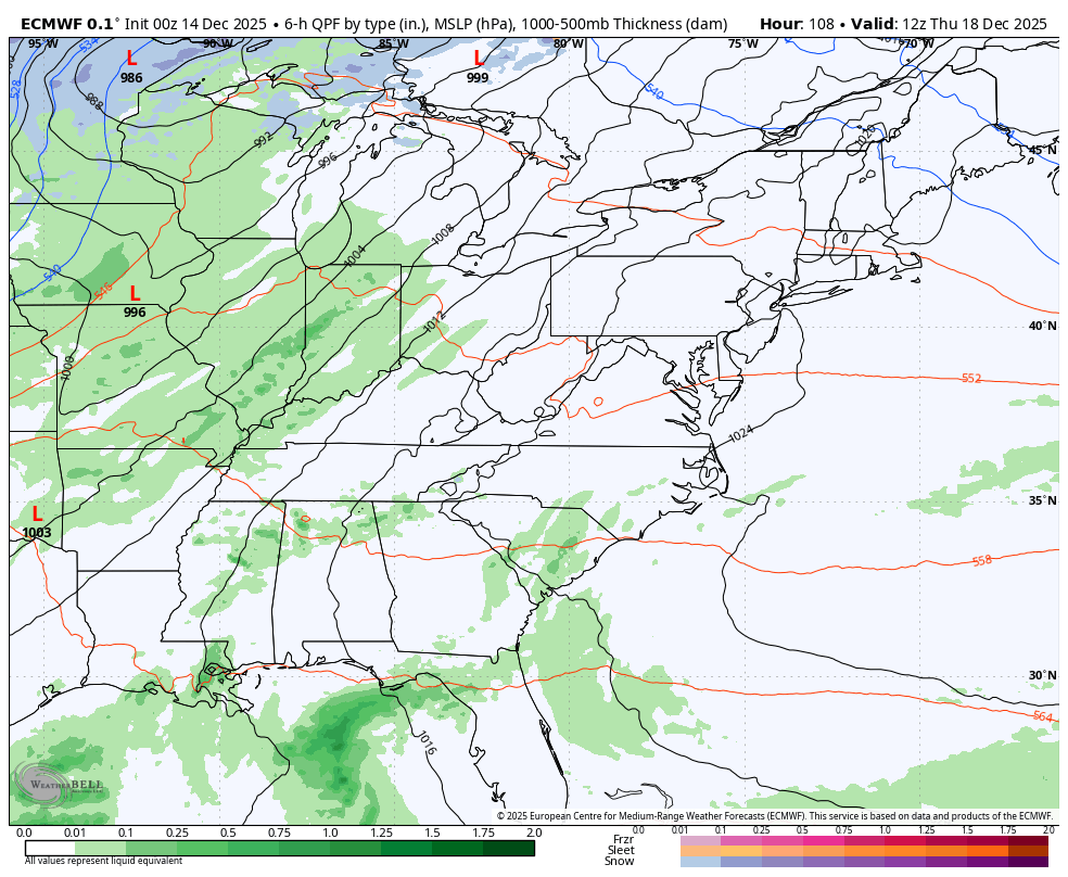
Friday Morning Snapshot
A cold front will spawn heavy rain and perhaps some thunder.
Snow will return across the Great Lakes and high mountains of Western Maryland and West Virginia.
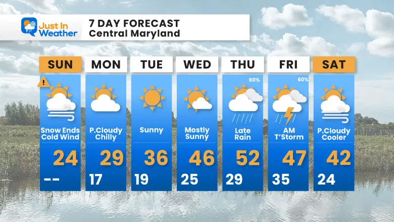
7 Day Forecast
- Sunday Afternoon: BRUTALLY COLD WIND
- Warming Up: Wednesday = 40s
- Thursday = 50s with rain arriving late
- Friday: Rain, Wind, and maybe a T’Storm
Subscribe for eMail Alerts
Snow Report December 5 to 6 and Grade My Forecast
In case you missed it. The brief summary of the final snow totals from the last event.

My Winter Outlook For Above-Average Snow
Click here for the full report

La Niña Advisory
This was issued October 9, as expected: A weak and short-lived event to start winter may play a different role this winter.

In Case You Missed It
Woolly Bear Caterpillar Winter Folklore
These are NOT all the same caterpillar!

Winter Outlook From 2 Farmers’ Almanacs

STEM Assemblies/In School Fields Trips Are Back
Click to see more and ‘Book’ a visit to your school

THANK YOU:
Baltimore Sun Magazine Readers’ Choice Best Of Baltimore

Maryland Trek 12 Day 7 Completed Sat August 9
UPDATED: We raised OVER $170,000 for Just In Power Kids – AND Still Collecting More
The annual event: Hiking and biking 329 miles in 7 days between The Summit of Wisp to Ocean City.
Each day, we honor a kid and their family’s cancer journey.
Fundraising is for Just In Power Kids: Funding Free Holistic Programs. I never have and never will take a penny. It is all for our nonprofit to operate.
Click here or the image to donate:

RESTATING MY MESSAGE ABOUT DYSLEXIA
I am aware there are some spelling and grammar typos and occasional other glitches. I take responsibility for my mistakes and even the computer glitches I may miss. I have made a few public statements over the years, but if you are new here, you may have missed it: I have dyslexia and found out during my second year at Cornell University. It didn’t stop me from getting my meteorology degree and being the first to get the AMS CBM in the Baltimore/Washington region. One of my professors told me that I had made it that far without knowing and to not let it be a crutch going forward. That was Mark Wysocki, and he was absolutely correct! I do miss my mistakes in my own proofreading. The autocorrect spell check on my computer sometimes does an injustice to make it worse. I can also make mistakes in forecasting. No one is perfect at predicting the future. All of the maps and information are accurate. The ‘wordy’ stuff can get sticky. There has been no editor who can check my work while writing and to have it ready to send out in a newsworthy timeline. Barbara Werner is a member of the web team that helps me maintain this site. She has taken it upon herself to edit typos when she is available. That could be AFTER you read this. I accept this and perhaps proves what you read is really from me… It’s part of my charm. #FITF
Please share your thoughts and best weather pics/videos, or just keep in touch via social media.


