


My Call For Snowfall Saturday Morning Inland And Sunday Closer To The Coast
Friday Evening Update January 16 2026 Two weather events will bring snow to our region this weekend. They are related to the fast winds aloft on the edge of this…
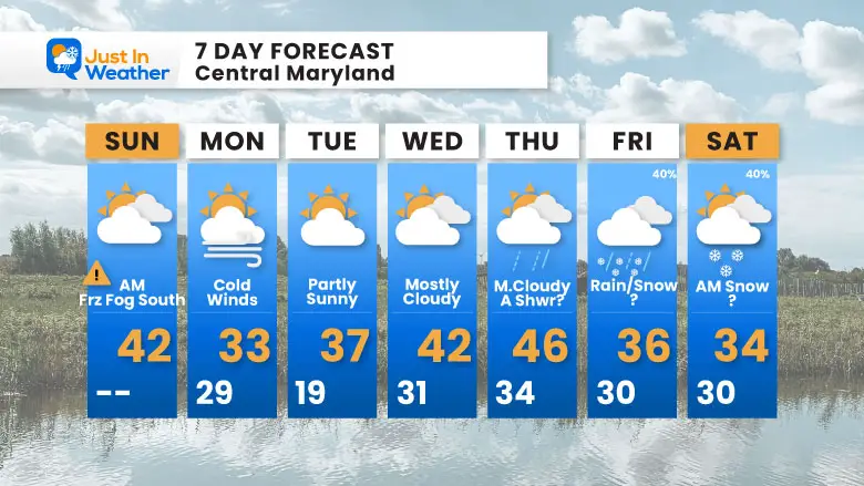
Sunday, December 7 2025
Morning Report
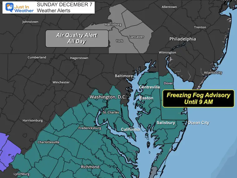
Two areas with weather alerts starting our day, and they are both based on the same reason. High Pressure is in control, but it has put a cap in the atmosphere, trapping air below. To the north in Pennsylvania, this has resulted in pollution and an Air Quality Alert.
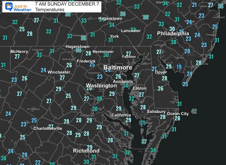
To the south (roughly US 50 and Southward), where there is snow on the ground, the temperatures are below freezing AND fog. This may help form a glaze of ice. This Freezing Fog Advisory lasts through 9 AM.
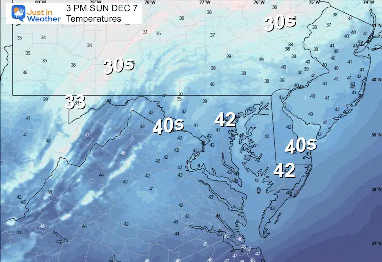
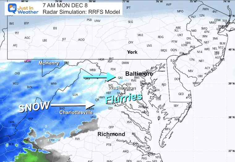
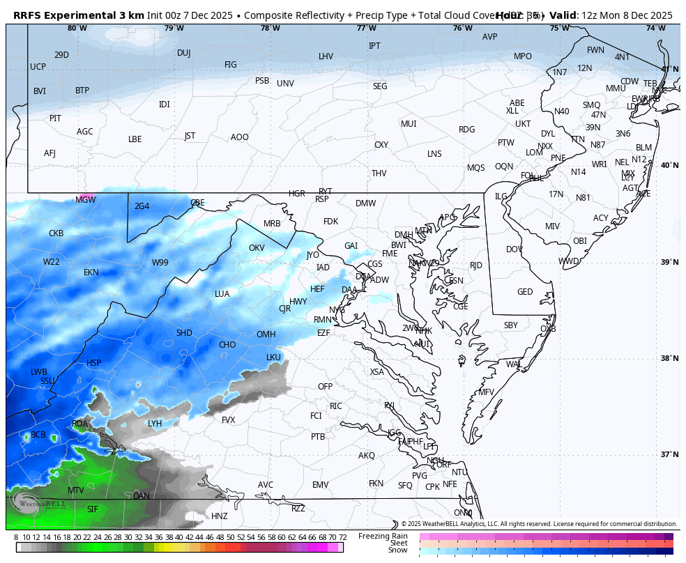
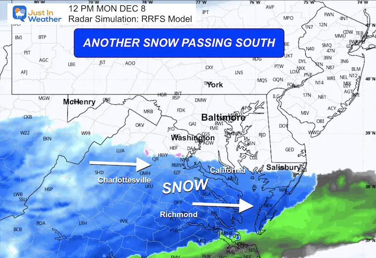
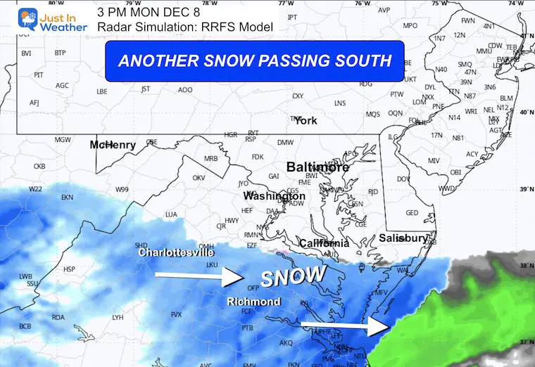
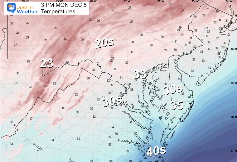
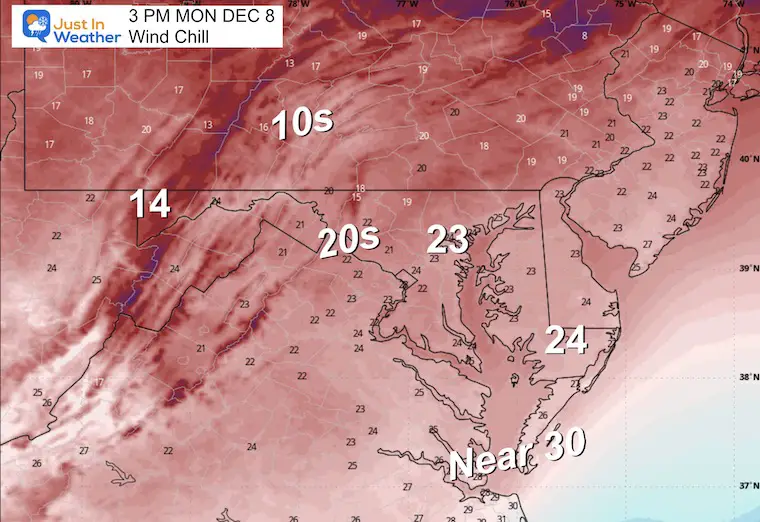
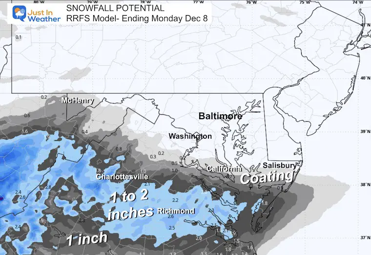
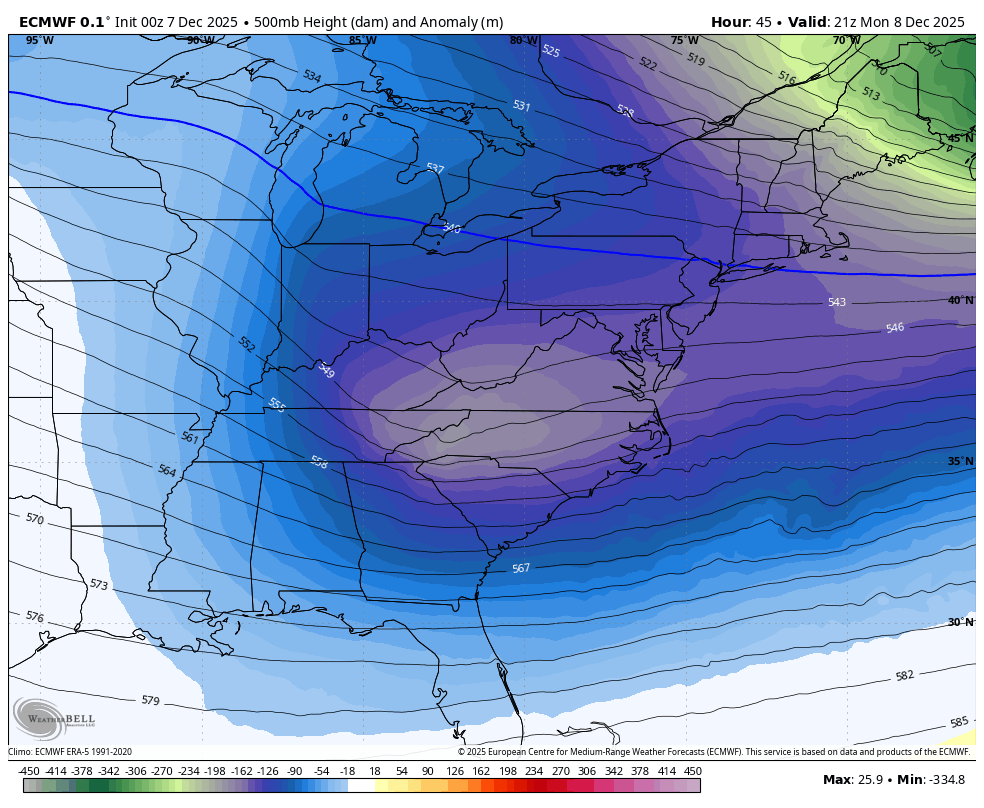
Then much of this area may get light snow on Monday as cold winds dominate the rest of the region.
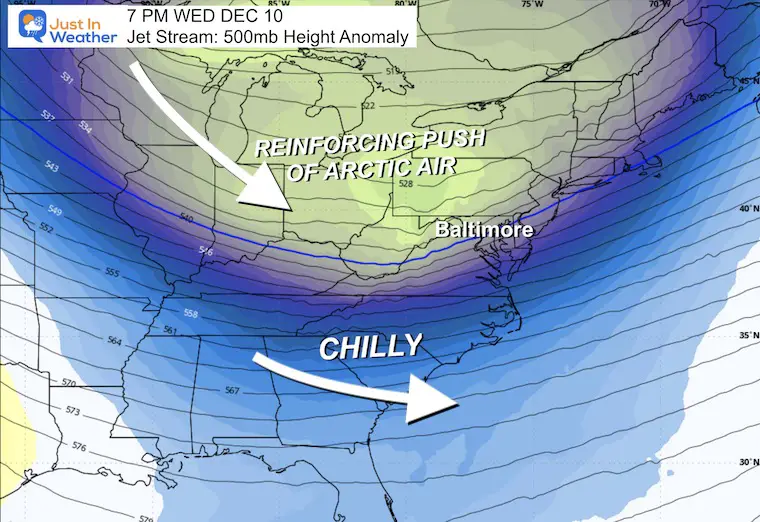
A roller coaster will boost temps back close to average mid-week, then a true Polar Vortex will send arctic air our way next weekend.
Freezing Fog Advisory includes Washington metro, Southern Maryland, and Delmarva:
THIS HAS BEEN EXTENDED TO 10 AM
The Air Quality Alert in Southern Pennsylvania will last all day.
High Pressure has capped and trapped the air here in the east. This will try to break to peaks of sun today, but willl remain hazy.
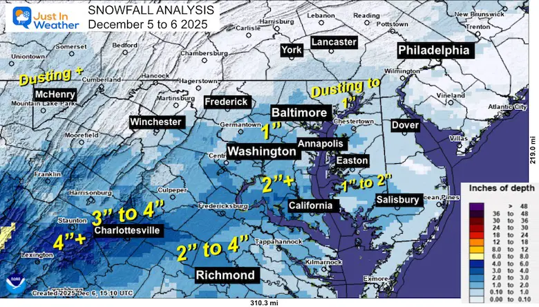
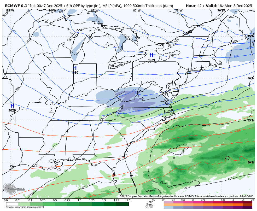
The snow in the Great Lakes will pass to our north, but along the next cold front, a new band of snow will develop. This is what will track into Virginia tomorrow.
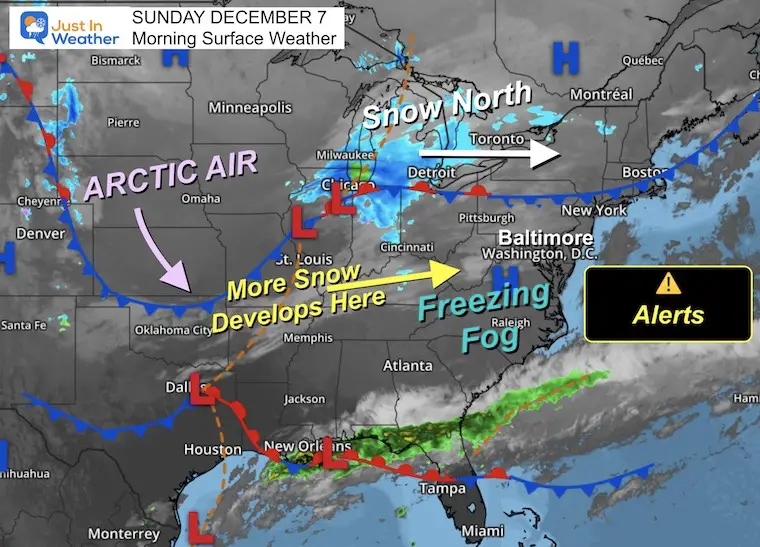
NOTE: With the cold front, there may be some flurries overnight and into the morning. More snow will pass across Virginia and may clip Southern Maryland. More on that below.
Subscribe for eMail Alerts
Sign up and be the first to know!
Yesterday: Low 29F; High 45F
Precipitation: 0.01”
Snow = Trace
Season Snow Total: 1.0″
Top Wind Gust 20 mph
Sunrise at 7:13 AM
Sunset at 4:44 PM
Normal Low in Baltimore: 31ºF
Record 6ºF in 2002
Normal High in Baltimore: 50ºF
Record 77ºF 1998
Rainfall Deficit at BWI
In case you missed it. This is the brief summary of the final snow totals from the last event.

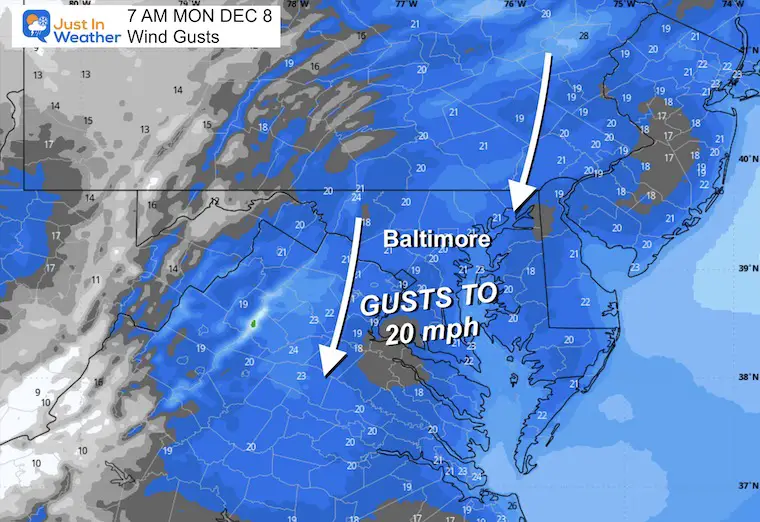
Frigid with winds enforcing the new cold air mass. This will also help block the northern fringe of snow.
From the north gusting to 20 mph.
Light snow and flurries may reach close to metro Washington, as snow develops across Virginia.
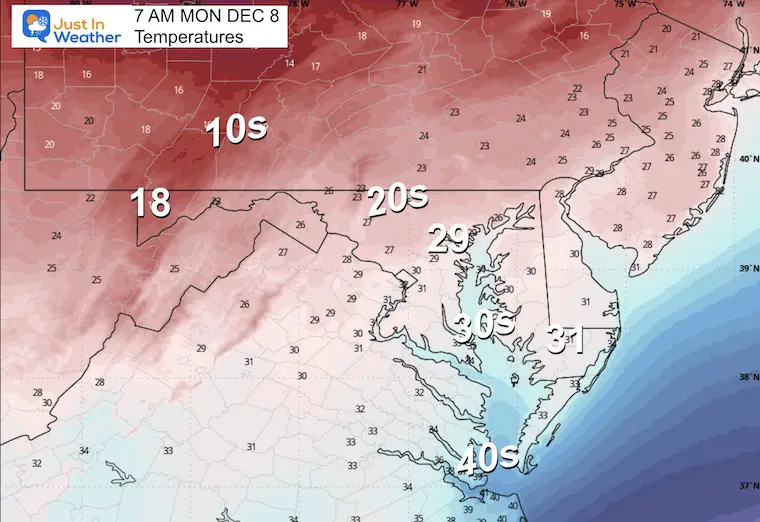
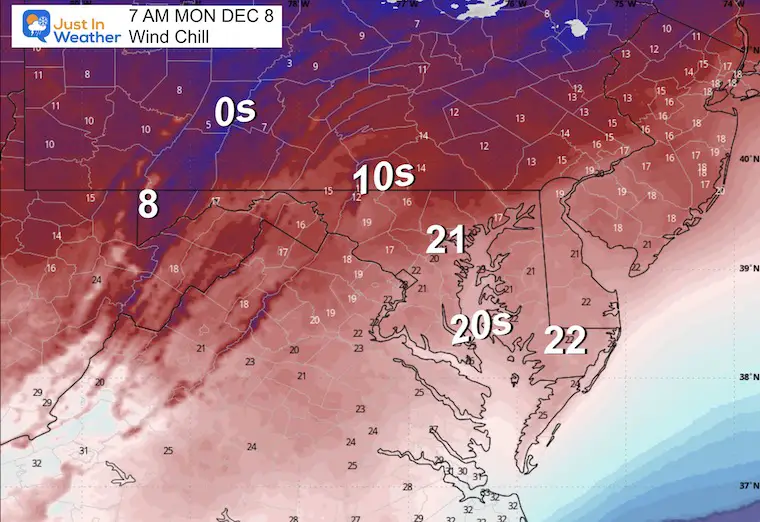
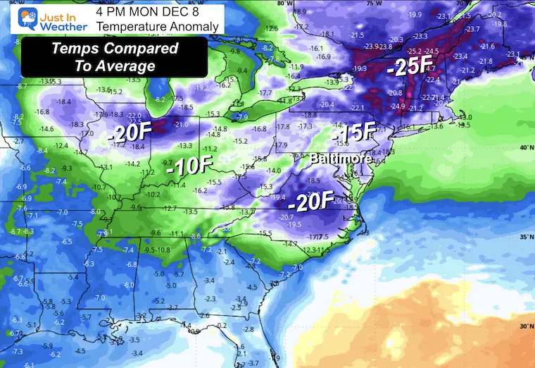
How cold the temperatures will be compared to average in the afternoon. Yes, we will be 15 to 20 degrees below ‘average’.
The advertised Polar Vortex will be sending more lobes of arctic air our way. The first will arrive on Monday, then again later in the week, which may be the coldest so far.
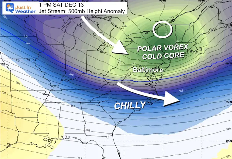
There will be a few clippers passing to our north mid-week. This will help some mild air fill in during the week, then possibly bring in a track farther south to bring us a chance for light snow on Friday into Saturday.
Subscribe for eMail Alerts
Sign up and be the first to know!
Click here for the full report

This was issued October 9, as expected: A weak and short-lived event to start winter may play a different role this winter.

These are NOT all the same caterpillar!


Click to see more and ‘Book’ a visit to your school


The annual event: Hiking and biking 329 miles in 7 days between The Summit of Wisp to Ocean City.
Each day, we honor a kid and their family’s cancer journey.
Fundraising is for Just In Power Kids: Funding Free Holistic Programs. I never have and never will take a penny. It is all for our nonprofit to operate.
Click here or the image to donate:

I am aware there are some spelling and grammar typos and occasional other glitches. I take responsibility for my mistakes and even the computer glitches I may miss. I have made a few public statements over the years, but if you are new here, you may have missed it: I have dyslexia and found out during my second year at Cornell University. It didn’t stop me from getting my meteorology degree and being the first to get the AMS CBM in the Baltimore/Washington region. One of my professors told me that I had made it that far without knowing and to not let it be a crutch going forward. That was Mark Wysocki, and he was absolutely correct! I do miss my mistakes in my own proofreading. The autocorrect spell check on my computer sometimes does an injustice to make it worse. I can also make mistakes in forecasting. No one is perfect at predicting the future. All of the maps and information are accurate. The ‘wordy’ stuff can get sticky. There has been no editor who can check my work while writing and to have it ready to send out in a newsworthy timeline. Barbara Werner is a member of the web team that helps me maintain this site. She has taken it upon herself to edit typos when she is available. That could be AFTER you read this. I accept this and perhaps proves what you read is really from me… It’s part of my charm. #FITF