


My Call For Snowfall Saturday Morning Inland And Sunday Closer To The Coast
Friday Evening Update January 16 2026 Two weather events will bring snow to our region this weekend. They are related to the fast winds aloft on the edge of this…
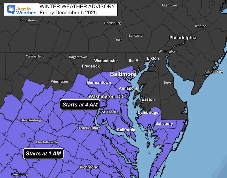
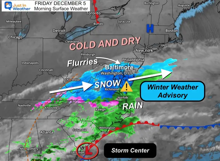
Friday December 5 2025
Morning Report
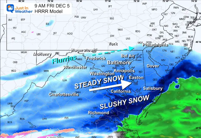
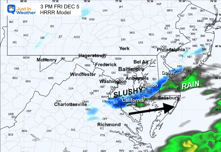
Light snow was first reported at BWI in Baltimore before 5 AM. This is the northern edge of the expectation for any possible impact, and Anne Arundel County did issue a 2-hour school delay.
We have been splitting hairs for the Northern EDGE of the snow, and the Doppler Radar has not helped. Often in winter, there is Virga, showing snow falling into a dry layer of air and not hitting the ground. The flakes sublimate!
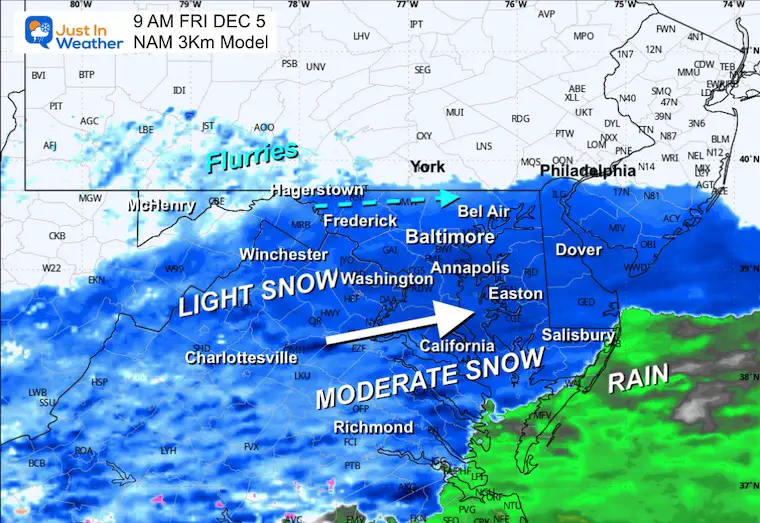
The air should saturate gradually. So while I did suggest this would begin by sunrise, and it has… There are a few more hours where we may see more reach the ground across Central Maryland.
If you are traveling, more snow is still expected in Southern Maryland and already compromising travel in South Central Virginia… including Richmond.
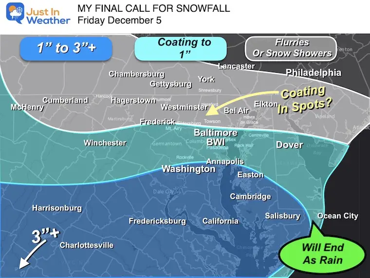
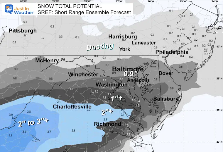
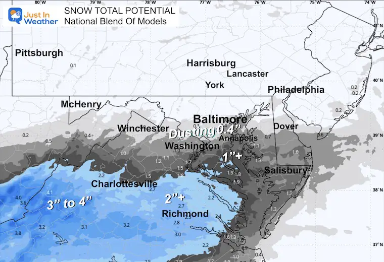
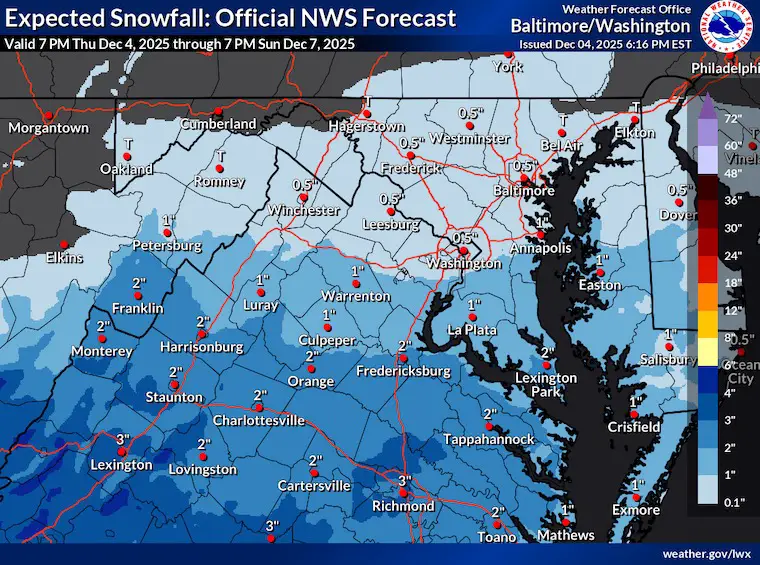
Snow Total Expectations – Still the same as my last report.
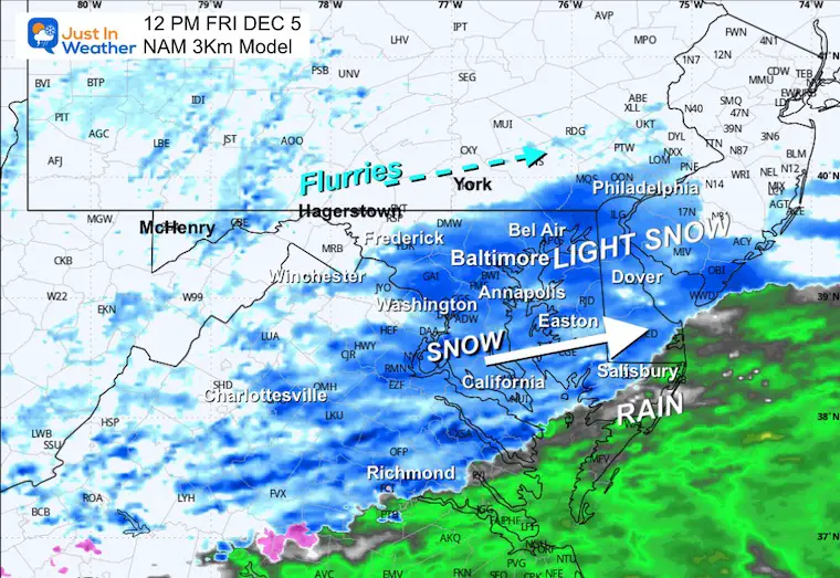
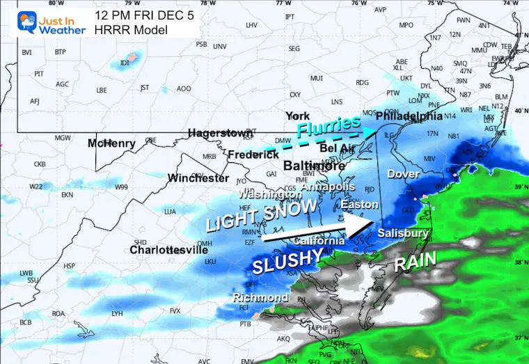
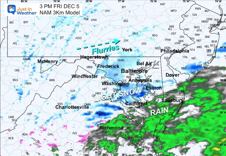
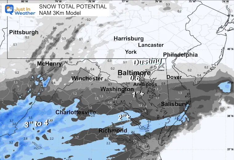
No One Computer Model Is Perfect. I see a blend of the information available. The challenge is finding the correct blend. So I will compare two high-resolution short-range models for how today may play out
Baltimore City and southern counties, and into Virginia!
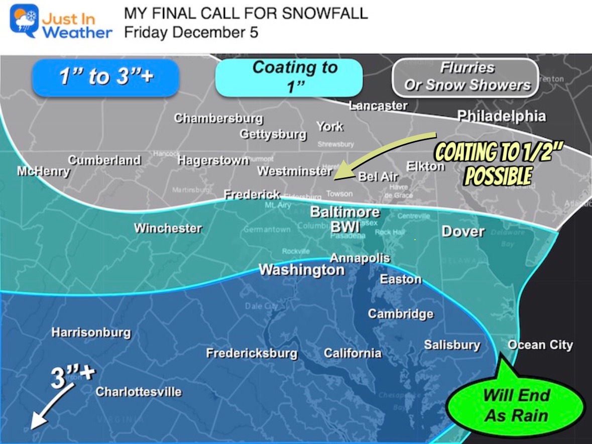
My FINAL Call For Snowfall From Yesterday
I wanted to emphasize the marginal chance of a coating North of Baltimore.
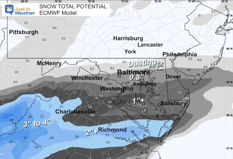
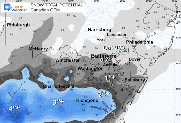
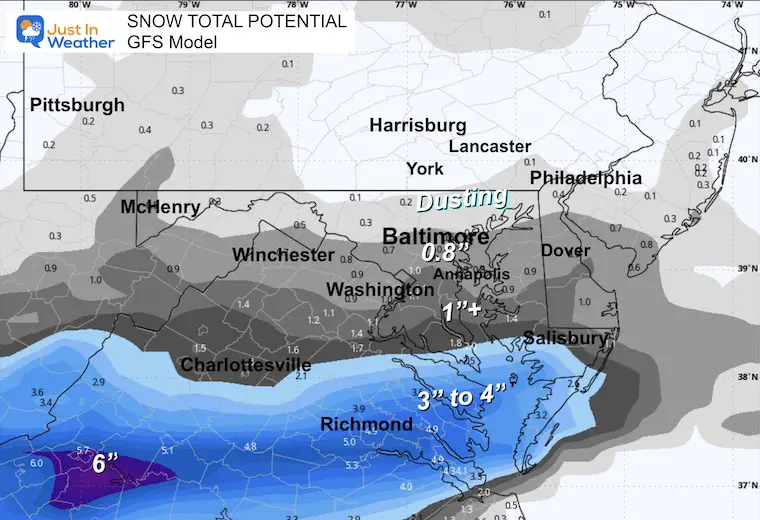
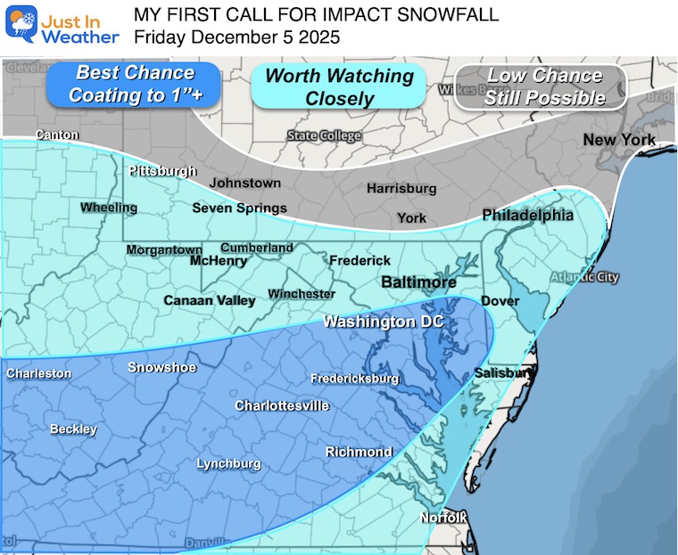
Compare to the 5 Snow Model Maps Below
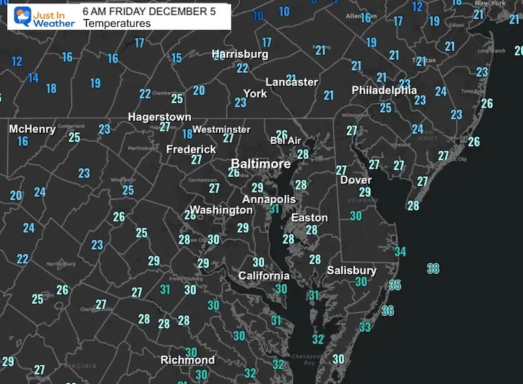
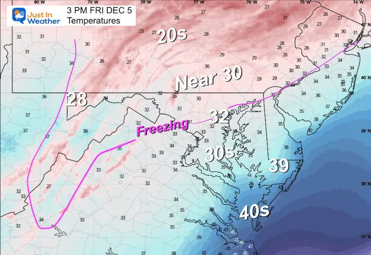
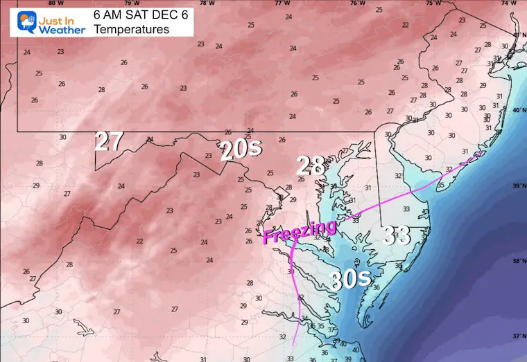
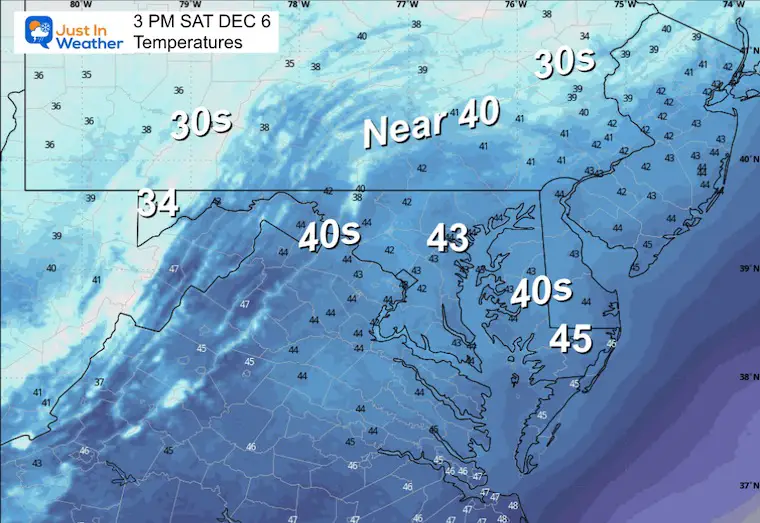
Morning Temperatures at 6 AM
It is cold enough for stickage on untreated roads.
Steady snow as expected in Southern Maryland and Virginia.
The north edge is either Virga (not reaching the ground, or flurries).
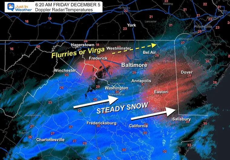
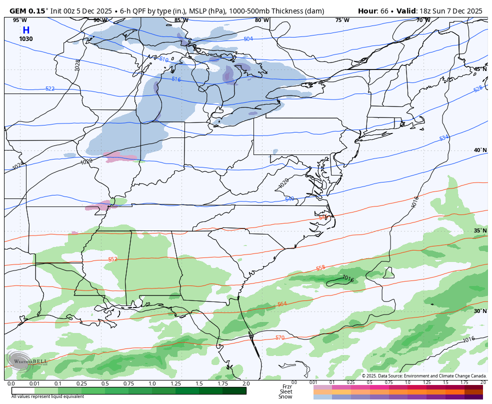
The EDGE of this snow is in Maryland. High Pressure to the north is providing a cap with dry air, while the low-pressure center is located far south of the South Carolina Coast.
This band of snow is from that upper-level piece of energy I showed the other night. It has raced in here faster and will depart faster.
This is mostly a morning event, but some snow showers may linger this afternoon.
Comparing the NAM 3 Km to the HRRR Model, we can see the subtle differences in how far north the snow will reach and flurries lingering into the afternoon. My call is a blend between these two.
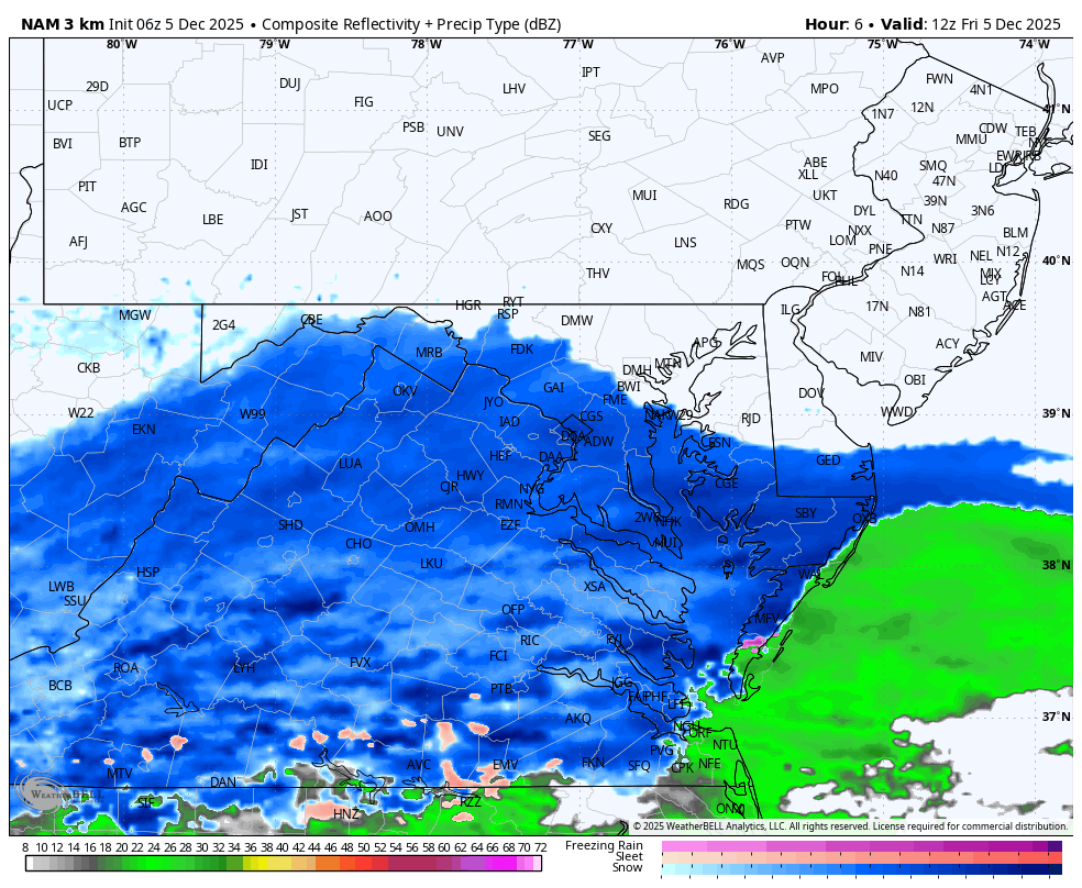
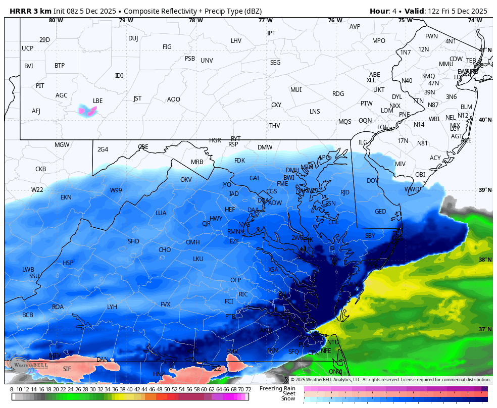
NAM 3Km
HRRR
NAM 3Km
HRRR
NAM 3Km
HRRR
Not much change since last night…
SREF: Short Range Ensemble Forecast
NBM: National Blend of Models
NAM 3Km
ECMWF Model
Canadian GEM
GFS Model
Wider View
Yesterday: Low 24F; High 45F
Precipitation: 0.00”
Top Wind Gust 30 mph
Sunrise at 7:11 AM
Sunset at 4:44 PM
Normal Low in Baltimore: 32ºF
Record 16ºF in 1886; 1926; 1966
Normal High in Baltimore: 50ºF
Record 75ºF 2001
Rainfall Deficit at BWI

Canadian GEM Model Sunday to Thursday
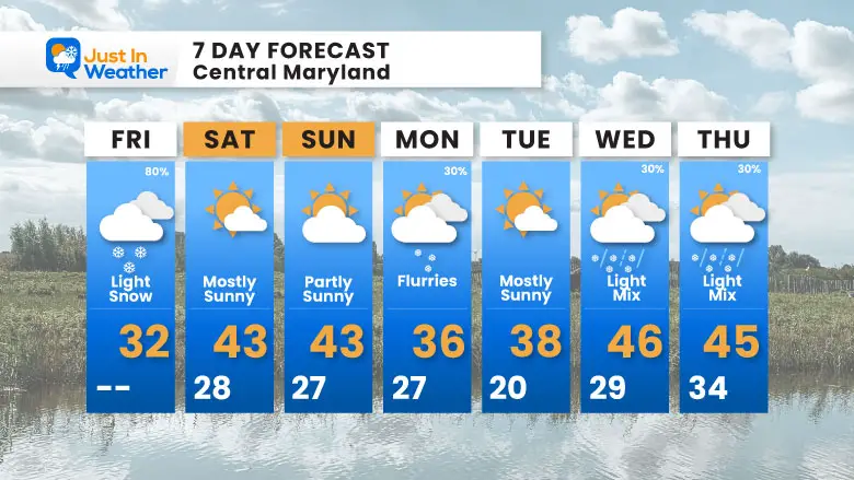
A few clipper-like systems will swing through with a minimal impact of scattered showers on Monday, then again from Wednesday to Thursday.
Subscribe for eMail Alerts
Sign up and be the first to know!
Click here for the full report

This was issued October 9, as expected: A weak and short-lived event to start winter may play a different role this winter.

These are NOT all the same caterpillar!


Click to see more and ‘Book’ a visit to your school


The annual event: Hiking and biking 329 miles in 7 days between The Summit of Wisp to Ocean City.
Each day, we honor a kid and their family’s cancer journey.
Fundraising is for Just In Power Kids: Funding Free Holistic Programs. I never have and never will take a penny. It is all for our nonprofit to operate.
Click here or the image to donate:

I am aware there are some spelling and grammar typos and occasional other glitches. I take responsibility for my mistakes and even the computer glitches I may miss. I have made a few public statements over the years, but if you are new here, you may have missed it: I have dyslexia and found out during my second year at Cornell University. It didn’t stop me from getting my meteorology degree and being the first to get the AMS CBM in the Baltimore/Washington region. One of my professors told me that I had made it that far without knowing and to not let it be a crutch going forward. That was Mark Wysocki, and he was absolutely correct! I do miss my mistakes in my own proofreading. The autocorrect spell check on my computer sometimes does an injustice to make it worse. I can also make mistakes in forecasting. No one is perfect at predicting the future. All of the maps and information are accurate. The ‘wordy’ stuff can get sticky. There has been no editor who can check my work while writing and to have it ready to send out in a newsworthy timeline. Barbara Werner is a member of the web team that helps me maintain this site. She has taken it upon herself to edit typos when she is available. That could be AFTER you read this. I accept this and perhaps proves what you read is really from me… It’s part of my charm. #FITF