


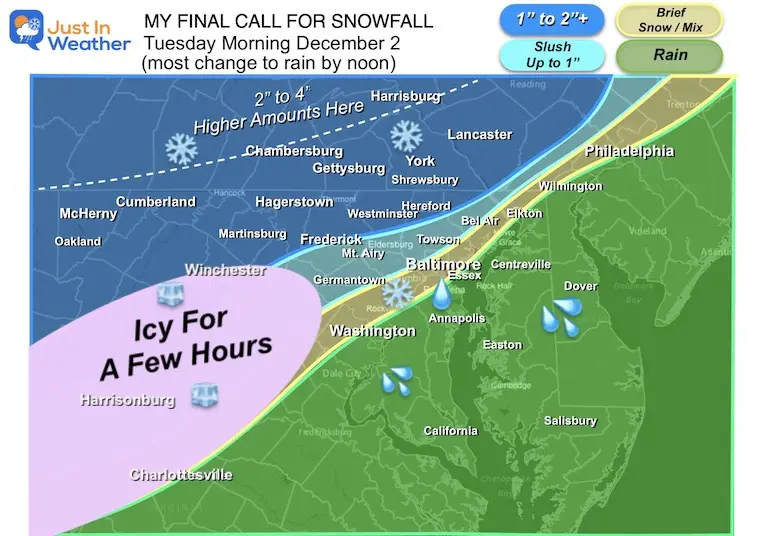
My Call For Snowfall Saturday Morning Inland And Sunday Closer To The Coast
Friday Evening Update January 16, 2026 Two weather events will bring snow to our region this weekend. They are related to the fast winds aloft on the edge of this…
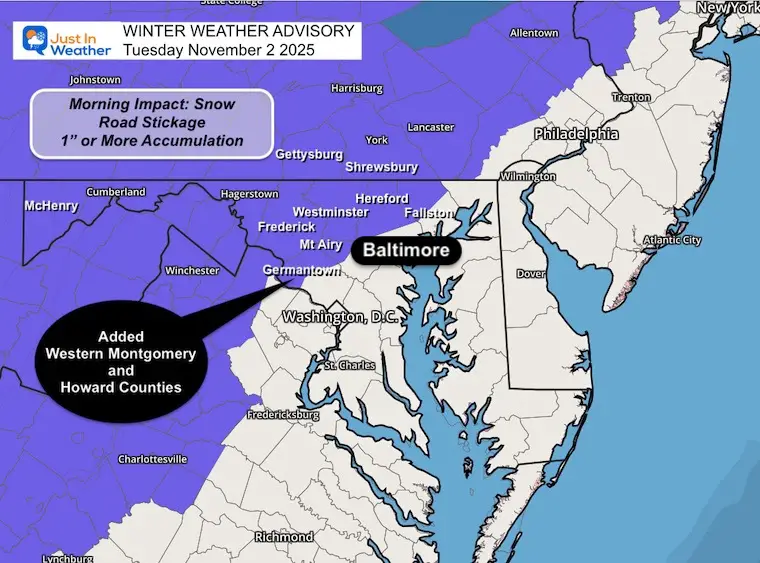
Tuesday, December 2, 2025
Morning Report
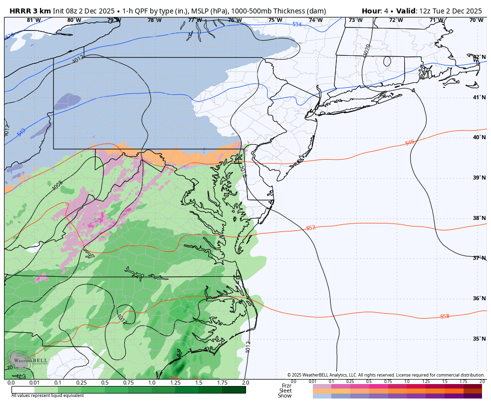
The precipitation began early this morning within reason of the expectation, just a little sooner. There has been a wide range of slushy snow, sleet, and chilly rain. The complicated part is that this is NOT the same for everyone. Also, there was some evaporative cooling at the start, so a change to snow after it begins, then back to rain gradually.
This goes through 1 PM.
Reminder the Western parts of Howard and Montgomery Counties in Maryland were added in the expansion.
HOWEVER, the NWS WILL CANCEL Counties as temperatures warm across the region.
The districts that made a call last night were extra cautious AND have parents who complain when last-minute decisions are made. The ‘night before’ calls are for parents to have time to adjust their plans or care for the kids.
Frederick County, MD, CLOSED because they had a 1/2 day scheduled anyway… So the delay was not possible.
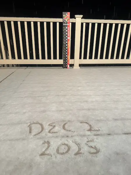
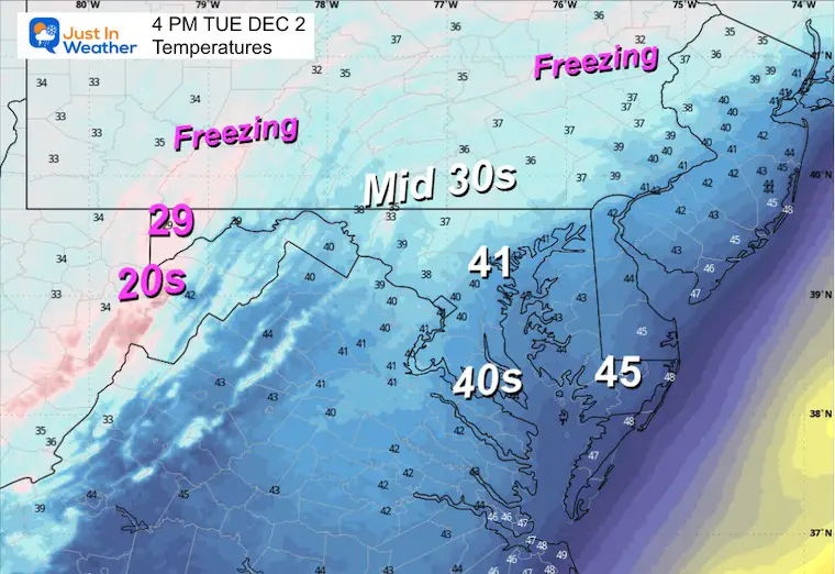
Temp was 32°F, which dropped from 33°F when the snow began. Some stickage on elevated surfaces.
A lot of the MIXING has been with SLEET. This can still be slippery, where it can lay and stay. Mostly Elevated Surfaces.
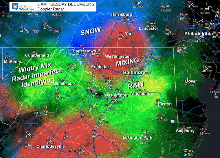
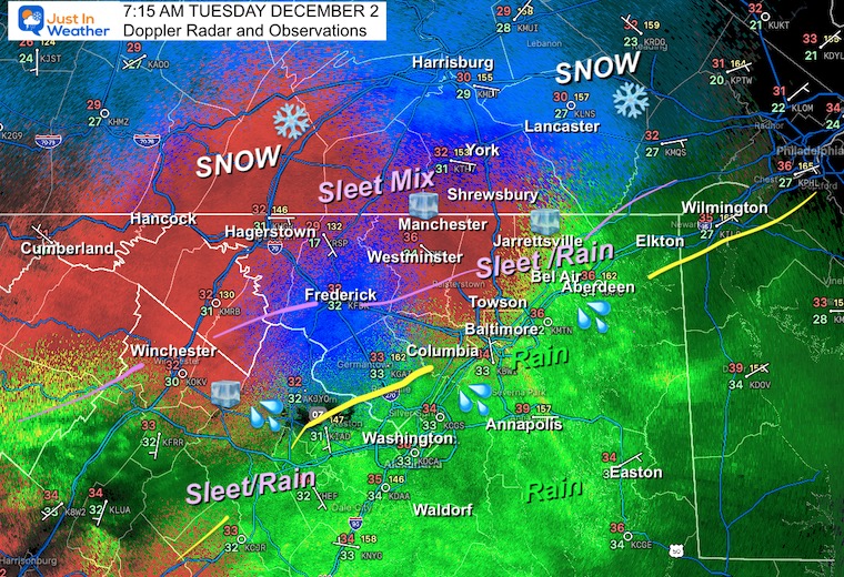
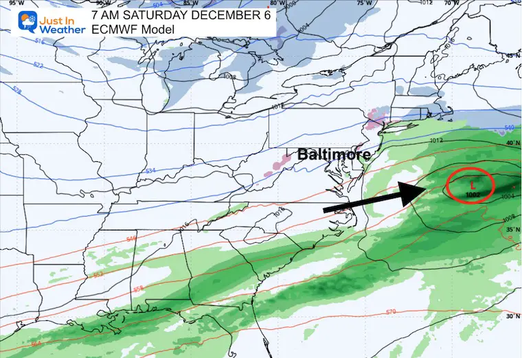
This plot of the storm has had trouble identifying the snow, mix, and chilly rain.
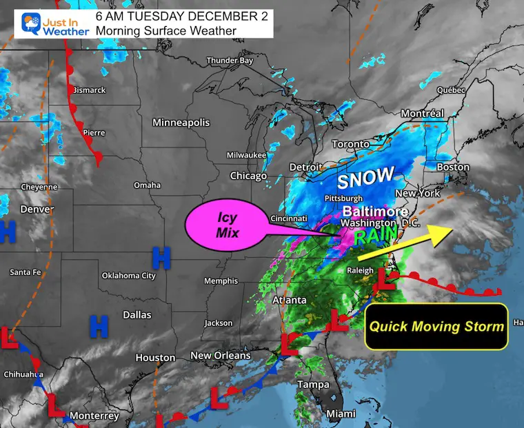
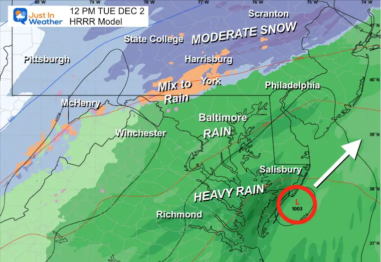
Low Pressure off the coast will bring heavy rain across Southern Maryland and Delmarva.
A mix to rain will be shifting north into Pennsylvania.
I posted this on social media yesterday.
Yesterday: Low 26F; High 45F
Precipitation: 0.00”
Top Wind Gust 34 mph
Sunrise at 7:08 AM
Sunset at 4:44 PM
Normal Low in Baltimore: 33ºF
Record 12ºF in 1967
Normal High in Baltimore: 52ºF
Record 75ºF 2006
Rainfall Deficit at BWI
Subscribe for eMail Alerts
Sign up and be the first to know!

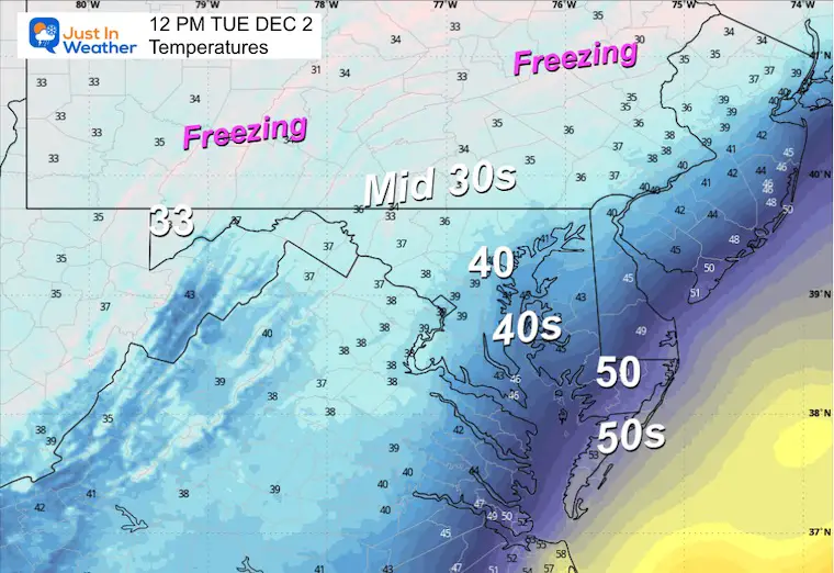
My suggestion is that the ground will dry before any chance of icing over.
More cold air will be flowing into the Eastern US.
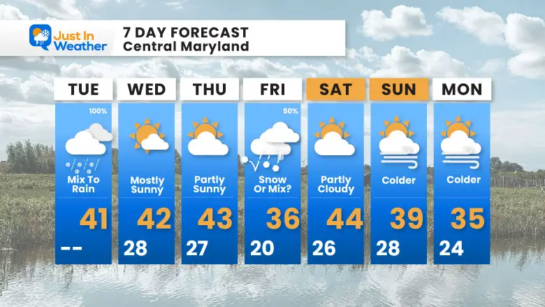
There will be one impulse on Friday before the next surge that may produce snow or an icy mix.
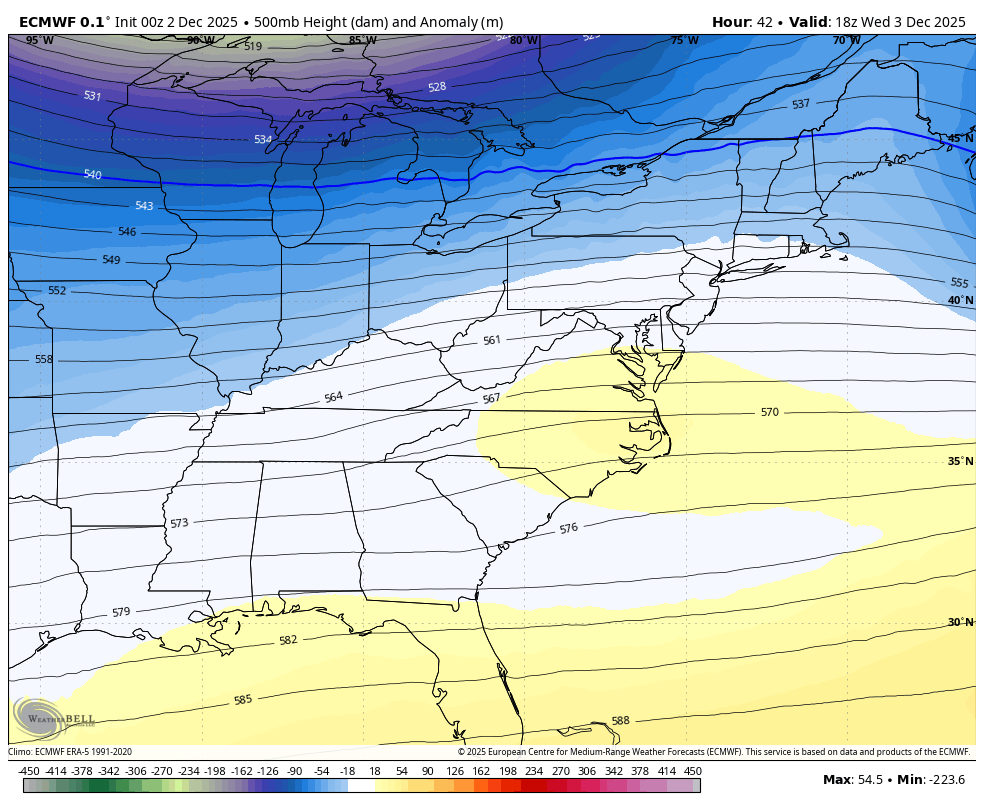
This setup does show High Pressure to our North making it cold enough to help hold that cold as Low Pressure organizes to our South.
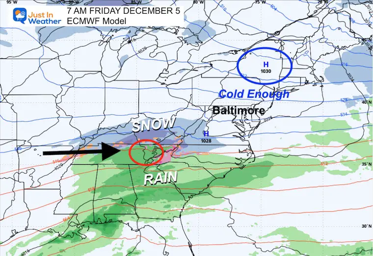
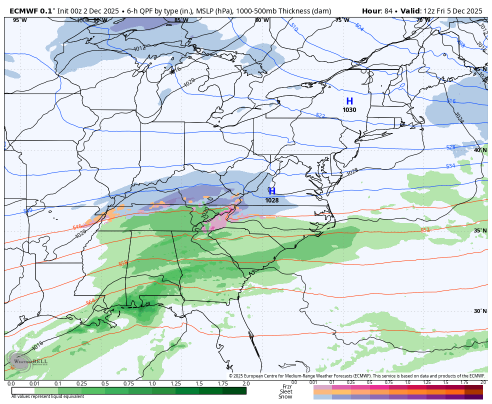
We will watch this for the increasing chance of snow.
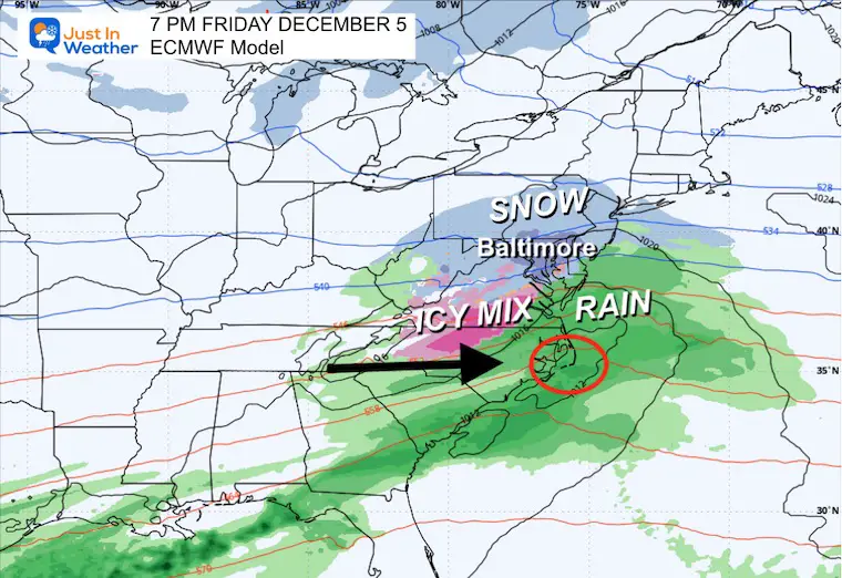
Another quick mover, this will be gone for the weekend. Colder air will follow Sunday and Monday.
Subscribe for eMail Alerts
Sign up and be the first to know!
Click here for the full report

This was issued October 9, as expected: A weak and short-lived event to start winter may play a different role this winter.

These are NOT all the same caterpillar!


Click to see more and ‘Book’ a visit to your school


The annual event: Hiking and biking 329 miles in 7 days between The Summit of Wisp to Ocean City.
Each day, we honor a kid and their family’s cancer journey.
Fundraising is for Just In Power Kids: Funding Free Holistic Programs. I never have and never will take a penny. It is all for our nonprofit to operate.
Click here or the image to donate:

I am aware there are some spelling and grammar typos and occasional other glitches. I take responsibility for my mistakes and even the computer glitches I may miss. I have made a few public statements over the years, but if you are new here, you may have missed it: I have dyslexia and found out during my second year at Cornell University. It didn’t stop me from getting my meteorology degree and being the first to get the AMS CBM in the Baltimore/Washington region. One of my professors told me that I had made it that far without knowing and to not let it be a crutch going forward. That was Mark Wysocki, and he was absolutely correct! I do miss my mistakes in my own proofreading. The autocorrect spell check on my computer sometimes does an injustice to make it worse. I can also make mistakes in forecasting. No one is perfect at predicting the future. All of the maps and information are accurate. The ‘wordy’ stuff can get sticky. There has been no editor who can check my work while writing and to have it ready to send out in a newsworthy timeline. Barbara Werner is a member of the web team that helps me maintain this site. She has taken it upon herself to edit typos when she is available. That could be AFTER you read this. I accept this and perhaps proves what you read is really from me… It’s part of my charm. #FITF