


Winter Weather Advisory Sunday As Snowfall In Two Parts Affecting Two Different Areas
Saturday Evening Update January 17 2026 One thing I carry after all of my years of forecasting: If one model does a really good job in an active pattern, then…
Monday, November 24, 2025 Evening Update
The roller coaster weather this week is special because it will span the Thanksgiving Holiday. However, in a transition month like November, it is more common than many believe to have a big warm-up followed by a taste of winter within days.
This week will bring us more needed rain on Tuesday, with lingering showers on Wednesday that will include a bump of temps to the upper 60s. This same system will be responsible for strong to severe thunderstorms in the Southern U.S. On the north end, the Arctic air we’ve been talking about for weeks will spawn heavy Lake Effect Snow.
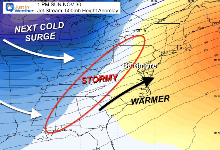
Here in the Mid-Atlantic, the atmosphere is setting up to support flurries and snow showers that may reach into Central Maryland by Friday.
Let’s take a look:
The bulk of the energy from the developing storm has been focused in Texas, where severe storms produced at least one tornado today in Houston.
Rain is organizing on the north end, which will spread our way on Tuesday.
The first signal of cold air is arriving along the Canadian border.
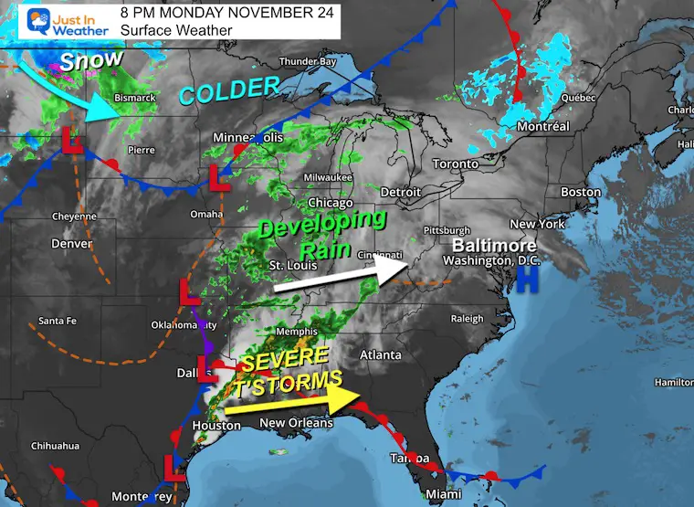
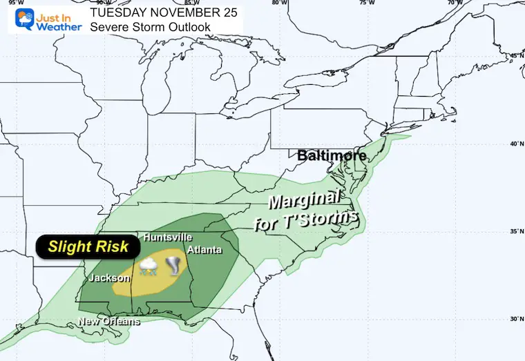
A Slight Risk for storms to turn severe includes Mississippi and Alabama.
There is a marginal risk for thunderstorms in Southern Maryland.
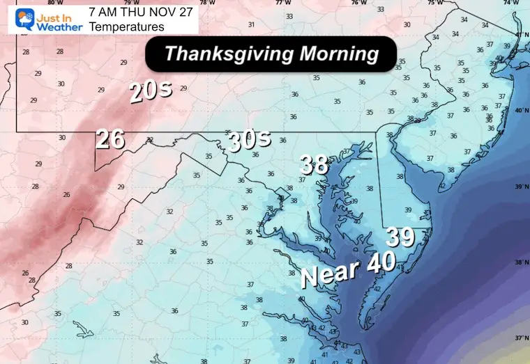
Tracking the storm with rain and warm air, followed by the cold surge and Lake Effect snow expanding into Maryland on Thanksgiving and into Friday.
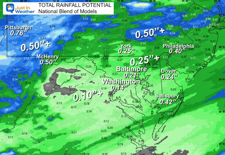
Steady rain is likely in Metro Baltimore and north through PA.
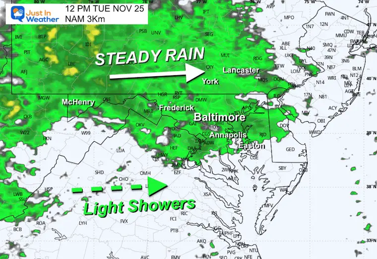
Rain may be heavy at times in PA, while rain showers will be breaking up in metro areas. There is a chance for spotty showers that pulse with rumbles of thunder.
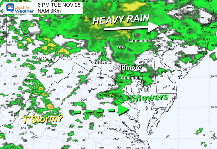
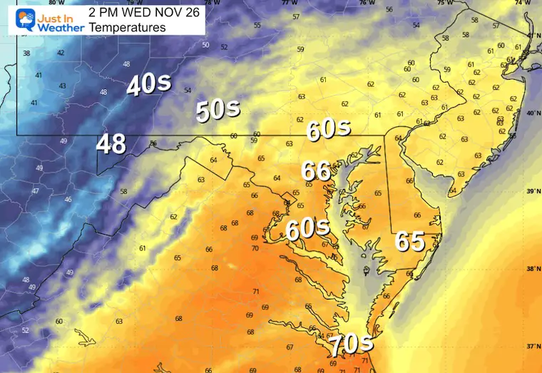
Rain showers may be briefly strong with the cold front. Temps will peak and then drop rapidly as they pass.
Highs will reach the upper 60s.
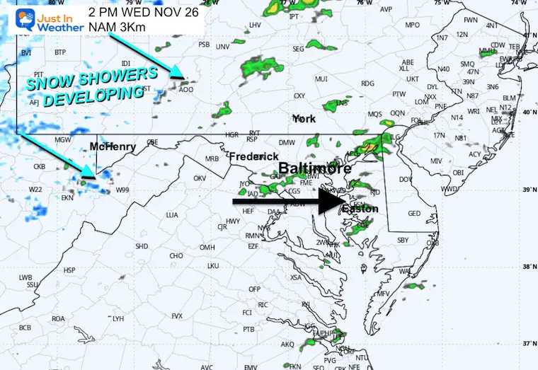
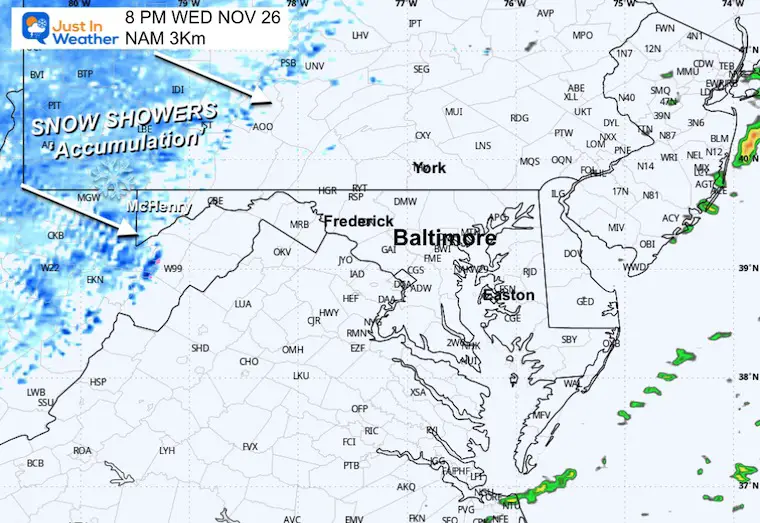
The cold air will put the mountains into the 40s at this time, with rain showers turning to flurries.
Snow showers will become more pronounced with steady snow that will accumulate in Garrett County, MD.
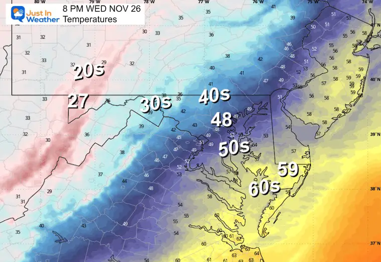
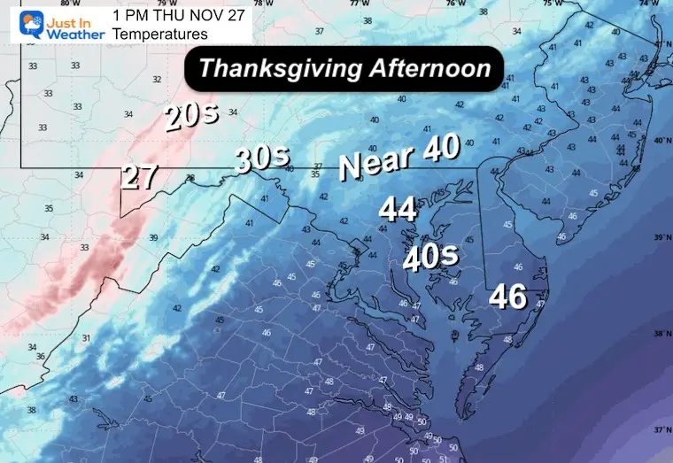
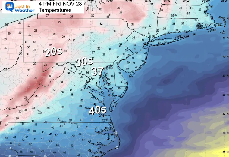
This may be the most dynamic spread of temps from the 60s in the Lower Eastern Shore to 20s in Garrett County.
Gusty winds will keep temps falling in Central Maryland.
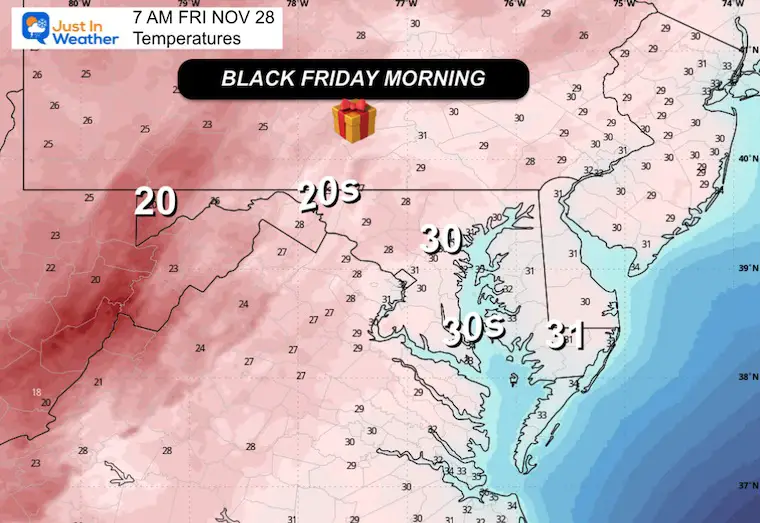
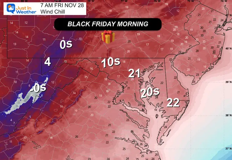
If you are doing a Turkey Trot, it will be windy and chilly! The 30s may feel like the 20s with the wind chill.
Winds will average 10 to 20 mph and gust over 30 mph.
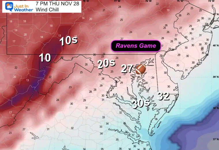
The night game in Baltimore will be cold. Here are the forecast conditions at 7 PM when the crowd will be filing into the stadium. It will be getting colder during the game.
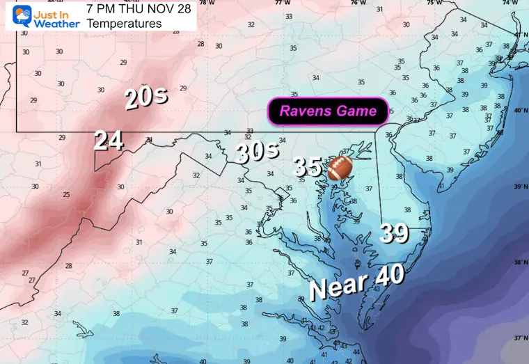
With winds 10 to 20 mph and higher gusts, temps will FEEL like the 20s downtown.
I am not sure how many still race to be in line at stores, but if you participate in the aging tradition, this is for you. For what it’s worth, I still drive a manual transmission by preference. So I understand hanging on to nostalgia. My truck has heated seats. If you will be standing outside, it will be cold! Nothing dire, just that we are not accustomed to these temps yet this season.
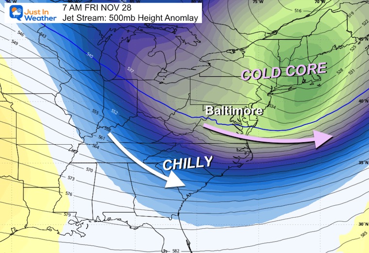
The jet stream does support the energy, as seen here with the vorticity at 500 mb.
This jet streak is aligned to support carrying Lake Effect snow showers over the mountains. At least the moisture may help some snow flurries or a snow shower into Central Maryland.
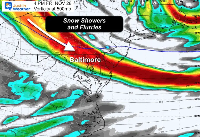
It will not be cold enough for stickage, but it will be chilly in the mid-30s.
The arctic blast will relax over next weekend. A big return warm-up will follow to start December. This also may be short-lived.
Subscribe for eMail Alerts
Sign up and be the first to know!
Click here for the full report

I am working with Jarrettsville Furniture on this great promotion to possibly get free furniture if we get snow on Christmas.
Here’s my first announcement. More info to come.
This was issued October 9, as expected: A weak and short-lived event to start winter may play a different role this winter

These are NOT all the same caterpillar!


Click to see more and ‘Book’ a visit to your school


The annual event: Hiking and biking 329 miles in 7 days between The Summit of Wisp to Ocean City.
Each day, we honor a kid and their family’s cancer journey.
Fundraising is for Just In Power Kids: Funding Free Holistic Programs. I never have and never will take a penny. It is all for our nonprofit to operate.
Click here or the image to donate:

I am aware there are some spelling and grammar typos and occasional other glitches. I take responsibility for my mistakes and even the computer glitches I may miss. I have made a few public statements over the years, but if you are new here, you may have missed it: I have dyslexia and found out during my second year at Cornell University. It didn’t stop me from getting my meteorology degree and being the first to get the AMS CBM in the Baltimore/Washington region. One of my professors told me that I had made it that far without knowing and to not let it be a crutch going forward. That was Mark Wysocki, and he was absolutely correct! I do miss my mistakes in my own proofreading. The autocorrect spell check on my computer sometimes does an injustice to make it worse. I can also make mistakes in forecasting. No one is perfect at predicting the future. All of the maps and information are accurate. The ‘wordy’ stuff can get sticky. There has been no editor who can check my work while writing and to have it ready to send out in a newsworthy timeline. Barbara Werner is a member of the web team that helps me maintain this site. She has taken it upon herself to edit typos when she is available. That could be AFTER you read this. I accept this and perhaps proves what you read is really from me… It’s part of my charm. #FITF