


Winter Weather Advisory Sunday As Snowfall In Two Parts Affecting Two Different Areas
Saturday Evening Update January 17 2026 One thing I carry after all of my years of forecasting: If one model does a really good job in an active pattern, then…
Friday, November 21, 2025
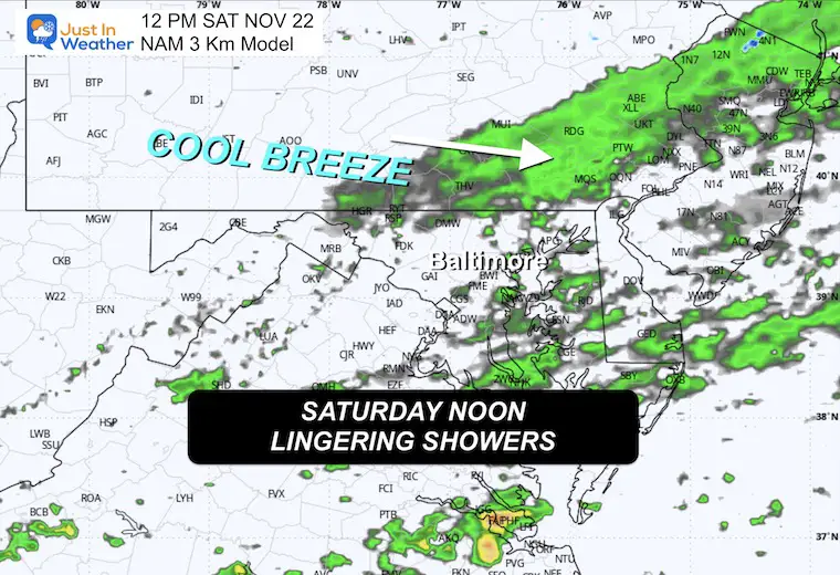
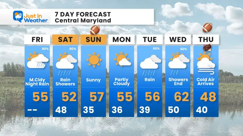
As is often the case, our initial expectations get tweaked and not refined. The rain on the way will still be mostly overnight, now expected a little later. That also means it may linger longer. The bulk of steady rain will end by sunrise, but showers could hold through lunchtime tomorrow.
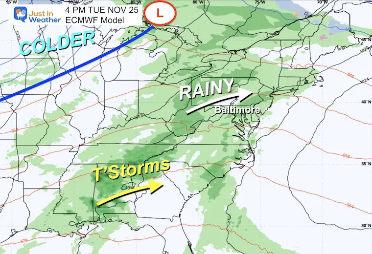
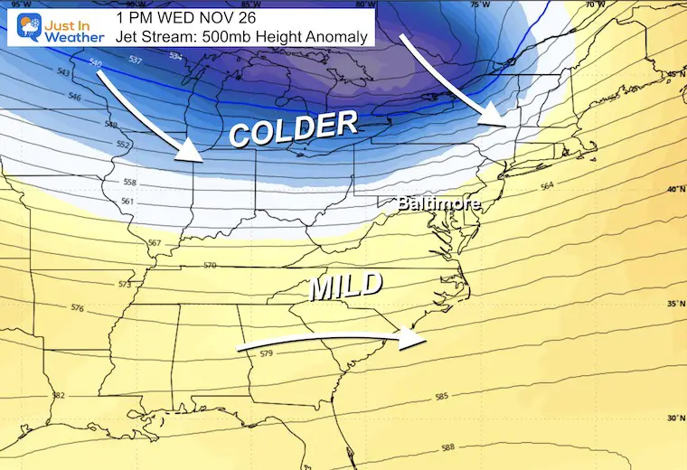
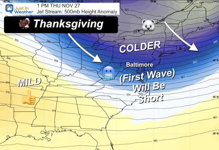
Sunday looks good for the Ravens’ home game, then the next rain will actually arrive earlier. Speeding this up means Tuesday looks wetter, with rain showers on Wednesday AND the arrival of colder air during Thanksgiving Day into Friday.
This will be our FIRST WAVE of arctic air.
The OVER ADVERTISED change is our weather pattern, which also has some tweaking. As I have mentioned, there often are multiple surges of polar air. This first hit will be brief and relax within a few days.
December will start mild, and then the second push of cold air during the first week of the month is more likely to hold.
What does this mean? Most likely ‘normal old-fashioned winter. The global pattern supports a cold and possibly stormy month that will evolve, but I do not believe we can get into specifics of any sort beyond that now.
FYI- All record Snow this month is within reach for two locations.
Jay Peak Ski Resort in Northern Vermont
Mount Washington, NH Weather Observations Center
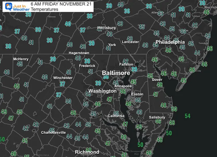
Plenty of cloud cover and pockets of fog this morning.
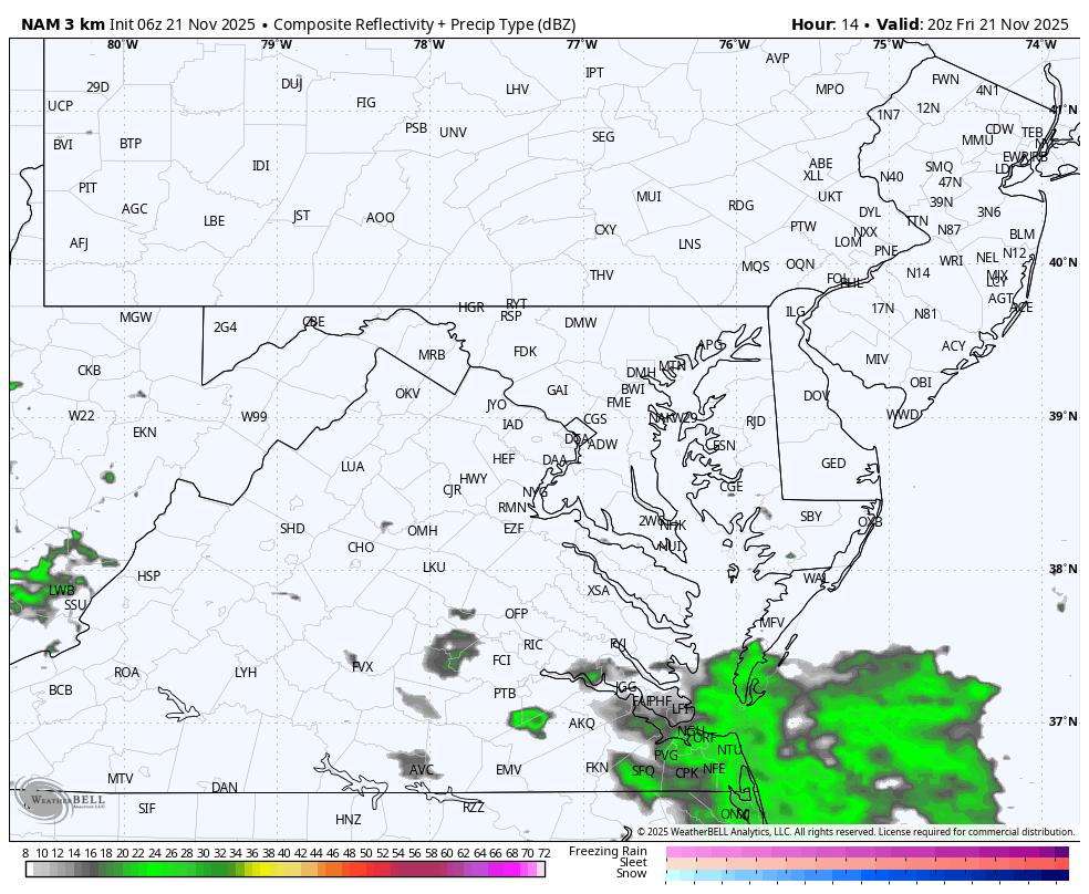
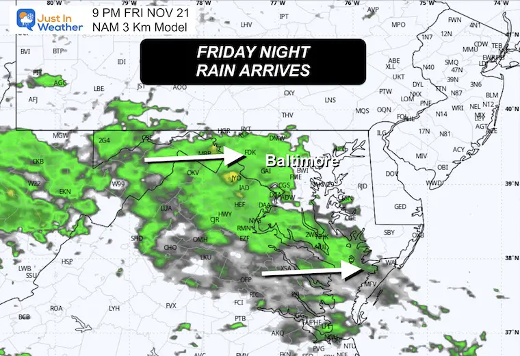
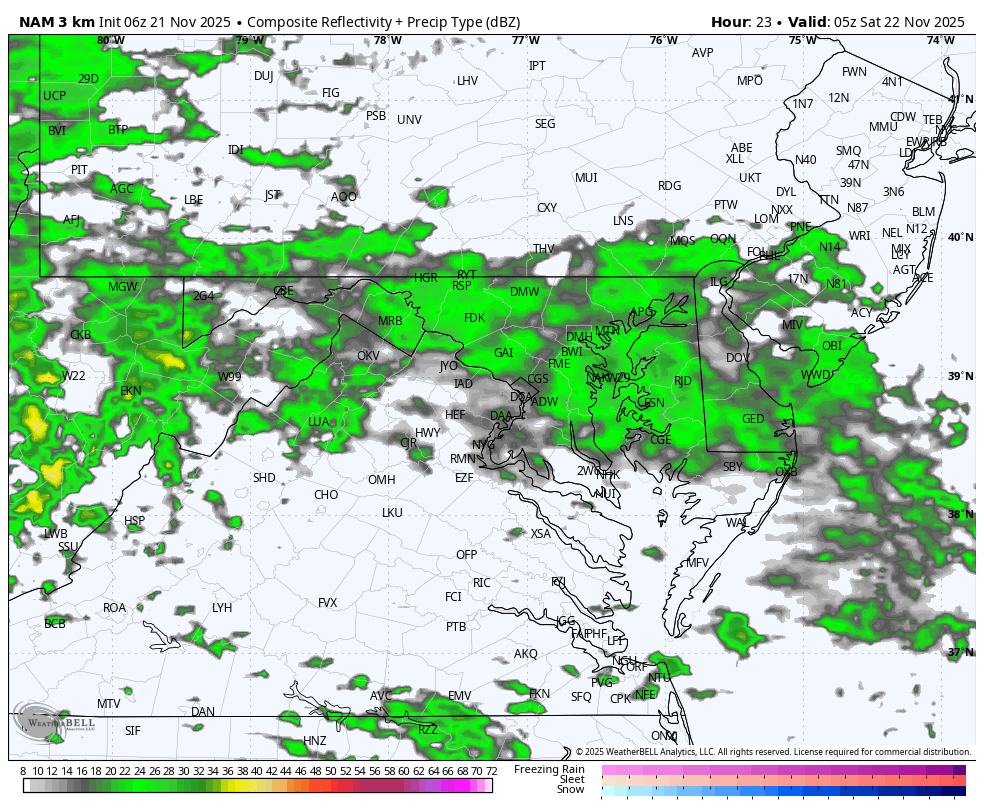
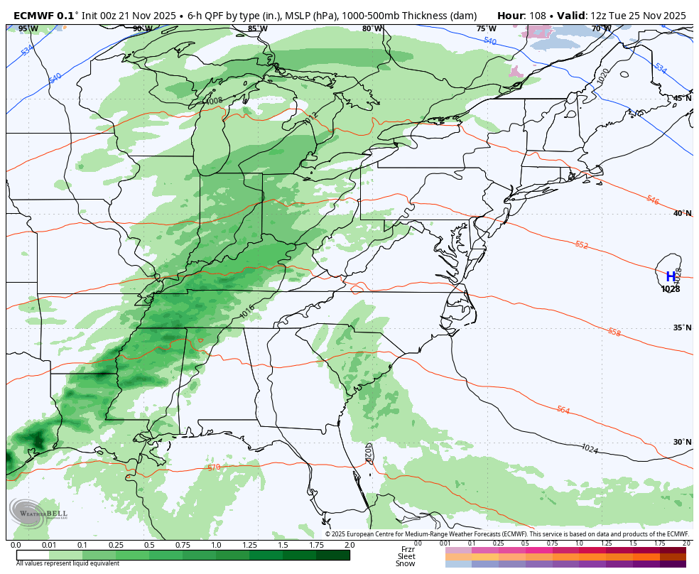
The storm centered west of Kansas City is the event we expect tonight. The rain will be heading due east and will reach us tonight.
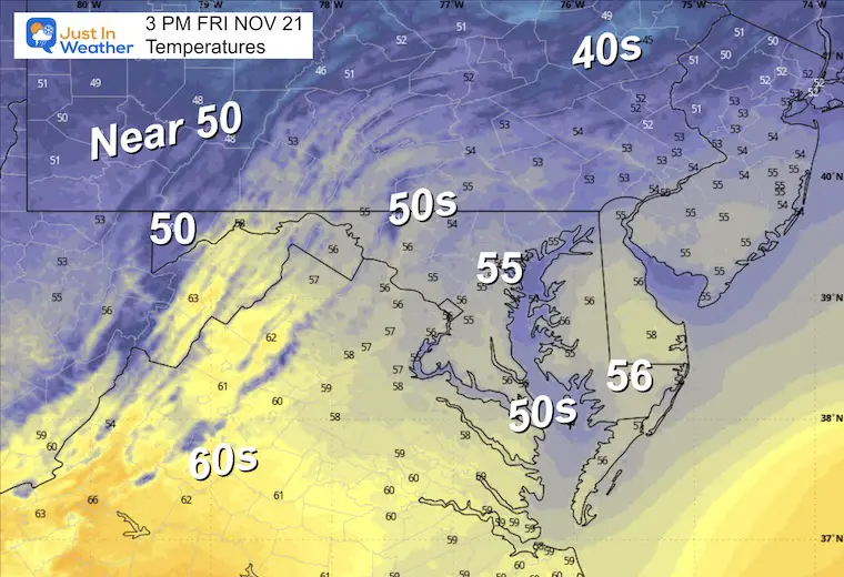
South of this system will have many record high temperatures today that may fuel strong thunderstorms as well.
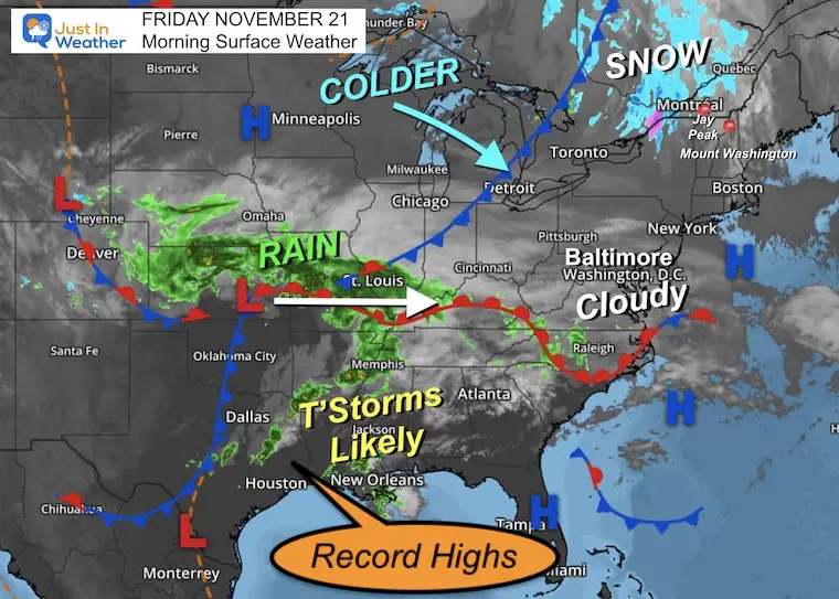
The rain is likely to not arrive until AFTER dark.
If you have plans to be out, there may be rain on the way home.
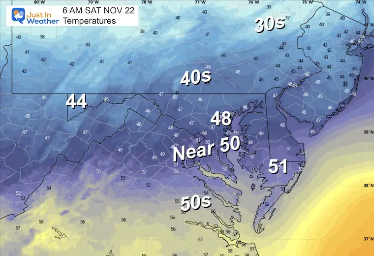
Yesterday: Low 37F; High 47F
Precipitation: 0.00”
Sunrise at 6:57 AM
Sunset at 4:48 PM
Normal Low in Baltimore: 35ºF
Record 16ºF in 1951
Normal High in Baltimore: 55ºF
Record 79ºF 1900
Rainfall Deficit at BWI
Click here for the full report

I am working with Jarrettsville Furniture on this great promotion to possibly get free furniture if we get snow on Christmas.
Here’s my first announcement. More info to come.
Subscribe for eMail Alerts
Sign up and be the first to know!
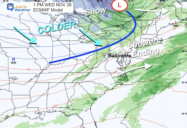
Steady rain overnight will end in the morning. Then, lingering showers through the afternoon.
Steady rain should be ending before sunrise, but scattered showers on and off will take us through the morning.
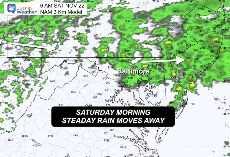
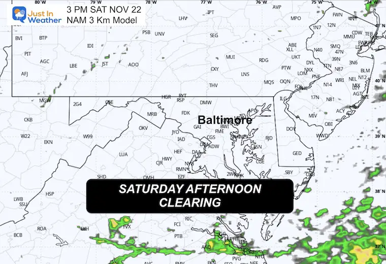
The last batch of rain showers maybe finally break up.
Sun may break out as the storm moves away.
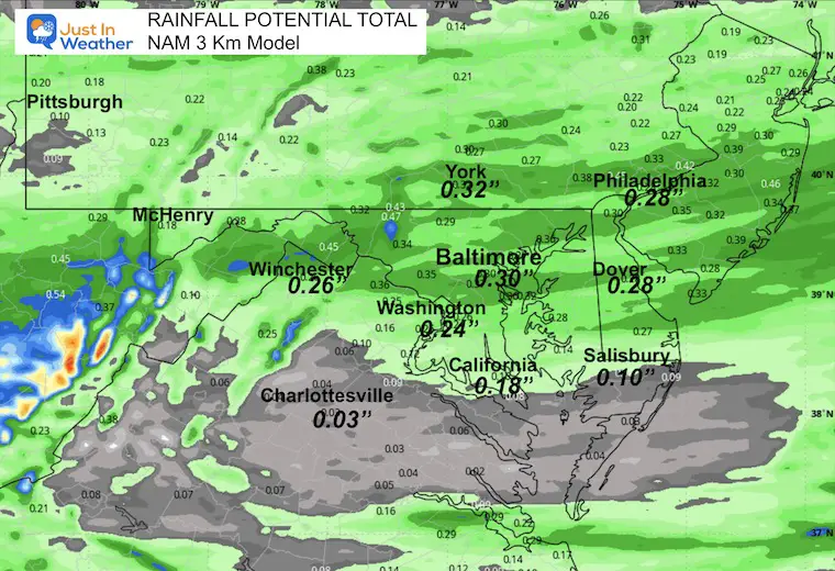
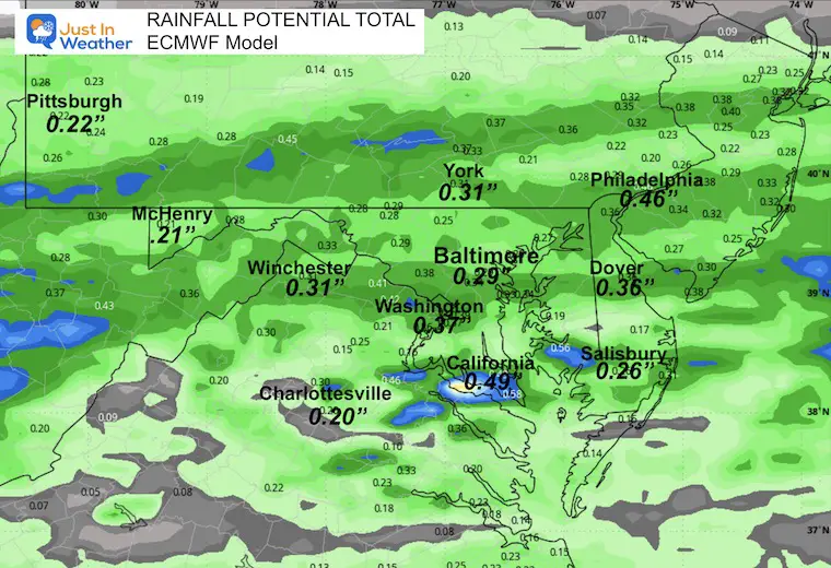
This has dropped back a little, but still most of the region should be in the 0.25″+ range.
NAM 3 Km Model
ECMWF Model
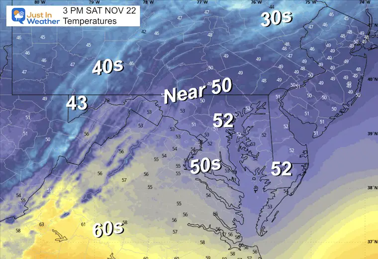
More sun and warming temps.
The next system will arrive sooner, with rain on Tuesday and lingering showers on Wednesday. The colder air will follow during the holiday.
This may break our recent pattern of nighttime-focused rain, as the afternoon is expected to be wet.
Another quick-moving rain event is likely to time out early in the day, followed by a warm-up.
The OVER ADVERTISED Arctic Air will come in waves. The first one will arrive sooner on Thanksgiving and Friday. Then will relax within a few days. The second surge is expected in the first week of December.
The cold air will fill in behind the cold front AFTER our rain departs.
I have said this will be our transition day. It looks like the cold air will be here and fully entrenched on Friday.
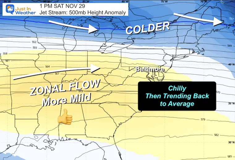
The jet stream will become more ‘zonal’, allowing a return to average temperatures. This may take a day or two to arrive in the following week.
That coastal storm I showed yesterday is no longer there as I expected. The computer guidance is NOT reliable for surface storms beyond one week. I stand by this and will not entertain that heading into winter.
The more reliable signals for longer-range trends are in the jet stream and global patterns. More on that in a later report.
Subscribe for eMail Alerts
Sign up and be the first to know!
This was issued October 9, as expected: A weak and short-lived event to start winter may play a different role this winter

These are NOT all the same caterpillar!


Click to see more and ‘Book’ a visit to your school


The annual event: Hiking and biking 329 miles in 7 days between The Summit of Wisp to Ocean City.
Each day, we honor a kid and their family’s cancer journey.
Fundraising is for Just In Power Kids: Funding Free Holistic Programs. I never have and never will take a penny. It is all for our nonprofit to operate.
Click here or the image to donate:

I am aware there are some spelling and grammar typos and occasional other glitches. I take responsibility for my mistakes and even the computer glitches I may miss. I have made a few public statements over the years, but if you are new here, you may have missed it: I have dyslexia and found out during my second year at Cornell University. It didn’t stop me from getting my meteorology degree and being the first to get the AMS CBM in the Baltimore/Washington region. One of my professors told me that I had made it that far without knowing and to not let it be a crutch going forward. That was Mark Wysocki, and he was absolutely correct! I do miss my mistakes in my own proofreading. The autocorrect spell check on my computer sometimes does an injustice to make it worse. I can also make mistakes in forecasting. No one is perfect at predicting the future. All of the maps and information are accurate. The ‘wordy’ stuff can get sticky. There has been no editor who can check my work while writing and to have it ready to send out in a newsworthy timeline. Barbara Werner is a member of the web team that helps me maintain this site. She has taken it upon herself to edit typos when she is available. That could be AFTER you read this. I accept this and perhaps proves what you read is really from me… It’s part of my charm. #FITF